|
Kamata, Ōta, Tokyo
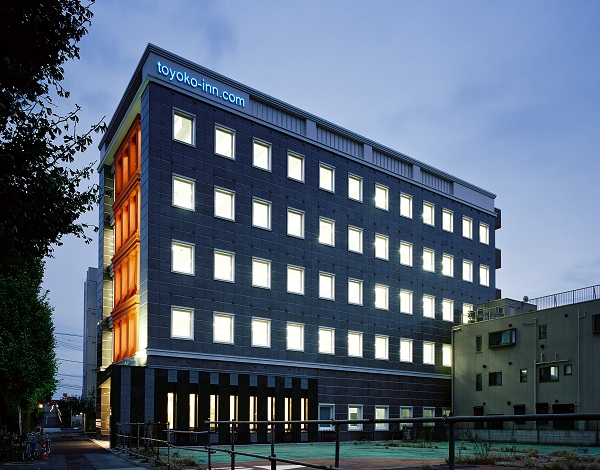
is a district of Ōta, Tokyo, Ōta, Tokyo, Japan. Features include the Kamata Station (Tokyo), Kamata Station, Kamata High School, and the headquarters of Toyoko Inn. History The name "Kamata" has been used to refer to the area since at least the 900s AD. Historically, the area was famous for Prunus mume, Japanese apricots(''ume''). Kamata was first linked to Tokyo by rail in 1901 with the opening of Keikyū Kamata Station, Kamata Station (now Keikyū Kamata Station, Keikyu Kamata Station) on the Keikyū Main Line, Keikyu Main Line. This was followed in 1904 by the opening of a separate Kamata Station (Tokyo), Kamata Station on the Tōkaidō Main Line, Tokaido Line. Kamata became a ward of Tokyo City in October 1932, incorporating the historical towns of Kamata, Yaguchi, Rokugo and Haneda. Kamata merged with the neighboring ward of Ōmori, Ōta, Tokyo, Omori to form the ward (city) of Ota in March 1947. Education Ota operates the public elementary and junior high schools i ... [...More Info...] [...Related Items...] OR: [Wikipedia] [Google] [Baidu] |
Keikyū Kamata Station
, is a railway station in Ōta, Tokyo, Japan, operated by the private railway company Keikyu. Lines Keikyu Kamata Station is served by the Keikyu Main Line and Keikyu Airport Line. This station is a reversing station for direct train services between Yokohama Station and Haneda Airport. Station layout As of 21 October 2012, the station structure has three levels. Up trains (to and Haneda Airport) depart from the second level, down trains (to and ) and Haneda Airport depart from the third level. Platforms The 3rd floor consists of one large platform serving three tracks in a unique configuration. Platforms 1 and 4 are equipped with platform screen doors. 3rd floor 2nd floor History The station opened on 1 February 1901 as . The Airport Line (then called the Haneda Branch Line) was opened in 1902. Kamata Station was renamed in November 1925, and again renamed Keikyū Kamata Station, the present name, on 1 June 1987. In 1995, the platforms were extended to accommo ... [...More Info...] [...Related Items...] OR: [Wikipedia] [Google] [Baidu] |
Chome
The Japanese addressing system is used to identify a specific location in Japan. When written in Japanese characters, addresses start with the largest geographical entity and proceed to the most specific one. When written in Latin characters, addresses follow the convention used by most Western addresses and start with the smallest geographic entity (typically a house number) and proceed to the largest. The Japanese system is complex and idiosyncratic, the product of the natural growth of urban areas, as opposed to the systems used in cities that are laid out as grids and divided into quadrants or districts. Address parts Japanese addresses begin with the largest division of the country, the prefecture. Most of these are called ''ken'' (県), but there are also three other special prefecture designations: ''to'' (都) for Tokyo, ''dō'' (道) for ''Hokkaidō'' and ''fu'' (府) for the two urban prefectures of Osaka and Kyoto. Following the prefecture is the municipality. For ... [...More Info...] [...Related Items...] OR: [Wikipedia] [Google] [Baidu] |
Tokyo City
was a Cities of Japan, municipality in Japan and part of Tokyo Prefecture (1868–1943), Tokyo-fu which existed from 1 May 1889 until its merger with its prefecture on 1 July 1943. The historical boundaries of Tokyo City are now occupied by the Special wards of Tokyo, Special Wards of Tokyo. The new merged government became what is now Tokyo, also known as the ''Tokyo, Tokyo Metropolis'', or, ambiguously, ''Tokyo, Tokyo Prefecture''. History In 1868, the medieval city of Edo, seat of the Tokugawa shogunate, Tokugawa government, was renamed Tokyo, and the offices of Tokyo Prefecture (''-fu'') were opened. The extent of Tokyo Prefecture was initially limited to the former Edo city, but rapidly augmented to be comparable with the present Tokyo Metropolis. In 1878, the Meiji government's reorganization of local governments subdivided prefectures into Counties of Japan, counties or districts (''gun'', further subdivided into Towns of Japan, towns and Villages of Japan, village ... [...More Info...] [...Related Items...] OR: [Wikipedia] [Google] [Baidu] |
Tōkaidō Main Line
The is a major Japanese railway line of the Japan Railways Group (JR Group) network, connecting and stations. It is long, not counting its many freight feeder lines around the major cities. The high-speed Tōkaidō Shinkansen largely parallels the line. The term "Tōkaidō Main Line" is largely a holdover from pre-Shinkansen days; now various portions of the line have different names which are officially used by JR East, JR Central, and JR West. Today, the only daily passenger train that operate over the entire length of the line is the combined overnight-train Sunrise Izumo - Sunrise Seto. During the day longer intercity trips require several transfers along the way. The Tokaido Main Line is owned and operated by three JR companies: * East Japan Railway Company (JR East) ( - ) Tōkaidō Line * Central Japan Railway Company (JR Central) ( - ) Tōkaidō Line * West Japan Railway Company (JR West) ( - ) Biwako Line, JR Kyoto Line, JR Kobe Line Basic data *Total distance: (i ... [...More Info...] [...Related Items...] OR: [Wikipedia] [Google] [Baidu] |
Keikyū Main Line
The is a railway line in Japan, operated by the private railway operator Keikyu. The line connects the Tokyo wards of Minato, Shinagawa, Ōta, and the Kanagawa municipalities of Kawasaki, Yokohama and Yokosuka. The Keikyu Main Line began as a short line in 1895. By 1905 it was extended from Shinagawa Station in Tokyo to central Yokohama, becoming a major interurban line between the two cities. Service types Keikyu operates the following different types of service, including all-stations "Local" trains. Abbreviations: * Lo = : Stops at all stations * AE = :(1) between Sengakuji and Haneda Airport Terminal 1·2 (mornings and evenings only) :(2) between Zushi·Hayama and Haneda Airport Terminal 1·2 * LE = (mornings and evenings only) * LE = * A = * MW = : A "Home Liner" service with an additional charge for seat reservation. Operates only on weekday mornings from Miurakaigan on the Keikyu Kurihama Line to Shinagawa and Sengakuji. * EW = : A "Home Liner" service with an ... [...More Info...] [...Related Items...] OR: [Wikipedia] [Google] [Baidu] |
Prunus Mume
''Prunus mume'' is an East Asian and Southeast Asian tree species classified in the ''Armeniaca'' section of the genus ''Prunus'' subgenus ''Prunus''. Its common names include Chinese plum, Japanese plum, and Japanese apricot. The flower, long a beloved subject in the traditional painting and poetry of East Asia and Vietnam, is usually called plum blossom. This distinct tree species is related to both the plum and apricot trees. Although generally referred to as a plum in English, it is more closely related to the apricot. In East Asian cuisine (Chinese, Japanese and Korean) and Vietnamese cuisine, the fruit of the tree is used in juices, as a flavouring for alcohol, as a pickle and in sauces. It is also used in traditional medicine. The tree's flowering in late winter and early spring is highly regarded as a seasonal symbol. ''Prunus mume'' should not be confused with ''Prunus salicina'', a related species also grown in China, Japan, Korea and Vietnam. Another tree, ''Prunus ... [...More Info...] [...Related Items...] OR: [Wikipedia] [Google] [Baidu] |
Toyoko Inn
Toyoko is a village in the Zam Department of Ganzourgou Province in central Burkina Faso Burkina Faso (, ; , ff, 𞤄𞤵𞤪𞤳𞤭𞤲𞤢 𞤊𞤢𞤧𞤮, italic=no) is a landlocked country in West Africa with an area of , bordered by Mali to the northwest, Niger to the northeast, Benin to the southeast, Togo and Ghana to the .... The village has a population of 1334. References External links Satellite map at Maplandia.com [...More Info...] [...Related Items...] OR: [Wikipedia] [Google] [Baidu] |
Kamata High School
01. is a Japanese high school located in the Kamata area of Ōta, Tokyo Tokyo (; ja, 東京, , ), officially the Tokyo Metropolis ( ja, 東京都, label=none, ), is the capital and largest city of Japan. Formerly known as Edo, its metropolitan area () is the most populous in the world, with an estimated 37.468 .... The school's nickname is . 02. Kamata High School (ମାଣିକେଶ୍ୱରୀ ନୋଡାଲ ଉଚ୍ଚ ବିଦ୍ୟାଳୟ,କାମତା) Or Govt (New) Manikeswari Nodal High School, Kamata is a Board of Secondary Education, Odisha High School Located at Kamata Village, Block - Borigumma, Dist - Koraput, Odisha, Pin 764057. See also References External links Kamata High School(Japanese)Manikeswari Nodal High School, Kamata Official Website(India) Tokyo Metropolitan Government Board of Education schools High schools in Tokyo Ōta, Tokyo {{Japan-school-stub ... [...More Info...] [...Related Items...] OR: [Wikipedia] [Google] [Baidu] |


