|
Kalambaka
Kalabaka ( el, Καλαμπάκα, ''Kalabáka'', alternative transliterations are ''Kalambaka'' and ''Kalampaka'') is a town and seat of the municipality of Meteora in the Trikala regional unit, part of Thessaly in Greece. The population was 12,000 at the 2011 census, of which 8,330 in the town proper. The Meteora monasteries are located near the town. Kalabaka is the northwestern terminal of the old Thessaly Railways, now part of OSE. History A Greek inscription on the wall of one of the town's oldest churches (Saint John the Baptist) testifies to the existence of an ancient Greek settlement under the name Aiginion. In the 10th century AD, it was known as Stagoi (Σταγοί), a Byzantine fortress and bishopric (the name is still in use for the town by the Greek Orthodox Church). Of its medieval monuments, only the cathedral, the Church of the Dormition, survives. It was a late 11th- or early 12th-century building, built on the remains of an earlier, late antique chu ... [...More Info...] [...Related Items...] OR: [Wikipedia] [Google] [Baidu] |
Kalambaka Railway Station
Kalambaka railway station ( el, Σιδηροδρομικός σταθμός Καλαμπάκας, Sidirodromikós stathmós Kalambákas) is the main railway station in Kalabaka, in the Trikala regional unit, Thessaly. Opened on 16 June 1886 by the Thessaly Railways (now part of OSE) as its first terminal station. Today Hellenic Train operates Regional Express services to destinations across Greece. It is currently the most northwesterly part of the Greek railway network in operation. History The station opened on 16 June 1886 as a terminus of Thessaly Railways. The original station building (and the line) was designed by the Italian Evaristo de Chirico, (father of Giorgio de Chirico). The line was authorised by the Greek government under the law AMH’/22.6.1882. soon after the liberation of Central Greece from the Ottomans. After the First World War, the Greek state planned the ambitious construction of several new rail lines and links, including a standard gauge line from Kalam ... [...More Info...] [...Related Items...] OR: [Wikipedia] [Google] [Baidu] |
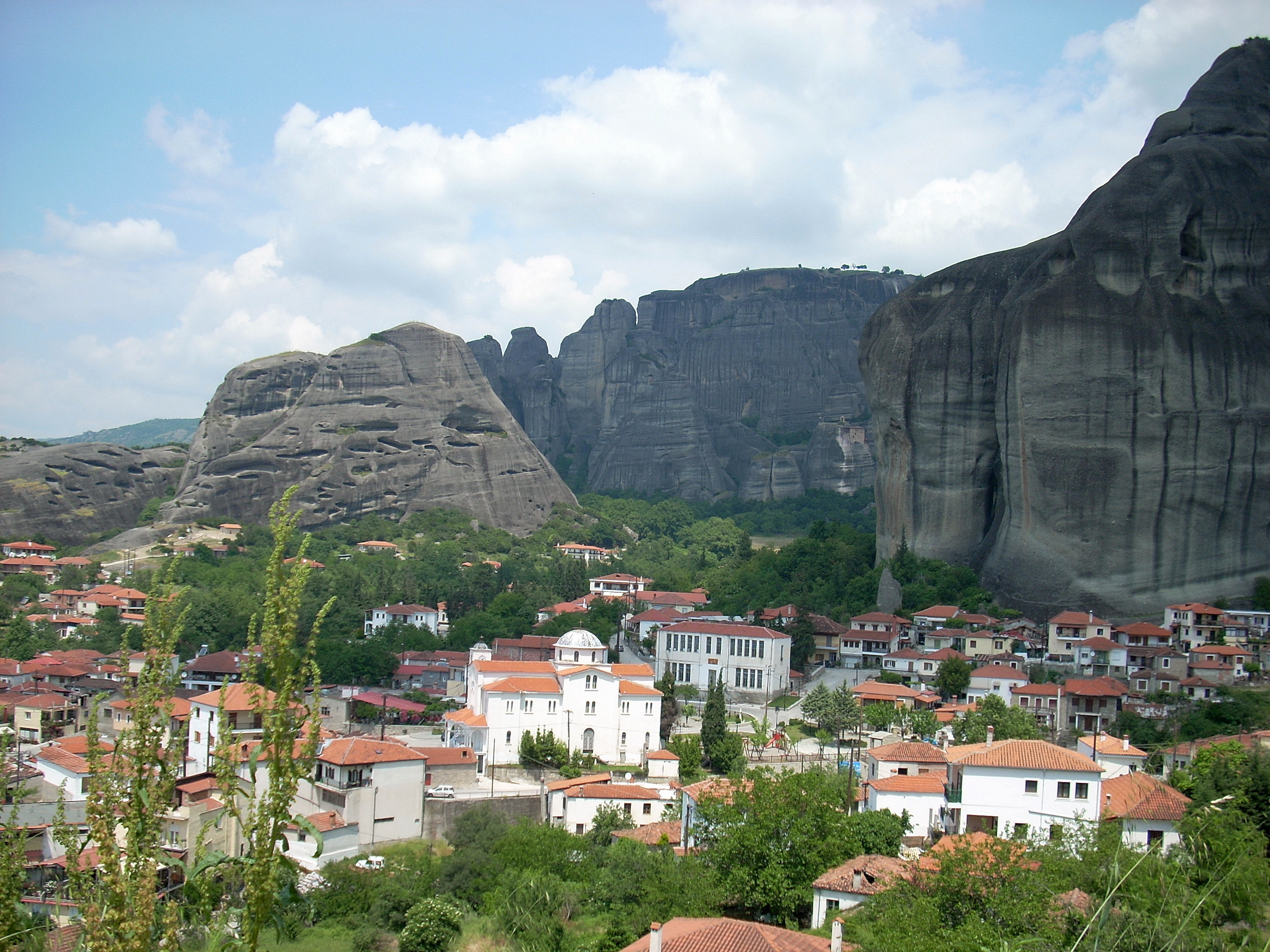
Kalampaka Panorama
Kalabaka ( el, Καλαμπάκα, ''Kalabáka'', alternative transliterations are ''Kalambaka'' and ''Kalampaka'') is a town and seat of the municipality of Meteora in the Trikala regional unit, part of Thessaly in Greece. The population was 12,000 at the 2011 census, of which 8,330 in the town proper. The Meteora monasteries are located near the town. Kalabaka is the northwestern terminal of the old Thessaly Railways, now part of OSE. History A Greek inscription on the wall of one of the town's oldest churches (Saint John the Baptist) testifies to the existence of an ancient Greek settlement under the name Aiginion. In the 10th century AD, it was known as Stagoi (Σταγοί), a Byzantine fortress and bishopric (the name is still in use for the town by the Greek Orthodox Church). Of its medieval monuments, only the cathedral, the Church of the Dormition, survives. It was a late 11th- or early 12th-century building, built on the remains of an earlier, late antique ch ... [...More Info...] [...Related Items...] OR: [Wikipedia] [Google] [Baidu] |
Thessaly Railways
Thessaly Railways ( el, Σιδηρόδρομοι Θεσσαλίας) was a railway company in Greece, which owned and operated the metre gauge railway network of Thessaly and Pelion railway from 1884 to 1955, when the company was absorbed by the Hellenic State Railways. Today the term usually refers to the section of mainline between Domokos and Rapsani and its two branches, the West Thessaly branch to Kalambaka and the Volos branch. Network and stations The network of Thessaly Railways consisted of the following lines: * Volos—Velestinon. The line extended from Volos station to the city centre along Dimitriados Street. * Velestinon—Kalampaka, connecting with the Athens-Larissa-Thessaloniki standard gauge mainline at Palaiofarsalos. This section had a maximum gradient of 3% between Velestinon and Aerinon. * Velestinon—Larissa, terminating to the Thessaly Railways station, next to the mainline (standard gauge) station. * Volos—Mileai (Pelion railway) Construction started ... [...More Info...] [...Related Items...] OR: [Wikipedia] [Google] [Baidu] |
Hellenic Railways Organisation
The Hellenic Railways Organisation or OSE ( el, Οργανισμός Σιδηροδρόμων Ελλάδος, italic=yes or el, Ο.Σ.Ε.) is the Greek national railway company which owns, maintains and operates all railway infrastructure in Greece with the exception of Athens' rapid transit lines. Train services on these lines are run by Hellenic Train S.A., a former OSE subsidiary, Rail Cargo Logistics Goldair, Pearl and Grup Feroviar Român. History It was founded on 1 January 1971, with the Legislative Decree 674/1970, taking over the responsibilities as the successor to the Hellenic State Railways SEK. which had been founded in 1920. OSE is owned 100% by the Greek State. In 1996 Ergose was created within OSE to facilitate infrastructure projects. In 2001, the infrastructure element of OSE was created, known as GAIAOSE. It would henceforth be responsible for the maintenance of stations, bridges and other elements of the network, as well as the leasing and sale of rai ... [...More Info...] [...Related Items...] OR: [Wikipedia] [Google] [Baidu] |
Meteora With View Over Kastraki
The Meteora (; el, Μετέωρα, ) is a rock formation in central Greece hosting one of the largest and most precipitously built complexes of Eastern Orthodox monasteries, second in importance only to Mount Athos.Sofianos, D.Z.: "Metéora". Holy Monastery of Great Meteoro, 1991. The six (of an original twenty-four) monasteries are built on immense natural pillars and hill-like rounded boulders that dominate the local area. Between the 13th and 14th centuries, the twenty-four monasteries were established atop the rocks. Meteora is located near the town of Kalabaka at the northwestern edge of the Plain of Thessaly near the Pineios river and Pindus Mountains. Meteora was added to the UNESCO World Heritage List in 1988 because of the outstanding architecture and beauty of the complex, in addition to its religious and artistic significance. The name means "lofty", "elevated", and is etymologically related to ''meteor''. Geology Beside the Pindos Mountains, in the western re ... [...More Info...] [...Related Items...] OR: [Wikipedia] [Google] [Baidu] |
Meteora
The Meteora (; el, Μετέωρα, ) is a rock formation in central Greece hosting one of the largest and most precipitously built complexes of Eastern Orthodox monasteries, second in importance only to Mount Athos.Sofianos, D.Z.: "Metéora". Holy Monastery of Great Meteoro, 1991. The six (of an original twenty-four) monasteries are built on immense natural pillars and hill-like rounded boulders that dominate the local area. Between the 13th and 14th centuries, the twenty-four monasteries were established atop the rocks. Meteora is located near the town of Kalabaka at the northwestern edge of the Plain of Thessaly near the Pineios river and Pindus Mountains. Meteora was added to the UNESCO World Heritage List in 1988 because of the outstanding architecture and beauty of the complex, in addition to its religious and artistic significance. The name means "lofty", "elevated", and is etymologically related to ''meteor''. Geology Beside the Pindos Mountains, in the western regio ... [...More Info...] [...Related Items...] OR: [Wikipedia] [Google] [Baidu] |
Provinces Of Greece
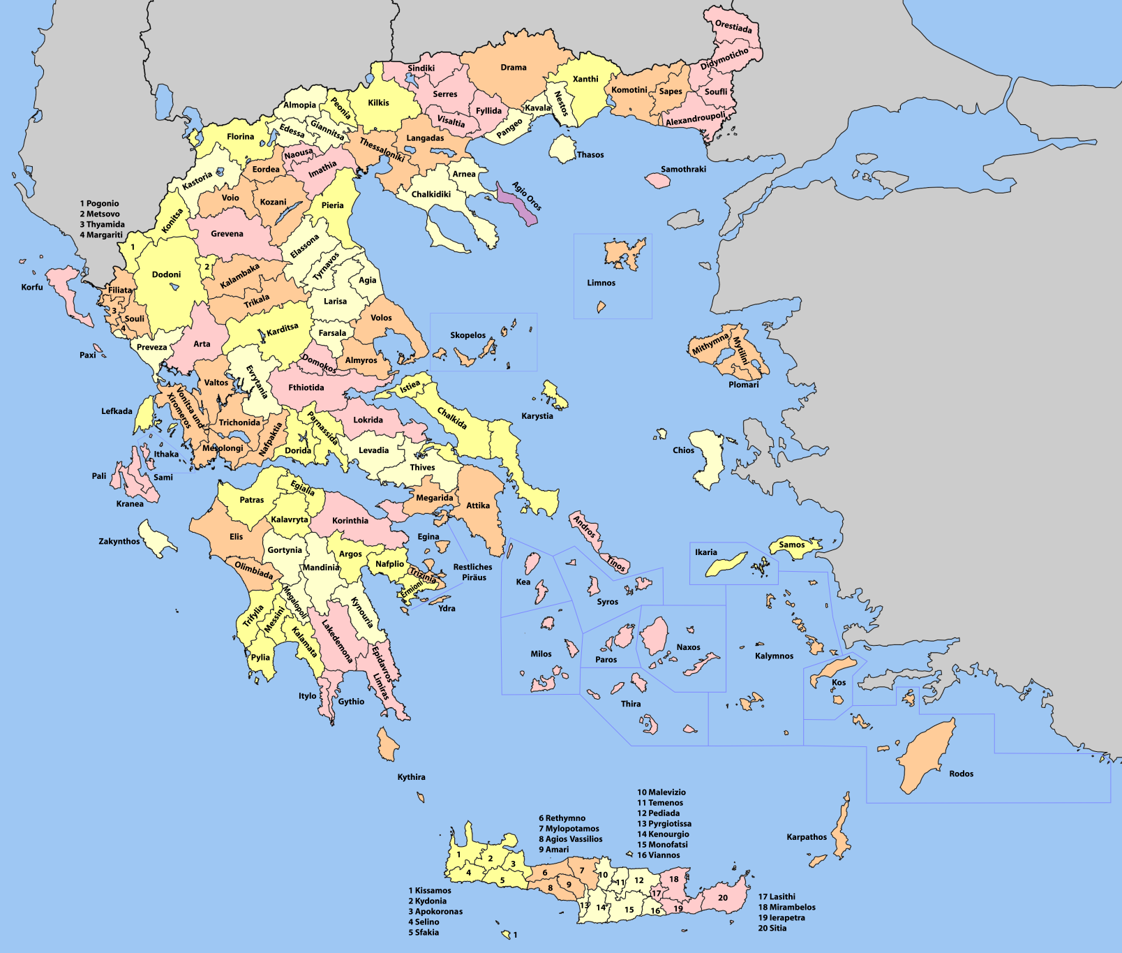
The provinces of Greece ( el, επαρχία, "eparchy") were sub-divisions of some the country's prefectures of Greece, prefectures. From 1887, the provinces were abolished as actual administrative units, but were retained for some state services, especially financial and educational services, as well as for electoral purposes. Before the Second World War, there were 139 provinces, and after the war, with the addition of the Dodecanese, Dodecanese Islands, their number grew to 147. According to the Article 7 of the Code of Prefectural Self-Government (Presidential Decree 30/1996), the provinces constituted a "particular administrative district" within the wider "administrative district" of the prefectures. The provinces were finally abolished after the 2006 Greek local elections, 2006 local elections, in line with Law 2539/1997, as part of the wide-ranging administrative reform known as the "Kapodistrias reform, Kapodistrias Project", and replaced by enlarged Municipalities and ... [...More Info...] [...Related Items...] OR: [Wikipedia] [Google] [Baidu] |
Meteora (municipality)
Meteora ( el, Μετέωρα, before 2018: ''Kalampaka'') is a municipality in the regional unit of Trikala in the Thessaly region in Greece. Its seat is the town Kalampaka. The municipality Meteora was formed as the municipality Kalampaka at the 2011 local government reform by the merger of the following 8 former municipalities, that became municipal units: * Aspropotamos *Chasia *Kalabaka * Kastania *Kleino *Malakasi Malakasi ( el, Μαλακάσι) is a village and a former municipality in the Trikala regional unit, Thessaly, Greece. Since the 2011 local government reform it is part of the municipality Meteora, of which it is a municipal unit. The municipal u ... * Tymfaia * Vasiliki In 2018 it was renamed to "Municipality of Meteora". The municipality has an area of 1,658.280 km2. References {{Meteora div Populated places in Trikala (regional unit) 2018 establishments in Greece Municipalities of Thessaly ... [...More Info...] [...Related Items...] OR: [Wikipedia] [Google] [Baidu] |
Trikala (regional Unit)
Trikala ( el, Περιφερειακή ενότητα Τρικάλων) is one of the regional units of Greece, forming the northwestern part of the modern regions of Greece, region of Thessaly. Its capital is the town of Trikala. The regional unit includes the town of Kalampaka and the Meteora monastery complex. Geography Trikala borders the regional units of Karditsa (regional unit), Karditsa to the south, Arta (regional unit), Arta to the southwest, Ioannina (regional unit), Ioannina to the west, Grevena (regional unit), Grevena to the north and Larissa (regional unit), Larissa to the east. The southeastern part belongs to the Thessalian Plain. The forested Pindus mountain range dominates the western part. The northern part of Trikala is also mountainous and made up of forests and barren lands, the ranges here are Chasia and Antichasia. Its major river is the Pineios (Thessaly), Pineios, flowing to the south and east. Its climate is mainly of Mediterranean character, with hot ... [...More Info...] [...Related Items...] OR: [Wikipedia] [Google] [Baidu] |
Middle Ages
In the history of Europe, the Middle Ages or medieval period lasted approximately from the late 5th to the late 15th centuries, similar to the post-classical period of global history. It began with the fall of the Western Roman Empire and transitioned into the Renaissance and the Age of Discovery. The Middle Ages is the middle period of the three traditional divisions of Western history: classical antiquity, the medieval period, and the modern period. The medieval period is itself subdivided into the Early, High, and Late Middle Ages. Population decline, counterurbanisation, the collapse of centralized authority, invasions, and mass migrations of tribes, which had begun in late antiquity, continued into the Early Middle Ages. The large-scale movements of the Migration Period, including various Germanic peoples, formed new kingdoms in what remained of the Western Roman Empire. In the 7th century, North Africa and the Middle East—most recently part of the Eastern Ro ... [...More Info...] [...Related Items...] OR: [Wikipedia] [Google] [Baidu] |
Diocese
In Ecclesiastical polity, church governance, a diocese or bishopric is the ecclesiastical district under the jurisdiction of a bishop. History In the later organization of the Roman Empire, the increasingly subdivided Roman province, provinces were administratively associated in a larger unit, the Roman diocese, diocese (Latin ''dioecesis'', from the Greek language, Greek term διοίκησις, meaning "administration"). Christianity was given legal status in 313 with the Edict of Milan. Churches began to organize themselves into Roman diocese, dioceses based on the Roman diocese, civil dioceses, not on the larger regional imperial districts. These dioceses were often smaller than the Roman province, provinces. Christianity was declared the Empire's State church of the Roman Empire, official religion by Theodosius I in 380. Constantine the Great, Constantine I in 318 gave litigants the right to have court cases transferred from the civil courts to the bishops. This situ ... [...More Info...] [...Related Items...] OR: [Wikipedia] [Google] [Baidu] |
Byzantine Emperor
This is a list of the Byzantine emperors from the foundation of Constantinople in 330 AD, which marks the conventional start of the Eastern Roman Empire, to its fall to the Ottoman Empire in 1453 AD. Only the emperors who were recognized as legitimate rulers and exercised sovereign authority are included, to the exclusion of junior co-emperors (''symbasileis'') who never attained the status of sole or senior ruler, as well as of the various usurpers or rebels who claimed the imperial title. The following list starts with Constantine the Great, the first Christian emperor, who rebuilt the city of Byzantium as an imperial capital, Constantinople, and who was regarded by the later emperors as the model ruler. It was under Constantine that the major characteristics of what is considered the Byzantine state emerged: a Roman polity centered at Constantinople and culturally dominated by the Greek East, with Christianity as the state religion. The Byzantine Empire was the direct le ... [...More Info...] [...Related Items...] OR: [Wikipedia] [Google] [Baidu] |


%2C_Greece_01.jpg)


