|
Kajiado
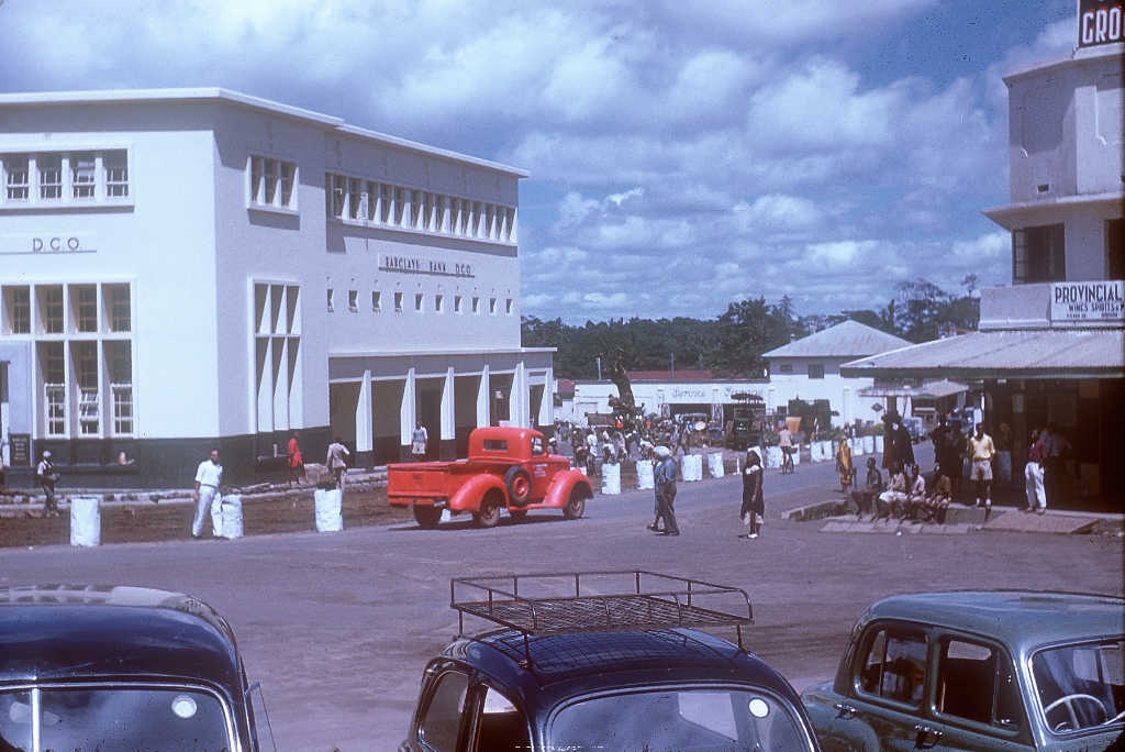
Kajiado is a town in Kajiado County, Kenya. The town is located south of Nairobi, along the Nairobi – Arusha highway ( A104 road). Kajiado has an urban population of 24,678 (2019 census). Local people are predominantly of the Maasai tribe. Kajiado is the headquarters for Kajiado County. The name "Kajiado" comes from the word "Olkeju-ado." Which means "The Long River" in the Maasai language. The seasonal river named after the town runs from West to the East of the town. The original name for Kajiado was "Olpurapurana", which means "a round elevation". Transport Kajiado has a station on the Magadi Soda Railway line which runs from Konza (on the Nairobi-Mombasa line) to Magadi. However this line operates limited passenger services, the most convenient way to travel to Kajiado from Nairobi is by using a matatu number 134, with NAEKANA sacco dominating the road transport to Kajiado town. See also * Railway stations in Kenya Railway stations in Kenya include: Maps * ... [...More Info...] [...Related Items...] OR: [Wikipedia] [Google] [Baidu] |
Kajiado County
Kajiado County is a county in the former Rift Valley Province of Kenya. As of 2019, Kajiado county spanned an area of 21,292.7 km2, with a recorded population of 1,117,840. The county borders Nairobi and to its south it borders the Tanzanian regions of Arusha and Kilimanjaro. The county capital is Kajiado, but the largest town is Ongata Rongai. Its main tourist attraction is its wildlife. Demographics Kajiado county has a total population of 1,117,840 people, of which 557,098 being male, 560,704 are females and 38 intersex people. There are 316,179 households with an average size of 3.5 person per household and a population density of 51 people per square kilometre. Source Administrative and political units Kajiado County is divided into 5 sub-counties and 25 Wards with Kajiado West being the largest and Kajiado North Sub-county being the smallest in terms of area in Km2 Administration units Kajiado is subdivided into five sub-counties with 25 county assembly w ... [...More Info...] [...Related Items...] OR: [Wikipedia] [Google] [Baidu] |
Nairobi
Nairobi ( ) is the capital and largest city of Kenya. The name is derived from the Maasai phrase ''Enkare Nairobi'', which translates to "place of cool waters", a reference to the Nairobi River which flows through the city. The city proper had a population of 4,397,073 in the 2019 census, while the metropolitan area has a projected population in 2022 of 10.8 million. The city is commonly referred to as the Green City in the Sun. Nairobi was founded in 1899 by colonial authorities in British East Africa, as a rail depot on the Uganda - Kenya Railway.Roger S. Greenway, Timothy M. Monsma, ''Cities: missions' new frontier'', (Baker Book House: 1989), p.163. The town quickly grew to replace Mombasa as the capital of Kenya in 1907. After independence in 1963, Nairobi became the capital of the Republic of Kenya. During Kenya's colonial period, the city became a centre for the colony's coffee, tea and sisal industry. The city lies in the south central part of Kenya, at an elevation ... [...More Info...] [...Related Items...] OR: [Wikipedia] [Google] [Baidu] |
Kenya
) , national_anthem = "Ee Mungu Nguvu Yetu"() , image_map = , map_caption = , image_map2 = , capital = Nairobi , coordinates = , largest_city = Nairobi , official_languages = Constitution (2009) Art. 7 ational, official and other languages"(1) The national language of the Republic is Swahili. (2) The official languages of the Republic are Swahili and English. (3) The State shall–-–- (a) promote and protect the diversity of language of the people of Kenya; and (b) promote the development and use of indigenous languages, Kenyan Sign language, Braille and other communication formats and technologies accessible to persons with disabilities." , languages_type = National language , languages = Swahili , ethnic_groups = , ethnic_groups_year = 2019 census , religion = , religion_year = 2019 census , demonym = ... [...More Info...] [...Related Items...] OR: [Wikipedia] [Google] [Baidu] |
Counties Of Kenya
The Counties of Kenya ( sw, Kaunti za Kenya) are geographical units envisioned by the 2010 Constitution of Kenya as the new units of devolved government that replaced the previous provincial system. The establishment and executive powers of the counties is provided in Chapter Eleven of the Constitution on devolved government, the Constitution's Fourth Schedule and any other legislation passed by the Senate of Kenya concerning counties. The counties are also single-member constituencies for the election of members of parliament to the Senate of Kenya, and special women members to the National Assembly of Kenya. As of 2022, there are 47 counties whose size and boundaries are based on the 47 legally recognized regions established by the 2010 Constitution. Following the re-organization of Kenya's national administration, counties were integrated into a new national administration with the national government posting county commissioners to counties to serve as a collaborative ... [...More Info...] [...Related Items...] OR: [Wikipedia] [Google] [Baidu] |
Maasai People
The Maasai (; sw, Wamasai) are a Nilotic ethnic group inhabiting northern, central and southern Kenya and northern Tanzania. They are among the best-known local populations internationally due to their residence near the many game parks of the African Great Lakes and their distinctive customs and dress.Maasai - Introduction Jens Fincke, 2000–2003 The Maasai speak the Maa language (ɔl Maa), a member of the Nilotic language family that is related to the , |
Magadi, Kenya
Magadi, Kenya is a town in the Kenya Rift Valley at Lake Magadi, located southwest of Nairobi, in southern Kenya. Magadi is northeast of Lake Natron in Tanzania. The general population of Magadi, Kenya is 980 people, with an elevation of . Magadi township lies on Lake Magadi's east shore, and is home to the Magadi Soda Company, now owned by Tata India. This factory produces soda ash, which has a range of industrial uses. Magadi is the central town of Magadi division of the Kajiado County. Magadi has gained organized access to the Internet, and computer usage, through the United Nations Development Programme-Kenya for solar-powered laptop computers, begun in July 2002: by the end of 2003, about 10,000 residents (48%) had visited the five E-Centers for Internet computer access, developed by the UN project."Community Solar Powered E-Centers, Magadi, Kenya" (computer access), United Nations Development Programme, 2004,UNDP-Solar-Magadi. Magadi was a filming location for Fernando M ... [...More Info...] [...Related Items...] OR: [Wikipedia] [Google] [Baidu] |
Railway Stations In Kenya
Railway stations in Kenya include: Maps * UN Map * UNHCR Atlas Map * Prondis Map * Railway Gazette International June 2012, p31 * KRC Map Towns served by metre gauge railways * Mombasa - ocean port * Changamwe * Miritini * Mazeras * Mariakani * Maji ya Chumvi * Samburu, Kenya, Samburu * Taru, Kenya, Taru * Mackinnon Road * Mwanatibu * Buchuma * Wangala, Kenya, Wangala * Maungu * Ndara * Voi - junction ** Mwatate ** Bura, Taita-Taveta District, Kenya, Bura ** Mashoti ** Maktau ** Murka ** Ziwani ** Taveta, Kenya, Taveta - across Tanzania border from Moshi, Kilimanjaro, Moshi * Irima * Ndi * Manyani * Tsavo * Kyulu * Kenani * Kanga, Kenya, Kanga * Mtito Andei * Kathekani * Darajani * Ngwata * Masongaleni * Kikumbulyu * Kibwezi * Mbuinzau * Makindu * Ikoyo * Kiboko, Kenya, Kiboko * Simba, Kenya, Simba * Kabati * Emali * Nzai * Sultan Hamud * Kima, Kenya, Kima * Kalembwani * Kiu * Ulu, Kenya, Ulu * Konza, Kenya, Konza - junction for Magadi ** Kajiado ** Kenya Marble Quarry ** El ... [...More Info...] [...Related Items...] OR: [Wikipedia] [Google] [Baidu] |
East Africa Time
East Africa Time, or EAT, is a time zone used in eastern Africa. The time zone is three hours ahead of UTC ( UTC+03:00), which is the same as Moscow Time, Arabia Standard Time, Further-eastern European Time and Eastern European Summer Time. As this time zone is predominantly in the equatorial region, there is no significant change in day length throughout the year and so daylight saving time is not observed. East Africa Time is observed by the following countries: * * * * * * * * * See also *Moscow Time, an equivalent time zone covering Belarus, Turkey and most of European Russia, also at UTC+03:00 *Arabia Standard Time, an equivalent time zone covering Bahrain, Iraq, Kuwait, Qatar, Saudi Arabia and Yemen, also at UTC+03:00 *Eastern European Summer Time, an equivalent time zone covering European and Middle Eastern countries during daylight saving, also at UTC+03:00 *Israel Summer Time, an equivalent time zone covering the State of Israel during daylight saving, also at U ... [...More Info...] [...Related Items...] OR: [Wikipedia] [Google] [Baidu] |
Arusha
Arusha City is a Tanzanian city and the regional capital of the Arusha Region, with a population of 416,442 plus 323,198 in the surrounding Arusha District Council (2012 census). Located below Mount Meru on the eastern edge of the eastern branch of the Great Rift Valley, Arusha City has a temperate climate. The city is close to the Serengeti National Park, the Ngorongoro Conservation Area, Lake Manyara National Park, Olduvai Gorge, Tarangire National Park, Mount Kilimanjaro, and Mount Meru in the Arusha National Park. The city is a major international diplomatic hub. It hosts the African Court of the African Union and is the capital of the East African Community. From 1994 to 2015, the city also hosted the International Criminal Tribunal for Rwanda, but that entity has ceased operations. It is a multicultural city with a majority Tanzanian population of mixed backgrounds: indigenous African, Arab-Tanzanian and Indian-Tanzanian population, plus a small European and North Am ... [...More Info...] [...Related Items...] OR: [Wikipedia] [Google] [Baidu] |
A104 Road (Kenya)
This is a list of road designation, roads designated A104 (other), A104. Roads entries are sorted in the countries alphabetical order. * A104 road (England), the road from Islington Green to Epping in London, England * A104 road (Kenya), the road from Nairobi, Kenya to the Tanzanian border at Namanga on the route to Arusha and Dar es Salaam * A104 motorway (France), part of the Francilienne, a road around Paris See also * List of highways numbered 104 References {{Road index, A104 ... [...More Info...] [...Related Items...] OR: [Wikipedia] [Google] [Baidu] |
Matatu
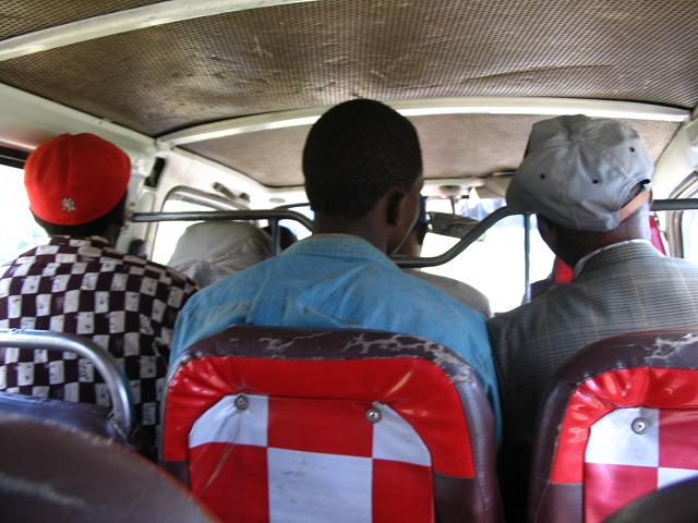
In Kenya matatu or matatus (known as mathree in Sheng) are privately owned minibuses used as share taxis. Often decorated, many ''matatu'' feature portraits of famous people or slogans and sayings. Likewise, the music they play is also aimed at quickly attracting riders. Over 70% of commuter trips are taken using matatu in cities like Nairobi. Although their origins can be traced back to the 1960s, ''matatu'' saw growth in Kenya in the 1980s and 1990s, and by the early 2000s the archetypal form was a (gaily decorated) Japanese microvan. C. 2015, larger, bus-sized vehicles also started to be used as ''matatu''. The name may also be used in parts of Nigeria. In Kenya, this industry is regulated,In Nairobi, Kenya puts brakes on its runaway success csmonitor.com, June 28, 1999. and such minibuses m ... [...More Info...] [...Related Items...] OR: [Wikipedia] [Google] [Baidu] |


