|
Kaiser Burnout
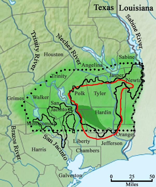
The Kaiser Burnout was a fire set by Confederate Captain James Kaiser during the American Civil War in the Big Thicket area of Southeast Texas. Historical background Like their counterparts in the Kansas region, local Texans that lived in the Big Thicket forest region who refused to fight for the Confederacy were referred to as Jayhawkers. Unlike the Kansas Jayhawkers, the Big Thicket Jayhawkers were not known to be guerrilla fighters. The Big Thicket was a good place to hide, and Sam Houston had planned to hide his army there had he lost the Battle of San Jacinto. Sometime after April 1862, people who were drafted and didn't want to fight for the Confederate Army during the Civil War hid in the Big Thicket and became known as Jayhawkers. The Big Thicket Jayhawkers were initial followers of Sam Houston and fully believed that the Civil War was a "rich man's war and a poor man's fight". Randolph Fillingim stated that Jayhawkers "were sensible men. They knew what would happen if ... [...More Info...] [...Related Items...] OR: [Wikipedia] [Google] [Baidu] |
American Civil War
The American Civil War (April 12, 1861 – May 26, 1865; also known by other names) was a civil war in the United States. It was fought between the Union ("the North") and the Confederacy ("the South"), the latter formed by states that had seceded. The central cause of the war was the dispute over whether slavery would be permitted to expand into the western territories, leading to more slave states, or be prevented from doing so, which was widely believed would place slavery on a course of ultimate extinction. Decades of political controversy over slavery were brought to a head by the victory in the 1860 U.S. presidential election of Abraham Lincoln, who opposed slavery's expansion into the west. An initial seven southern slave states responded to Lincoln's victory by seceding from the United States and, in 1861, forming the Confederacy. The Confederacy seized U.S. forts and other federal assets within their borders. Led by Confederate President Jefferson Davis, ... [...More Info...] [...Related Items...] OR: [Wikipedia] [Google] [Baidu] |
Honey Island, Texas
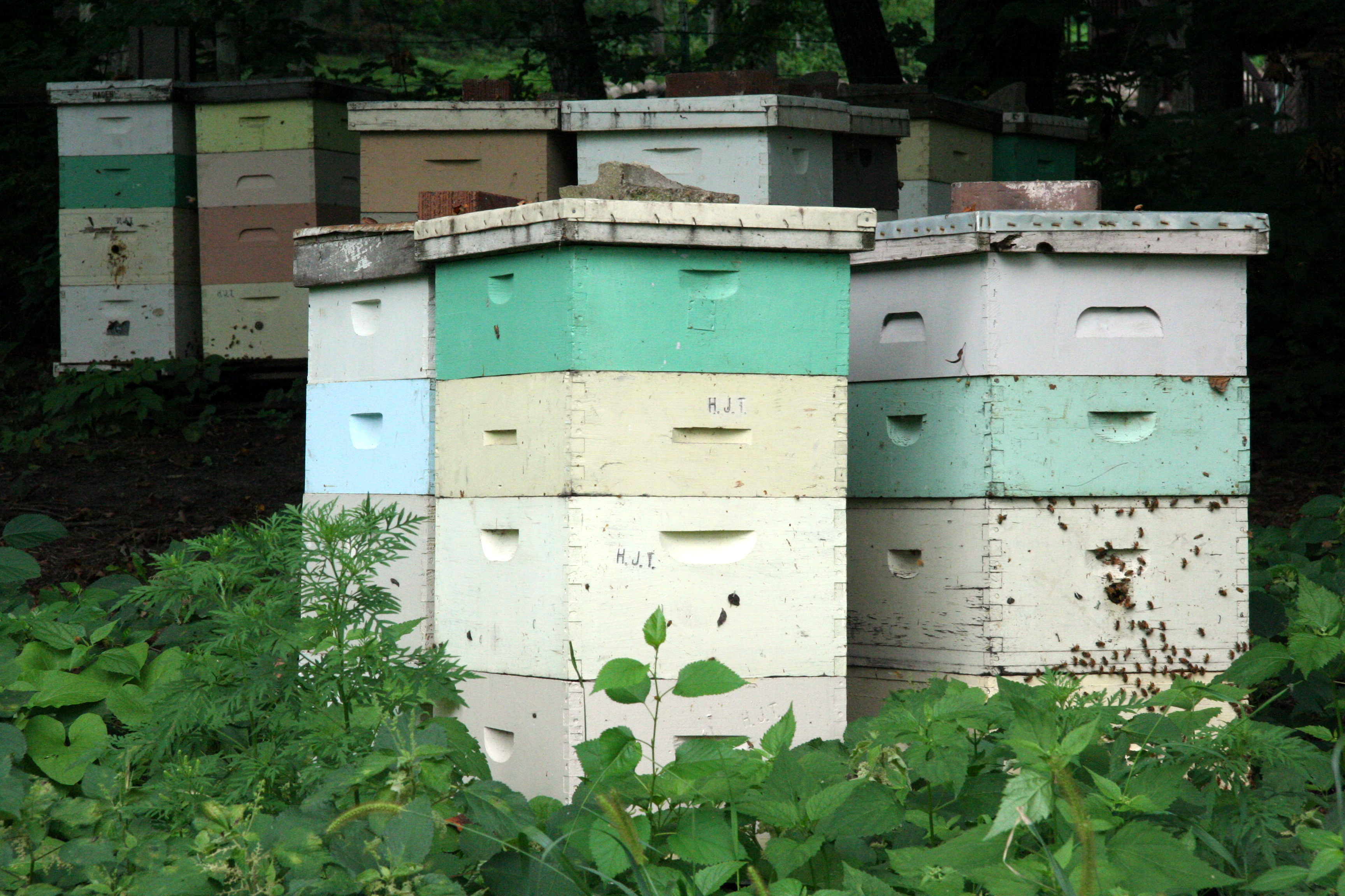
Honey Island is an unincorporated community in Hardin County, Texas, United States. It is part of the Beaumont– Port Arthur Metropolitan Statistical Area. The Kountze Independent School District provides public schools for area students. Though not usually an island, it is located on elevated land between the Cypress and Flat Cypress creeks, which rise in heavy rain, thereby temporarily isolating the area as an island. Historical development During the time of the Civil War, this site was known to attract Jayhawkers due to the area's numerous beehives. In addition to using the honey as food source, they would often stash honey in hidden pots that local sympathizers would exchange for supplies. This activity would eventually lead to the Kaiser Burnout by the Confederates in the nearby cane fields. In 1901 the Gulf, Colorado and Santa Fe Railway reached the site, and by 1907 a post office was established. The local sawmill was sold several times until it came into ownership ... [...More Info...] [...Related Items...] OR: [Wikipedia] [Google] [Baidu] |
Polk County, Texas
Polk County is a County (United States), county located in the U.S. state of Texas. As of the 2020 United States Census, 2020 census, its population was 50,123. Its county seat is Livingston, Texas, Livingston. The county is named after James K. Polk. The Alabama-Coushatta Indian Reservation of the federally recognized tribe is in Polk County, where the people have been since the early 19th century. They were forcibly evicted by the federal government from their traditional territory in the Southeast.Howard N. Martin, "ALABAMA-COUSHATTA INDIANS" ''Handbook of Texas Online'', uploaded 9 June 2010, accessed 18 November 2014 The 2000 United States Census, 2000 census reported a resident population of 480 persons on the reservation. The tribe reports 1100 enrolled members. History |
Hardin County, Texas
Hardin County is a county located in the U.S. state of Texas, United States. As of the 2020 census, its population was 56,231. The county seat is Kountze. The county is named for the family of William Hardin from Liberty County, Texas. Hardin County is part of the Beaumont- Port Arthur, TX metropolitan statistical area. History The county is named for the family of William Hardin (1801-1839), a settler, judge, and postmaster. The Hardin family cemetery is located north of Liberty. The current Hardin County Courthouse was built in 1959. It is at least the third courthouse to serve Hardin County. Geography According to the U.S. Census Bureau, the county has a total area of , of which (0.8%) are covered by water. Hardin County is located on the flat coastal plains of Southeast Texas, roughly north of the Gulf of Mexico. The county is largely covered by the dense forest of the Big Thicket. It is crossed by numerous small streams and creeks that drain the county into the Nech ... [...More Info...] [...Related Items...] OR: [Wikipedia] [Google] [Baidu] |
Texas In The American Civil War
Texas declared its secession from the Union on February 1, 1861, and joined the Confederate States on March 2, 1861, after it had replaced its governor, Sam Houston, who had refused to take an oath of allegiance to the Confederacy. As with those of other states, the Declaration of Secession was not recognized by the US government at Washington, DC. Some Texan military units fought in the Civil War east of the Mississippi River, but Texas was more useful for supplying soldiers and horses for the Confederate Army. Texas' supply role lasted until mid-1863, when Union gunboats started to control the Mississippi River, which prevented large transfers of men, horses, or cattle. Some cotton was sold in Mexico, but most of the crop became useless because of the Union's naval blockade of Galveston, Houston, and other ports. Secession In the early winter of 1860, Texan counties sent delegates to a special convention to debate the merits of secession. The convention adopted an " Ordina ... [...More Info...] [...Related Items...] OR: [Wikipedia] [Google] [Baidu] |
Canebrake
A canebrake or canebreak is a thicket of any of a variety of ''Arundinaria'' grasses: '' A. gigantea'', '' A. tecta'' and '' A. appalachiana''. As a bamboo, these giant grasses grow in thickets up to 24 ft tall. ''A. gigantea'' is generally found in stream valleys and ravines throughout the southeastern United States. ''A. tecta'' is a smaller stature species found on the Atlantic and Gulf Coastal Plains. Finally, ''A. appalachiana'' is found in more upland areas at the southern end of the Appalachian mountains. Cane does not do well on sites that meet wetland classification; instead canebrakes are characteristic of moist lowland, floodplain areas that are not as saturated as true wetlands. Canebrakes were formerly widespread in the Southern United States, potentially covering 10 million acres, but have been widely replaced by agriculture. This destruction has impacted a number of species. The survival of the Florida panther (''Puma concolor'' subsp. ''coryi'') has been chal ... [...More Info...] [...Related Items...] OR: [Wikipedia] [Google] [Baidu] |
Woodville, Texas
Woodville is a town in Tyler County, Texas, Tyler County, Texas, United States. The town is intersected by three U.S. highways: U.S. Route 69, U.S. Highway 69, U.S. Route 190, U.S. Highway 190, and U.S. Route 287, U.S. Highway 287. The population was 2,403 at the 2020 United States census, 2020 census. It is the county seat of Tyler County, Texas, Tyler County. The town was named after George Tyler Wood, List of Governors of Texas, governor of Texas from 1847 to 1849. Geography Woodville is located at (30.776246, –94.421243). According to the United States Census Bureau, the town has a total area of 3.2 square miles (8.2 km2), all of it land. Climate The climate in this area is characterized by hot, humid summers and generally mild to cool winters. According to the Köppen Climate Classification system, Woodville has a humid subtropical climate, abbreviated "Cfa" on climate maps. Demographics As of the 2020 United States census, there were 2,403 people, 1,084 ho ... [...More Info...] [...Related Items...] OR: [Wikipedia] [Google] [Baidu] |
Beaumont, Texas
Beaumont is a coastal city in the U.S. state of Texas. It is the county seat, seat of government of Jefferson County, Texas, Jefferson County, within the Beaumont–Port Arthur, Texas, Port Arthur Beaumont–Port Arthur metropolitan area, metropolitan statistical area, located in Southeast Texas on the Neches River about east of Houston (city center to city center). With a population of 115,282 at the 2020 United States census, 2020 census, Beaumont is the largest incorporated municipality by population near the Louisiana border. Its metropolitan area was the List of Texas metropolitan areas, 10th largest in Texas in 2019, and List of metropolitan statistical areas, 132nd in the United States. The city of Beaumont was founded in 1838. The pioneer settlement had an economy based on the development of lumber, farming, and port industries. In 1892, Joseph Eloi Broussard opened the first commercially successful rice mill in Texas, stimulating development of rice farming in the area; ... [...More Info...] [...Related Items...] OR: [Wikipedia] [Google] [Baidu] |
Beehive (beekeeping)
A beehive is an enclosed structure in which some honey bee species of the subgenus '' Apis'' live and raise their young. Though the word ''beehive'' is commonly used to describe the nest of any bee colony, scientific and professional literature distinguishes ''nest'' from ''hive''. ''Nest'' is used to discuss colonies that house themselves in natural or artificial cavities or are hanging and exposed. ''Hive'' is used to describe an artificial/man-made structure to house a honey bee nest. Several species of ''Apis'' live in colonies, but for honey production the western honey bee (''Apis mellifera'') and the eastern honey bee (''Apis cerana'') are the main species kept in hives. The nest's internal structure is a densely packed group of hexagonal prismatic cells made of beeswax, called a honeycomb. The bees use the cells to store food (honey and pollen) and to house the brood (eggs, larvae, and pupae). Beehives serve several purposes: production of honey, pollination of near ... [...More Info...] [...Related Items...] OR: [Wikipedia] [Google] [Baidu] |
Big Thicket
The Big Thicket is the name given to a somewhat imprecise region of a heavily-forested area of Southeast Texas in the United States. This area represents a portion of the mixed pine-hardwood forests of southeast US. The National Park Service established the Big Thicket National Preserve (BTNP) within the region in 1974 and it is recognized as a biosphere reserve by UNESCO. Although the diversity of animals in the area is high, with over 500 vertebrates, it is the complex mosaic of ecosystems and plant diversity that is particularly remarkable. Biologists have identified at least eight, and up to eleven, ecosystems in the Big Thicket area. More than 160 species of trees and shrubs, 800 herbs and vines, and 340 types of grasses are known to occur in the Big Thicket, and estimates as high as over 1000 flowering plant species and 200 trees and shrubs have been made, plus ferns, carnivorous plants, and more. The Big Thicket has historically been the most dense forest region in what is n ... [...More Info...] [...Related Items...] OR: [Wikipedia] [Google] [Baidu] |
Battle Of San Jacinto
The Battle of San Jacinto ( es, Batalla de San Jacinto), fought on April 21, 1836, in present-day La Porte and Pasadena, Texas, was the final and decisive battle of the Texas Revolution. Led by General Samuel Houston, the Texan Army engaged and defeated General Antonio López de Santa Anna's Mexican army in a fight that lasted just 18 minutes. A detailed, first-hand account of the battle was written by General Houston from the headquarters of the Texan Army in San Jacinto on April 25, 1836. Numerous secondary analyses and interpretations have followed. General Santa Anna, the president of Mexico, and General Martín Perfecto de Cos both escaped during the battle. Santa Anna was captured the next day on April 22 and Cos on April 24. After being held for about three weeks as a prisoner of war, Santa Anna signed the peace treaty that dictated that the Mexican army leave the region, paving the way for the Republic of Texas to become an independent country. These treaties did not ... [...More Info...] [...Related Items...] OR: [Wikipedia] [Google] [Baidu] |
Sam Houston
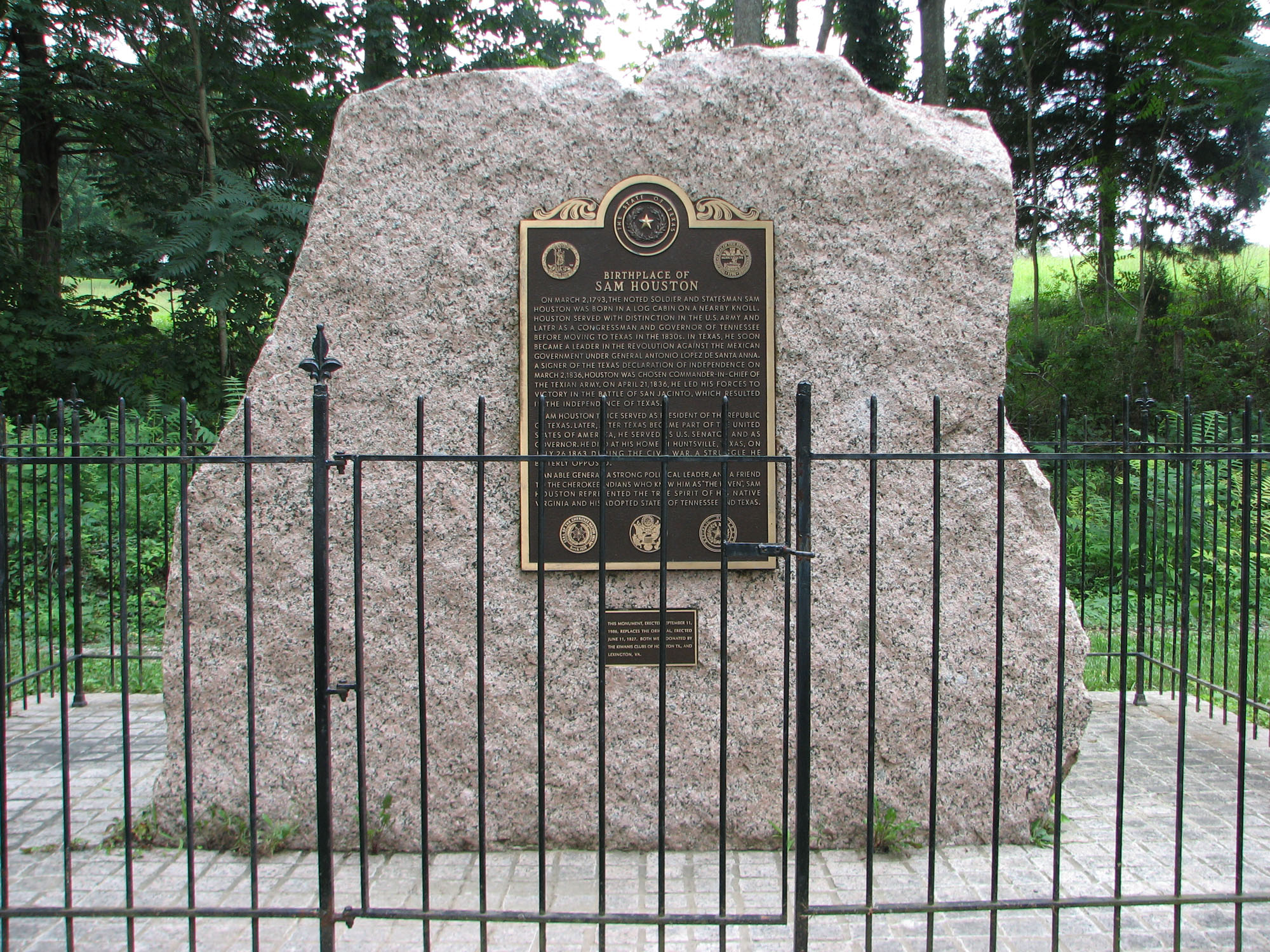
Samuel Houston (, ; March 2, 1793 – July 26, 1863) was an American general and statesman who played an important role in the Texas Revolution. He served as the first and third president of the Republic of Texas and was one of the first two individuals to represent Texas in the United States Senate. He also served as the sixth governor of Tennessee and the seventh governor of Texas, the only individual to be elected governor of two different states in the United States. Born in Rockbridge County, Virginia, Houston and his family migrated to Maryville, Tennessee, when Houston was a teenager. Houston later ran away from home and spent about three years living with the Cherokee, becoming known as Raven. He served under General Andrew Jackson in the War of 1812, and after the war, he presided over the removal of many Cherokee from Tennessee. With the support of Jackson and others, Houston won election to the United States House of Representatives in 1823. He strongly supported ... [...More Info...] [...Related Items...] OR: [Wikipedia] [Google] [Baidu] |


