|
Kainakary
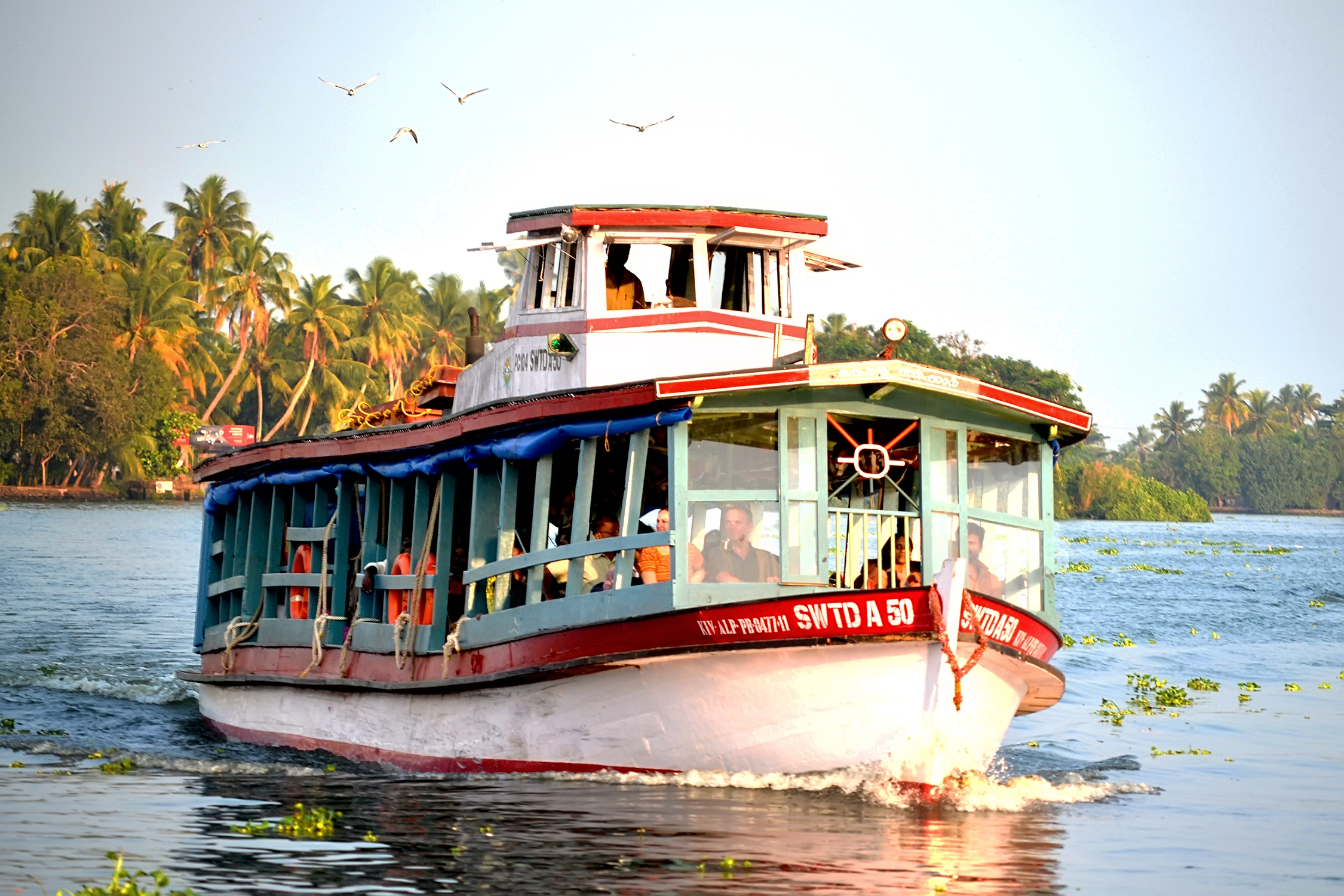
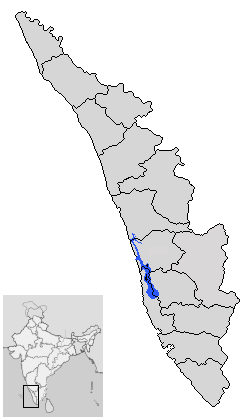
Kainakary is a village in Kuttanad Taluk in Alappuzha District of the Indian state of Kerala. History Kainakary was part of the Chembakassery Dynasty. Geography Five rivers originating from the Western Ghats, including the sacred Pamba River, drain into the Vembanad lake in the tip of Kainakary. Once a communist bastion, its literacy rate is notably better than many of its counterparts. The village is close to more than five lakes, which are vast in area. Kainakary is a shooting location for movie/TV soaps/music videos, etc. The village itself has numerous small water bodies, rivers, canals and ponds. People dwell near to canals and river banks mainly. Being part of Kuttanad, vast paddy lands make up the major part of the village. These paddy lands are below sea water level. So the rice cultivation in this area is unique and well appreciated. Floods are another major calamity that can be seen in Kainakary's history. Floods in Kuttanad are expected during every heavy mon ... [...More Info...] [...Related Items...] OR: [Wikipedia] [Google] [Baidu] |
Kuttanad
Kuttanad ( ml, കുട്ടനാട്) is a region covering the Alappuzha, Kottayam and Pathanamthitta Districts, in the state of Kerala, India, well known for its vast paddy fields and geographical peculiarities. The region has the lowest altitude in India, and is one of the few places in the world where farming is carried on around below sea level. Kuttanad is historically important in the ancient history of South India and is the major rice producer in the state. Farmers of Kuttanad are famous for Biosaline Farming. Food and Agriculture Organization (FAO) has declared the Kuttanad Farming System as a Globally Important Agricultural Heritage System (GIAHS). Four of Kerala's major rivers, the Pamba, Meenachil, Achankovil and Manimala flow into the region. It is well known for its boat race in the Punnamada Backwaters, known in Malayalam as Vallamkalli. History This region with abundant paddy fields and lakes produces rice, vegetables & fruits, fish, dairy p ... [...More Info...] [...Related Items...] OR: [Wikipedia] [Google] [Baidu] |
Chennamkary
{{Infobox settlement , name = Chennamkary , native_name = , native_name_lang = , other_name = , settlement_type = village , image_skyline = , image_alt = , image_caption = , nickname = , pushpin_map = , pushpin_label_position = right , pushpin_map_alt = , pushpin_map_caption = Location in Kerala, India , coordinates = {{coord, 9, 28, 0, N, 76, 23, 0, E, display=inline,title , subdivision_type = Country , subdivision_name = {{flag, India , subdivision_type1 = State , subdivision_type2 = District , subdivision_name1 = Kerala , subdivision_name2 = Alappuzha , established_title = , established_date = , founder = , named_for = , government_type = , governing_body = , unit_pref = Metric , area_footnotes = , area_total_km2 = , area_rank = , elevation_footnotes = , elevation_m = , population_total = , population_as_of = , population_footnotes = , population_density_km2 = auto , population_rank = , population_demonym = , demogr ... [...More Info...] [...Related Items...] OR: [Wikipedia] [Google] [Baidu] |
Pamba River
The Pamba River (also called Pampa River) is the longest river in the Indian state of Kerala after Periyar and Bharathappuzha, and the longest river in the erstwhile former princely state of Travancore. Sabarimala temple dedicated to Lord Ayyappa is located on the banks of the river Pamba. The river is also known as 'Dakshina Bhageerathi'. During ancient times it was called 'River Baris' and jordan of malankara The River Pamba enriches the lands of Pathanamthitta District and the Kuttanad area of Alappuzha District and few areas of Kottayam Course The Pamba originates at Pulachimalai hill in the Peerumedu plateau in the Western Ghats at an altitude of . Starting from the Idukki district and traversing a distance of through Pathanamthitta and Alappuzha districts, the river joins the Arabian Sea through a number of channels. The basin extends over an area of with the entire catchment area within Kerala state. The basin is bounded on the east by Western Ghats and on the w ... [...More Info...] [...Related Items...] OR: [Wikipedia] [Google] [Baidu] |
States And Territories Of India
India is a federal union comprising 28 states and 8 union territories, with a total of 36 entities. The states and union territories are further subdivided into districts and smaller administrative divisions. History Pre-independence The Indian subcontinent has been ruled by many different ethnic groups throughout its history, each instituting their own policies of administrative division in the region. The British Raj The British Raj (; from Hindi language, Hindi ''rāj'': kingdom, realm, state, or empire) was the rule of the British The Crown, Crown on the Indian subcontinent; * * it is also called Crown rule in India, * * * * or Direct rule in India, * Q ... mostly retained the administrative structure of the preceding Mughal Empire. India was divided into provinces (also called Presidencies), directly governed by the British, and princely states, which were nominally controlled by a local prince or raja loyal to the British Empire, which held ''de f ... [...More Info...] [...Related Items...] OR: [Wikipedia] [Google] [Baidu] |
Vembanadu
Vembanad is the longest lake in India, as well as the largest lake in the state of Kerala. The lake has an area of 230 square kilometers and a maximum length of 96.5 km. Spanning several districts in the state of Kerala, it is known as Vembanadu Lake in Kottayam, Vaikom, Changanassery, Punnamada Lake in Alappuzha, Punnappra, Kuttanadu and Kochi Lake in Kochi. Several groups of small islands including Vypin, Mulavukad, Maradu, Udayamperoor, Vallarpadam, Willingdon Island are located in the Kochi Lake portion. Kochi Port is built around the Willingdon Island and the Vallarpadam island. Kuttanad, also known as ''The Rice Bowl of Kerala'', has the lowest altitude in India, and is also one of the few places in world where cultivation takes place below sea level. Kuttanad lies on the southern portion of Vembanad. The Nehru Trophy Boat Race is conducted in a portion of the lake. High levels of pollution have been noticed at certain hotspots of the Vembanad backwaters. The Gov ... [...More Info...] [...Related Items...] OR: [Wikipedia] [Google] [Baidu] |
Kuttamangalam
Kuttamangalam is a village in Thrissur district in the Indian state of Kerala. Demographics India census A census is the procedure of systematically acquiring, recording and calculating information about the members of a given population. This term is used mostly in connection with national population and housing censuses; other common censuses in ..., Kuttamangalam had a population of 16832 with 8398 males and 8434 females. References Villages in Thrissur district {{Thrissur-geo-stub ... [...More Info...] [...Related Items...] OR: [Wikipedia] [Google] [Baidu] |

