|
Kaag
Kaag is a village in the Dutch province of South Holland. It is a part of the municipality of Kaag en Braassem, and lies about northeast of Leiden. The village of Kaag lies on an island called Kagereiland in the Kager Lakes (Kagerplassen). To reach De Kaag, a ferry can be taken from Buitenkaag all year or Zevenhuizen in the summer months. De Kaag is also part of an area called the Duin- en Bollenstreek ("Dune and Bulb Region"). The village is conventionally referred to as "De Kaag", but the name reported on both English and Dutch maps is just "Kaag". History The village is first mentioned in 1308, called "Kaghe", meaning "lands outside the dike". Kaag developed as a dike village on the island Kagereiland in the Kagermeer. Until the end of the 16th century De Kaag was the largest settlement in the Alkemade area. The island received its current shape between the Haarlemmermeer was ''polder A polder () is a low-lying tract of land that forms an artificial hydrological ent ... [...More Info...] [...Related Items...] OR: [Wikipedia] [Google] [Baidu] |
Kaag En Braassem
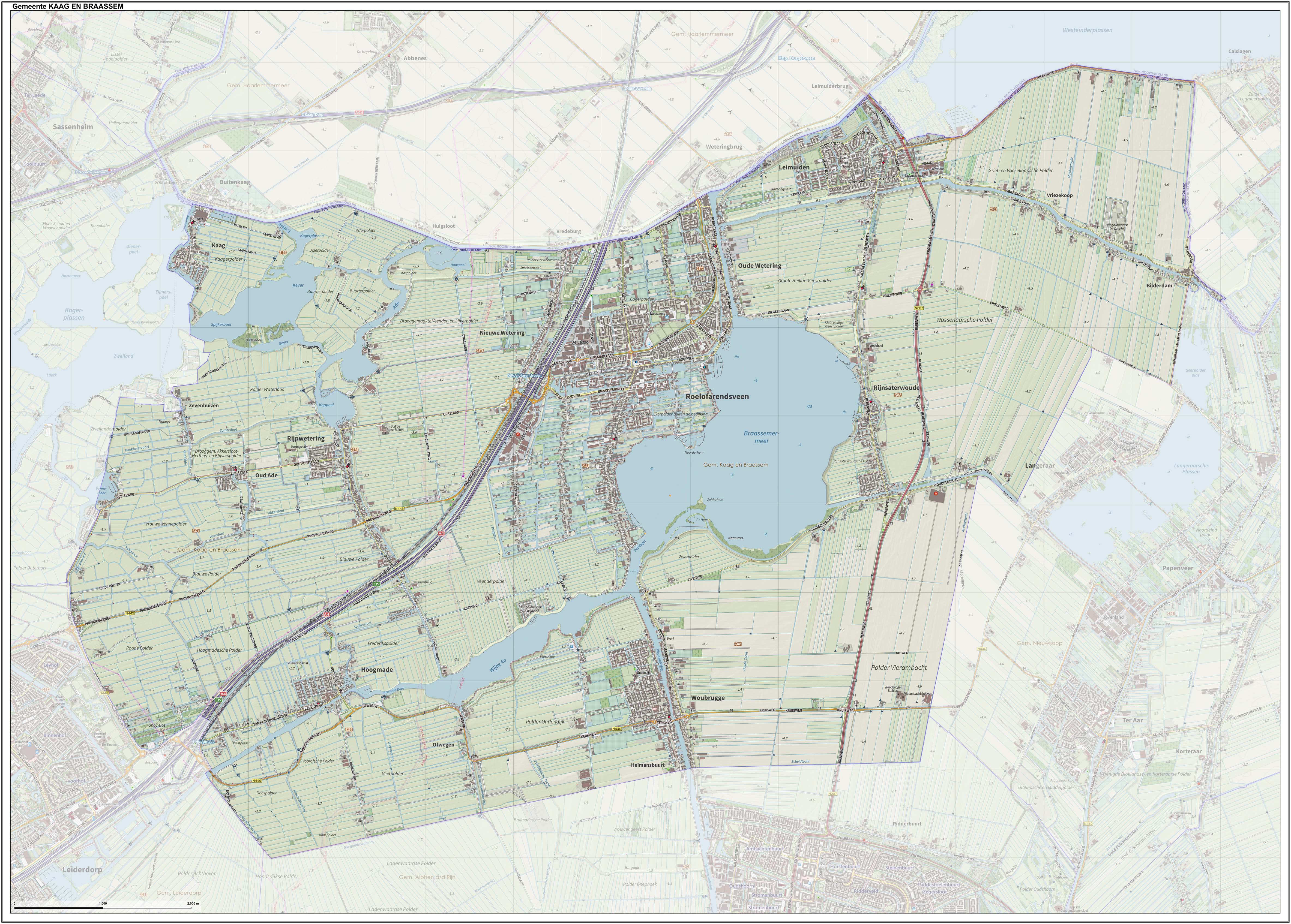
Kaag en Braassem () is a municipality in the western Netherlands, in the province of South Holland. It was formed on 1 January 2009, through the merger of Alkemade and Jacobswoude. Kaag en Braassem consists of 10 towns: In addition, there are 5 hamlets: Topography ''Dutch topographic map of the municipality of Kaag en Braassem, June 2015'' Notable people * Marinus Heijnes (1888 – 1963 in De Kaag) a Dutch impressionist artist of the Hague School Sport * Cornelis van Staveren (1889 in Leimuiden – 1982) a sailor who competed at the 1928 Summer Olympics * Joop Zoetemelk (born 1946) a retired professional racing cyclist, raised in Rijpwetering * Monique Velzeboer (born in Oud Ade 1969) a Dutch skater and photographer, medallist in the 1998 Winter Olympics * Michael Buskermolen (born 1972 in Leimuiden) a Dutch retired footballer with 399 club caps with AZ Alkmaar * Bob de Jong (born 1976 in Leimuiden) a Dutch former speed skater, silver, gold and twice bronze medalli ... [...More Info...] [...Related Items...] OR: [Wikipedia] [Google] [Baidu] |
Kagerplassen
{{coord, 52, 12, 19, N, 4, 32, 18, E, type:waterbody_region:NL_scale:60000, display=title The ''Kagerplassen'' (a Dutch term meaning "the Kaag Lakes") is a small lake system in South Holland located to the northeast of Leiden.Some of the information in this article is a translation of the Dutch article on the Kagerplassen on the Dutch Wikipedia. The Kaag Lakes are a popular area for boating, watersports, fishing, camping and walking. Windmills, waterfront pasture land (''weilanden'') with grazing animals, quaint Dutch boats and buildings and (in season) flower fields are all part of the charm of boating and walking in this area. Places The Kaag Lakes are part of two municipalities: Kaag en Braassem and Teylingen. Three villages that lay directly on the lakes are: * Warmond (Teylingen) * De Kaag (Kaag en Braassem) * Buitenkaag (Haarlemmermeer, North Holland). A number of other villages and towns (including Leiden itself) are located on connecting waterways providing easy access ... [...More Info...] [...Related Items...] OR: [Wikipedia] [Google] [Baidu] |
Zevenhuizen, Kaag En Braassem
Zevenhuizen is a hamlet in the Dutch province of South Holland. It is a partly in the municipality of Kaag en Braassem and partly in the municipality of Teylingen. Zevenhuizen lies about 7 km northeast of Leiden. Zevenhuizen is not a statistical entity, and is considered part of Oud Ade and Warmond Warmond () is a village and former municipality in the Western Netherlands, north of Leiden in the province of South Holland. The municipality covered an area of 14.42 km² (5.57 mile², 30.7%) of which 4.42 km² (1.71 mile²) is water; .... It consists of about 40 houses and 70 houseboats. References Populated places in South Holland Kaag en Braassem {{SouthHolland-geo-stub ... [...More Info...] [...Related Items...] OR: [Wikipedia] [Google] [Baidu] |
Duin- En Bollenstreek
The Duin- en Bollenstreek (; Dutch for "Dune and Bulb Region") is a region in the Western Netherlands, that features coastal dunes and the cultivation of flower bulbs. Situated at the heart of historical Holland nearby the city of Leiden, South Holland, it is bordered by The Hague to the west and Haarlem to the north. The combination of beaches, flower fields, lakes and history makes this area attractive to tourists. Composition and name The Dune and Bulb Region stretches from the area around the lower reaches of the Old Rhine west of Leiden to just south of Haarlem. Since it is not a municipality or administrative region, the region's borders are not clearly defined. The Dune and Bulb Region proper is made up of the towns from Katwijk to Hillegom, and from the coast to the Kaag Lakes. Officials consider six municipalities to be part of this region: Hillegom, Katwijk, Lisse, Noordwijk, Noordwijkerhout and Teylingen. However, towns just outside these boundaries also consider ... [...More Info...] [...Related Items...] OR: [Wikipedia] [Google] [Baidu] |
Buitenkaag
Buitenkaag is a village in the Dutch province of North Holland. It is a part of the municipality of Haarlemmermeer, and lies about 8 km northeast of Leiden. The name Buitenkaag (''Outer Kaag'') refers to the town Kaag and the surrounding lake area, the Kagerplassen. The village officially received the name in 1859. One of the most distinctive buildings in Buitenkaag is "Gemaal de Leeghwater", a pumping station named after Jan Leeghwater. Built in the mid-19th century to land reclamation, reclaim the Haarlemmermeer Haarlemmermeer () is a municipality in the west of the Netherlands, in the province of North Holland. Haarlemmermeer is a polder, consisting of land reclaimed from water. The name Haarlemmermeer means ' Haarlem's lake', referring to the body of w ... lake, it is still operational today. Originally, it was based on steam engine. In 1930, diesel engines were installed in the pumping station. Gallery File:Gemaal de Leeghwater Buitenkaag.jpg, Leeghwater pumping st ... [...More Info...] [...Related Items...] OR: [Wikipedia] [Google] [Baidu] |
Haarlemmermeer
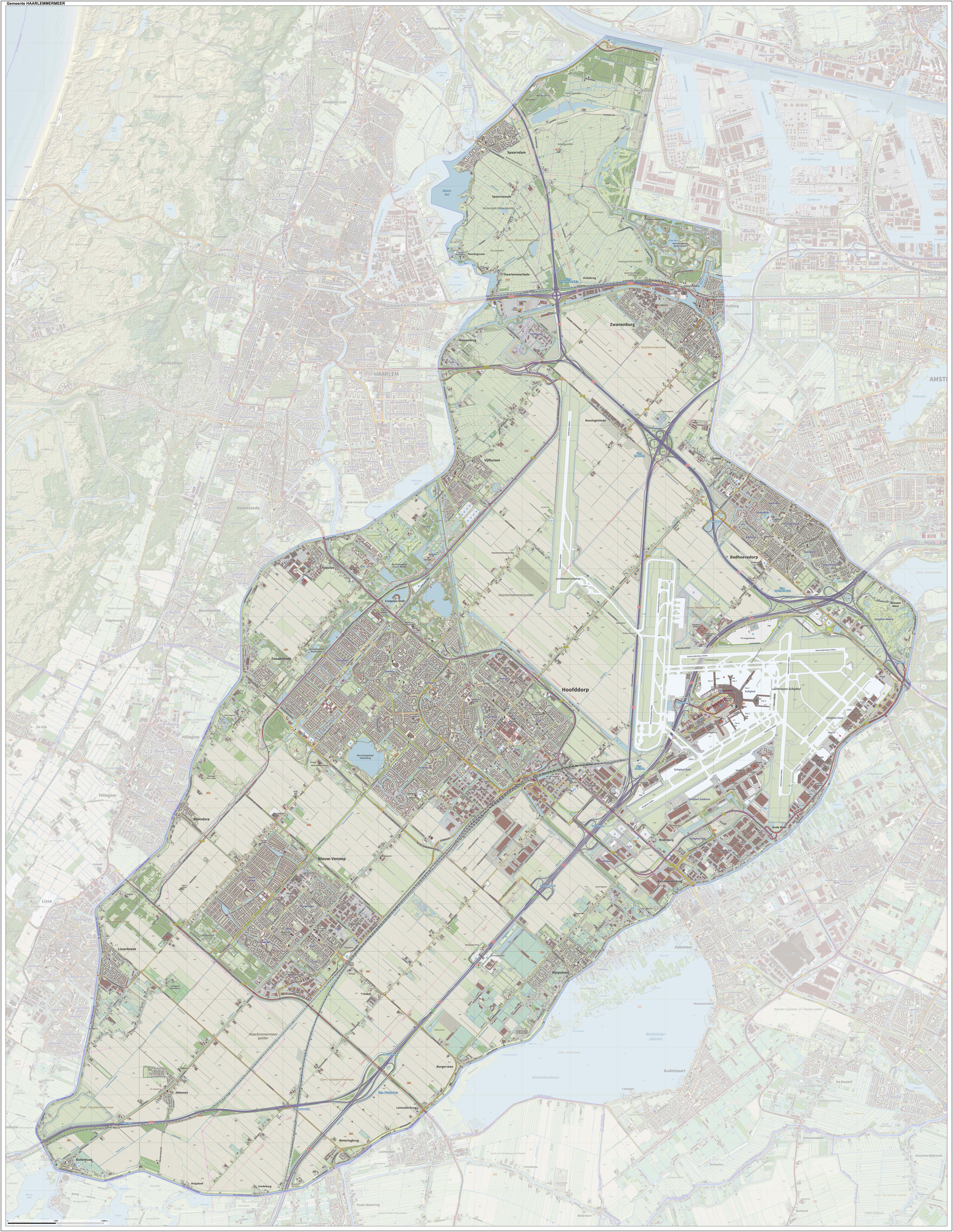
Haarlemmermeer () is a municipality in the west of the Netherlands, in the province of North Holland. Haarlemmermeer is a polder, consisting of land reclaimed from water. The name Haarlemmermeer means ' Haarlem's lake', referring to the body of water from which the region was reclaimed in the 19th century. Haarlemmermeer's main town is Hoofddorp, which has a population of 76,660. Hoofddorp, along with the rapidly growing towns of Nieuw-Vennep and Badhoevedorp, are part of the Randstad agglomeration. The main international airport of the Netherlands, Schiphol, is located in Haarlemmermeer. History The original Haarlemmermeer lake is said to have been mostly a peat bog, a relic of a northern arm of the Rhine which passed through the district in Roman times. In 1531, the original Haarlemmermeer had an area of , and near it were three smaller lakes: the Leidsche Meer (Leiden Lake), the Spiering Meer, and the Oude Meer (Old Lake), with a combined area of about . The four lakes were ... [...More Info...] [...Related Items...] OR: [Wikipedia] [Google] [Baidu] |
South Holland
South Holland ( nl, Zuid-Holland ) is a province of the Netherlands with a population of over 3.7 million as of October 2021 and a population density of about , making it the country's most populous province and one of the world's most densely populated areas. Situated on the North Sea in the west of the Netherlands, South Holland covers an area of , of which is water. It borders North Holland to the north, Utrecht and Gelderland to the east, and North Brabant and Zeeland to the south. The provincial capital is the Dutch seat of government The Hague, while its largest city is Rotterdam. The Rhine-Meuse-Scheldt delta drains through South Holland into the North Sea. Europe's busiest seaport, the Port of Rotterdam, is located in South Holland. History Early history Archaeological discoveries in Hardinxveld-Giessendam indicate that the area of South Holland has been inhabited since at least c. 7,500 years before present, probably by nomadic hunter-gatherers. Agriculture and perman ... [...More Info...] [...Related Items...] OR: [Wikipedia] [Google] [Baidu] |
Leiden
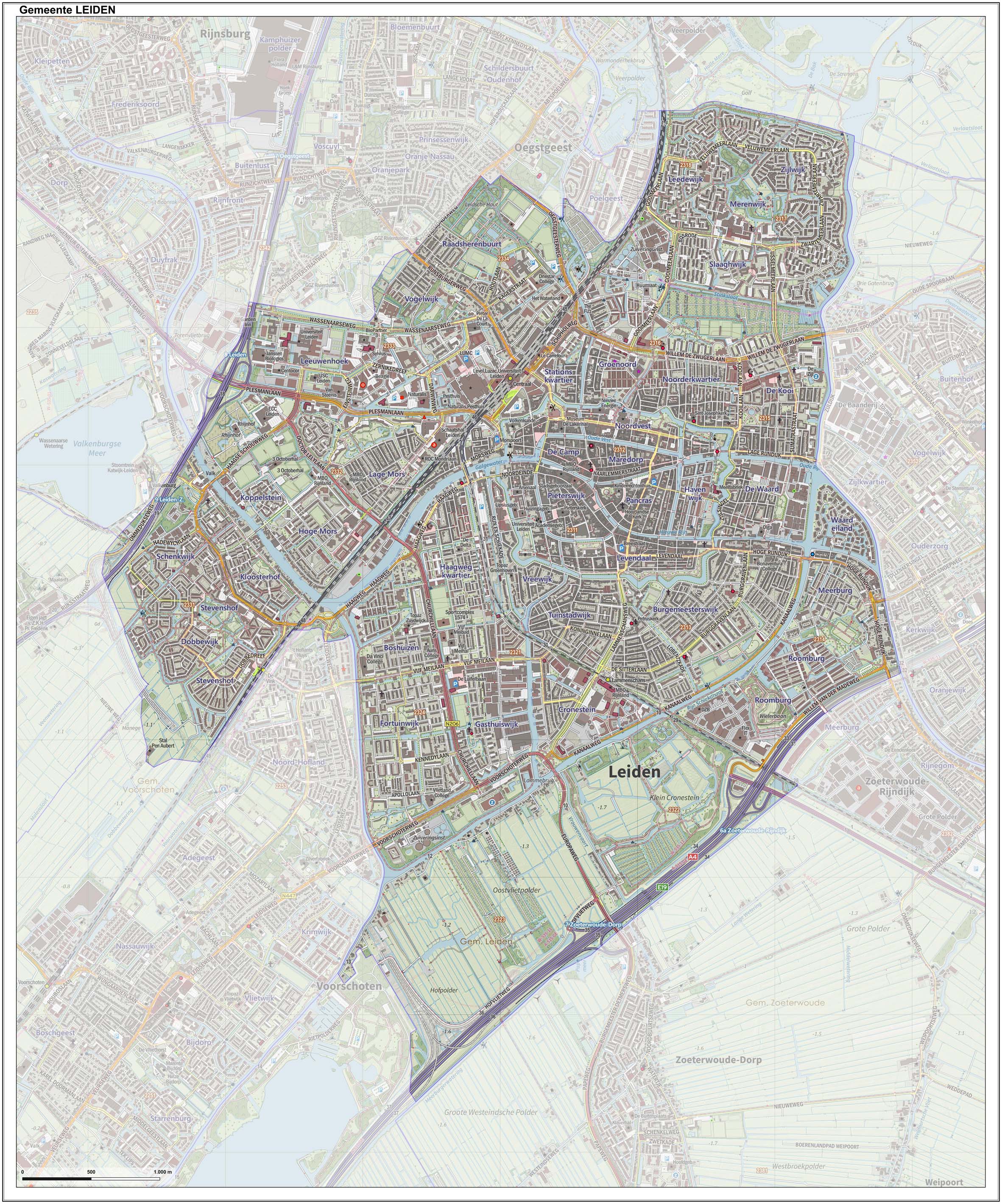
Leiden (; in English and archaic Dutch also Leyden) is a city and municipality in the province of South Holland, Netherlands. The municipality of Leiden has a population of 119,713, but the city forms one densely connected agglomeration with its suburbs Oegstgeest, Leiderdorp, Voorschoten and Zoeterwoude with 206,647 inhabitants. The Netherlands Central Bureau of Statistics (CBS) further includes Katwijk in the agglomeration which makes the total population of the Leiden urban agglomeration 270,879, and in the larger Leiden urban area also Teylingen, Noordwijk, and Noordwijkerhout are included with in total 348,868 inhabitants. Leiden is located on the Oude Rijn, at a distance of some from The Hague to its south and some from Amsterdam to its north. The recreational area of the Kaag Lakes (Kagerplassen) lies just to the northeast of Leiden. A university city since 1575, Leiden has been one of Europe's most prominent scientific centres for more than four centuries. Leide ... [...More Info...] [...Related Items...] OR: [Wikipedia] [Google] [Baidu] |
Polder
A polder () is a low-lying tract of land that forms an artificial hydrological entity, enclosed by embankments known as dikes. The three types of polder are: # Land reclaimed from a body of water, such as a lake or the seabed # Flood plains separated from the sea or river by a dike # Marshes separated from the surrounding water by a dike and subsequently drained; these are also known as ''koogs'', especially in Germany The ground level in drained marshes subsides over time. All polders will eventually be below the surrounding water level some or all of the time. Water enters the low-lying polder through infiltration and water pressure of groundwater, or rainfall, or transport of water by rivers and canals. This usually means that the polder has an excess of water, which is pumped out or drained by opening sluices at low tide. Care must be taken not to set the internal water level too low. Polder land made up of peat (former marshland) will sink in relation to its previous l ... [...More Info...] [...Related Items...] OR: [Wikipedia] [Google] [Baidu] |
Central European Time
Central European Time (CET) is a standard time which is 1 hour ahead of Coordinated Universal Time (UTC). The time offset from UTC can be written as UTC+01:00. It is used in most parts of Europe and in a few North African countries. CET is also known as Middle European Time (MET, German: MEZ) and by colloquial names such as Amsterdam Time, Berlin Time, Brussels Time, Madrid Time, Paris Time, Rome Time, Warsaw Time or even Romance Standard Time (RST). The 15th meridian east is the central axis for UTC+01:00 in the world system of time zones. As of 2011, all member states of the European Union observe summer time (daylight saving time), from the last Sunday in March to the last Sunday in October. States within the CET area switch to Central European Summer Time (CEST, UTC+02:00) for the summer. In Africa, UTC+01:00 is called West Africa Time (WAT), where it is used by several countries, year round. Algeria, Morocco, and Tunisia also refer to it as ''Central European ... [...More Info...] [...Related Items...] OR: [Wikipedia] [Google] [Baidu] |
Central European Summer Time
Central European Summer Time (CEST), sometimes referred to as Central European Daylight Time (CEDT), is the standard clock time observed during the period of summer daylight-saving in those European countries which observe Central European Time (CET; UTC+01:00) during the other part of the year. It corresponds to UTC+02:00, which makes it the same as Eastern European Time, Central Africa Time, South African Standard Time, Egypt Standard Time and Kaliningrad Time in Russia. Names Other names which have been applied to Central European Summer Time are Middle European Summer Time (MEST), Central European Daylight Saving Time (CEDT), and Bravo Time (after the second letter of the NATO phonetic alphabet). Period of observation Since 1996, European Summer Time has been observed between 01:00 UTC (02:00 CET and 03:00 CEST) on the last Sunday of March, and 01:00 UTC on the last Sunday of October; previously the rules were not uniform across the European Union. There were proposals ... [...More Info...] [...Related Items...] OR: [Wikipedia] [Google] [Baidu] |
List Of Postal Codes In The Netherlands
Postal codes in the Netherlands, known as ''postcodes'', are alphanumeric, consisting of four digits followed by two uppercase letters. The letters 'F', 'I', 'O', 'Q', 'U' and 'Y' were originally not used for technical reasons, but almost all existing combinations are now used as these letters were allowed for new locations starting 2005. The letter combinations ' SS', ' SD' and ' SA' are not used because of their associations with the Nazi occupation of the Netherlands. The first two digits indicate a city and a region, the second two digits and the two letters indicate a range of house numbers, usually on the same street. Consequently, a postal address is uniquely defined by the postal code and the house number. On average, a Dutch postal code comprises eight single addresses. There are over 575,000 postal codes in the Netherlands . Stadsregio Amsterdam Postbus 626 1000 AP Amsterdam Caribbean Netherlands The three BES-islands, which became part of the country in 2010, do ... [...More Info...] [...Related Items...] OR: [Wikipedia] [Google] [Baidu] |


