|
Königshafen (Sylt)
The Königshafen ("king's harbour") is the northernmost bight of the North Frisian island of Sylt in the German state of Schleswig-Holstein and thus also the northernmost bay in Germany. The bay gets its name from its use as a natural harbour and its legal status as part of the of Listland. The harbour was used until at least the 18th century and was later abandoned as it silted up. Location The bay of Königshafen lies north of the Sylt coastal resort of List and southeast of the promontory of , the northernmost point of Germany, on which stand the lighthouses of and , the two northernmost buildings in Germany. The bay has an area of roughly 4.2 km² and opens towards the east onto the Wadden Sea; it is only separated from the open North Sea to the west by a spit which is just 300 metres wide. In the Königshafen lie the small uninhabited island of Uthörn with its bird reserve, and the ''Lister Haken''. History The natural harbour formed by the bight was ... [...More Info...] [...Related Items...] OR: [Wikipedia] [Google] [Baidu] |
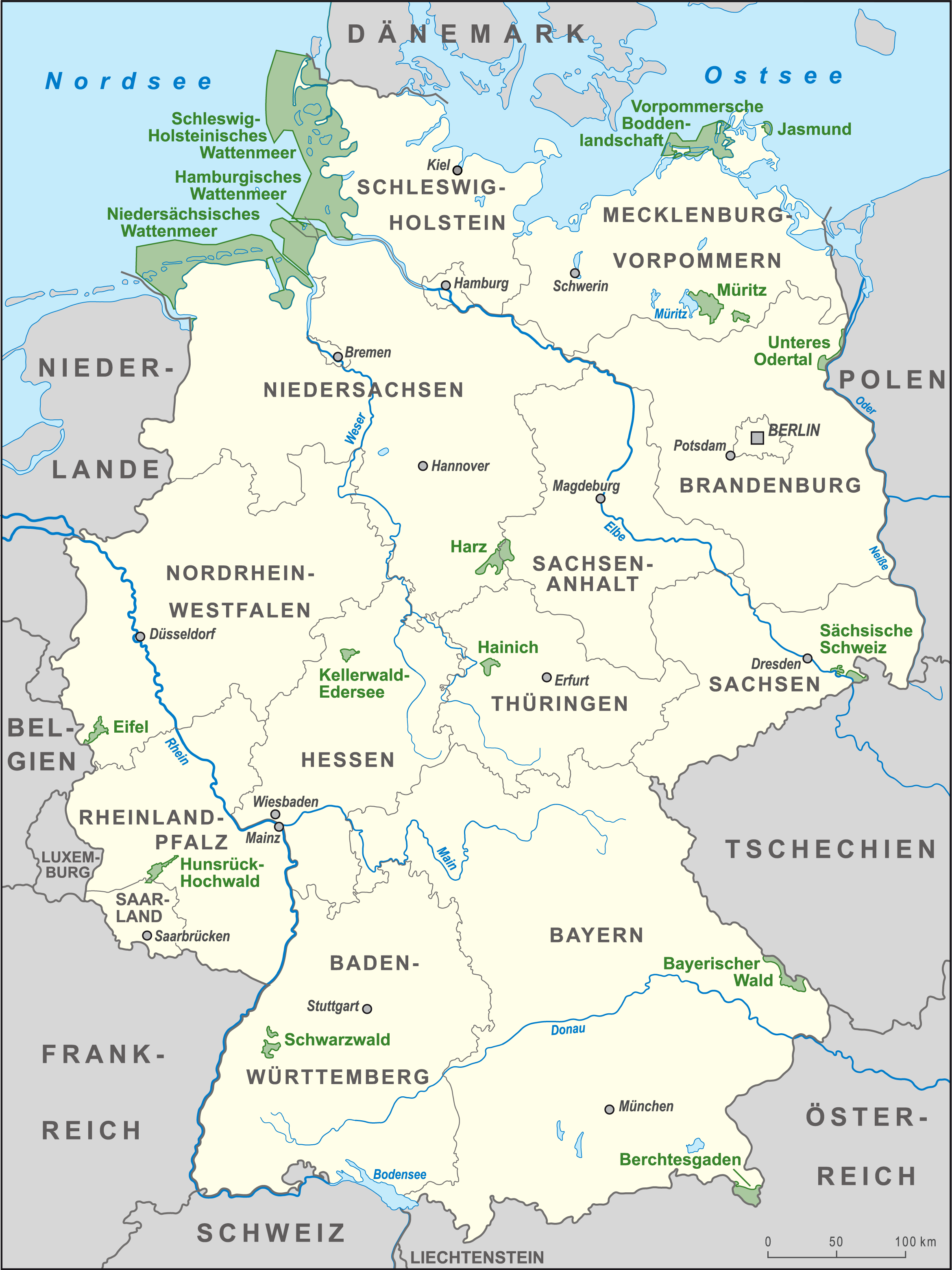
List Of National Parks Of Germany
The following are the 16 national parks of Germany, sorted from North to South: Germany also has 14 Biosphere Reserves, as well as 98 nature parks. Including the national protected areas, about 25% of Germany's area is national parks or nature parks. See also * List of nature parks in Germany * Natural National Landscapes References External links National Parks and other Protected Areas * {{Europe in topic, List of national parks of, countries_only=yes |
Bays Of Schleswig-Holstein
A bay is a recessed, coastal body of water that directly connects to a larger main body of water, such as an ocean, a lake, or another bay. A large bay is usually called a Gulf (geography), gulf, sea, sound (geography), sound, or bight (geography), bight. A cove is a small, circular bay with a narrow entrance. A fjord is an elongated bay formed by glacial action. A bay can be the estuary of a river, such as the Chesapeake Bay, an estuary of the Susquehanna River. Bays may also be nested within each other; for example, James Bay is an arm of Hudson Bay in Atlantic Canada, northeastern Canada. Some large bays, such as the Bay of Bengal and Hudson Bay, have varied marine geology. The land surrounding a bay often reduces the strength of winds and blocks waves. Bays may have as wide a variety of shoreline characteristics as other shorelines. In some cases, bays have Beaches in estuaries and bays, beaches, which "are usually characterized by a steep upper foreshore with a broad, fla ... [...More Info...] [...Related Items...] OR: [Wikipedia] [Google] [Baidu] |
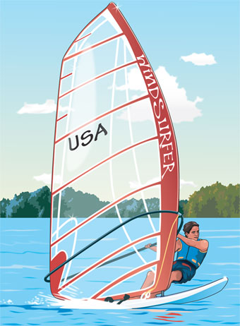
Wind Surfing
Windsurfing is a wind propelled water sport that is a combination of sailing and surfing. It is also referred to as "sailboarding" and "boardsailing", and emerged in the late 1960s from the aerospace and surf culture of California. Windsurfing gained a popular following across Europe and North America by the late 1970s and had achieved significant global popularity by the 1980s. Windsurfing became an olympic sport in 1984. Newer variants include windfoiling, kiteboarding and wingfoiling. Hydrofoil fins under the board allow the boards to safely lift out of the water and fly silently and smoothly above the surface even in lighter winds. Windsurfing is a recreational, family friendly sport, most popular at flat water locations around the world that offer safety and accessibility for beginner and intermediate participants. Technique and equipment have evolved over the years Major competitive disciplines include slalom, wave and freestyle. Increasingly, "foiling" is replacing tradi ... [...More Info...] [...Related Items...] OR: [Wikipedia] [Google] [Baidu] |
Schleswig-Holstein Wadden Sea National Park
The Schleswig-Holstein Wadden Sea National Park (german: Nationalpark Schleswig-Holsteinisches Wattenmeer) is a national park in the Schleswig-Holstein area of the German Wadden Sea. It was founded by the Parliament of Schleswig-Holstein on 1 October 1985 by the National Park Act of 22 July 1985 and expanded significantly in 1999. Together with the Lower Saxon Wadden Sea National Park, the Hamburg Wadden Sea National Park and those parts of Elbe estuary which are not nature reserves, it forms the German part of the Wadden Sea. The national park extends from the German-Danish maritime border in the north down to the Elbe estuary in the south. In the North Frisian area, it includes the mudflats around the geest-based and marsh islands and the '' Halligen'' (undyked islands). There, the mudflats are 40 km wide in places. Further south lie areas of mudflats which contain particularly large sandbanks. In addition to the plants and animals that are typical of the entire Wadde ... [...More Info...] [...Related Items...] OR: [Wikipedia] [Google] [Baidu] |
NATO
The North Atlantic Treaty Organization (NATO, ; french: Organisation du traité de l'Atlantique nord, ), also called the North Atlantic Alliance, is an intergovernmental military alliance between 30 member states – 28 European and two North American. Established in the aftermath of World War II, the organization implemented the North Atlantic Treaty, signed in Washington, D.C., on 4 April 1949. NATO is a collective security system: its independent member states agree to defend each other against attacks by third parties. During the Cold War, NATO operated as a check on the perceived threat posed by the Soviet Union. The alliance remained in place after the dissolution of the Soviet Union and has been involved in military operations in the Balkans, the Middle East, South Asia, and Africa. The organization's motto is ''animus in consulendo liber'' (Latin for "a mind unfettered in deliberation"). NATO's main headquarters are located in Brussels, Belgium, while NATO ... [...More Info...] [...Related Items...] OR: [Wikipedia] [Google] [Baidu] |
List Of Kings Of Denmark
This is a list of Danish monarchs, that is, the kings and queens regnant of Denmark. This includes: * The Kingdom of Denmark (up to 1397) ** Personal union of Denmark and Norway (1380–1397) * The Kalmar Union (1397–1536) ** Union of Denmark, Norway and Sweden (1397–1523) ** Union of Denmark and Norway (1523–1536/1537) * The United Kingdoms of Denmark–Norway (1536/1537–1814) * The Kingdom of Denmark (1814–present) ** Iceland (since the union between Denmark and Norway in 1380; independent kingdom in a personal union with Denmark 1918–1944; a sovereign republic since 1944) ** Greenland (since the union between Denmark and Norway in 1380; effective Danish–Norwegian control began in 1721; integrated into the Danish realm in 1953; internal home rule introduced 1979; self-determination assumed in 2009; Greenland has two out of 179 seats in the Danish parliament Folketinget) ** Faroe Islands (since the union between Denmark and Norway in 1380; County of Denmark 1816� ... [...More Info...] [...Related Items...] OR: [Wikipedia] [Google] [Baidu] |
River Elbe
The Elbe (; cs, Labe ; nds, Ilv or ''Elv''; Upper and dsb, Łobjo) is one of the major rivers of Central Europe. It rises in the Giant Mountains of the northern Czech Republic before traversing much of Bohemia (western half of the Czech Republic), then Germany and flowing into the North Sea at Cuxhaven, northwest of Hamburg. Its total length is . The Elbe's major tributaries include the rivers Vltava, Saale, Havel, Mulde, Schwarze Elster, and Ohře. The Elbe river basin, comprising the Elbe and its tributaries, has a catchment area of , the twelfth largest in Europe. The basin spans four countries, however it lies almost entirely just in two of them, Germany (65.5%) and the Czech Republic (33.7%, covering about two thirds of the state's territory). Marginally, the basin stretches also to Austria (0.6%) and Poland (0.2%). The Elbe catchment area is inhabited by 24.4 million people, the biggest cities within are Berlin, Hamburg, Prague, Dresden and Leipzig. Etymology Firs ... [...More Info...] [...Related Items...] OR: [Wikipedia] [Google] [Baidu] |
Skagen
Skagen () is Denmark's northernmost town, on the east coast of the Skagen Odde peninsula in the far north of Jutland, part of Frederikshavn Municipality in Nordjylland, north of Frederikshavn and northeast of Aalborg. The Port of Skagen is Denmark's main fishing port and it also has a thriving tourist industry, attracting 2 million people annually. The name was applied originally to the peninsula but it now also refers to the town. The settlement began during the Middle Ages as a fishing village, renowned for its herring industry. Thanks to its seascapes, fishermen and evening light, towards the end of the 19th century it became popular with a group of impressionist artists now known as the Skagen Painters. In 1879, the Skagen Fishermen's Association was established with the purpose of facilitating the local fishing industry through the Skagensbanen railway, which opened as a narrow-gauged railway in 1890. The modern port of Skagen opened on 20 November 1907, and with ... [...More Info...] [...Related Items...] OR: [Wikipedia] [Google] [Baidu] |
Middle Ages
In the history of Europe, the Middle Ages or medieval period lasted approximately from the late 5th to the late 15th centuries, similar to the post-classical period of global history. It began with the fall of the Western Roman Empire and transitioned into the Renaissance and the Age of Discovery. The Middle Ages is the middle period of the three traditional divisions of Western history: classical antiquity, the medieval period, and the modern period. The medieval period is itself subdivided into the Early, High, and Late Middle Ages. Population decline, counterurbanisation, the collapse of centralized authority, invasions, and mass migrations of tribes, which had begun in late antiquity, continued into the Early Middle Ages. The large-scale movements of the Migration Period, including various Germanic peoples, formed new kingdoms in what remained of the Western Roman Empire. In the 7th century, North Africa and the Middle East—most recently part of the Eastern Ro ... [...More Info...] [...Related Items...] OR: [Wikipedia] [Google] [Baidu] |
Uthörn
Uthörn ( da, Udhjørne Holm) is a small German island adjacent to the Sylt island in the district of Nordfriesland, and as such it is Germany's northernmost isle right after Sylt proper. It belongs to the List municipality. Geography The island is situated in the so-called Königshafen (King's Harbour), a bay on the eastern shore of Sylt which is facing the shallow tidal flats of the Wadden Sea in that area. Uthörn is located north of the town of List, only a kilometre away from the ''Ellbogen'' (Elbow) peninsula of Sylt, which is in fact Germany's northernmost area. Uthörn is almost 800 meters long and up to 240 meters wide, its area amounts to about 13 ha. The island is relatively young, as it developed out of a sand bar, which due to wind drift of sand from Sylt has now grown to a height of approximately 4.10 m above sea level and is no longer submerged during high tide. It is thought that the growth of Uthörn is likely to continue in the future. The island is overgro ... [...More Info...] [...Related Items...] OR: [Wikipedia] [Google] [Baidu] |
.jpg)


