|
Kästeklippen
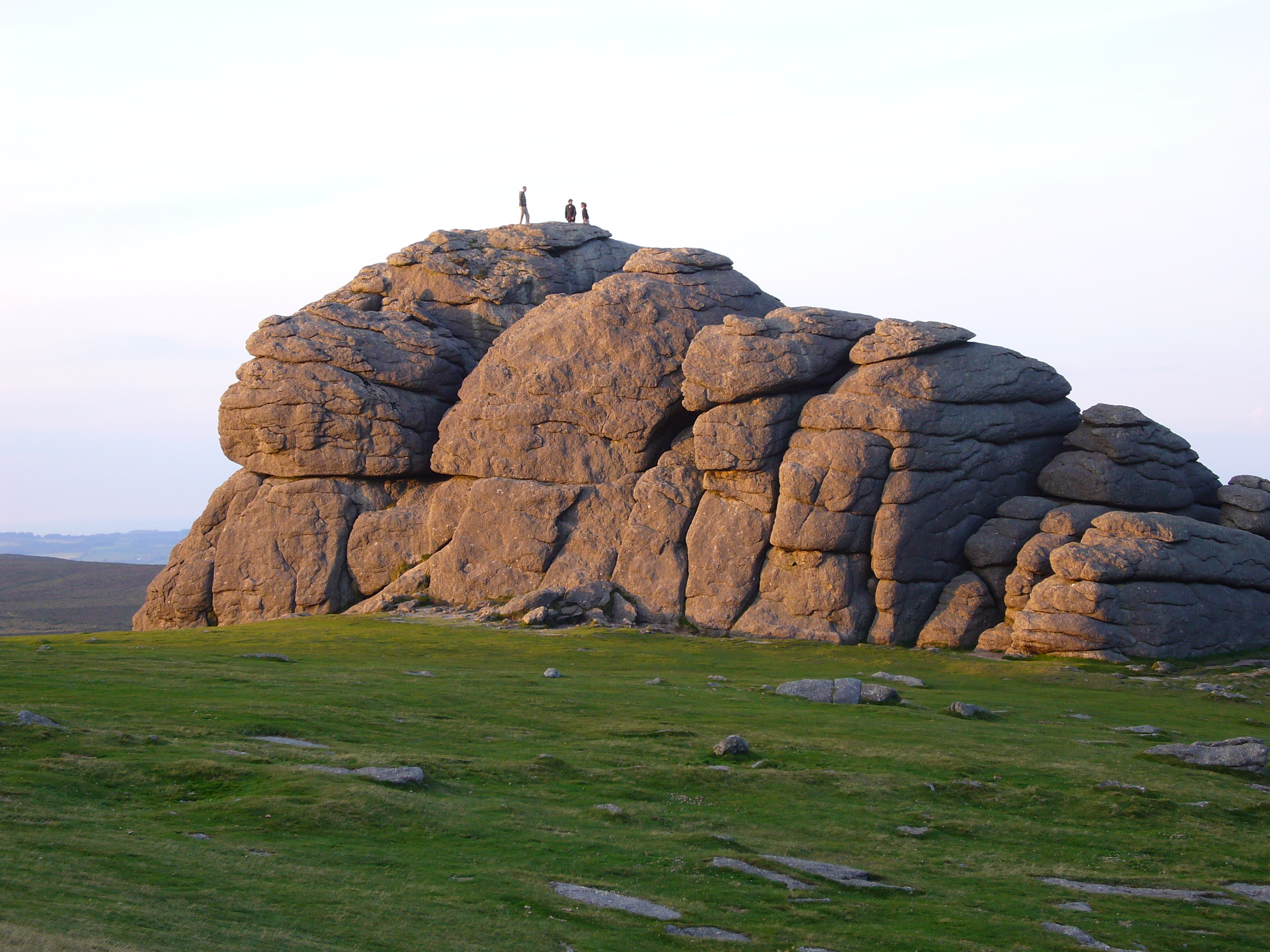
The ''Kästeklippen'', often shortened to ''Käste'', is a rocky tor above the Oker valley in the Upper Harz mountains of central Germany. It lies at a height of . Near the ''Käste'' are other similar granite rock formations such as the ''Hexenküche'' ("Witch's Kitchen"), ''Mausefalle'' ("Mousetrap"), ''Feigenbaumklippe'' and the ''Treppenstein''. Next to the observation platform is a protruding rock which resembles the face of an old man and is called ''Der Alte vom Berge'' ("Old Man of the Mountain"). The rocks consist of granite "wool sacks", typical of the Harz region. The ''Kästeklippen'' (''Klippen'' = crags) are a popular destination in the Harz. From here, there are views to the Sudmerberg hill in the borough of Goslar. Numerous paths lead from the Oker Reservoir, Romkerhall, Oker, Göttingerode and Bad Harzburg up to the ''Käste''. The most important access route is the ''Kästestraße''. It runs from Bad Harzburg up to the ''Schlackenplatz'' on the Morlberg and th ... [...More Info...] [...Related Items...] OR: [Wikipedia] [Google] [Baidu] |
Romkerhall
Romkerhall (also frequently called ''Romkerhalle'') is a popular tourist destination on the River Oker in the Harz Mountains of Germany. There is a public car park here as well as a hotel and restaurant opposite the Romkerhall Waterfall. Romkerhall lies within the unincorporated area of Harz in the Lower Saxon county of Goslar in the Harz Mountains. The hotel and waterfall form a small tourist attraction which is marketed as the "Kingdom of Romkerhall - the smallest kingdom in the world!" (German: ''"Königreich Romkerhall − das kleinste Königreich der Welt!"'') Location Romkerhalle lies in the Upper Harz within the Harz Nature Park, around 5 kilometres south of the village of Oker in the borough of Goslar and about 1.5 kilometres (both distances as the crow flies) northeast of the Oker Reservoir on the B 498 federal road which runs parallel to the River Oker, here at a height of . About 200 metres to the south is the Romkerhalle Hydropower Station, ... [...More Info...] [...Related Items...] OR: [Wikipedia] [Google] [Baidu] |
Feigenbaumklippe
The ''Feigenbaumklippe'' is a rock formation in the Oker valley in the Harz mountains of central Germany. They lie on the hiking trail from the ''Kästeklippen'' crags to Romkerhall Waterfall. These granite Granite () is a coarse-grained ( phaneritic) intrusive igneous rock composed mostly of quartz, alkali feldspar, and plagioclase. It forms from magma with a high content of silica and alkali metal oxides that slowly cools and solidifies under ... rocks, which show clear signs of "wool sack weathering" (''Wollsackverwitterung'') are a favourite destination for hikers and offer a good view of the valley towards the west. The observation point has safety railings. retrieved on 21 May 2010 References [...More Info...] [...Related Items...] OR: [Wikipedia] [Google] [Baidu] |
Treppenstein
The ''Treppenstein'' is a rock formation in the Oker valley in the Harz mountains of central Germany. It lies on the trail from the Romkerhall Waterfall to the ''Kästeklippen''. The rocks consist of granite and have clearly undergone so-called "wool sack weathering" (''Wollsackverwitterung''). The ''Treppenstein'' is a popular destination and part of the system of checkpoints (no. 117) in the ''Harzer Wandernadel'' hiking trail network. The summit has safety railings and may be climbed using steps hacked out of the rock and flights of stairs attached to the rocks. From the summit there is a view towards the west. In addition, part of the rock formation, the ''Kleine Treppenstein'' is used for rock climbing. The routes Route or routes may refer to: * Route (gridiron football), a path run by a wide receiver * route (command), a program used to configure the routing table * Route, County Antrim, an area in Northern Ireland * ''The Route'', a 2013 Ugandan film * Ro ... here are rated ... [...More Info...] [...Related Items...] OR: [Wikipedia] [Google] [Baidu] |
Oker (Goslar)
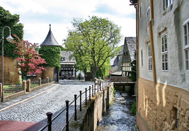
Oker is a borough (''Stadtteil'') of Goslar in Lower Saxony, Germany. Since 1952 a mining town in its own right within Wolfenbüttel district, it was incorporated into the Goslar municipality on 1 July 1972. Geography The settlement is situated on the northern edge of the Harz mountain range. The river Oker gives its name to the location, where the stream together with its Abzucht tributary leads out of the Oker valley between the Hahnenberg and Adenberg mountains in the south and the Sudmerberg hill in the north. Oker is divided into two unofficial districts: ''Oberoker'' (Upper Oker) south of the Vienenburg–Goslar railway line (and nearer to the Harz range), and ''Unteroker'' (Lower Oker) north of it. History Founded in 1527 by the Wolfenbüttel duke Henry V of Brunswick-Lüneburg as a smelting site for the processing of ore from the Rammelsberg mines, Oker for centuries was a centre of smelting technology in the Harz region. The Oker lead and copper works (''Bleihütte O ... [...More Info...] [...Related Items...] OR: [Wikipedia] [Google] [Baidu] |
Harzklippen
This is a list of rock formations in the Harz. They are known as the Harzklippen (literally "Harz crags" or "Harz cliffs") in German, which is the collective name for the, mainly, granite rock outcrops, crags and tors in the Harz mountains of Germany. Most of them have the status of a natural monument. The following list contains an alphabetically-sorted selection of rock formations in the Harz with - where known - their height in metres (m) above sea level, referenced to Normalnull (NN): * Achtermannstor (max. c. 900 m), on the Achtermannshöhe, near Braunlage, Lower Saxony * Ackertklippe, near Königshütte, Saxony-Anhalt * Adlerklippen (max. c. 340 m), in the valley of the Oker, near Goslar-Oker, Lower Saxony * Adlersklippen (see below: ''Teufelsmauer'') * Ahrentsklint (''Ahrentsklintklippe''; max. 822.4 m), on the Erdbeerkopf, near Schierke, Saxony-Anhalt * Altarklippen (max. c. 490 m), on the Heimberg, near Lautenthal, Lower Saxony * Anhaltin ... [...More Info...] [...Related Items...] OR: [Wikipedia] [Google] [Baidu] |
Oker
The Oker is a river in Lower Saxony, Germany, that has historically formed an important political boundary. It is a left tributary of the River Aller, in length and runs in a generally northerly direction. Origin and meaning of the name The river's name was recorded around 830 as ''Obacra'' and, later, as ''Ovokare'' und ''Ovakara''.H. Blume: ''Oker, Schunter, Wabe.'' In: ''Braunschweigisches Jahrbuch für Landesgeschichte'', vol. 86, 2005, p. 14 sqq. The origin of the name is derived from the roots ''ov-'' and ''-akara'' meaning “upper” (cf. New High German ''ober-'') and “onward rushing” (rendered in German as “Vorwärtsdrängende”) as distinct from its tributary, the Ecker, whose name means only “onward rushing”. Course The Oker rises at about 910 metres in the Harz National Park in a boggy area on the Bruchberg in the Harz mountains of central Germany. This early section is known as the ''Große Oker'' ("Great Oker") and it is impounded below A ... [...More Info...] [...Related Items...] OR: [Wikipedia] [Google] [Baidu] |
Upper Harz
The Upper Harz (german: Oberharz, ) refers to the northwestern and higher part of the Harz mountain range in Germany. The exact boundaries of this geographical region may be defined differently depending on the context. In its traditional sense, the term Upper Harz covers the area of the seven historical mining towns (''Bergstädte'') - Clausthal, Zellerfeld, Andreasberg, Altenau, Lautenthal, Wildemann and Grund - in the present-day German federal state of Lower Saxony. Orographically, it comprises the Harz catchment areas of the Söse, Innerste and Grane, Oker and Abzucht mountain streams, all part of the larger Weser watershed. Much of the Upper Harz area is up to above sea level. In a wider sense, it also comprises the adjacent High Harz (''Hochharz'') range in the east, climbing to over in the Brocken massif. Geography The region is centred on the geological structure of the region around the municipality of Clausthal-Zellerfeld, merged in 1924. From the Clausthal ''Ku ... [...More Info...] [...Related Items...] OR: [Wikipedia] [Google] [Baidu] |
Woolsack Weathering
Spheroidal weathering is a form of chemical weathering that affects jointed bedrock and results in the formation of concentric or spherical layers of highly decayed rock within weathered bedrock that is known as ''saprolite.'' When saprolite is exposed by physical erosion, these concentric layers peel (spall) off as concentric shells much like the layers of a peeled onion. Within saprolite, spheroidal weathering often creates rounded boulders, known as ''corestones'' or ''woolsack'', of relatively unweathered rock. Spheroidal weathering is also called onion skin weathering, concentric weathering, spherical weathering, or woolsack weathering.Fairbridge, RW (1968) ''Spheroidal Weathering.'' in RW Fairbridge, ed., pp. 1041–1044, The Encyclopedia of Geomorphology, Encyclopedia of Earth Sciences, vol. III. Reinhold Book Corporation, New York, New York. Ollier, C.D. (1971). ''Causes of spheroidal weathering. ''Earth-Science Reviews 7:127–141.Neuendorf, KKE, JP Mehl Jr., and JA J ... [...More Info...] [...Related Items...] OR: [Wikipedia] [Google] [Baidu] |
Sudmerberg
Sudmerberg is a quarter (''Stadtteil'') of Goslar in Lower Saxony, Germany, named after a prominent -metre-high hill to the east. Geography The settlement is located between Goslar town centre and the Oker in the southeast. The Abzucht stream runs between the Sudmerberg hill, rising in the east, and the northern edge of the Harz mountains. The area is part of the Harz Nature Park. Sudmerberg currently has about 1,880 inhabitants. The Vienenburg–Goslar railway follows the Abzucht river south of Sudmerberg. To the north, the ''Bundesstraße 6'' federal highway runs to the neighbouring town of Bad Harzburg. History An early medieval lowland castle, located at the confluence of the Abzucht and the Oker, was first mentioned as ''Sudburg'' in a 1064 deed issued by King Henry IV of Germany. Probably affiliated with the nearby royal palace of Werla, it lent its name to the adjacent Sudmerberg hill. Today, only the foundations remain of the fortress which fell into ruins in the 14 ... [...More Info...] [...Related Items...] OR: [Wikipedia] [Google] [Baidu] |
Goslar
Goslar (; Eastphalian: ''Goslär'') is a historic town in Lower Saxony, Germany. It is the administrative centre of the district of Goslar and located on the northwestern slopes of the Harz mountain range. The Old Town of Goslar and the Mines of Rammelsberg are UNESCO World Heritage Sites for their millenium-long testimony to the history of ore mining and their political importance for the Holy Roman Empire and Hanseatic League. Each year Goslar awards the Kaiserring to an international artist, called the "Nobel Prize" of the art world. Geography Goslar is situated in the middle of the upper half of Germany, about south of Brunswick and about southeast of the state capital, Hanover. The Schalke mountain is the highest elevation within the municipal boundaries at . The lowest point of is near the Oker river. Geographically, Goslar forms the boundary between the Hildesheim Börde which is part of the Northern German Plain, and the Harz range, which is the highest, norther ... [...More Info...] [...Related Items...] OR: [Wikipedia] [Google] [Baidu] |
Oker Reservoir
The Oker is a river in Lower Saxony, Germany, that has historically formed an important political boundary. It is a left tributary of the River Aller, in length and runs in a generally northerly direction. Origin and meaning of the name The river's name was recorded around 830 as ''Obacra'' and, later, as ''Ovokare'' und ''Ovakara''.H. Blume: ''Oker, Schunter, Wabe.'' In: ''Braunschweigisches Jahrbuch für Landesgeschichte'', vol. 86, 2005, p. 14 sqq. The origin of the name is derived from the roots ''ov-'' and ''-akara'' meaning “upper” (cf. New High German ''ober-'') and “onward rushing” (rendered in German as “Vorwärtsdrängende”) as distinct from its tributary, the Ecker, whose name means only “onward rushing”. Course The Oker rises at about 910 metres in the Harz National Park in a boggy area on the Bruchberg in the Harz mountains of central Germany. This early section is known as the ''Große Oker'' ("Great Oker") and it is impounded below Alte ... [...More Info...] [...Related Items...] OR: [Wikipedia] [Google] [Baidu] |


