|
Kurumayama
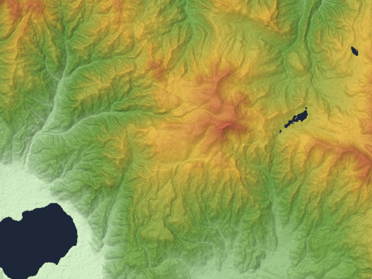
is mountain in Nagano Prefecture, Japan. A part of the Kirigamine volcano and is the highest point. The north-west side is covered with forest. The south-east side of Kurumayama is grassy which allows easy paragliding. The car access to the bottom of Kurumayama does not require the four-wheel drive, but at heavy snow, snow chains may help a lot. File:Mount Kuruma 20140929.jpg, East side of Kurumayama File:KirigamineFromSouth.jpg, January File:Kurumayama Kogen14s3s4592.jpg, Small Shinto shrine on the summit File:Kurumayama Kogen11s2s4592.jpg, JMA's weather radar on the summit File:Tateshina07.JPG, East view from the top of Mount Kuruma. in the center. Mount Tateshina also Suwa Fuji is a complex volcano located on the border of the municipalities of Chino and Tateshina in Nagano Prefecture, Japan. It has an elevation of . This mountain is one of the 100 Famous Japanese Mountains. Outline Mount Tateshi ... in the background. References {{coord, 36, 06, 10, N, ... [...More Info...] [...Related Items...] OR: [Wikipedia] [Google] [Baidu] |
Mount Kirigamine
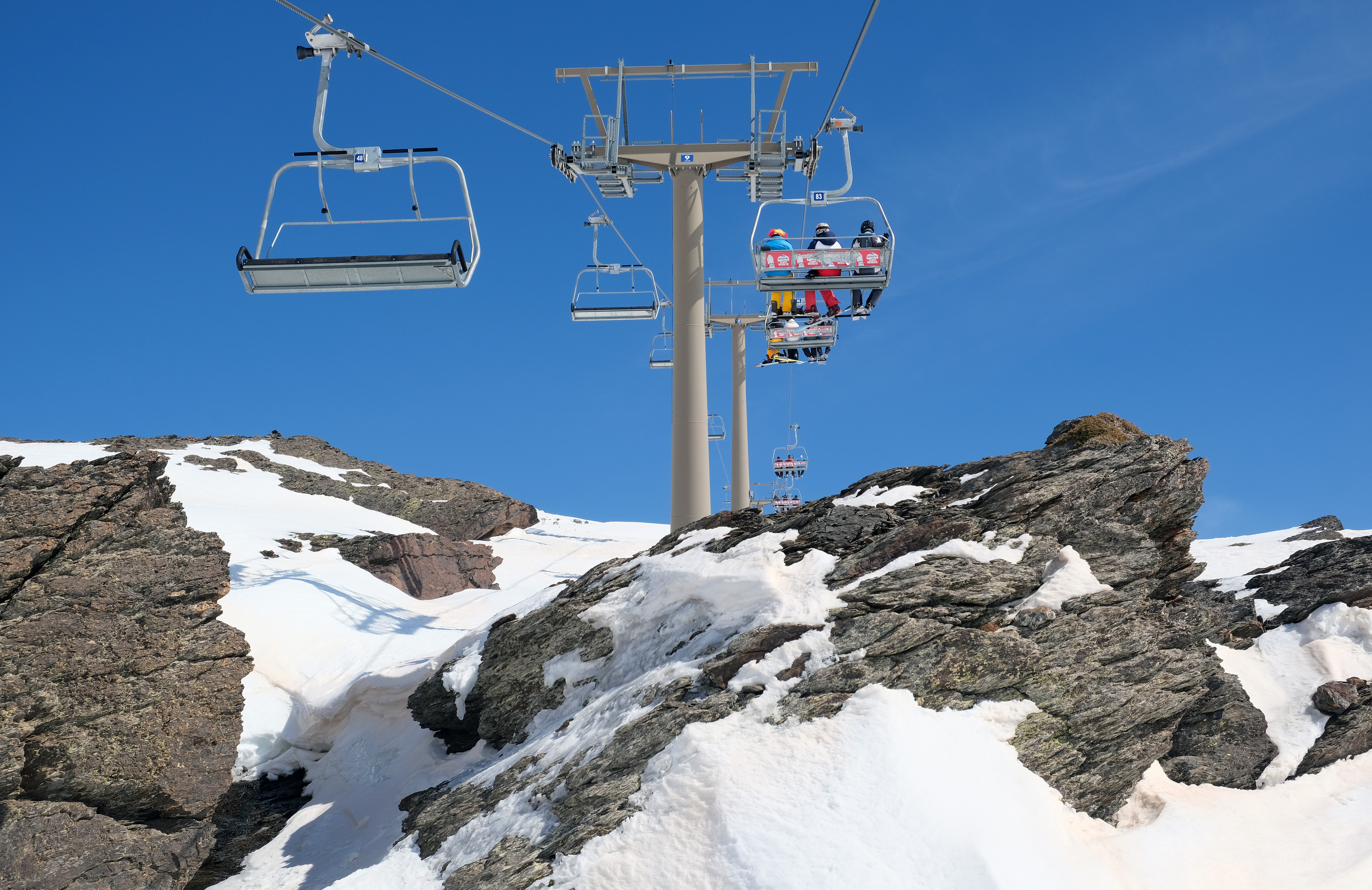
is a 1,925m volcano, located in Nagano Prefecture, Japan. Outline The tallest peak of Mount Kirigamine is Mount Kuruma, on which there is a weather radar site. Most of the mountain is covered in grass with sparse bushes and rocks. The south and east sides are suitable for gliding with a narrow landing zone in the vicinity of a parking lot and a huge emergency landing at the west side of the mountain. The southeast cliffs are a launching point for gliders, with winds above 3 meters. The north part is equipped with ski lifts. Access Vehicle access to the bottom of Kirigamine does not require four-wheel drive but snow chains may be necessary if there is heavy snow. Gallery KirigamineFromSouth.jpg, Mount Kuruma is a tallest peak File:Kurumayama04.JPG, Mount Kuruma from Mount Minaminomimi File:Mount Kirigamine 20140929.jpg, Kirigamine seen from the east. File:Yashima04.JPG, Mount Kirigamine and Yashimagahara Wetland File:Kurumayama08.JPG, A weather radar site on the top of Mount ... [...More Info...] [...Related Items...] OR: [Wikipedia] [Google] [Baidu] |
:en:Mount Kirigamine
is a 1,925m volcano, located in Nagano Prefecture, Japan. Outline The tallest peak of Mount Kirigamine is Mount Kuruma, on which there is a weather radar site. Most of the mountain is covered in grass with sparse bushes and rocks. The south and east sides are suitable for gliding with a narrow landing zone in the vicinity of a parking lot and a huge emergency landing at the west side of the mountain. The southeast cliffs are a launching point for gliders, with winds above 3 meters. The north part is equipped with ski lifts. Access Vehicle access to the bottom of Kirigamine does not require four-wheel drive but snow chains may be necessary if there is heavy snow. Gallery KirigamineFromSouth.jpg, Mount Kuruma is a tallest peak File:Kurumayama04.JPG, Mount Kuruma from Mount Minaminomimi File:Mount Kirigamine 20140929.jpg, Kirigamine seen from the east. File:Yashima04.JPG, Mount Kirigamine and Yashimagahara Wetland File:Kurumayama08.JPG, A weather radar site on the top of Mou ... [...More Info...] [...Related Items...] OR: [Wikipedia] [Google] [Baidu] |
Yatsugatake-Chūshin Kōgen Quasi-National Park
is a quasi-national park on Honshū in Japan. It is rated a protected landscape (category V) according to the IUCN. The park includes the Yatsugatake Mountains and the surrounding lava plateaus: Tateshina plateau, Kirigamine, and Utsukushigahara. It straddles the border between Nagano and Yamanashi prefectures. Mount Aka is the highest point in the park at 2,899 m. The volcanoes of the Yatsugatake mountains erupted from the middle of the Fossa Magna ( ja) and spread skirts of lava south, east and west. Lake Matsubara, Shirakoma Pond, and Lake Shirakaba attract tourists to the region for boating, skating, and camping. Utsukushigahara is a lava plateau at the northern end of the park and offers views of the Northern Alps. The extensive lava plateau of Kirigahara is popular for hiking. There are also a number of onsens in addition to the hotsprings at Tateshina. The park was designated a quasi-national in 1964. Like all quasi-national parks in Japan, the park is managed by th ... [...More Info...] [...Related Items...] OR: [Wikipedia] [Google] [Baidu] |
Japan
Japan ( ja, 日本, or , and formally , ''Nihonkoku'') is an island country in East Asia. It is situated in the northwest Pacific Ocean, and is bordered on the west by the Sea of Japan, while extending from the Sea of Okhotsk in the north toward the East China Sea, Philippine Sea, and Taiwan in the south. Japan is a part of the Ring of Fire, and spans Japanese archipelago, an archipelago of List of islands of Japan, 6852 islands covering ; the five main islands are Hokkaido, Honshu (the "mainland"), Shikoku, Kyushu, and Okinawa Island, Okinawa. Tokyo is the Capital of Japan, nation's capital and largest city, followed by Yokohama, Osaka, Nagoya, Sapporo, Fukuoka, Kobe, and Kyoto. Japan is the List of countries and dependencies by population, eleventh most populous country in the world, as well as one of the List of countries and dependencies by population density, most densely populated and Urbanization by country, urbanized. About three-fourths of Geography of Japan, the c ... [...More Info...] [...Related Items...] OR: [Wikipedia] [Google] [Baidu] |
Nagano Prefecture
is a landlocked prefecture of Japan located in the Chūbu region of Honshū. Nagano Prefecture has a population of 2,052,493 () and has a geographic area of . Nagano Prefecture borders Niigata Prefecture to the north, Gunma Prefecture to the northeast, Saitama Prefecture to the east, Yamanashi Prefecture to the southeast, Shizuoka Prefecture and Aichi Prefecture to the south, and Gifu Prefecture and Toyama Prefecture to the west. Nagano is the capital and largest city of Nagano Prefecture, with other major cities including Matsumoto, Ueda, and Iida. Nagano Prefecture has impressive highland areas of the Japanese Alps, including most of the Hida Mountains, Kiso Mountains, and Akaishi Mountains which extend into the neighbouring prefectures. The abundance of mountain ranges, natural scenic beauty, and rich history has gained Nagano Prefecture international recognition as a world-class winter sports tourist destination, including hosting the 1998 Winter Olympics and a new ... [...More Info...] [...Related Items...] OR: [Wikipedia] [Google] [Baidu] |
Prefectures Of Japan
Japan is divided into 47 prefectures (, ''todōfuken'', ), which rank immediately below the national government and form the country's first level of jurisdiction and administrative division. They include 43 prefectures proper (, ''ken''), two urban prefectures (, '' fu'': Osaka and Kyoto), one " circuit" or "territory" (, '' dō'': Hokkai-dō) and one metropolis (, '' to'': Tokyo). In 1868, the Meiji ''Fuhanken sanchisei'' administration created the first prefectures (urban ''fu'' and rural ''ken'') to replace the urban and rural administrators (''bugyō'', ''daikan'', etc.) in the parts of the country previously controlled directly by the shogunate and a few territories of rebels/shogunate loyalists who had not submitted to the new government such as Aizu/ Wakamatsu. In 1871, all remaining feudal domains ''( han)'' were also transformed into prefectures, so that prefectures subdivided the whole country. In several waves of territorial consolidation, today's 47 prefecture ... [...More Info...] [...Related Items...] OR: [Wikipedia] [Google] [Baidu] |
Suwa, Nagano
is a city located in Nagano Prefecture, Japan. , the city had an estimated population of 48,972 in 20698 households, and a population density of 452 persons per km². The total area of the city is . History The shores of Lake Suwa have been inhabited since at least the Japanese Paleolithic period. The Suwa clan ruled the area since the Nara period, and the area developed as a castle town for Suwa Domain under the Edo period Tokugawa shogunate and as a post station on the Kōshū Kaidō highway. In the post-Meiji restoration cadastral reforms of April 1, 1889, the village of Kamisuwa was established. Kawasuwa was elevated to town status on April 20, 1891. After merger with the villages of Shiga and Toyoda (from Suwa District), Kamisuwa was elevated to city status on August 10, 1941, changing its name to Suwa. Geography Suwa is located in central Nagano Prefecture, bordered on the north and west by Lake Suwa, approximately 100 kilometers south of the prefectural capital of N ... [...More Info...] [...Related Items...] OR: [Wikipedia] [Google] [Baidu] |
Chino, Nagano
is a city located in Nagano Prefecture, Japan. , the city had an estimated population of 55,673 in 23,236 households, and a population density of 210 persons per km². The total area of the city is . Geography Chino is located in a mountainous area of the east-central Nagano prefecture. Notable mountains within the city limits include Mount Yatsugatake, Mount Tateshina, and Mount Kirigamine. Chino city hall is located at an elevation of 801 meters and is thus the highest city hall location in Japan. Climate The city has a climate characterized by hot and humid summers, and relatively mild winters (Köppen climate classification ''Cfa''). The average annual temperature in Chino is 10.9 °C. The average annual rainfall is 1310 mm with September as the wettest month. The temperatures are highest on average in August, at around 23.6 °C, and lowest in January, at around -1.8 °C. The mountainous portions of the city are considered part of the snow country of ... [...More Info...] [...Related Items...] OR: [Wikipedia] [Google] [Baidu] |
Municipalities Of Japan
Japan has three levels of governments: national, prefectural, and municipal. The nation is divided into 47 prefectures. Each prefecture consists of numerous municipalities, with 1,719 in total (January 2013 figures There are four types of municipalities in Japan: Cities of Japan, cities, towns, villages and special wards (the ''ku'' of Tokyo). In Japanese, this system is known as , where each kanji in the word represents one of the four types of municipalities. Some designated cities also have further administrative subdivisions, also known as wards. But, unlike the Special wards of Tokyo, these wards are not municipalities. Status The status of a municipality, if it is a village, town or city, is decided by the prefectural government. Generally, a village or town can be promoted to a city when its population increases above fifty thousand, and a city can (but need not) be demoted to a town or village when its population decreases below fifty thousand. The least-populated cit ... [...More Info...] [...Related Items...] OR: [Wikipedia] [Google] [Baidu] |
Chairlift
An elevated passenger ropeway, or chairlift, is a type of aerial lift, which consists of a continuously circulating steel wire rope loop strung between two end terminals and usually over intermediate towers, carrying a series of chairs. They are the primary onhill transport at most ski areas (in such cases referred to as 'ski lifts'), but are also found at amusement parks, various tourist attractions, and increasingly in urban transport. Depending on carrier size and loading efficiency, a passenger ropeway can move up to 4000 people per hour, and the fastest lifts achieve operating speeds of up to or . The two-person double chair, which for many years was the workhorse of the ski industry, can move roughly 1200 people per hour at rope speeds of up to . The four person detachable chairlift ("high-speed quad") can transport 2400 people per hour with an average rope speed of . Some bi and tri cable elevated ropeways and reversible tramways achieve much greater operating speeds ... [...More Info...] [...Related Items...] OR: [Wikipedia] [Google] [Baidu] |
Snow Chains
Snow chains, or tire chains, are devices fitted to the tires of vehicles to provide increased traction when driving through snow and ice. Snow chains attach to the drive wheels of a vehicle or special systems deploy chains which swing under the tires automatically. Although named after steel chain, snow chains may be made of other materials and in a variety of patterns and strengths. Chains are usually sold in pairs and often must be purchased to match a particular tire size (tire diameter and tread width), although some designs can be adjusted to fit various sizes of tire. Driving with chains reduces fuel efficiency, and can reduce the allowable speed of the automobile to approximately , but increase traction and braking on snowy or icy surfaces. Some regions require chains to be used under some weather conditions, but other areas prohibit the use of chains, as they can deteriorate road surfaces. History Snow chains were invented in 1904 by Harry D. Weed in Canastota, New ... [...More Info...] [...Related Items...] OR: [Wikipedia] [Google] [Baidu] |
:en:Shinto Shrine
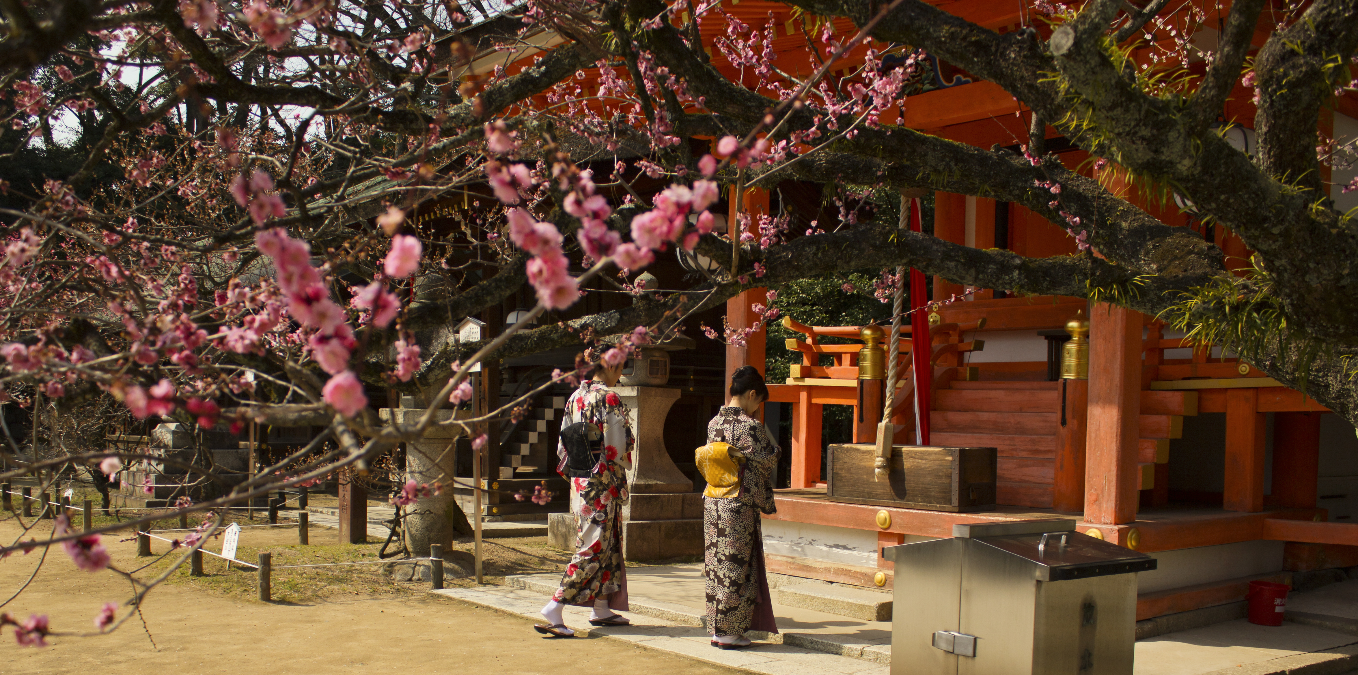
A Stuart D. B. Picken, 1994. p. xxiii is a structure whose main purpose is to house ("enshrine") one or more ''kami'', the deities of the Shinto religion. The ''honden''Also called (本殿, meaning: "main hall") is where a shrine's patron ''kami'' is/are enshrined.Iwanami Japanese dictionary The ''honden'' may be absent in cases where a shrine stands on or near a sacred mountain, tree, or other object which can be worshipped directly or in cases where a shrine possesses either an altar-like structure, called a ''himorogi,'' or an object believed to be capable of attracting spirits, called a ''yorishiro,'' which can also serve as direct bonds to a ''kami''. There may be a and other structures as well. Although only one word ("shrine") is used in English, in Japanese, Shinto shrines may carry any one of many different, non-equivalent names like ''gongen'', ''-gū'', ''jinja'', ''jingū'', ''mori'', ''myōjin'', ''-sha'', ''taisha'', ''ubusuna'' or ''yashiro''. Miniature shrine ... [...More Info...] [...Related Items...] OR: [Wikipedia] [Google] [Baidu] |


