|
Kulata
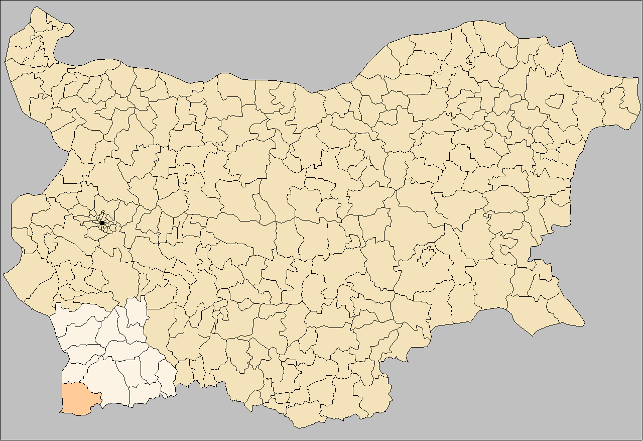
Kulata ( bg, Кулата , , el, Κούλα or Κούλατα) is a village in Petrich Municipality, Blagoevgrad Province, in southwestern Bulgaria. it has 892 inhabitants and the mayor is Dimitar Manolev. The village is a major border checkpoint on the border with Greece. The community of Promachonas in Serres regional unit lies across the border. The first-class European route E79 and the railway from Sofia to Thessaloniki pass through the village. It will be an important stop on the Struma motorway The Struma Motorway (, ) is a motorway currently under construction in Bulgaria. The motorway is located in the Yugozapaden area in South West Bulgaria, and follows the route Sofia-Pernik-Dupnitsa-Blagoevgrad-Sandanski to Kulata on the border wit .... Villages in Blagoevgrad Province Bulgaria–Greece border crossings {{Blagoevgrad-geo-stub ... [...More Info...] [...Related Items...] OR: [Wikipedia] [Google] [Baidu] |
Struma Motorway
The Struma Motorway (, ) is a motorway currently under construction in Bulgaria. The motorway is located in the Yugozapaden area in South West Bulgaria, and follows the route Sofia-Pernik-Dupnitsa-Blagoevgrad-Sandanski to Kulata on the border with in Greece. It is part of the Pan-European Corridor IV and also is part of Е79, that runs from Miskolc (Hungary) to Thessaloniki (Greece), via the Romanian cities of Deva and Craiova. This project is under the European Union's Ten-T Priority Projects. The road is also part of the proposed Via Carpatia route. The Struma motorway forms a connection between Sofia and Kulata at the Bulgaria-Greece border with a total planned length of 172.8 km. As of December 2018, about 129.46 km of the motorway, from Sofia to Blagoevgrad, and from Kresna to Kulata have already been completed and are in service. The highway has a total width of 29 m, and has two asphalt-surfaced lanes in each direction, two emergency halt lanes, and a 3.5m ... [...More Info...] [...Related Items...] OR: [Wikipedia] [Google] [Baidu] |
Promachonas
Promachonas ( el, Προμαχώνας, bg, Драготин, ) is a village and a former community in the Serres regional unit, Greece. Since the 2011 local government reform it is part of the municipality Sintiki, of which it is a municipal unit. The municipal unit has an area of 42.212 km2. Population 140 (2011). A major border crossing with Bulgaria is located here. The Bulgarian town opposite Promachonas is Kulata. History The village was annexed in 1913 by Greek forces during the Second Balkan War. During the years of Ottoman rule, the village was known by its Bulgarian name ''Dragotin''. After the events of the Greek genocide in Asia Minor, refugees settled in the village. In 1927 the village was renamed Promachonas. Around the village, there are also the villages of Kapnotopos and Rupel. In 1928 the village numbered 463 inhabitants. Before World War II, the village numbered 1,528 inhabitants, but with the beginning of the Greek-Italian War, the village and its other 2 s ... [...More Info...] [...Related Items...] OR: [Wikipedia] [Google] [Baidu] |
Sofia
Sofia ( ; bg, София, Sofiya, ) is the capital and largest city of Bulgaria. It is situated in the Sofia Valley at the foot of the Vitosha mountain in the western parts of the country. The city is built west of the Iskar river, and has many mineral springs, such as the Sofia Central Mineral Baths. It has a humid continental climate. Being in the centre of the Balkans, it is midway between the Black Sea and the Adriatic Sea, and closest to the Aegean Sea. Known as Serdica in Antiquity and Sredets in the Middle Ages, Sofia has been an area of human habitation since at least 7000 BC. The recorded history of the city begins with the attestation of the conquest of Serdica by the Roman Republic in 29 BC from the Celtic tribe Serdi. During the decline of the Roman Empire, the city was raided by Huns, Visigoths, Avars and Slavs. In 809, Serdica was incorporated into the Bulgarian Empire by Khan Krum and became known as Sredets. In 1018, the Byzantines ended Bulgarian rule ... [...More Info...] [...Related Items...] OR: [Wikipedia] [Google] [Baidu] |
Provinces Of Bulgaria
The provinces of Bulgaria ( bg, области на България, oblasti na Bǎlgarija) are the first-level administrative subdivisions of the country. Since 1999, Bulgaria has been divided into 28 provinces ( bg, области, links=no – ''oblasti;'' singular: – ''oblast''; also translated as "regions") which correspond approximately to the 28 districts (in bg, links=no, окръг – ''okrug, okrǎg'', plural: – ''okrǎzi''), that existed before 1987. The provinces are further subdivided into 265 municipalities (singular: – ''obshtina'', plural: – ''obshtini''). Sofia – the capital city of Bulgaria and the largest settlement in the country – is the administrative centre of both Sofia Province and Sofia City Province (Sofia-Grad (toponymy), grad). The capital is included (together with three other cities plus 34 villages) in Sofia Capital Municipality (over 90% of whose population lives in Sofia), which is the sole municipality comprising Sofia City ... [...More Info...] [...Related Items...] OR: [Wikipedia] [Google] [Baidu] |
Municipalities Of Bulgaria
The 28 Provinces of Bulgaria, provinces of Bulgaria are divided into 265 municipalities (община, ''obshtina''). Municipalities typically comprise multiple towns, villages and settlements and are governed by a mayor who is elected by popular majority vote for a four-year term, and a municipal council which is elected using proportional representation for a four-year term. The creation of new municipalities requires that they must be created in a territory with a population of at least 6,000 and created around a designated settlement. They must also be named after the settlement that serves as the territory's administrative center, among other criteria. The council of a municipality is further permitted to create administrative subdivisions: mayoralties (''kmetstvo''), settlements (''naseleno myasto''), and wards or quarters (''rayon''). Mayoralties are overseen by elected mayors and typically comprises one or more villages or towns; they must contain a population of at leas ... [...More Info...] [...Related Items...] OR: [Wikipedia] [Google] [Baidu] |
Blagoevgrad Province
Blagoevgrad Province ( bg, област Благоевград, ''oblast Blagoevgrad'' or Благоевградска област, ''Blagoevgradska oblast''), also known as Pirin Macedonia or Bulgarian Macedonia ( bg, Пиринска Македония; Българска Македония), (''Pirinska Makedoniya or Bulgarska Makedoniya'') is a province (''oblast'') of southwestern Bulgaria. It borders four other Bulgarian provinces to the north and east, the Greek region of Macedonia to the south, and North Macedonia to the west. The province has 14 municipalities with 12 towns. Its principal city is Blagoevgrad, while other significant towns include Bansko, Gotse Delchev, Melnik, Petrich, Razlog, Sandanski, and Simitli. Geography and climate Geography The province has a territory of and a population of 323,552 (). It is the third largest in Bulgaria after Burgas and Sofia Provinces and comprises 5.8% of the country's territory. Blagoevgrad Province includes the mou ... [...More Info...] [...Related Items...] OR: [Wikipedia] [Google] [Baidu] |
Petrich Municipality
Petrich Municipality is a municipality in Blagoevgrad Province in Southwestern Bulgaria Bulgaria (; bg, България, Bǎlgariya), officially the Republic of Bulgaria,, ) is a country in Southeast Europe. It is situated on the eastern flank of the Balkans, and is bordered by Romania to the north, Serbia and North Macedon .... It had a population of 47,949 at the 2021 Census. Demographics Religion According to the latest Bulgarian census of 2011, the religious composition, among those who answered the optional question on religious identification, was the following: References External links Municipalities in Blagoevgrad Province {{Blagoevgrad-geo-stub ... [...More Info...] [...Related Items...] OR: [Wikipedia] [Google] [Baidu] |
Bulgaria
Bulgaria (; bg, България, Bǎlgariya), officially the Republic of Bulgaria,, ) is a country in Southeast Europe. It is situated on the eastern flank of the Balkans, and is bordered by Romania to the north, Serbia and North Macedonia to the west, Greece and Turkey to the south, and the Black Sea to the east. Bulgaria covers a territory of , and is the sixteenth-largest country in Europe. Sofia is the nation's capital and largest city; other major cities are Plovdiv, Varna and Burgas. One of the earliest societies in the lands of modern-day Bulgaria was the Neolithic Karanovo culture, which dates back to 6,500 BC. In the 6th to 3rd century BC the region was a battleground for ancient Thracians, Persians, Celts and Macedonians; stability came when the Roman Empire conquered the region in AD 45. After the Roman state splintered, tribal invasions in the region resumed. Around the 6th century, these territories were settled by the early Slavs. The Bulgars, led by Asp ... [...More Info...] [...Related Items...] OR: [Wikipedia] [Google] [Baidu] |
Border Checkpoint
A border checkpoint is a location on an international border where travelers or goods are inspected and allowed (or denied) passage through. Authorization often is required to enter a country through its borders. Access-controlled borders often have a limited number of checkpoints where they can be crossed without legal sanctions. Arrangements or treaties may be formed to allow or mandate less restrained crossings (e.g. the Schengen Agreement). Land border checkpoints (land ports of entry) can be contrasted with the customs and immigration facilities at seaports, international airports, and other ports of entry. Checkpoints generally serve two purposes: * To prevent entrance of individuals who are either undesirable (e.g. criminals or others who pose threats) or simply unauthorized to enter. * To prevent entrance of goods that are illegal or subject to restriction, or to collect tariffs. Checkpoints are usually staffed by a uniformed service (sometimes referred to as customs ... [...More Info...] [...Related Items...] OR: [Wikipedia] [Google] [Baidu] |
Greece
Greece,, or , romanized: ', officially the Hellenic Republic, is a country in Southeast Europe. It is situated on the southern tip of the Balkans, and is located at the crossroads of Europe, Asia, and Africa. Greece shares land borders with Albania to the northwest, North Macedonia and Bulgaria to the north, and Turkey to the northeast. The Aegean Sea lies to the east of the Geography of Greece, mainland, the Ionian Sea to the west, and the Sea of Crete and the Mediterranean Sea to the south. Greece has the longest coastline on the Mediterranean Basin, featuring List of islands of Greece, thousands of islands. The country consists of nine Geographic regions of Greece, traditional geographic regions, and has a population of approximately 10.4 million. Athens is the nation's capital and List of cities and towns in Greece, largest city, followed by Thessaloniki and Patras. Greece is considered the cradle of Western culture, Western civilization, being the birthplace of Athenian ... [...More Info...] [...Related Items...] OR: [Wikipedia] [Google] [Baidu] |
Serres (regional Unit)
Serres ( el, Περιφερειακή ενότητα Σερρών) is one of the regional units of Greece, in the geographic region of Macedonia. It is part of the Region of Central Macedonia. Its capital is the city of Serres. The total population reaches just over 175,000. Geography The mountains are Orvelos to the north, Menoikio to the east, Pangaio to the southeast, Kerdylio to the southwest, Vertiskos to the west, parts of Krousi to the west and portions of the Kerkini lies to the northwest. The regional unit borders on Thessaloniki to the southwest, Kilkis to the west, North Macedonia with the Novo Selo Municipality to the northwest, the Blagoevgrad Province of Bulgaria to the north, Drama to the northeast and Kavala to the east. The Strymonian Gulf lies to the south along with the Strymonas delta. Lake Kerkini was a lake located in the southern portion which is now drained. 41% of the regional unit are arable and most of the lands are near the Strymonas river which f ... [...More Info...] [...Related Items...] OR: [Wikipedia] [Google] [Baidu] |


