|
Krommenie
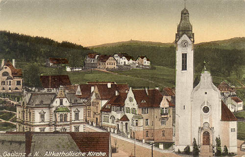
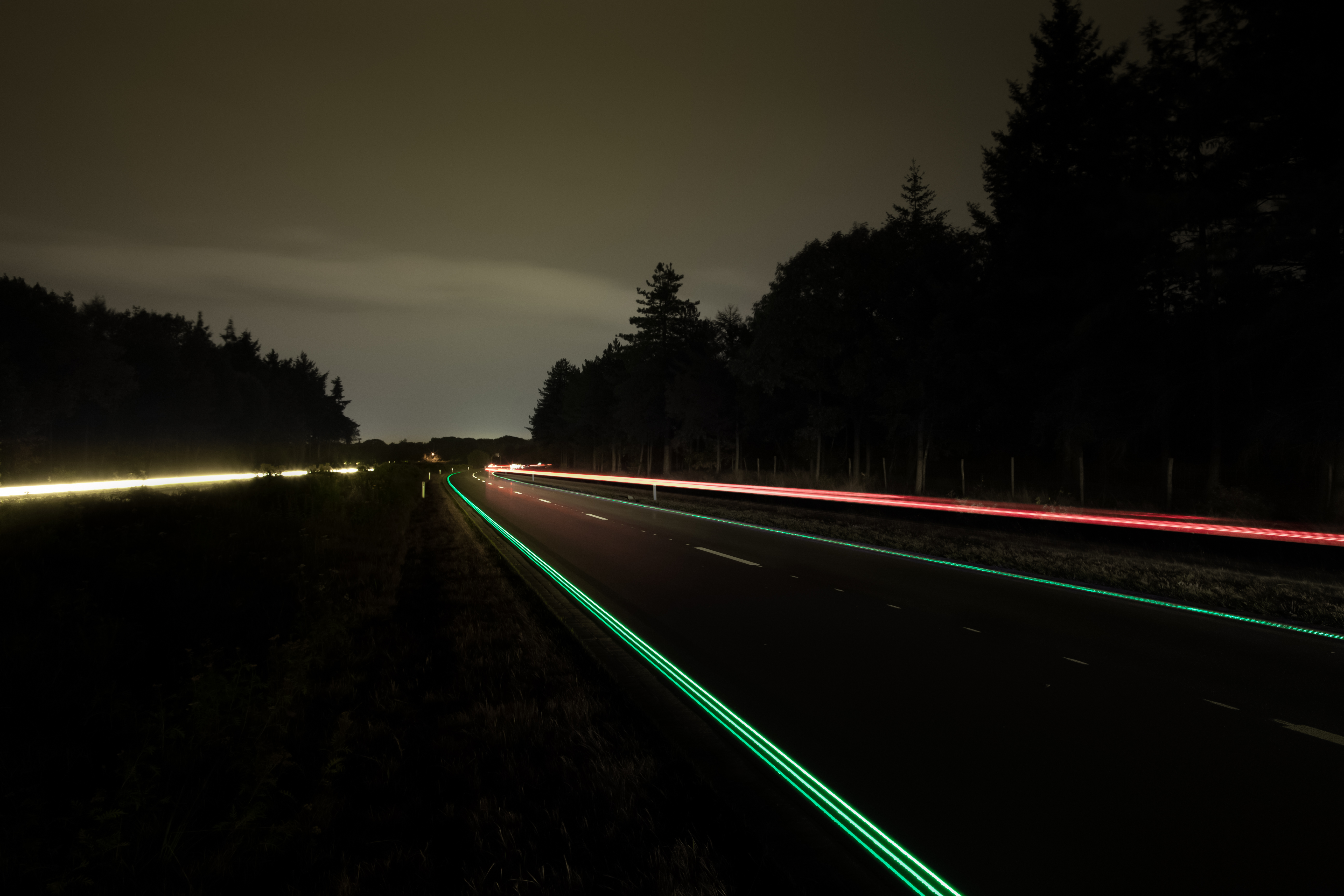
Krommenie () is a town in the Dutch province of North Holland. It is a part of the municipality of Zaanstad, and lies about 15 km northeast of Haarlem. History Krommenie developed in the 11th century as a peat excavation settlement. In 1702, it severely damaged by fire. During the 19th century, Krommenie started to industrialise. The Dutch Reformed church is a single aisled church from the 15th century. It was severely damaged in 1574 by fire and extensively modified and restored between 1657 and 1658. The Old Catholic Church was built in 1602 as a clandestine church in a farm. It was enlarged in 1633 and modified in 1826. Krommenie was a separate municipality until 1974, when the new municipality of Zaanstad was created. Krommenie is the first town in the world to have a solar bikepath (SolaRoad), a path made of a transparent surface over solar cells to generate electricity fed back to the grid. The path, over 70 meters long, was to test engineering feasibility. Train ... [...More Info...] [...Related Items...] OR: [Wikipedia] [Google] [Baidu] |
Krommenie-Assendelft Railway Station
Krommenie-Assendelft is a railway station in Krommenie and Assendelft, Netherlands. The station lies on the Den Helder–Amsterdam railway, and was opened on 1 November 1869. The station had a goods yard, but no longer does. The station had remained unchanged since 1975 until 2006. The station began being moved in 2006, further west, closer to the Saendelft estate. This new station opened on 14 December 2008. Train services The following train services call at Krommenie-Assendelft: *2× per hour local service (''sprinter'') Uitgeest – Zaandam – Amsterdam – Woerden – Rotterdam (all day, every day) *2× per hour local service (''sprinter'') Uitgeest – Zaandam – Amsterdam – Utrecht – Rhenen (only on weekdays until 8:00 PM) Bus services Bus services serving the station are operated by Connexxion Connexxion is a large public transport company in the Netherlands, operating in the west, middle, east and southwest parts of the country. It is owned by Transdev and Ba ... [...More Info...] [...Related Items...] OR: [Wikipedia] [Google] [Baidu] |
Zaanstad
Zaanstad () is a Dutch municipality in the province of North Holland, situated northwest of Amsterdam. Its main city is Zaandam. It is part of the conurbation and metropolitan area of Amsterdam. It had a population of in . Topography Population centres The municipality of Zaanstad is a conurbation itself and consists of the following cities, towns, villages and/or districts: Assendelft, Koog aan de Zaan, Krommenie, Westzaan, Wormerveer, Zaandam, Zaandijk. However, being surrounded by countryside and due to its relatively protracted shape that follows the river Zaan, a rural atmosphere is always nearby. Railway stations in Zaanstad * Koog aan de Zaan railway station (formerly Koog Bloemwijk) * Krommenie-Assendelft railway station * Wormerveer railway station * Zaandam railway station * Zaandam Kogerveld railway station * Zaandijk Zaanse Schans railway station (formerly Koog-Zaandijk) Local government The municipal council of Zaanstad consists of 39 seats, wh ... [...More Info...] [...Related Items...] OR: [Wikipedia] [Google] [Baidu] |
Amsterdam Centraal Railway Station
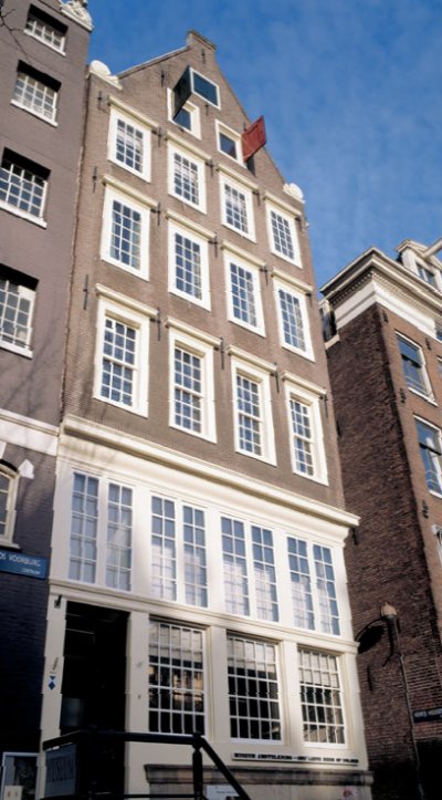
Amsterdam Centraal Station ( nl, italic=no, Station Amsterdam Centraal ; abbreviation: Asd) is the largest railway station in Amsterdam, North Holland, the Netherlands. A major international railway hub, it is used by 192,000 passengers a day, making it the second busiest railway station in the country after Utrecht Centraal and the most visited Rijksmonument of the Netherlands. National and international railway services at Amsterdam Centraal are provided by NS, the principal rail operator in the Netherlands. Amsterdam Centraal is the northern terminus of Amsterdam Metro routes 51, 53, 54, and stop for 52 operated by municipal public transport operator GVB. It is also served by a number of GVB tram and ferry routes as well as local and regional bus routes operated by GVB, Connexxion and EBS. Amsterdam Centraal was designed by Dutch architect Pierre Cuypers and opened in 1889. It features a Gothic, Renaissance Revival station building and a cast iron platform roof spanni ... [...More Info...] [...Related Items...] OR: [Wikipedia] [Google] [Baidu] |
SolaRoad
The SolaRoad was the world's first bike path made from solar panels, and was a prototype project testing the feasibility of various proposals for smart highways. The path opened in the week of 21 October 2014, and was designed by a consortium of organizations, which built the pathway in Krommenie, Netherlands. The path was formally opened in November 2014 by the Dutch Minister of Energy Henk Kamp. By January 2020, extensive damage was apparent on the path, which had led to the installation of a sign warning of 'Bad Road Surface' NL:Slecht Wegdek. The path was removed in November 2020 and is considered a failure. Consortium The technology was developed by a consortium consisting of Netherlands Organisation for Applied Scientific Research (TNO), Imtech (Dynniq) and Ooms Civiel, with a grant of €1.5million from the province (county) North Holland as owner of the path. The total cost of the pilot project was €3.5million. In addition to the €1.5million from the province N ... [...More Info...] [...Related Items...] OR: [Wikipedia] [Google] [Baidu] |
List Of Sovereign States
The following is a list providing an overview of sovereign states around the world with information on their status and recognition of their sovereignty. The 206 listed states can be divided into three categories based on membership within the United Nations System: 193 member states of the United Nations, UN member states, 2 United Nations General Assembly observers#Present non-member observers, UN General Assembly non-member observer states, and 11 other states. The ''sovereignty dispute'' column indicates states having undisputed sovereignty (188 states, of which there are 187 UN member states and 1 UN General Assembly non-member observer state), states having disputed sovereignty (16 states, of which there are 6 UN member states, 1 UN General Assembly non-member observer state, and 9 de facto states), and states having a political status of the Cook Islands and Niue, special political status (2 states, both in associated state, free association with New Zealand). Compi ... [...More Info...] [...Related Items...] OR: [Wikipedia] [Google] [Baidu] |
Old Catholic Church
The terms Old Catholic Church, Old Catholics, Old-Catholic churches or Old Catholic movement designate "any of the groups of Western Christians who believe themselves to maintain in complete loyalty the doctrine and traditions of the Great Church, undivided church but who separated from the see of Rome after the First Vatican council of 1869–70". The expression Old Catholic has been used from the 1850s by communions separated from the Roman Catholic Church over certain doctrines, primarily concerned with Papal supremacy, papal authority and Papal infallibility, infallibility. Some of these groups, especially in the Netherlands, had already existed long before the term. These churches are not in full communion with the Holy See. Member churches of the Union of Utrecht (Old Catholic), Union of Utrecht of the Old Catholic Churches (UU) are in full communion with the Church of Sweden, Evangelical Lutheran Church of Sweden and the Anglican Communion; many members of the Union of ... [...More Info...] [...Related Items...] OR: [Wikipedia] [Google] [Baidu] |
Smart Highways
Smart highways and smart roads are highways and roads that incorporate electronic technologies. They are used to improve the operation of connected and autonomous vehicles (CAVs), for traffic lights and street lighting, and for monitoring the condition of the road, as well as traffic levels and the speed of vehicles. Intelligent transportation systems Intelligent transportation systems usually refer to the use of information and communication technologies (rather than innovations in the construction of the roadway) in the field of road transport, infrastructure, vehicles, and users, and in traffic management and mobility management, as well as for interfaces with other modes of transportation. Vehicle infrastructure integration Structural health monitoring Solar road panels Purpose The principal idea of solar road panels is to utilize the space occupied by the roads to generate electricity via photovoltaic panels installed in place of a conventional concrete or asph ... [...More Info...] [...Related Items...] OR: [Wikipedia] [Google] [Baidu] |
Clandestine Church
A clandestine church ( nl, schuilkerk), defined by historian Benjamin J. Kaplan as a "semi-clandestine church", is a house of worship used by religious minorities whose communal worship is tolerated by those of the majority faith on condition that it is discreet and not conducted in public spaces. ''Schuilkerken'' are commonly built inside houses or other buildings, and do not show a public façade to the street. They were an important advance in religious tolerance in the wake of the Reformation, an era when worship services conducted by minority faiths were often banned and sometimes penalized by exile or execution. History According to historian Benjamin Kaplan, clandestine churches became common in Europe in the wake of the Reformation as a way for governments to permit a degree of religious toleration for minority Christian denominations and Jews. Both political and religious considerations frequently led governments to ban all worship not sanctioned by the state, and in m ... [...More Info...] [...Related Items...] OR: [Wikipedia] [Google] [Baidu] |
Haarlem
Haarlem (; predecessor of ''Harlem'' in English) is a city and municipality in the Netherlands. It is the capital of the province of North Holland. Haarlem is situated at the northern edge of the Randstad, one of the most populated metropolitan areas in Europe; it is also part of the Amsterdam metropolitan area, being located about 15 km to the west of the core city of Amsterdam. Haarlem had a population of in . Haarlem was granted city status or '' stadsrechten'' in 1245, although the first city walls were not built until 1270. The modern city encompasses the former municipality of Schoten as well as parts that previously belonged to Bloemendaal and Heemstede. Apart from the city, the municipality of Haarlem also includes the western part of the village of Spaarndam. Newer sections of Spaarndam lie within the neighbouring municipality of Haarlemmermeer. Geography Haarlem is located on the river Spaarne, giving it its nickname 'Spaarnestad' (Spaarne city). It is ... [...More Info...] [...Related Items...] OR: [Wikipedia] [Google] [Baidu] |
Peat
Peat (), also known as turf (), is an accumulation of partially decayed vegetation or organic matter. It is unique to natural areas called peatlands, bogs, mires, moors, or muskegs. The peatland ecosystem covers and is the most efficient carbon sink on the planet, because peatland plants capture carbon dioxide (CO2) naturally released from the peat, maintaining an equilibrium. In natural peatlands, the "annual rate of biomass production is greater than the rate of decomposition", but it takes "thousands of years for peatlands to develop the deposits of , which is the average depth of the boreal orthernpeatlands", which store around 415 gigatonnes (Gt) of carbon (about 46 times 2019 global CO2 emissions). Globally, peat stores up to 550 Gt of carbon, 42% of all soil carbon, which exceeds the carbon stored in all other vegetation types, including the world's forests, although it covers just 3% of the land's surface. '' Sphagnum'' moss, also called peat moss, is one of ... [...More Info...] [...Related Items...] OR: [Wikipedia] [Google] [Baidu] |
Netherlands
) , anthem = ( en, "William of Nassau") , image_map = , map_caption = , subdivision_type = Sovereign state , subdivision_name = Kingdom of the Netherlands , established_title = Before independence , established_date = Spanish Netherlands , established_title2 = Act of Abjuration , established_date2 = 26 July 1581 , established_title3 = Peace of Münster , established_date3 = 30 January 1648 , established_title4 = Kingdom established , established_date4 = 16 March 1815 , established_title5 = Liberation Day (Netherlands), Liberation Day , established_date5 = 5 May 1945 , established_title6 = Charter for the Kingdom of the Netherlands, Kingdom Charter , established_date6 = 15 December 1954 , established_title7 = Dissolution of the Netherlands Antilles, Caribbean reorganisation , established_date7 = 10 October 2010 , official_languages = Dutch language, Dutch , languages_type = Regional languages , languages_sub = yes , languages = , languages2_type = Reco ... [...More Info...] [...Related Items...] OR: [Wikipedia] [Google] [Baidu] |
Telephone Numbers In The Netherlands
Telephone numbers in the Netherlands are administered by the Ministry of Economic Affairs, Agriculture and Innovation of the Netherlands and may be grouped into three general categories: geographical numbers, non-geographical numbers, and numbers for public services. Geographical telephone numbers are sequences of 9 digits (0-9) and consist of an area code of two or three digits and a subscriber number of seven or six digits, respectively. When dialled within the country, the number must be prefixed with the trunk access code 0, identifying a destination telephone line in the Dutch telephone network. Non-geographical numbers have no fixed length, but also required the dialling of the trunk access code (0). They are used for mobile telephone networks and other designated service types, such as toll-free dialling, Internet access, voice over IP, restricted audiences, and information resources. In addition, special service numbers exist for emergency response, directory assistanc ... [...More Info...] [...Related Items...] OR: [Wikipedia] [Google] [Baidu] |


.jpg)