|
Krishna District
Krishna district is a district in the coastal Andhra Region in Indian state of Andhra Pradesh, with Machilipatnam as its administrative headquarters. It is surrounded on the East by Bay of Bengal, West by Guntur, Bapatla and North by Eluru and NTR districts and South again by Bay of Bengal. Etymology Krishna District with its district headquarters at Machilipatnam is the coastal district of Andhra Pradesh. It was formerly called as Machilipatnam District. Later it was renamed as Krishna District after the holy river Krishna, by adding certain Taluks of the abolished Guntur District in 1859. Again in 1925, Krishna District was further divided into Krishna and West Godavari Districts. There are no changes in its jurisdiction except some minor changes (in Divi Taluk and Munagala Paragana). Further Again in 2022 Krishna District was divided into Krishna and NTR Districts. It was named after the Krishna River (also known as Krishnaveni in literature) the third longest river ... [...More Info...] [...Related Items...] OR: [Wikipedia] [Google] [Baidu] |
List Of Districts Of Andhra Pradesh
The state of Andhra Pradesh has 26 districts spread across three regions ŌĆö Uttarandhra, Coastal Andhra and Rayalaseema. Uttarandhra consists of Srikakulam, Vizianagaram, Parvathipuram Manyam, Alluri Sitharama Raju, Visakhapatnam and Anakapalli districts. Coastal Andhra comprises Kakinada, Dr. B. R. Ambedkar Konaseema, East Godavari, West Godavari, Eluru, Krishna, NTR, Guntur, Palnadu, Bapatla, Prakasam and SPSR Nellore districts. Rayalaseema consists of Kurnool, Nandyal, Anantapur, Sri Sathya Sai, YSR, Annamayya, Tirupati and Chittoor districts. Prakasam is the largest district in area while Visakhapatnam is the smallest. Nellore is the most populous whereas Parvathipuram Manyam is the least populous district. The districts are further divided into two or more revenue divisions and mandals for administrative purposes. History At the time of Independence the present day Andhra Pradesh was a part of Madras State. Coastal Andhra and Rayalaseema were separa ... [...More Info...] [...Related Items...] OR: [Wikipedia] [Google] [Baidu] |
List Of Constituencies Of The Andhra Pradesh Legislative Assembly
The Legislative Assembly of Andhra Pradesh currently has 175 constituencies out of which 29 constituencies are reserved for Scheduled Castes candidates and 7 constituencies are reserved for Scheduled tribes candidates. District-wise summary List of current constituencies The below is a list of constituencies of Andhra Pradesh Legislative Assembly. List of former constituencies See also * List of former constituencies of the Andhra Pradesh Legislative Assembly * Lok Sabha constituencies of Andhra Pradesh *Andhra Pradesh State Assembly The Andhra Pradesh Legislative Assembly or Andhra Pradesh Śāsana Sabha is the lower house of the Andhra Pradesh Legislature. The Legislative Assembly consists of 175 members which are elected by adult universal suffrage under the first-p ... References External links Election Commissioner of India {{Andhra Pradesh Legislative Assembly * Constituencies, Vidan Sabha A ... [...More Info...] [...Related Items...] OR: [Wikipedia] [Google] [Baidu] |
A View Of Jaggayyapeta Buddhist Stupa
A, or a, is the first letter and the first vowel of the Latin alphabet, used in the modern English alphabet, the alphabets of other western European languages and others worldwide. Its name in English is ''a'' (pronounced ), plural ''aes''. It is similar in shape to the Ancient Greek letter alpha, from which it derives. The uppercase version consists of the two slanting sides of a triangle, crossed in the middle by a horizontal bar. The lowercase version can be written in two forms: the double-storey a and single-storey ɑ. The latter is commonly used in handwriting and fonts based on it, especially fonts intended to be read by children, and is also found in italic type. In English grammar, " a", and its variant " an", are indefinite articles. History The earliest certain ancestor of "A" is aleph (also written 'aleph), the first letter of the Phoenician alphabet, which consisted entirely of consonants (for that reason, it is also called an abjad to distinguish it fro ... [...More Info...] [...Related Items...] OR: [Wikipedia] [Google] [Baidu] |
Hamsaladeevi
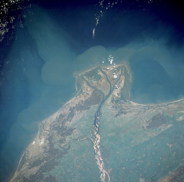
Hamsaladeevi is a village in Diviseema, Koduru Mandal, Krishna District of the Indian state of Andhra Pradesh. In the regional language it translated as "Swans Island".In this place Krishna River converges into the Bay of Bengal. The Krishna River meets the Bay of Bengal outside the village of Hamsaladeevi. There is also an old Venugopalaswamy (Lord Krishna) temple at Hamsaladeevi. The temple is one of the 108 Vishnu temples. It was constructed during the rule of Chola kings. The place where krishna river meets the sea is known as ''Sagara'' ''Sangamam''. Avanigadda is nearest city. It is about 88 km from Vijayawada and {{convert, 40, km, abbr=off from Machilipatnam Machilipatnam (), also known as Masulipatnam and Bandar, is a city in Krishna district of the Indian state of Andhra Pradesh. It is a municipal corporation and the administrative headquarters of Krishna district. It is also the Tehsil, mandal he .... The place where the River Krishna meets the Bay of Ben ... [...More Info...] [...Related Items...] OR: [Wikipedia] [Google] [Baidu] |
Guntur District
Guntur district is one of the twenty six districts in the Coastal Andhra region of the Indian state of Andhra Pradesh. The administrative seat of the district is located at Guntur, the largest city of the district in terms of area and with a population of 670,073. It has a coastline of approximately on the right bank of Krishna River, that separates it from Krishna district and NTR district. It is bounded on the south by Bapatla district and on the west by Palnadu district. It has an area of and with a population of 20,91,075 as per 2011 census of India. The district is often referred to as the ''Land of Chillies''. It is also a major centre for agriculture, education and learning. It exports large quantities of chillies and tobacco. Etymology The district derives its name from its district headquarters, Guntur. There are several opinions on the meaning and origin of the word Guntur. The word owes its origin to words like gundu (a rock), gunta (a pond) and kunta (1/3 o ... [...More Info...] [...Related Items...] OR: [Wikipedia] [Google] [Baidu] |
Krishna District
Krishna district is district in the coastal Andhra Region in Indian state of Andhra Pradesh, with Machilipatnam as its administrative headquarters. It is the coastal district of Andhra Pradesh. Machilipatnam is the most populated city in the district. It is surrounded on the east by Bay of Bengal, west by Guntur and north by Eluru and NTR districts and south again by Bay of Bengal. In 2022 Krishna district was divided into Krishna and NTR districts. Etymology Krishna district, with its district headquarters at Machilipatnam was formerly called Machilipatnam district. Later it was renamed as Krishna district, by adding certain Taluks of the abolished Guntur District in 1859 with Machilipatnam with its head. It was named after the Krishna River, the third longest river in India. The river flows through the state of Andhra Pradesh before it empties itself into Bay of Bengal, near Hamsaladevi village of Krishna district. History This history of this region dates back ... [...More Info...] [...Related Items...] OR: [Wikipedia] [Google] [Baidu] |
NTR District
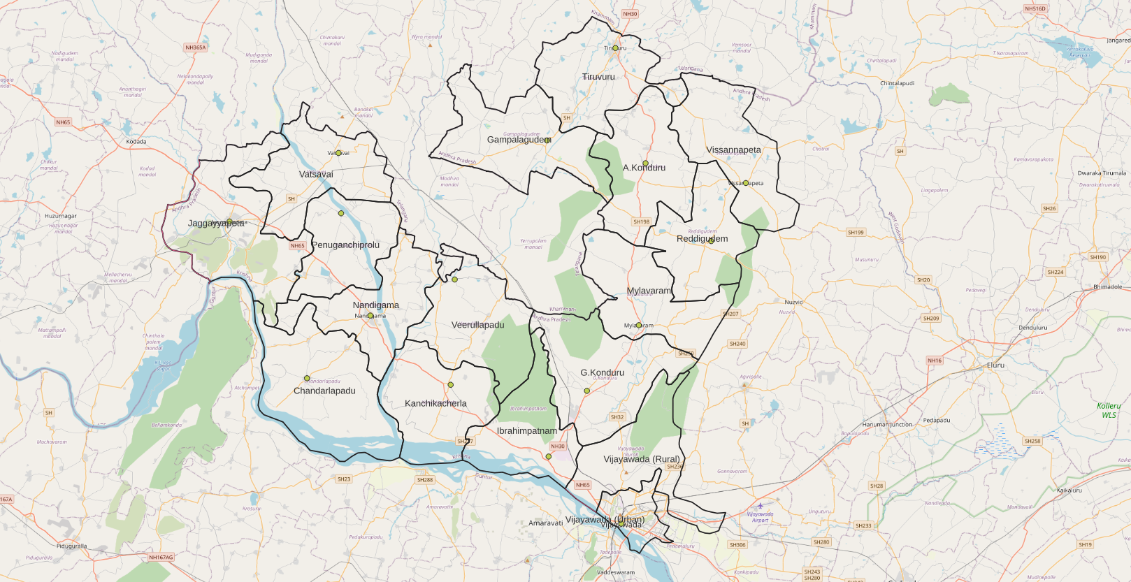
NTR district is a district in coastal Andhra Region in the Indian state of Andhra Pradesh. The administrative headquarters is located at Vijayawada. The district is named after former Chief Minister of Andhra Pradesh N. T. Rama Rao. History Named after former Chief Minister of Andhra Pradesh N. T. Rama Rao, NTR district was proposed on 26 January 2022 and became one of the List of districts of Andhra Pradesh, twenty-six districts in the state after the gazette notification was issued by the Government of Andhra Pradesh on 3 April 2022. The gazette notification came into force on 4 April 2022. The district was carved out of Krishna district, and consists of the existing Vijayawada revenue division along with Nandigama revenue division, Nandigama and Tiruvuru revenue divisions, which were formed along with the district. Geography NTR district is bordered with Krishna district and Eluru districts on the East, Palnadu district and Guntur districts on the South, Suryapet distri ... [...More Info...] [...Related Items...] OR: [Wikipedia] [Google] [Baidu] |
Eluru District
Eluru district is a district in coastal Andhra Region in the Indian state of Andhra Pradesh. With Eluru as its administrative headquarters, it was proposed on 26 January 2022 to become one of the resultant twenty six districts in the state once a final notification is issued by the government of Andhra Pradesh. It is formed from Eluru revenue division and Jangareddygudem revenue division from West Godavari district and Nuzvid revenue division from Krishna district. History Eluru District history is shared common history with West Godavari district, The Eastern Chalukyas ruled coastal Andhra from 700 to 1200, with Vengi, near Pedavegi village, as their capital. Historical pieces of evidence are found at the villages, Pedavegi and Guntupalli (Jilakarragudem). Eluru then became a part of the Kalinga Empire until 1471. Later it fell into the hands of the Gajapati Empire. In 1515, Krishnadevaraya captured it. After the fall of the Vijayanagara Empire, it was taken by the Sultan ... [...More Info...] [...Related Items...] OR: [Wikipedia] [Google] [Baidu] |
Bapatla District
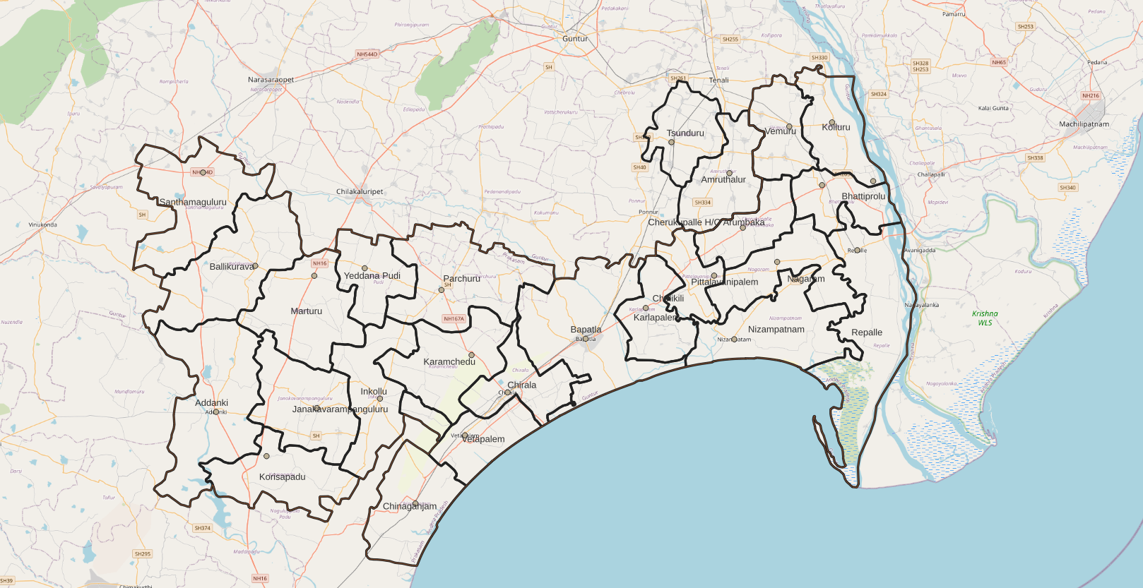
Bapatla district is a district in coastal Andhra in the Indian state of Andhra Pradesh established on 4 April 2022. The administrative headquarter is Bapatla. The district is formed from part of erstwhile Prakasam district and part of erstwhile Guntur district. It has an Air Force Station and several universities. Geography This district is surrounded by North of Palnadu district , Northeast of Guntur district ,South of Bay of Bengal , West of Prakasam district And East of Krishna district. Administrative divisions The district has two revenue divisions, namely Bapatla, Chirala and Repalle division, each headed by a sub collector. These revenue divisions are divided into 25 mandals. The district consists of three municipalities and One Nagar Panchayath. Repalle(28 wards), Bapatla (34 wards) and Chirala (33 wards) are the three municipalities & Addanki(20 wards) is the only one Nagar Panchayath. Politics There are one parliamentary and six assembly constituencies in ... [...More Info...] [...Related Items...] OR: [Wikipedia] [Google] [Baidu] |
Guntur District
Guntur district is one of the twenty six districts in the Coastal Andhra region of the Indian state of Andhra Pradesh. The administrative seat of the district is located at Guntur, the largest city of the district in terms of area and with a population of 670,073. It has a coastline of approximately on the right bank of Krishna River, that separates it from Krishna district and NTR district. It is bounded on the south by Bapatla district and on the west by Palnadu district. It has an area of and with a population of 20,91,075 as per 2011 census of India. The district is often referred to as the ''Land of Chillies''. It is also a major centre for agriculture, education and learning. It exports large quantities of chillies and tobacco. Etymology The district derives its name from its district headquarters, Guntur. There are several opinions on the meaning and origin of the word Guntur. The word owes its origin to words like gundu (a rock), gunta (a pond) and kunta (1/3 o ... [...More Info...] [...Related Items...] OR: [Wikipedia] [Google] [Baidu] |
Bay Of Bengal
The Bay of Bengal is the northeastern part of the Indian Ocean, bounded on the west and northwest by India, on the north by Bangladesh, and on the east by Myanmar and the Andaman and Nicobar Islands of India. Its southern limit is a line between Sangaman Kanda, Sri Lanka, and the north westernmost point of Sumatra, Indonesia. It is the largest water region called a bay in the world. There are countries dependent on the Bay of Bengal in South Asia and Southeast Asia. During the existence of British India, it was named as the Bay of Bengal after the historic Bengal region. At the time, the Port of Kolkata served as the gateway to the Crown rule in India. Cox's Bazar, the longest sea beach in the world and Sundarbans, the largest mangrove forest and the natural habitat of the Bengal tiger, are located along the bay. The Bay of Bengal occupies an area of . A number of large rivers flow into the Bay of Bengal: the GangesŌĆō Hooghly, the Padma, the BrahmaputraŌĆōYamuna, the BarakŌĆ ... [...More Info...] [...Related Items...] OR: [Wikipedia] [Google] [Baidu] |

.png)


