|
Krapina-Zagorje County
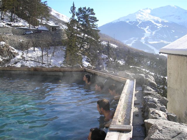
Krapina-Zagorje County (, hr, Krapinsko-zagorska županija) is a Counties of Croatia, county in northern Croatia, bordering Slovenia. It encompasses most of the historic region called Hrvatsko Zagorje. The area contains the excavation site of a 100,000-year-old Neanderthal man in caves near the central town of Krapina. The existence of Krapina itself has been verified since 1193, and it has been a common site for castles and other country houses of Croatian, Austrian and Hungary, Hungarian rulers. Other towns of the county are Zabok, Pregrada, Zlatar (Croatia), Zlatar, Oroslavje, Donja Stubica, Klanjec. The town of Donja Stubica, Stubica features another thermal spring, the Stubičke destination spa, spa. Also in the area are the medieval castles Veliki Tabor, Miljana, Bezanec, Bežanec, Hellenbach, Milengrad etc. The Krapina-Zagorje County borders on the Varaždin County in the northwest, Zagreb County in the southwest and southeast, and the city of Zagreb in the south. The c ... [...More Info...] [...Related Items...] OR: [Wikipedia] [Google] [Baidu] |
Counties Of Croatia
The counties of Croatia ( hr, hrvatske županije) are the primary administrative subdivisions of the Republic of Croatia. Since they were re-established in 1992, Croatia has been divided into 20 counties and the capital city of Zagreb, which has the authority and legal status of both a county and a city (separate from the surrounding Zagreb County). As of 2015, the counties are subdivided into 128 cities and 428 (mostly rural) municipalities. The divisions have changed over time since the medieval Croatian state. They reflected territorial losses and expansions; changes in the political status of Dalmatia, Dubrovnik and Istria; and political circumstances, including the personal union and subsequent development of relations between the Kingdom of Croatia-Slavonia and the Kingdom of Hungary. Government County assembly ( hr, županijska skupština, label=none) is a representative and deliberative body in each county. Assembly members are elected for a four-year term by popu ... [...More Info...] [...Related Items...] OR: [Wikipedia] [Google] [Baidu] |
županija
''Županija'' (singular; plural ''županije'') or ''Župnija'' (singular; plural ''župnije'') is a South Slavic administrative subdivision. For the etymology, see Župa. The term Županija is used in: * Croatia: counties of Croatia *Cantons of the Federation of Bosnia and Herzegovina are frequently referred to as ''županije'' by the Bosnian Croat population. The term Župnija is used in Slovenia Slovenia ( ; sl, Slovenija ), officially the Republic of Slovenia (Slovene: , abbr.: ''RS''), is a country in Central Europe. It is bordered by Italy to the west, Austria to the north, Hungary to the northeast, Croatia to the southeast, an .... {{DEFAULTSORT:Zupanija Types of administrative division Subdivisions of Croatia Subdivisions of Bosnia and Herzegovina pl:Županija ... [...More Info...] [...Related Items...] OR: [Wikipedia] [Google] [Baidu] |
Veliki Tabor
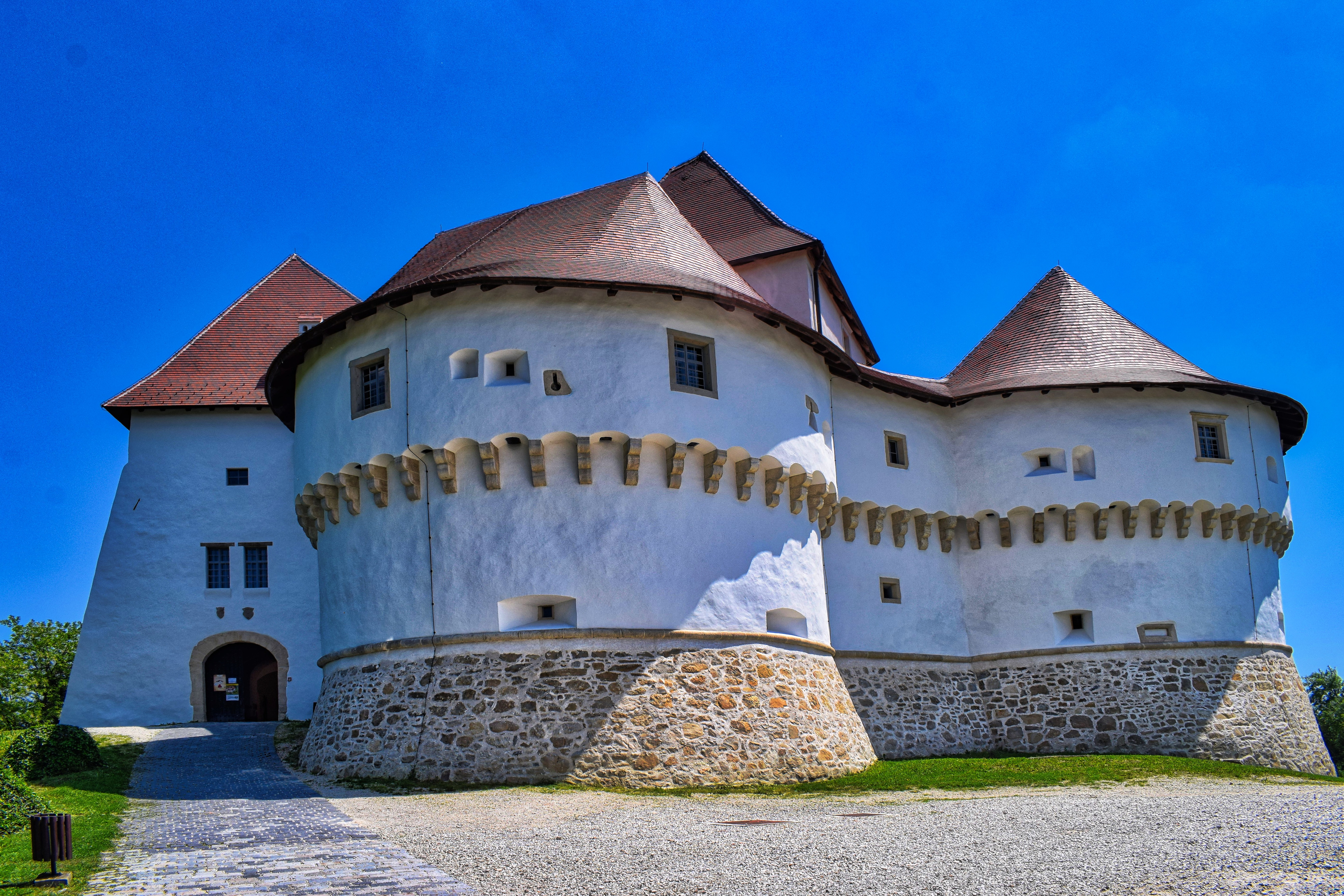
Veliki Tabor ( hr, Great Camp) is a castle and museum in northwest Croatia, dating from the middle of 15th century. The castle's present appearance dates back to the 16th century. Most of the castle was built by the Hungarian noble family of Ráttkay, in whose ownership it remained until 1793. It is located in the region of Zagorje near Desinić, west of Pregrada, above sea level. It has around . The castle is owned by the state, which manages it as a museum and a tourist site. The results of the conservation research and the analysis of the archaeological finds indicate that the oldest part of Veliki Tabor was built in middle of 15th century. The oldest part of the fort centre is its central part, the pentagonal castle, whose stylistic characteristics belong to the Late Gothic period. The castle is surrounded by four semi-circular Renaissance towers connected by curtain walls and the walls of the northern entrance part. The fort centre is surrounded by the outer defence ... [...More Info...] [...Related Items...] OR: [Wikipedia] [Google] [Baidu] |
Destination Spa
A destination spa or health resort is a resort centered on a spa, such as a mineral spa. Historically, many such spas were developed at the location of natural hot springs or mineral springs; in the era before modern biochemical knowledge and pharmacotherapy, "taking the waters" was often believed to have great medicinal powers. Even without such mystic powers, however, the stress relief and health education of spas also often has some degree of positive effect on health. Typically, over a seven-day stay, such facilities provide a comprehensive program that includes spa services, physical fitness activities, wellness education, healthy cuisine, and special interest programming. Some destination spas offer an all-inclusive program that includes facilitated fitness classes, healthy cuisine, educational classes and seminars, as well as similar to a beauty salon or a day spa. Guests reside and participate in the program at a destination spa instead of just visiting for a treatment o ... [...More Info...] [...Related Items...] OR: [Wikipedia] [Google] [Baidu] |
Klanjec
Klanjec () is a small town in northwestern Croatia, in the region of Hrvatsko Zagorje on the border with Slovenia. History In the late 19th and early 20th century, Klanjec was a district capital in the Varaždin County of the Kingdom of Croatia-Slavonia. Population The population of Klanjec is 567, but there are 2,543 people in the municipality (census 2021). The absolute majority were Croats at 98.8%. Settlements The list of settlements is as follows: * Bobovec Tomaševečki, population 21 * Bratovski Vrh, population 67 * Cesarska Ves, population 14 * Dol Klanječki, population 91 * Florijan, population 7 * Goljak Klanječki, population 71 * Gorkovec, population 16 * Gredice, population 319 * Klanjec, population 567 * Ledine Klanječke, population 164 * Lepoglavec, population 139 * Letovčan Novodvorski, population 75 * Letovčan Tomaševečki, population 69 * Lučelnica Tomaševečka, population 212 * Mihanovićev Dol, population 319 * Novi Dvori Klanječki, p ... [...More Info...] [...Related Items...] OR: [Wikipedia] [Google] [Baidu] |
Donja Stubica
Donja Stubica () is a town in Croatia, about northeast of Zagreb on the northern slope of Medvednica. It is connected by the state road D307 and L202 railway. The total population is 5,680, with 2,200 people in Donja Stubica itself (census 2011), with a total area of 44.6 km2. It is one of the southern-most towns in the Krapina-Zagorje County, which covers the Hrvatsko Zagorje mountain region north of Zagreb up to the border with Slovenia. Population There are 10 settlements in the Town: * Donja Podgora, population 371 * Donja Stubica, population 2,200 * Gornja Podgora, population 287 * Hižakovec, population 106 * Hruševec, population 388 * Lepa Ves, population 411 * Matenci, population 482 * Milekovo Selo, population 127 * Pustodol, population 844 * Vučak, population 464 History The town was founded in 1209 by Andrew II of Hungary, during the period of Croatia in the union with Hungary. In 1573 it was a site of the Croatian and Slovenian peasant revolt u ... [...More Info...] [...Related Items...] OR: [Wikipedia] [Google] [Baidu] |
Oroslavje
Oroslavje () is a town and municipality in Krapina-Zagorje County in Croatia. Oroslavje is often referred to as The Gate of Croatian Zagorje (''Vrata Hrvatskog zagorja'') because of its geographical position and its proximity to The City of Zagreb and Zagreb County. Location and transport Oroslavje is considered to be a town with a good location in Croatia. Oroslavje is ~30 min () from the capital of The Republic of Croatia, Zagreb. Oroslavje has an entrance/exit point to the A2 Motorway connecting Zagreb to the border crossing Macelj/Gruškovje with Slovenia. Oroslavje also has two entrance/exit points to the D14 Freeway in Croatia connecting the A2 Motorway with Zabok, Bedekovčina, finishing in Zlatar Bistrica. Further expansion of the road to the A4 Motorway which could then be used to get to Zagreb or Varaždin is in progress. It has frequent public transit. Busses and trains are commonly used. Demographics In the 2011 census, there were 6,124 inhabitants ... [...More Info...] [...Related Items...] OR: [Wikipedia] [Google] [Baidu] |
Zlatar (Croatia)
Zlatar is a town and municipality in Krapina-Zagorje County in Croatia. In the 2011 census, there were 6,096 inhabitants in the following settlements: * Belec, population 356 * Borkovec, population 225 * Cetinovec, population 129 * Donja Batina, population 374 * Donja Selnica, population 196 * Ervenik Zlatarski, population 35 * Gornja Batina, population 238 * Gornja Selnica, population 201 * Juranšćina, population 193 * Ladislavec, population 144 * Martinšćina, population 375 * Petruševec, population 135 * Ratkovec, population 105 * Repno, population 231 * Šćrbinec, population 11 * Vižanovec, population 156 * Završje Belečko, population 62 * Znož, population 24 * Zlatar, population 2,906 In the 2011 census, the absolute majority were Croats. History In the late 19th and early 20th century, Zlatar was a district capital in the Varaždin County of the Kingdom of Croatia-Slavonia The Kingdom of Croatia-Slavonia ( hr, Kraljevina Hrvatska i Slavonija ... [...More Info...] [...Related Items...] OR: [Wikipedia] [Google] [Baidu] |
Pregrada
Pregrada is a town and municipality in Krapina-Zagorje County in Croatia. In the 2011 census, there were 6,594 inhabitants in the following settlements: * Benkovo, population 326 * Bregi Kostelski, population 269 * Bušin, population 139 * Cigrovec, population 414 * Donja Plemenšćina, population 138 * Gabrovec, population 59 * Gorjakovo, population 344 * Gornja Plemenšćina, population 273 * Klenice, population 80 * Kostel, population 137 * Kostelsko, population 244 * Mala Gora, population 169 * Marinec, population 118 * Martiša Ves, population 19 * Pavlovec Pregradski, population 229 * Pregrada, population 1,828 * Sopot, population 330 * Stipernica, population 172 * Svetojurski Vrh, population 166 * Valentinovo, population 163 * Velika Gora, population 86 * Vinagora, population 41 * Višnjevec, population 174 * Vojsak, population 157 * Vrhi Pregradski, population 395 * Vrhi Vinagorski, population 124 In the 2011 census, the absolute majority were Cro ... [...More Info...] [...Related Items...] OR: [Wikipedia] [Google] [Baidu] |
Zabok
Zabok is a town and situated in northwest Croatia in the Krapina-Zagorje County. According to the 2011 census, it has a total population of 8,994, with 2,714 in Zabok itself. Zabok is situated on the main crossroads in the heart of Hrvatsko Zagorje region. Zabok is the economical centre of the Krapina-Zagorje County. History In 1782, Sigismund Vojković-Vojkffy started the construction of a church in Zabok, completing it in 1805. With the abolition of the feudalism, former serfs were offered a possibility of choosing their own place of settlement, and the majority settled along the roads connecting Gredice and Bračak with the new centre developing around the church, to form the new city centre. The town reached its final shape in the period after World War II, when it spread longitudinally along the northern side of the railway track. Geography Zabok is located at , at an altitude of 186 m above sea level. The following settlements comprise the town's administrative area: * Br ... [...More Info...] [...Related Items...] OR: [Wikipedia] [Google] [Baidu] |
Hungary
Hungary ( hu, Magyarország ) is a landlocked country in Central Europe. Spanning of the Carpathian Basin, it is bordered by Slovakia to the north, Ukraine to the northeast, Romania to the east and southeast, Serbia to the south, Croatia and Slovenia to the southwest, and Austria to the west. Hungary has a population of nearly 9 million, mostly ethnic Hungarians and a significant Romani minority. Hungarian, the official language, is the world's most widely spoken Uralic language and among the few non-Indo-European languages widely spoken in Europe. Budapest is the country's capital and largest city; other major urban areas include Debrecen, Szeged, Miskolc, Pécs, and Győr. The territory of present-day Hungary has for centuries been a crossroads for various peoples, including Celts, Romans, Germanic tribes, Huns, West Slavs and the Avars. The foundation of the Hungarian state was established in the late 9th century AD with the conquest of the Carpathian Basin by Hungar ... [...More Info...] [...Related Items...] OR: [Wikipedia] [Google] [Baidu] |


