|
Kozachok, Russia
Kozachok (from Cossacks) is a hamlet in the Grayvoronsky district of Belgorod in Central Russia, Russia. 600 km South of Moscow. It is located near the Vorskla River The Vorskla (; ) is a river that runs from Belgorod Oblast in Russia southwards into northeastern Ukraine, where it joins the Dnieper. It has a length of , and a basin area of . [...More Info...] [...Related Items...] OR: [Wikipedia] [Google] [Baidu] |
Cossacks
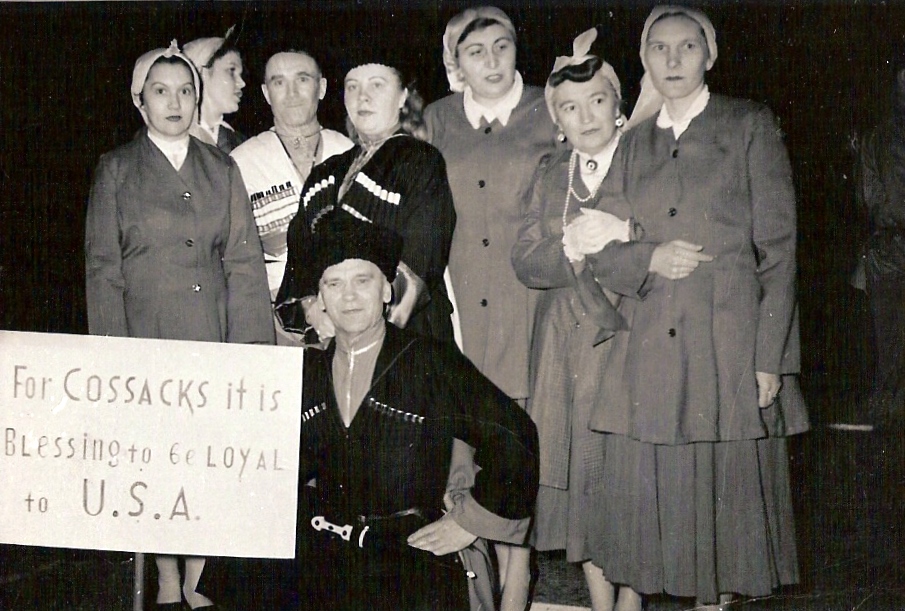
The Cossacks , es, cosaco , et, Kasakad, cazacii , fi, Kasakat, cazacii , french: cosaques , hu, kozákok, cazacii , it, cosacchi , orv, коза́ки, pl, Kozacy , pt, cossacos , ro, cazaci , russian: казаки́ or , sk, kozáci , uk, козаки́ are a predominantly East Slavic Orthodox Christian people originating in the Pontic–Caspian steppe of Ukraine and southern Russia. Historically, they were a semi-nomadic and semi-militarized people, who, while under the nominal suzerainty of various Eastern European states at the time, were allowed a great degree of self-governance in exchange for military service. Although numerous linguistic and religious groups came together to form the Cossacks, most of them coalesced and became East Slavic-speaking Orthodox Christians. The Cossacks were particularly noted for holding democratic traditions. The rulers of the Polish-Lithuanian Commonwealth and Russian Empire endowed Cossacks with certain sp ... [...More Info...] [...Related Items...] OR: [Wikipedia] [Google] [Baidu] |
Grayvoronsky District
Grayvoronsky District (russian: Грайворо́нский райо́н) is an administrative district (raion), one of the twenty-one in Belgorod Oblast, Russia.Law #248 Municipally, it is incorporated as Grayvoronsky Municipal District.Law #159 It is located in the west of the oblast. The area of the district is . Its administrative center is the town of Grayvoron. Population: 31,567 ( 2002 Census). The population of Grayvoron accounts for 21.4% of the district's total population. Geography Grayvoronsky District sits at the southwest corner of Belgorod Oblast, on the border with Ukraine. It is bordered on the south and west by Kharkiv Oblast and Sumy Oblast (both of Ukraine), on the north by Krasnogvardeysky District, Belgorod Oblast and Rakityansky District, and on the east by Borisovsky District. The administrative center of the district is the town of Grayvoron. The district is west of the city of Belgorod, and is northwest of the Ukrainian city of Kharkiv. The terr ... [...More Info...] [...Related Items...] OR: [Wikipedia] [Google] [Baidu] |
Belgorod
Belgorod ( rus, Белгород, p=ˈbʲeɫɡərət) is a city and the administrative center of Belgorod Oblast, Russia, located on the Seversky Donets River north of the border with Ukraine. Population: Demographics The population of Belgorod is 339,978 as of the most recent censuses: Geography Urban layout The oldest Belgorod fortress was built at the end of the 16th century on a chalk mountain. The discussion among historians about the time of the city’s founding, in 1593 or 1596, is not over and both versions have serious scientific basis. One of the first serious researchers of Belgorod history, Drenyakin, in the second half of the 19th century, adhered to the date of 1593, while reasonably exposing the attempts of some scientists already then to date the foundation of the city by Vladimir in the 10th century. Contemporary local historian Shmelev, trying to somehow open a three-year "black hole" from the moment of the decision to build until the actual appearanc ... [...More Info...] [...Related Items...] OR: [Wikipedia] [Google] [Baidu] |
Central Russia
Central Russia is, broadly, the various areas in European Russia. Historically, the area of Central Russia varied based on the purpose for which it is being used. It may, for example, refer to European Russia (except the North Caucasus and Kalinigrad). The 1967 book by Stephen P. Dunn and Ethel Dunn ''The Peasants of Central Russia'' defines the area as the territory from Novgorod Oblast to the north to the border with Ukraine in the south and from Smolensk Oblast to the west and Volga to the east. A review of the book clarifies that this concept is treated in the book as the historical and ethnographical one: this is the historical area of Great Russians.L. A. Anokhina, V. Iu. Krupianskaia, M. N. Shmeleva (translated by Stephen P. Dunn and Ethel Dunn), "On the Study of the Russian Peasantry", ''Current Anthropology'', ''Current Anthropology'', Vol. 14, No. 1/2 (Feb. - Apr., 1973), pp. 143-157, See also * Central Agricultural Zone (Russia) * Central Economic Region o ... [...More Info...] [...Related Items...] OR: [Wikipedia] [Google] [Baidu] |
Vorskla River
The Vorskla (; ) is a river that runs from Belgorod Oblast in Russia southwards into northeastern Ukraine, where it joins the Dnieper. It has a length of , and a basin area of . Right tributaries of the river include the and Boromlia, and left tributaries Merla, |
