|
Kottangal
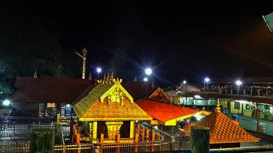
Kottangal is a small village in Mallappally Taluk of Pathanamthitta District in India. River Manimala flows through the boundary of Kottangal Panchayath which separates it from Kottayam District. Kottangal Devi Temple is situated in near Mallappally and is dedicated to goddess Bhadrakali. Temple has a history of about 1500 years with the famed Padayani held annually. "Orakkanpaara" is an unexplored scenic spot with a beautiful waterfall in Kottangal Panchayath which is famous for waterfall and spending holiday time for family and friends. "Nagappaara" is also an unexplored place in the Kottangal Panchayath. It is located about 3 km from Maramkulam (chunkappara-perumpetty road). It is explored and famous for a picnic spot in Pathanamthitta district. Nagappaara is located on the border of Pothen puzha forest division. Kottangal Padayani ''Kottangal Padayani'' is performed along with the 8 (''Ettu padayani'') days from a total of 28 days during January - February (''Makara ... [...More Info...] [...Related Items...] OR: [Wikipedia] [Google] [Baidu] |
Padayani
Padayani, also known Padeni (from the Malayalam word for military formations), is a traditional folk dance and a ritual art from the central portion of the Indian state of Kerala. A ceremonial dance involving masks, it is an ancient ritual performed in Bhagavati temples. The dance is performed in honor of Bhadrakaali. Meaning, a 'row of warriors', Padayani is an art form that blends all music, dance, theatre, satire, facial masks, and paintings. It is part of worship of Bhadrakali and is staged in temples dedicated to the goddess from mid-December to mid-May. Padayani is unique to central Travancore, comprising the Pathanamthitta and kottayam districts of Kerala. Padayani is regarded as a remnant of the Dravidian forms of worship that existed before the advent of Brahmanism. Padayani is like Theyyam in north Kerala. The percussion instruments used in Patayani are patayani thappu, chenda, para and kumbham. Padayani at Puthukulangara Devi Temple, Othera, Pathanamthitta District ... [...More Info...] [...Related Items...] OR: [Wikipedia] [Google] [Baidu] |
Pathanamthitta District
Pathanamthitta District (), is one of the 14 districts in the Indian state of Kerala. The district headquarters is in the town of Pathanamthitta. There are four municipalities in Pathanamthitta: Adoor, Pandalam, Pathanamthitta and Thiruvalla. According to the 2011 Census of India, the population was 1,197,412, making it the third least populous district in Kerala (out of 14), after Wayanad and Idukki. Pathanamthitta has been declared the first polio-free district in India. The district is 10.03% urbanised. Pathanamthitta is one of the richest districts in India with just 1.17% poverty as of 2013, which places the district among top 5 districts in India with least poverty. Etymology The district's name is a combination of two Malayalam words, and , which together mean 'array of houses on the river side'. The district capital is located on the banks of the river Achankovil. History It is presumed that the regions that form the district were formerly under the rule ... [...More Info...] [...Related Items...] OR: [Wikipedia] [Google] [Baidu] |
Manimala River
Manimala River or Manimalayar is a 92km long river which flows through South and Central Kerala. The river used to be wrongly considered as a tributary of Pamba River before satellite maps became popular, but this was proved incorrect. Manimala does not flow into the Pamba, instead a distributary of the Pamba river flows into the Manimala river at Kallunkal, later branches out again from Manimala at Nedumpuram and flows through Niranam, Thalavady, Edathua, Changankary, Champakulam, Nedumudy, Chennamkary, and finally Kainakary and then empties into the Vembanad lake. This branch again links with Manimala river at Chennankary in a short, but broad connection known as Munnattumukham. Manimala is a separate independent river for all geographical purposes. It has its origin on the uthavara Hills(1156 feet above main sea level) on the Western Ghats in Peermedu in Idukki district of Kerala, India. It has a length of about 90 km and flows through a catchment area of about 847 km2. T ... [...More Info...] [...Related Items...] OR: [Wikipedia] [Google] [Baidu] |
States And Territories Of India
India is a federal union comprising 28 states and 8 union territories, with a total of 36 entities. The states and union territories are further subdivided into districts and smaller administrative divisions. History Pre-independence The Indian subcontinent has been ruled by many different ethnic groups throughout its history, each instituting their own policies of administrative division in the region. The British Raj mostly retained the administrative structure of the preceding Mughal Empire. India was divided into provinces (also called Presidencies), directly governed by the British, and princely states, which were nominally controlled by a local prince or raja loyal to the British Empire, which held ''de facto'' sovereignty ( suzerainty) over the princely states. 1947–1950 Between 1947 and 1950 the territories of the princely states were politically integrated into the Indian union. Most were merged into existing provinces; others were organised into ... [...More Info...] [...Related Items...] OR: [Wikipedia] [Google] [Baidu] |
Bhadrakali
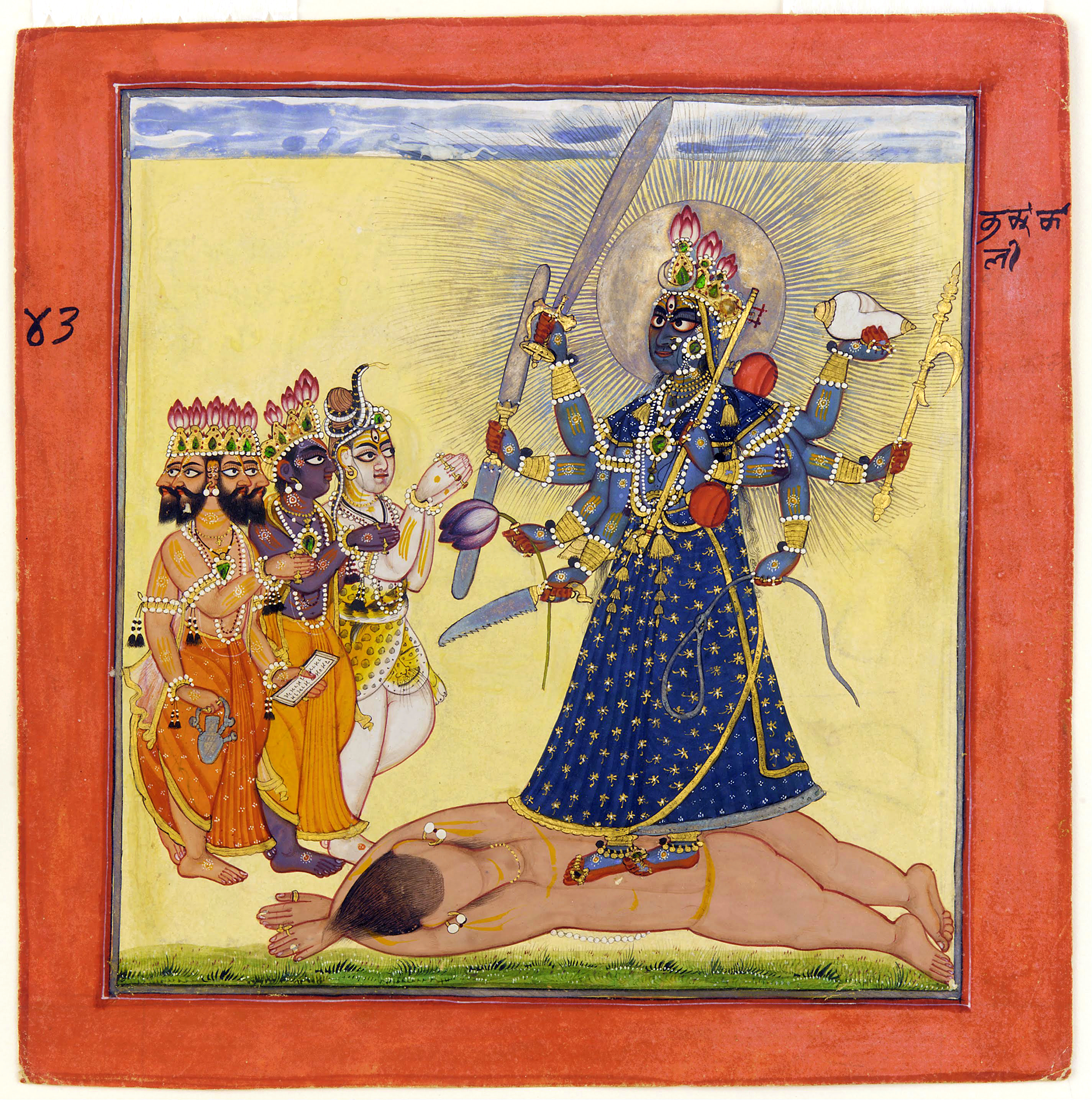
Bhadrakali (IAST: Bhadrakālī; ), also known as Mahakali and Kali, is a Hindu goddess. According to Shaktism, she is one of the fierce forms of the Supreme Goddess Shakti, or Adi Parashakti, mentioned in the Devi Mahatmyam. In Vaishnavism, Bhadrakali is among the many epithets of Yogamaya, the internal potency of illusion of the preserver deity, Vishnu. According to several Puranas, Bhadrakali is a form of the goddess Parvati. She is worshipped in Kerala as Bhagavati, Mahakali, Chamunda, Sree Kurumba, and Kariam Kali Murti. She is purported to be the auspicious and fortunate form of Mahakali who protects the good, known as Bhadra. Etymology In Sanskrit, ''Bhadra'' means ''auspicious.'' Another interpretation of this name is that ''Bhadra'' comes from 'Bha' and 'dra', The letter 'Bha' means 'delusion' or 'Maya'and 'dra' is used as a superlative i.e. meaning 'the most/the greatest etc.' which makes the meaning of Bhadra as ''Maha Maya''. In other words, maya represents th ... [...More Info...] [...Related Items...] OR: [Wikipedia] [Google] [Baidu] |
Kottayam
Kottayam () is a municipal town in the Indian state of Kerala. Flanked by the Western Ghats on the east and the Vembanad Lake and paddy fields of Kuttanad on the west. It is the district headquarters of Kottayam district, located in south-west Kerala. Kottayam is located in the basin of the Meenachil River at an average elevation of above sea level, and has a moderate climate. It is located approximately north of the state capital Thiruvananthapuram. Kottayam is also referred to as "The City of Letters" as many of the first Malayalam daily newspapers, like '' Deepika,'' ''Malayala Manorama,'' and ''Mangalam,'' were started and are headquartered in Kottayam, as are a number of publishing houses. Etymology The royal palace of the Thekkumkur ruler was protected by a fort called ''Thaliyilkotta''. It is believed that the name ''Kottayam'' is derived from a combination of the Malayalam words ''kotta'' which means fort (''Thaliyilkotta'') and ''akam'' which means inside. The com ... [...More Info...] [...Related Items...] OR: [Wikipedia] [Google] [Baidu] |
Postal Index Number
A Postal Index Number (PIN; sometimes redundantly a PIN code) refers to a six-digit code in the Indian postal code system used by India Post. On 15 August 2022, the PIN system celebrated its 50th anniversary. History The PIN system was introduced on 15 August 1972 by Shriram Bhikaji Velankar, an additional secretary in the Government of India's Ministry of Communications. The system was introduced to simplify the manual sorting and delivery of mail by eliminating confusion over incorrect addresses, similar place names, and different languages used by the public. PIN structure The first digit of a PIN indicates the zone, the second indicates the sub-zone, and the third, combined with the first two, indicates the sorting district within that zone. The final three digits are assigned to individual post offices within the sorting district. Postal zones There are nine postal zones in India, including eight regional zones and one functional zone (for the Indian Army). The f ... [...More Info...] [...Related Items...] OR: [Wikipedia] [Google] [Baidu] |
Taluk
A tehsil (, also known as tahsil, taluka, or taluk) is a local unit of administrative division in some countries of South Asia. It is a subdistrict of the area within a district including the designated populated place that serves as its administrative centre, with possible additional towns, and usually a number of villages. The terms in India have replaced earlier terms, such as '' pargana'' (''pergunnah'') and ''thana''. In Andhra Pradesh and Telangana, a newer unit called mandal (circle) has come to replace the system of tehsils. It is generally smaller than a tehsil, and is meant for facilitating local self-government in the panchayat system. In West Bengal, Bihar, Jharkhand, community development blocks are the empowered grassroots administrative unit, replacing tehsils. As an entity of local government, the tehsil office (panchayat samiti) exercises certain fiscal and administrative power over the villages and municipalities within its jurisdiction. It is the ultimate execu ... [...More Info...] [...Related Items...] OR: [Wikipedia] [Google] [Baidu] |
Kerala
Kerala ( ; ) is a state on the Malabar Coast of India. It was formed on 1 November 1956, following the passage of the States Reorganisation Act, by combining Malayalam-speaking regions of the erstwhile regions of Cochin, Malabar, South Canara, and Thiruvithamkoor. Spread over , Kerala is the 21st largest Indian state by area. It is bordered by Karnataka to the north and northeast, Tamil Nadu to the east and south, and the Lakshadweep Sea to the west. With 33 million inhabitants as per the 2011 census, Kerala is the 13th-largest Indian state by population. It is divided into 14 districts with the capital being Thiruvananthapuram. Malayalam is the most widely spoken language and is also the official language of the state. The Chera dynasty was the first prominent kingdom based in Kerala. The Ay kingdom in the deep south and the Ezhimala kingdom in the north formed the other kingdoms in the early years of the Common Era (CE). The region had been a prominent spic ... [...More Info...] [...Related Items...] OR: [Wikipedia] [Google] [Baidu] |


_22-Mar-2007_10-12-15_AM.jpg)