|
Koshin Region
The , or , is an inland List of regions of Japan, region on central Honshū in Japan. It forms the central part of the Chūbu region. It comprises most of Nagano Prefecture, Nagano and Yamanashi Prefectures, as well as the Hida (region), Hida area of Gifu Prefecture. Sometimes Tōnō area of Gifu Prefecture is included. The humid continental climate of the region gives large temperature differences between summers and winters, and between days and nights. Precipitation is light throughout the year. The more northern and western portions of this region tend to experience heavy snow during the winter with lower daytime temperatures resembling parts of Northern Japan and Hokkaido more so than its neighbor prefectures. In the Edo period, the Nakasendō and Kōshū Kaidō ran through the Central Highland. Geography The region is known for its various mountains and geological features, and is most well known for Mount Fuji, the tallest mountain in Japan. * Mountain Ranges: Akaishi ... [...More Info...] [...Related Items...] OR: [Wikipedia] [Google] [Baidu] |
List Of Regions Of Japan
Japan is divided into eight regions. They are not official administrative units, though they have been used by government officials for statistical and other purposes since 1905. They are widely used in, for example, maps, geography textbooks, and weather reports, and many businesses and institutions use their home regions in their names, for example Kintetsu Railway, Kinki Nippon Railway, list of banks in Japan, Chūgoku Bank, and Tōhoku University. Each region contains one or more of the country's Prefectures of Japan, 47 prefectures. Of the four Japanese Archipelago, main islands of Japan, Hokkaido, Hokkaidō, Shikoku, and Kyushu, Kyūshū make up one region each, the latter also containing the Satsunan Islands, while the largest island Honshu, Honshū is divided into five regions. Okinawa Prefecture is usually included in Kyūshū, but is sometimes treated as its own ninth region. Japan has eight High Courts, but their jurisdictions do not correspond to the eight regions ... [...More Info...] [...Related Items...] OR: [Wikipedia] [Google] [Baidu] |
Yatsugatake Mountains
The are a volcanic mountain range on the border between Nagano Prefecture and Yamanashi Prefecture on the island of Honshū in Japan. Description The mountain range consists of two volcanic groups, Northern Yatsugatake Volcanic Group and Southern Yatsugatake Volcanic Group. The two volcanic groups of Yatsugatake, North and South, have different characteristics. The North Yatsugatake mountains are gradual and lower while the South Yatsugatake mountains are steep and are more alpine in nature. The southern group ranges from the Natsuzawa Pass to the end of the mountain range. The northern range includes Mount Yoko to the other end of the range. Mount Tateshina is also included. These mountains form a major part of the Yatsugatake-Chūshin Kōgen Quasi-National Park. Geology These mountains consist of older eroded complex volcanoes, which were made by repeated volcanic eruptions over many thousands years. The last eruption was estimated from 600 to 800 years ago at Mount Yoko ... [...More Info...] [...Related Items...] OR: [Wikipedia] [Google] [Baidu] |
Tenryū River
The is a river in central Honshū, Japan. With a length of , it is Japan's ninth longest river. Its source is Lake Suwa in the Kiso Mountains near Okaya, Nagano, Okaya in Nagano Prefecture. It then flows through Aichi Prefecture and western Shizuoka Prefecture. Geography The Tenryū River is the only river exiting Lake Suwa. It follows a generally southern course. The upper reaches of the river in the Ina Basin of Nagano Prefecture is a rich agricultural area. The river exits through a gap between the Kiso Mountains (Central Alps) and the Akaishi Mountains (Southern Alps), which forms the border between Shizuoka and Nagano Prefectures . This area is characterized by heavy rainfall (up to 3000 mm per year) and deep V-shaped valleys. Continuing south through Shizuoka Prefecture, the river drains a wide coastal plain noted for fruit and rice production. The city of Hamamatsu, Shizuoka, Hamamatsu is near the river mouth at the Philippine Sea. History The Tenryū River is men ... [...More Info...] [...Related Items...] OR: [Wikipedia] [Google] [Baidu] |
Lake Suwa
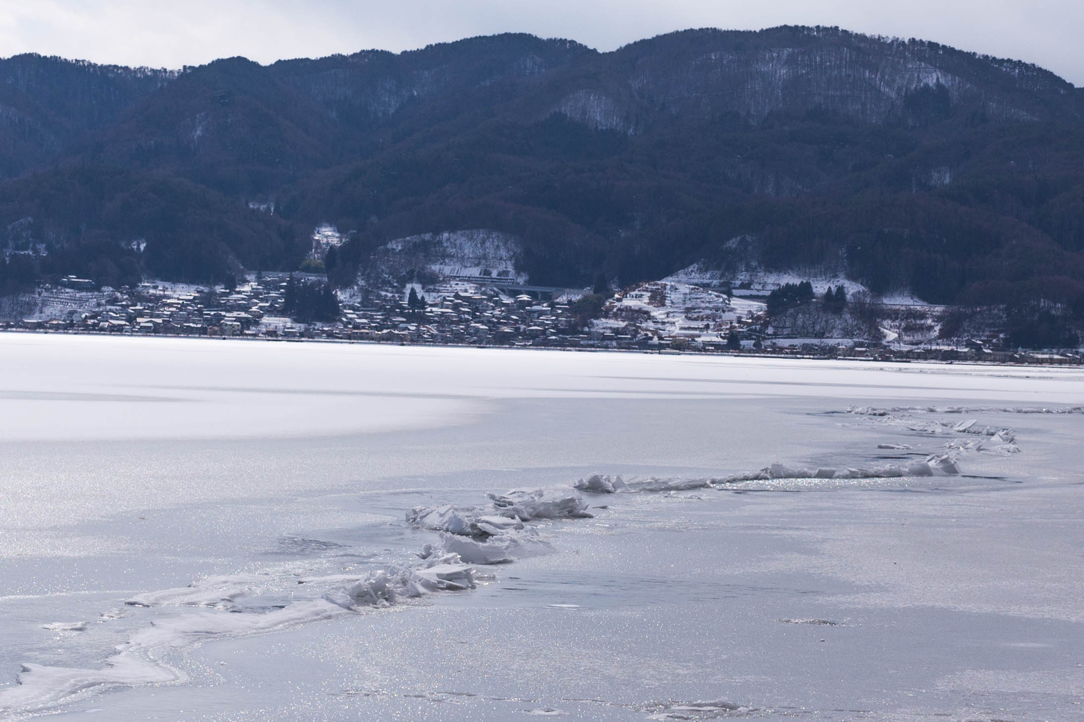
is a lake in the Kiso Mountains, in the central region of Nagano Prefecture, Japan. Geography The lake is the source of the Tenryū River. It ranks 24th in lake water surface area in Japan. The cities of Suwa and Okaya and the town of Shimosuwa are located on the shores of Lake Suwa. Omiwatari Lake Suwa is the site of a natural phenomenon known as the , large cracks that form in the winter across the surface of the frozen lake. A vertical temperature gradient results in ice pressure ridges forming in the surface ice, reaching heights of or more. Local Shinto tradition holds that the ridges are formed by the gods crossing the lake when traveling between the various buildings of the Suwa Grand Shrine. Folklore says it is the guardian god of Suwa, Takeminakata-no-kami, leaving his sanctuary to meet with his wife, the goddess , joining the opposite bank by walking on frozen water. The record of this crossing is the oldest-known human-observed climate record. This record has ... [...More Info...] [...Related Items...] OR: [Wikipedia] [Google] [Baidu] |
Kirigamine
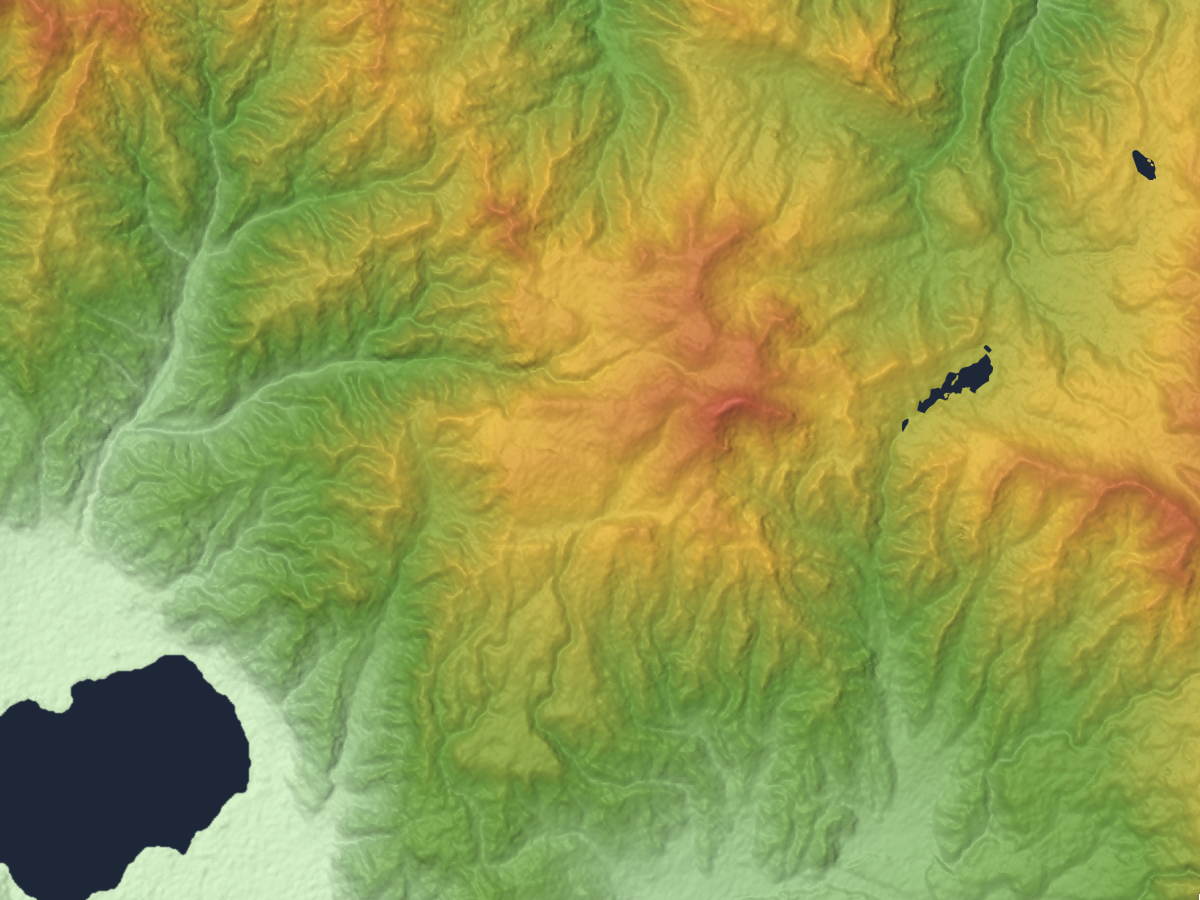
is a 1,925m volcano, located in Nagano Prefecture, Japan. Outline The tallest peak of Mount Kirigamine is Mount Kuruma, on which there is a weather radar site. Most of the mountain is covered in grass with sparse bushes and rocks. The south and east sides are suitable for gliding with a narrow landing zone in the vicinity of a parking lot and a huge emergency landing at the west side of the mountain. The southeast cliffs are a launching point for gliders, with winds above 3 meters. The north part is equipped with ski lifts. Access Vehicle access to the bottom of Kirigamine does not require four-wheel drive but snow chains may be necessary if there is heavy snow. Gallery KirigamineFromSouth.jpg, Mount Kuruma is a tallest peak File:Kurumayama04.JPG, Mount Kuruma from Mount Minaminomimi File:Mount Kirigamine 20140929.jpg, Kirigamine seen from the east. File:Yashima04.JPG, Mount Kirigamine and Yashimagahara Wetland File:Kurumayama08.JPG, A weather radar site on the top of Mou ... [...More Info...] [...Related Items...] OR: [Wikipedia] [Google] [Baidu] |
Kiso Valley
The is a geographical area that centers on the valley of the upper portions of the Kiso River in the southwestern part of Nagano Prefecture in Japan. It is a v-shaped valley with length of approximately 60 km (36 mi) that follows the river as it flows from north by northwest to south by southwest into Gifu Prefecture. Access Through much of Japan's history, the Kiso Valley was used to connect the former Mino and Shinano provinces. However, it came to be known as a difficult route because of its steep climbs. The '' Shoku Nihongi'' recorded that the ''Kiso no Yamamichi'' (岐蘇山道) was opened in 702. The same route was again mentioned in a 713 article, but it was then called the ''Kisoji no Michi'' (吉蘇路). The Kisoji (木曽路) would eventually follow the same path. However the official Tōsandō did not run through the Kiso Valley; instead, it ran from Mino Province towards the Kamisaka Pass and into the Ina Valley. During Japan's Middle Ages, the Nakasen ... [...More Info...] [...Related Items...] OR: [Wikipedia] [Google] [Baidu] |
Mount Asama
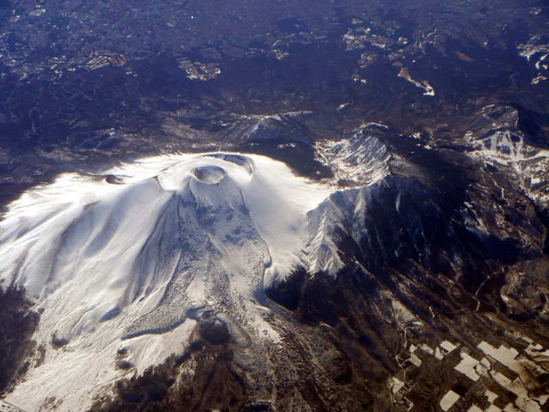
is an active complex volcano in central Honshū, the main island of Japan. The volcano is the most active on Honshū. The Japan Meteorological Agency classifies Mount Asama as rank A. It stands above sea level on the border of Gunma and Nagano prefectures. It is included in ''100 Famous Japanese Mountains''. Geology Mount Asama sits at the conjunction of the Izu–Bonin–Mariana Arc and the Northeastern Japan Arc. The mountain is built up from non-alkali mafic and pyroclastic volcanic rocks dating from the Late Pleistocene to the Holocene. The main rock type is andesite and dacite. Scientists from the University of Tokyo and Nagoya University completed their first successful imaging experiment of the interior of the volcano in April 2007. By detecting sub-atomic particles called muons as they passed through the volcano after arriving from space, the scientists were able gradually to build up a picture of the interior, creating images of cavities through which lava was passin ... [...More Info...] [...Related Items...] OR: [Wikipedia] [Google] [Baidu] |
Mount Shirouma
is a peak in the Hida Mountains range of the Japanese Alps, located in Nagano Prefecture and Toyama Prefecture, central Honshu, Japan. Geography Mount Shirouma is the 26th-tallest mountain in Japan. At , it is the highest peak in the Hakuba section of the Hida Mountains, and one of the top "to climb" peaks for Japanese hikers. It is also one of the few peaks in Japan with year-round snow fields (Firn), in the . It is located within the Chūbu-Sangaku National Park. Mount Shirouma is one of the landmark 100 Famous Japanese Mountains. Alpine plants are also abundant on Shirouma in the summer. Hiking There are several popular hiking routes, including the Shirouma Dai Sekkei. This route begins at the Sarukura Lodge (猿倉荘) (1,250m) in the village of Hakuba, and takes approximately 6 hours to reach the summit. Another popular route is via Tsugaike Panorama Way, Hakuba Ooike, and Mount Korenge (2,766m). There are two lodges near the summit, Hakuba Lodge (白馬山荘) (2,8 ... [...More Info...] [...Related Items...] OR: [Wikipedia] [Google] [Baidu] |
Mount Akaishi
, is a peak in the Akaishi Mountains, on the border of Shizuoka and Nagano Prefectures in central Honshū, Japan. On June 1, 1964, the mountain was included within the Minami Alps National Park. Geography At , Mount Akaish is the 7th tallest peak in Japan and the 4th tallest peak in the Akaishi Mountains. The peak is located within the Minami Alps National Park. There is a triangulation station on the summit, with a Mountain hut located below, on its southern approach. On the eastern slope is a cirque, with the trace remnants of Japan's southernmost glacier. At the timberline are stands of Siberian dwarf pine, above which are numerous flowering alpine plants, and the habitat for the Rock Ptarmigan. Ascents The first recorded ascent of Mount Akaishi was by Haruki Nashiba and Masaaki Terasawa of the Japanese Home Ministry in 1879. They were followed in July 1881 by a government survey team, which established the triangulation station. Ascent of the mountain became popu ... [...More Info...] [...Related Items...] OR: [Wikipedia] [Google] [Baidu] |
Mount Ontake
, also referred to as , is the 14th highest mountain and second highest volcano in Japan (after Mount Fuji) at . It is included in ''100 Famous Japanese Mountains''. Description Mt. Ontake is located around northeast of Nagoya, and around 200 km (125 mi) west of Tokyo, at the borders of Kiso and Ōtaki, Nagano Prefecture, and Gero, Gifu Prefecture. The volcano has five crater lakes, with at being the highest mountain lake in Japan. Ontake is a major sacred mountain, and following older shamanistic practices, actors and artists have gone to the mountain to put themselves into trances in order to get divine inspiration for their creative activities. Eruptions Ontake was thought to be inactive until October 1979, when it underwent a series of explosive phreatic eruptions which ejected 200,000 tons of ash, and had a volcanic explosivity index (VEI) of 2. There were minor non-explosive (VEI 0) phreatic eruptions in 1991 and 2007. On Saturday, September 27, 2014, at ... [...More Info...] [...Related Items...] OR: [Wikipedia] [Google] [Baidu] |
Mount Norikura
is a potentially active volcano located on the borders of Gifu and Nagano prefectures in Japan. It is part of the Hida Mountains and is listed among the 100 Famous Japanese Mountains and the New 100 Famous Japanese Mountains. Outline The mountain is located on the borders of Gifu and Nagano prefectures in Chūbu-Sangaku National Park. The Norikura Plateau borders the mountain on its northern side in Nagano Prefecture. The mountain, whose name means "riding saddle," received its name because its shape looks like a horse saddle. It is known for being the easiest to climb among the mountains in Japan that are above 3000-meters. History * 1680s - It is said that Enkū was the first to reach the peak. * 1878 - Englishman William Gowland became the first non-Japanese man to reach the peak. * 1892 - Englishman Walter Weston climbed on the peak. * December 4, 1934 - This area was specified to the Chūbu-Sangaku National Park. * 1973 - Norikura Skyline to the vicinity of the t ... [...More Info...] [...Related Items...] OR: [Wikipedia] [Google] [Baidu] |
Mount Yake
literally, ''"Burning mountain"'' is an active volcano in the Hida Mountains, lying between Matsumoto, Nagano Prefecture, and Takayama, Gifu Prefecture, Japan. It is one of the 100 Famous Japanese Mountains, reaching at the highest peak. Geography Mount Yake is the most active of all the volcanoes in the Hida Mountains. Its two main peaks are the northern and southern peaks, but visitors can only ascend to the northern peak, as the southern peak is currently a restricted area. A crater lake lies between the two peaks. High viscosity lava flowing from the upper regions of Mount Yake has led to the build up of a lava dome. The heat from the volcano produces many onsen in the surrounding area. Eruptions In 1911, 22 minor eruptions were recorded. In 1915, during the Taishō period, however, there was a major eruption. The flow of the lava blocked the Azusa River, which caused the river to form a lake that was named Lake Taishō. [...More Info...] [...Related Items...] OR: [Wikipedia] [Google] [Baidu] |


