|
Kosh-Köl
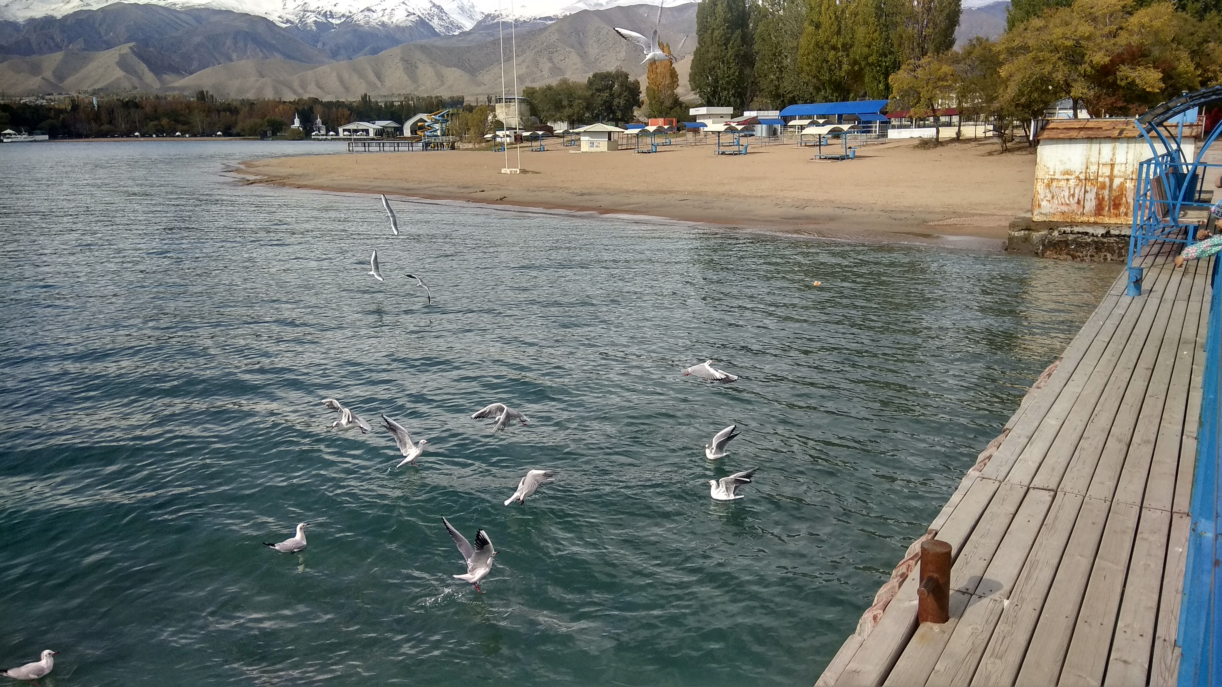
Kosh-Köl ( ky, Кош-Көл; russian: Кош-Кёль or Кош-Коль) is a village in the Issyk-Kul Region of Kyrgyzstan. The village name has also been transliterated as Kosh-Kël' or Kosh-Kel'. It is part of the Issyk-Kul District. Its population was 588 in 2021. It is located near the northern shore of Lake Issyk Kul between Balykchy and Cholpon-Ata. The village includes two built-up areas. First, the actual residential village, located along the Balykchy-Cholpon-Ata- Karakol highway, as it cuts across the base of a Koshkol promontory jutting into Lake Issyk Kul; this section is within a couple kilometers away from the lake shore. Second, the name Koshkol' is also applied to the resort strip to the south of the village, on the south-eastern shore of the peninsula. Most of the resort buildings there are decidedly Soviet-era; as of 2007, some of them appeared abandoned, while others received visitors. Gallery Image:E8312-Kosh-Kol-beachgoing-sheep.jpg, Sheep enjoying be ... [...More Info...] [...Related Items...] OR: [Wikipedia] [Google] [Baidu] |
Issyk-Kul District
Issyk-Kul District ( ky, Ысык-Көл району, ''Isıq-Köl rayonu'', ىسىق-كۅل رايونۇ; russian: Иссык-кульский район, ''Issyk-kuljskij rajon'') is a district of Issyk-Kul Region in north-eastern Kyrgyzstan. The seat lies at Cholpon-Ata. Its area is , and its resident population was 84,876 in 2021. Geography The district is located on the northern shore of Issyk-Kul and on the southern slopes of the Küngöy Ala-Too Range, which dominate much of the landscape. The topography varies from multiple-folded medium-altitude mountains featuring in erosional dissection to alluvial - proluvial planes with river fans, river valleys, intermittent water streams, and lakeside planes of Issyk-Kul lake area. Approximately 78% of the district is occupied by mountains, and 22% - by valleys. The hydrological conditions are dominated by rivers Toru-Aygyr with peak flood of 30 m/s, Orto Taldy-Bulak - 6.5 m/s, Chong Taldy-Bulak - 7 m/s, Cholpon-Ata - 20 m/s, Dyure ... [...More Info...] [...Related Items...] OR: [Wikipedia] [Google] [Baidu] |
Issyk Kul
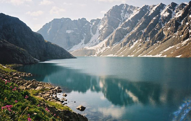
Issyk-Kul (also Ysyk-Köl, ky, Ысык-Көл, lit=warm lake, translit=Ysyk-Köl, , zh, 伊塞克湖) is an endorheic lake (i.e., without outflow) in the Northern Tian Shan mountains in Eastern Kyrgyzstan. It is the seventh-deepest lake in the world, the tenth-largest lake in the world by volume (though not in surface area) and the second-largest saline lake after the Caspian Sea. Issyk-Kul means "warm lake" in the Kyrgyz language; although it is located at a lofty elevation of and subject to severe cold during winter, it never freezes. The lake is a Ramsar site of globally significant biodiversity and forms part of the Issyk-Kul Biosphere Reserve. Geography Issyk-Kul Lake is long, up to wide and its area is . It is the second-largest mountain lake in the world behind Lake Titicaca in South America. It is at an altitude of and reaches in depth. About 118 rivers and streams flow into the lake; the largest are the Jyrgalang and Tüp. It is fed by springs, including many ... [...More Info...] [...Related Items...] OR: [Wikipedia] [Google] [Baidu] |
Kyrgyzstan
Kyrgyzstan,, pronounced or the Kyrgyz Republic, is a landlocked country in Central Asia. Kyrgyzstan is bordered by Kazakhstan to the north, Uzbekistan to the west, Tajikistan to the south, and the People's Republic of China to the east. Its capital and largest city is Bishkek. Ethnic Kyrgyz make up the majority of the country's seven million people, followed by significant minorities of Uzbeks and Russians. The Kyrgyz language is closely related to other Turkic languages. Kyrgyzstan's history spans a variety of cultures and empires. Although geographically isolated by its highly mountainous terrain, Kyrgyzstan has been at the crossroads of several great civilizations as part of the Silk Road along with other commercial routes. Inhabited by a succession of tribes and clans, Kyrgyzstan has periodically fallen under larger domination. Turkic nomads, who trace their ancestry to many Turkic states. It was first established as the Yenisei Kyrgyz Khaganate later in the ... [...More Info...] [...Related Items...] OR: [Wikipedia] [Google] [Baidu] |
Issyk-Kul Region
Issyk-Kul Region ( ky, Ысык-Көл облусу, Ysyk-Köl oblusu; russian: Иссык-Кульская область, Issyk-Kulskaya oblast) is one of the regions of Kyrgyzstan. Its capital is Karakol. It is surrounded by Almaty Region, Kazakhstan (north), Chüy Region (west), Naryn Region (southwest) and Xinjiang, China (southeast). It takes its name from Lake Issyk-Kul ("warm lake"), the world's second-largest high altitude lake. Its total area is . The resident population of the region was 501,933 as of January 2021. The region has a sizeable Russians, Russian (8.0% in 2009) minority. Geography The north is dominated by the eye-shaped Issyk-Kul lake, surrounded by the ridges of the Tian Shan mountain system: the Kyungey Ala-Too mountains to the north and the Terskey Alatau to the south (the 'sunny' and 'shady' Alatau, respectively). To the south are mountains and 'jailoos' (mountain meadows used for summer grazing). The highest peaks of the Tian Shan mountains, including ... [...More Info...] [...Related Items...] OR: [Wikipedia] [Google] [Baidu] |
Village
A village is a clustered human settlement or community, larger than a hamlet but smaller than a town (although the word is often used to describe both hamlets and smaller towns), with a population typically ranging from a few hundred to a few thousand. Though villages are often located in rural areas, the term urban village is also applied to certain urban neighborhoods. Villages are normally permanent, with fixed dwellings; however, transient villages can occur. Further, the dwellings of a village are fairly close to one another, not scattered broadly over the landscape, as a dispersed settlement. In the past, villages were a usual form of community for societies that practice subsistence agriculture, and also for some non-agricultural societies. In Great Britain, a hamlet earned the right to be called a village when it built a church. [...More Info...] [...Related Items...] OR: [Wikipedia] [Google] [Baidu] |
Balykchy
Balykchy ( ky, Балыкчы) is a town at the western end of Lake Issyk-Kul in Kyrgyzstan, at an elevation of about 1,900 metres. Its area is , and its resident population was 42,875 in 2021 (both including Orto-Tokoy). A major industrial and transport centre (wool and crop processing, lake shipping, rail terminal, and road junction) during the Soviet era, it lost most of its economic base after the collapse of the Soviet Union and the closure of virtually all of its industrial facilities. The main road from Bishkek, the capital of Kyrgyzstan, to China, a part of the ancient Great Silk Road, passes through Balykchy before it starts its long and arduous way across the alpine ranges of Naryn Province in central Kyrgyzstan to the Chinese border at Torugart Pass. Plans for the rail road from the Chinese border to Balykchy, where the line from Bishkek currently ends, are under discussion. Two other roads go around the north and south sides of Issyk Kul to Karakol and then around the ... [...More Info...] [...Related Items...] OR: [Wikipedia] [Google] [Baidu] |
Cholpon-Ata
Cholpon-Ata ( ky, Чолпон-Ата, ''Çolpon-Ata'', چولپون-اتا, pronounced , literally "Venus-father", the name of a mythological protecting spirit) is a resort town on the northern shore of Lake Issyk-Kul in Kyrgyzstan with a population of 14,237 (2021). It is the administrative center of the Issyk-Kul District of Issyk-Kul Region; this district occupies most of the lake's north shore. To the west along highway A363 is Tamchy and to the east, Bosteri. The town contains numerous large and small sanatoria, hotels and guesthouses to accommodate the many visitors who descend upon the lake in summer. During the Soviet era it was much frequented by vacationers brought here in organized mass tours from other parts of the USSR. Holidaymakers now usually visit on their own or in small groups and originate mainly from Kyrgyzstan, Kazakhstan and Uzbekistan. Attracting more demanding foreign tourists will require substantial upgrading of the existing facilities, but the location ... [...More Info...] [...Related Items...] OR: [Wikipedia] [Google] [Baidu] |
Karakol
Karakol ( ky, Каракол, Karakol, قاراقول, ; zh, 卡拉科尔), formerly Przhevalsk (russian: Пржевальск), is the fourth-largest city in Kyrgyzstan, near the eastern tip of Lake Issyk-Kul, about from the Kyrgyzstan–China border and from the capital Bishkek. It is the administrative capital of Issyk-Kul Region. Its area is , and its resident population was 84,351 in 2021 (both including Pristan'-Przheval'sk). To the north, on highway A363, is Tüp, and to the southwest Jeti-Ögüz resort. History A Russian military outpost founded on 1 July 1869, Karakol grew in the 19th century after explorers came to map the peaks and valleys separating Kyrgyzstan from China. In the 1880s Karakol's population surged with an influx of Dungans, Chinese Muslims fleeing warfare in China. In 1888, the Russian explorer Nicholay Przhevalsky died in Karakol of typhoid, while preparing for an expedition to Tibet; the city was renamed Przhevalsk in his honor. After local ... [...More Info...] [...Related Items...] OR: [Wikipedia] [Google] [Baidu] |
Sea Buckthorn
''Hippophae'' is the genus of sea buckthorns, deciduous shrubs in the family Elaeagnaceae. The name sea buckthorn may be hyphenated to avoid confusion with the unrelated true buckthorns (''Rhamnus'', family Rhamnaceae). It is also referred to as sandthorn, sallowthorn, or seaberry. It produces orange-yellow berries, which have been used over centuries as food, traditional medicine, and skin treatment in Mongolia, Ladakh, Russia, Ukraine, and northern Europe, which are its origin regions. It is an exceptionally hardy plant able to withstand winter temperatures as low as . Because ''Hippophae'' develops an aggressive and extensive root system, it is planted to inhibit soil erosion and is used in land reclamation for its nitrogen fixing properties, wildlife habitat, and soil enrichment. ''Hippophae'' berries and leaves are manufactured into various human and animal food and skincare products. Description The shrubs reach tall, rarely up to in central Asia. The leaf arrangement c ... [...More Info...] [...Related Items...] OR: [Wikipedia] [Google] [Baidu] |


