|
Korsimoro
Korsimoro is a town and the capital of the Korsimoro Department, in the Sanmatenga Province of central Burkina Faso. It is situated at 70 km NNE of Ouagadougou on the main road (''Route Nationale'' 3) to Kaya Kaya may refer to: People *Kaya (given name) *Kaya (surname) Places *Kaya, Burkina Faso, a town in Burkina Faso, capital of the department *Kaya Airport, serving the town * Kaya Department, a department or commune of Sanmatenga Province in centr .... It had a population of 18,875 (2019). References {{reflist Populated places in the Centre-Nord Region Sanmatenga Province ... [...More Info...] [...Related Items...] OR: [Wikipedia] [Google] [Baidu] |
Korsimoro Department
Korsimoro is a department or commune of Sanmatenga Province in central Burkina Faso. Its capital is the town of Korsimoro. Towns and villages The department/community consists of the capital Korsimoro Korsimoro is a town and the capital of the Korsimoro Department, in the Sanmatenga Province of central Burkina Faso Burkina Faso (, ; , ff, 𞤄𞤵𞤪𞤳𞤭𞤲𞤢 𞤊𞤢𞤧𞤮, italic=no) is a landlocked country in West Africa wit ..., divided into 6 Sectors, and 30 villages, including Baskoudré–Mossi, Baskoudré-Peulh, Dollé, Foulla, Ilartenga, Imiougou-Natenga, Ipalla, Kiendpalogo, Kirbaka, Mederin-Peulh, Nimpoui, Noungou, Ouidin, Ouitenga-Poecin, Sabouri-Nakoara, Sabouri-Natenga, Sabouri-Sonkin, Soubouri-Soukia, Tamboko, Tansablogo, Tansin, Taonsgo, Toulguéré-Peulh and Zourtenga. On 11 June 2015, the neighborhood Tangporin of the capital was promoted to village level with the name Tengressene.https://actu-sanmatenga.blog4ever.com/commune-de-korsimoro-teng ... [...More Info...] [...Related Items...] OR: [Wikipedia] [Google] [Baidu] |
Departments Of Burkina Faso
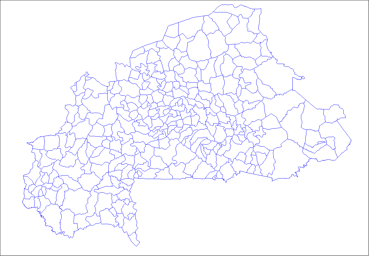
The provinces of Burkina Faso are divided into 351 departments (as of 2014 and since local elections of 2012), whose urbanized areas (cities, towns and villages) are grouped into the same commune (municipality) with the same name as the department. The department also covers rural areas (including national natural parks) that are not governed locally by the elected municipal council of the commune (presided by its mayor, with representants elected for each village or urban sector), but by the state represented at departmental level by a prefect (supervized by the haut-commissaire of its province, themself assisted by a general secretary and acting under the hierarchic authority the governor of its region, all of them being nominated by the national government). Status of communes The 351 communes (municipalities) created for each one of these departments have three kinds of status : * 49 urban communes are grouping their main city/town (subdivided into urban sectors) and all ... [...More Info...] [...Related Items...] OR: [Wikipedia] [Google] [Baidu] |
Sanmatenga Province
Sanmatenga is one of the 45 provinces of Burkina Faso, located in its Centre-Nord Region. Its capital is Kaya. Departments Sanmatenga is divided into 10 departments: *Barsalogho Department * Boussouma Department *Dablo Department * Kaya Department *Korsimoro Department *Mané Department * Namissiguima Department * Pensa Department * Pibaoré Department *Pissila Department * Ziga Department See also *Regions of Burkina Faso *Provinces of Burkina Faso *Departments of Burkina Faso *September 2019 Sanmatenga attacks The Sanmatenga attacks occurred on 8 September 2019 in the Sanmatenga Province, Burkina Faso. In the Barsalogho Department a vehicle transporting people and goods, that was returning from a market, drove over an improvised explosive device (IED) ... References Provinces of Burkina Faso {{Sanmatenga-geo-stub ... [...More Info...] [...Related Items...] OR: [Wikipedia] [Google] [Baidu] |
Burkina Faso
Burkina Faso (, ; , ff, 𞤄𞤵𞤪𞤳𞤭𞤲𞤢 𞤊𞤢𞤧𞤮, italic=no) is a landlocked country in West Africa with an area of , bordered by Mali to the northwest, Niger to the northeast, Benin to the southeast, Togo and Ghana to the south, and the Ivory Coast to the southwest. It has a population of 20,321,378. Previously called Republic of Upper Volta (1958–1984), it was renamed Burkina Faso by President Thomas Sankara. Its citizens are known as ''Burkinabè'' ( ), and its capital and largest city is Ouagadougou. The largest ethnic group in Burkina Faso is the Mossi people, who settled the area in the 11th and 13th centuries. They established powerful kingdoms such as the Ouagadougou, Tenkodogo, and Yatenga. In 1896, it was colonized by the French as part of French West Africa; in 1958, Upper Volta became a self-governing colony within the French Community. In 1960, it gained full independence with Maurice Yaméogo as president. Throughout the decades post in ... [...More Info...] [...Related Items...] OR: [Wikipedia] [Google] [Baidu] |
Regions Of Burkina Faso
Per Law No.40/98/AN in 1998, Burkina Faso adhered to decentralization to provide administrative and financial autonomy to local communities. Most of these, according to their individual articles, were implemented on 2 July 2001. Burkina Faso is divided into 13 administrative regions. Each region is administered by a governor. These regions are divided into 45 provinces and subdivided into 351 communes. See also *List of regions of Burkina Faso by Human Development Index *Provinces of Burkina Faso *Departments of Burkina Faso, Departments/Communes of Burkina Faso *Geography of Burkina Faso *ISO 3166-2:BF References See also Regions of Burkina Faso at Statoids.com {{Burkina Faso topics Regions of Burkina Faso, Subdivisions of Burkina Faso Lists of administrative divisions, Burkina Faso, Regions Administrative divisions in Africa, Burkina Faso 1 First-level administrative divisions by country, Regions, Burkina Faso Burkina Faso geography-related lists ... [...More Info...] [...Related Items...] OR: [Wikipedia] [Google] [Baidu] |
Centre-Nord Region
Centre-Nord is one of thirteen administrative regions of Burkina Faso, a landlocked country in Africa. The population of Centre-Nord in 2019 was 1,872,126. The region's capital is Kaya. Three provinces— Bam, Namentenga, and Sanmatenga, make up the region. , the population of the region was 1,872,126 with 52.6% females. The population in the region was 9.13% of the total population of the country. The child mortality rate was 55, infant mortality rate was 64 and the mortality of children under five was 116. As of 2007, the literacy rate in the region was 16.6%, compared to a national average of 28.3%. The coverage of cereal need compared to the total production of the region was 70.00%. Geography Most of Burkina Faso is a wide plateau formed by riverine systems and is called falaise de Banfora. There are three major rivers, the Red Volta, Black Volta and White Volta, which cuts through different valleys. The climate is generally hot, with unreliable rains across different seaso ... [...More Info...] [...Related Items...] OR: [Wikipedia] [Google] [Baidu] |
Provinces Of Burkina Faso
The regions of Burkina Faso are divided into 45 administrative provinces. These 45 provinces are currently sub-divided into 351 departments or communes. List of provinces by region Here is a list of the provinces, with their capitals in parentheses: Central Burkina Faso Centre Region * Kadiogo (Ouagadougou) (#14 in map) Centre-Nord Region * Bam (Kongoussi) (#2 in map) * Namentenga (Boulsa) (#26 in map) * Sanmatenga (Kaya) (#34 in map) Centre-Sud Region * Bazèga (Kombissiri) (#4 in map) * Nahouri ( Pô) (#25 in map) * Zoundwéogo (Manga) (#45 in map) Plateau-Central Region * Ganzourgou (Zorgho) (#9 in map) * Kourwéogo (Boussé) (#21 in map) * Oubritenga (Ziniaré) (#29 in map) Eastern Burkina Faso Centre-Est Region * Boulgou (Tenkodogo) (#6 in map) * Koulpélogo ( Ouargaye) (#19 in map) * Kouritenga ( Koupéla) (#20 in map) Est Region * Gnagna (Bogandé) (#10 in map) * Gourma (Fada N'gourma) (#11 in map) * Komondjari (Gayéri) (#16 in map) * Kompienga ( Pam ... [...More Info...] [...Related Items...] OR: [Wikipedia] [Google] [Baidu] |
Greenwich Mean Time
Greenwich Mean Time (GMT) is the Local mean time, mean solar time at the Royal Observatory, Greenwich, Royal Observatory in Greenwich, London, counted from midnight. At different times in the past, it has been calculated in different ways, including being calculated from noon; as a consequence, it cannot be used to specify a particular time unless a context is given. The term 'GMT' is also used as Western European Time, one of the names for the time zone UTC+00:00 and, in UK law, is the basis for civil time in the United Kingdom. English speakers often use GMT as a synonym for Coordinated Universal Time (UTC). For navigation, it is considered equivalent to UT1 (the modern form of mean solar time at 0° longitude); but this meaning can differ from UTC by up to 0.9s. The term GMT should thus not be used for purposes that require precision. Because of Earth's uneven angular velocity in its elliptical orbit and its axial tilt, noon (12:00:00) GMT is rarely the exact moment the S ... [...More Info...] [...Related Items...] OR: [Wikipedia] [Google] [Baidu] |
Kaya, Burkina Faso
Kaya is the fifth largest city in Burkina Faso, lying northeast of Ouagadougou, to which it is connected by railway. It is a centre for weaving and tanning. Kaya is the capital of Sanmatenga Province. It is located from Ouagadougou, the capital of Burkina Faso. Demographics Kaya has a population of 121,970 (2019 census). Population growth: Infrastructure Kaya Airport is a public airport in Kaya. As of 2014 it did not have any scheduled commercial flights. In 1988 Kaya was connected by railway to OuagadougouHistorical Dictionary of Burkina Faso, by Lawrence Rupley, Lamissa Bangali, Boureima Diamitani, 2013, third edition, Scarecrow Press, Inc. but, as of 2014, there were no passenger services available. Kaya is a road junction for the N3 and N15 national highways that link the city with Dori, Ouagadougou and Pouytenga, Boulsa, Kongoussi and Ouahigouya, respectively. Education *technical college for girls *secondary school Climate Köppen-Geiger climate classifi ... [...More Info...] [...Related Items...] OR: [Wikipedia] [Google] [Baidu] |
Populated Places In The Centre-Nord Region
Population typically refers to the number of people in a single area, whether it be a city or town, region, country, continent, or the world. Governments typically quantify the size of the resident population within their jurisdiction using a census, a process of collecting, analysing, compiling, and publishing data regarding a population. Perspectives of various disciplines Social sciences In sociology and population geography, population refers to a group of human beings with some predefined criterion in common, such as location, race, ethnicity, nationality, or religion. Demography is a social science which entails the statistical study of populations. Ecology In ecology, a population is a group of organisms of the same species who inhabit the same particular geographical area and are capable of interbreeding. The area of a sexual population is the area where inter-breeding is possible between any pair within the area and more probable than cross-breeding with ind ... [...More Info...] [...Related Items...] OR: [Wikipedia] [Google] [Baidu] |


