|
Komarpant
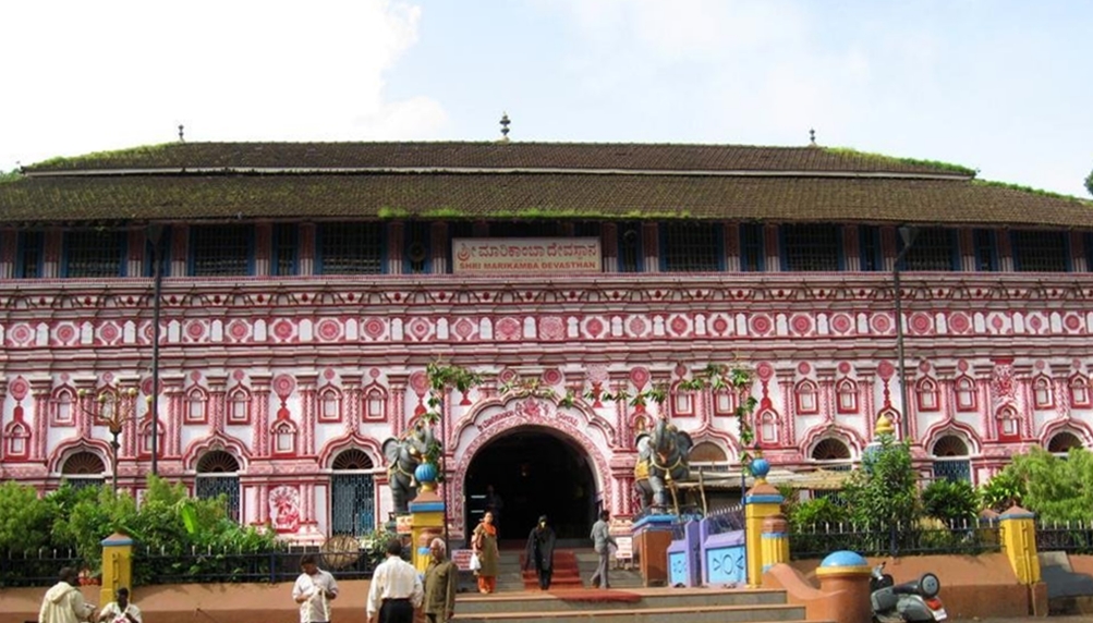
The Komarpanth (or Komarpant naik or Comorpaica) are a social group centred in and around Karwar Goa, komarpants used to primarily speak their own language, known as ''Halegannada'' (Old Kannada) alongwith ''Marathi'' and ''Konkani''. History The Komarpanths are originally from the Keladi Keladi Nayaka Kingdom or the Vijayanagar Empire, from the royal family of Karnataka or the old Mysore State, and are the followers of Shri Shringeri Mata” founded by Jagadguru Shri Shankaracharya at Shringeri. The Rulers of Keladi had extended their kingdom up to Goa State and the Keladi Nayaka Kingdom was under the control of the Vijayanagara Kingdom. Komarpanths are also referred to as those from the ''“Payaka”'' family which means that they are from the “superior leader” or the troop leaders. They were known for horsemanship, archery and soldiering. They have fought several times with the Sultans of Mysore and also against the British rule in India. Early modern period Komar ... [...More Info...] [...Related Items...] OR: [Wikipedia] [Google] [Baidu] |
Shringeri
Sringeri (IAST: Śṛngēri) also called Shringeri is a hill town and Taluk headquarters located in Chikkamagaluru district in the Indian state of Karnataka. It is the site of the first maṭha ( Dakshinamnaya Sringeri Sharada Peetham) established by Adi Shankara, Hindu theologian and exponent of the Advaita Vedanta philosophy, in the 8th century CE. Located on the banks of the river Tungā, the town draws a large number of pilgrims to its temples of Sri Sharadamba, Sri Vidyashankara, Sri Malahanikareshvara and other deities. Origin of name The name Sringeri is derived from Rishyashringa-giri, a nearby hill that is believed to have contained the hermitage of Rishi Vibhandaka and his son Rishyashringa. In an episode in the Bala-Kanda of the Ramayana, Vasishtha narrates how Rishyashringa brought rains to the drought-stricken kingdom of Romapada. According to legend, Sri Adi Shankara is said to have selected the site as the place to stay and teach his disciples, because when ... [...More Info...] [...Related Items...] OR: [Wikipedia] [Google] [Baidu] |
Haliyal
Haliyala is a town in Uttara Kannada in the Indian state of Karnataka. It is the headquarters town for Haliyal Taluk. It can be classified as a main-road town. Geography Haliyal has an average elevation of 559 metres (1834 feet). Demographics In the 2001 Indian census, Haliyal had a population of 20,652. Males constituted 51% of the population. Haliyal had an average literacy rate of 66%, higher than the national average (59.5%); male literacy was 72%, and female literacy was 60%. In 2001 in Haliyal, 13% of the population was under 6 years of age. Kannada is the main language spoken in the city. Media * Karwar eNewshttp://www.karwarenews.com Karwar website is a major local newspaper in the region. See also * Dandeli * Supa Dam * Ulavi * Sathodi Falls Sathoddi Falls is a waterfall in Uttara Kannada District Located from Yellapur Yellapura is a town in the Uttara Kannada district of Karnataka, India.It is a major trading centre for Arecanut, which i ... [...More Info...] [...Related Items...] OR: [Wikipedia] [Google] [Baidu] |
Yellapur
Yellapura is a town in the Uttara Kannada district of Karnataka, India.It is a major trading centre for Arecanut, which is the primary crop grown in the villages surrounding the town. Approximately 90% of the population of Yellapura are farmers who grow Arecanut and paddy. Geography Yellapur is located in the Western Ghats region of Karnataka. It has an average elevation of 541 metres (1774 feet The foot ( : feet) is an anatomical structure found in many vertebrates. It is the terminal portion of a limb which bears weight and allows locomotion. In many animals with feet, the foot is a separate organ at the terminal part of the leg made ...). Among many other hills and valleys, there are two well-known Waterfall, natural falls near Yellapur: Satoddi Falls, 25 km away from the town, and Magod Falls, 19 km away from Yellapur, in the village of Magodu. 17 km from Yellapur is Jenukallu Gudda (Honey-Stone Hill), a viewpoint with a panoramic view of th ... [...More Info...] [...Related Items...] OR: [Wikipedia] [Google] [Baidu] |
Joida
Joida is a town located in the Uttar Kannada district in the Indian state of Karnataka. The town is the headquarters of the eponymous taluk. Earlier it was known as Supa taluka but as Supa village got submerged due to dam built across river Kali, Joida taluka came into existence. Joida town has a Post office, branch of nationalised banks and a Police station. KPCL maintains the Supa Dam, which straddles the Kali River nearby. Geography Joida is located at . It has an average elevation of 532 metres (1745.4), and is situated in the Western Ghats. Joida is covered by 87% of dense forest. It is located around 412.1 kilometer away from the state capital Bangalore and 90 km from district capital Karwar. River Kali begins at a place near Joida called "Kushavali" and the river spread over 162 km in Joida and flows through all four dams (Supa, Bomnalli, Kodasalli and Kadra). Uttarakannada's highest hill called "Terali Betta" is in Joida its 1048 meter tall. Demogra ... [...More Info...] [...Related Items...] OR: [Wikipedia] [Google] [Baidu] |
Ankola
Ankola is a Town Municipal Council and a taluka in Uttara Kannada district of the Indian state of Karnataka. The name of the place is derived from a forest shrub Ankola grown on the coastal hill side and worshiped by the Halakki Vokkaligas as a totem. The town is around from Karwar and from Sirsi. Ankola is a small town surrounded by temples, schools, paddy fields and mango groves. It is located on the coast of the Arabian sea and has natural beaches. Ankola is known for its native breed of Mango called ''kari Ishaad'' as wells as its cashews. Vaidya Late Shivu Bommu Gouda Memorial Hospital is known for the treatment of paralysis. Geography Ankola is located at . It has an average elevation of . The Gangavali River (also known as Bedti) is a prominent river that flows near the town. Summer temperatures range between while winter temperatures drop down marginally to between . Belekeri is a natural port located nearby which is mainly used to ship iron ore to China and ... [...More Info...] [...Related Items...] OR: [Wikipedia] [Google] [Baidu] |
Dandeli
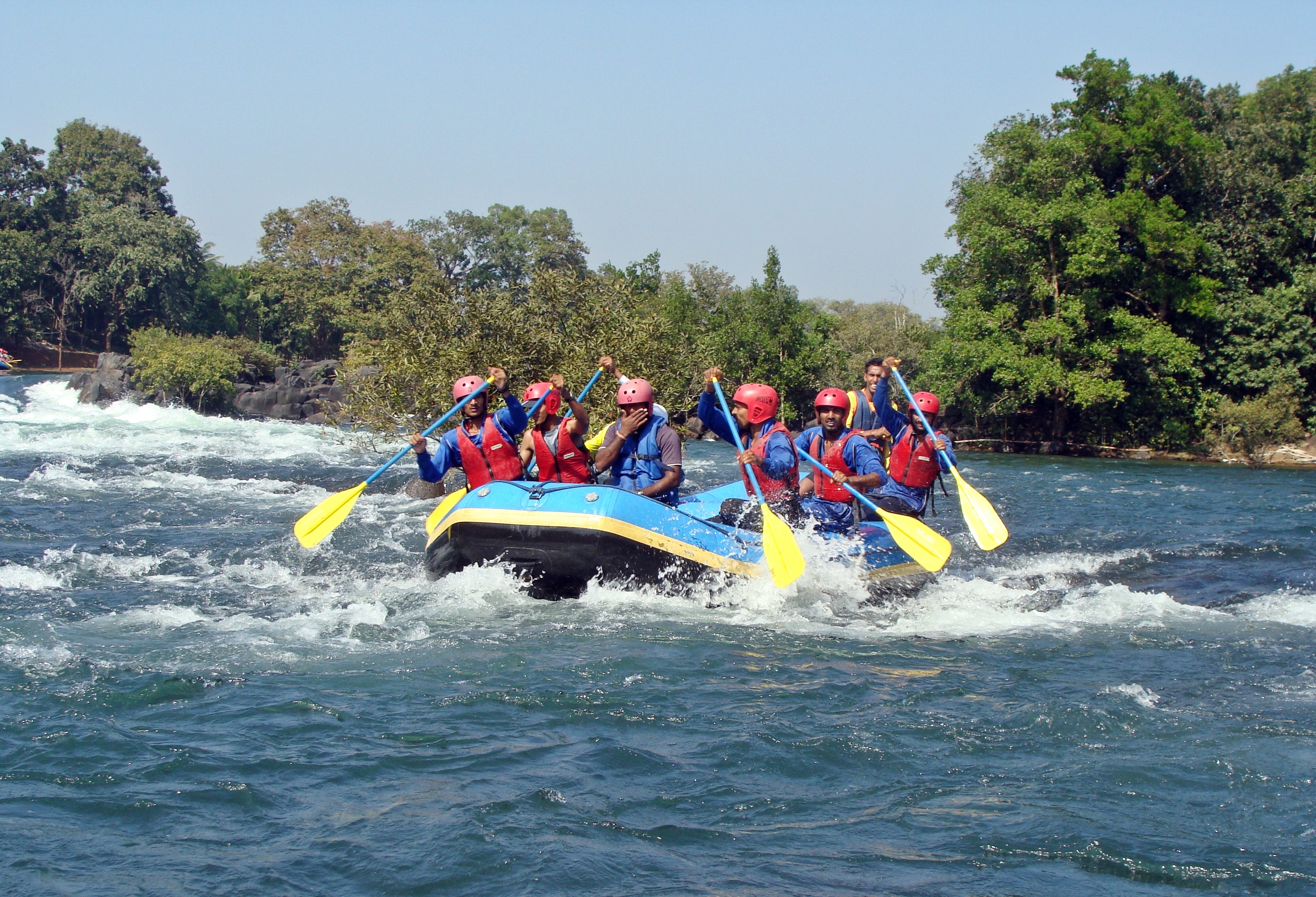
Dandeli is a taluk in Uttara Kannada district of Karnataka, India, in the Malenadu region. Description Old Dandeli As per the 1930 year, the population of Dandeli was only 515 and predominantly worked in the forestry department and government sawmill. Most residents belonged to the Konkanis, Devali, Marathas, Kuruba, Lambani, African, and Muslim communities. The settlement was located on the bank of the Kali River (Karnataka), Kali river and developed into an industrial town with the establishment of a number of companies, including The Indian Plywood Manufacturing Company, Lalbhai Ferro-manganese Factory, West Coast Paper Mill, Indian Saw Mill, and a number of small industries around the Dandeli and Karnataka Power Corporation which were engaged in the construction of several power-generating dams at different places along the Kali river. The place was later called Old-Dandeli. There was no school in the small town until in 1936, when Shivaji Narvekar, Pundalik Pai, Sadanand ... [...More Info...] [...Related Items...] OR: [Wikipedia] [Google] [Baidu] |
Sirsi, Karnataka
Sirsi is a city in Uttara Kannada district of Karnataka state in India. It was also known as Kalyana Pattana during the Sonda Dynasty. It is a tourist destination with evergreen forest and waterfalls and is also a commercial centre. The main businesses around the city are mostly subsistence and agriculture-based. Areca nut or betel nut, locally known as ''Adike'' (also known as ''supari''), is the primary crop grown in the nearby villages, making it one of the major trading centres for areca nut. The region is also known for spices such as cardamom, pepper, betel leaves, and vanilla. The major food crop is paddy. Geography Sirsi is located at (Grid Square MK74). It has an elevation ranging between 1860 feet to 2600 feet above sea level, and is situated in the heart of the Western Ghats. Sirsi is about from Bangalore. The nearest airport is located in Hubballi, about and Belagavi Airport, about from Sirsi. River Aghanashini begins at a place near Sirsi called "shanka ... [...More Info...] [...Related Items...] OR: [Wikipedia] [Google] [Baidu] |
Uttara Kannada
Uttara Kannada is a district in the Indian state of Karnataka. Uttara Kannada District is a major coastal district of Karnataka, and currently holding the title of the largest district in Karnataka. It is bordered by the state of Goa and Belagavi districts to the north, Dharwad District and Haveri District to the east, Shivamogga District, and Udupi District to the south, and the Arabian Sea to the west. Karwar is the district and headquarters, Kumta & Sirsi are the one of major commercial centers in the district. The district's agroclimatic divisions include the coastal plain (consisting of Karwar, Ankola, Kumta, Honnavar and Bhatkal taluks) and Malenadu (consisting of Sirsi, Siddapur, Yellapur, Haliyal, Joida, and Mundgod taluks). History The first known dynasty from Uttar Kannada District are Chutus of Banavasi. Uttara Kannada was the home of the Kadamba kingdom from the 350 to 525. They ruled from Banavasi. After the subjugation of the Kadambas by the Chalukya ... [...More Info...] [...Related Items...] OR: [Wikipedia] [Google] [Baidu] |
Kali River (Karnataka)
The Kali River or Kaali Nadi is a river flowing through Uttara Kannada district of Karnataka state in India. The river rises near Kushavali, a small village in Uttar Kannada district. The river is the lifeline to some 400,000 people in the Uttara Kannada district and supports the livelihoods of tens of thousands of people including fishermen on the coast of Karwar. There are many dams built across this river for the generation of electricity. One of the important dams build across Kali river is the Supa Dam at Ganeshgudi. The river runs 184 kilometers before joining Arabian Sea. Significant and picturesque, the Sadashivgad fort is now a popular tourist destination located by the coastal highway Kali river bridge, which has been built above the confluence of the river and the Arabian Sea. The National Highway NH-17 continues on the Kali Bridge built over Kali River and the road continues to split the Sadashivgad granite rock hill to connect Karnataka to Goa. In August 2019 ... [...More Info...] [...Related Items...] OR: [Wikipedia] [Google] [Baidu] |
Bhandari
Bhandari or Bhandary or Bhanderi is a surname found in various Hindu castes and communities in India and Nepal. Bhandari or Bhanderi means ''treasurer'', keeper of a storehouse. In Punjab, Bhandaris belong to the Khatri caste. In Nepal, the surname is used by both Matwali and Tagadhari Chhetris. Notable people Notable people bearing the name Bhandari or Bhandary include: *Amit Bhandari (born 1978), Indian cricketer *Anup Bhandari, Indian writer, director, music director, lyricist, playback singer and actor *Bidhya Devi Bhandari, Nepalese politician, President of Nepal *Binod Bhandari (born 1990), Nepalese cricketer * Damodar Bhandari, member of 2nd Nepalese Constituent Assembly *Dhruv Bhandari (born 1985), Indian television actor *Dil Kumari Bhandari (born 1949), Indian politician, former president of Bharatiya Gorkha Parisangh *Dinesh Chandra Bhandary, Group Captain in the Indian Air Force, the Vir Chakra awardee *Gagan Singh Bhandari, Nepalese politician and General * H. G ... [...More Info...] [...Related Items...] OR: [Wikipedia] [Google] [Baidu] |


.jpg)
