|
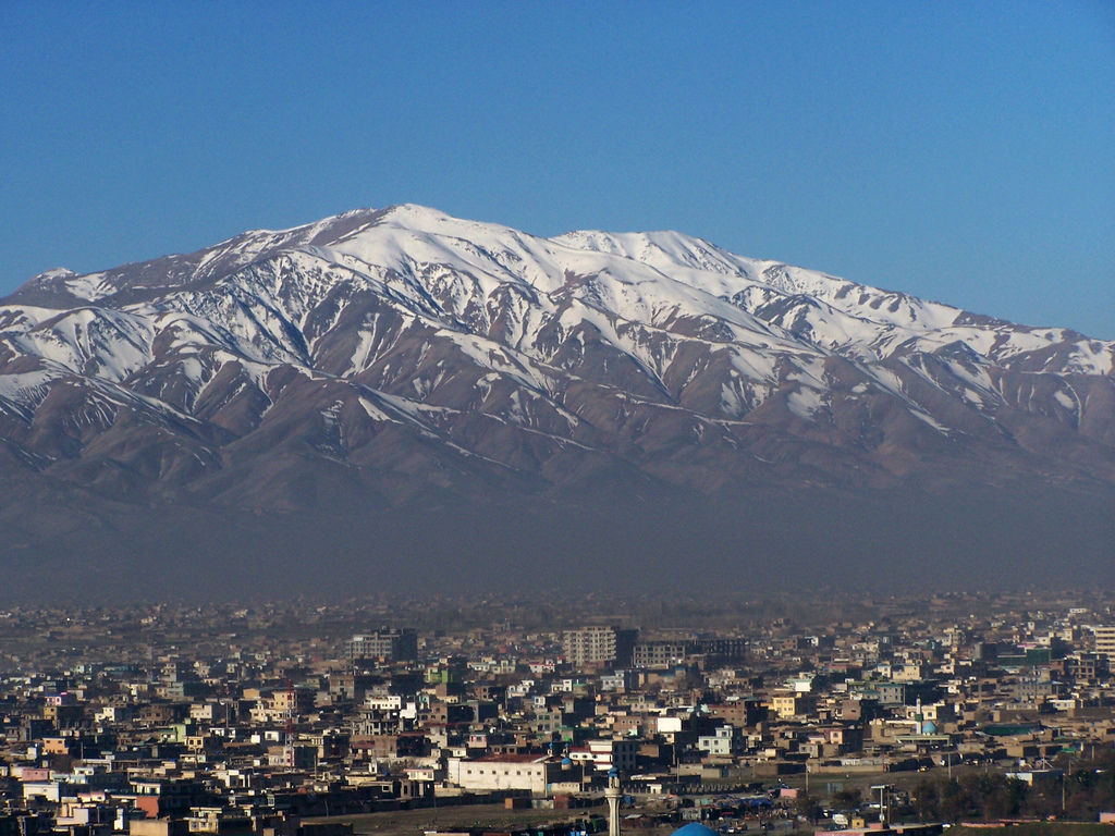
Koh E Hindaki
Koh e Hindaki ( prs, کوه هندکی ). It is located near Bagrami District in Kabul Province Kabul (Persian: ), situated in the east of the country, is one of the thirty-four provinces of Afghanistan. The capital of the province is Kabul city, which is also Afghanistan's capital and largest city. The population of the Kabul Province is .... translate by R. D. McChesney in English and ed. M. M. Khorrami Endlish “The History of Afghanistan”, Leiden-Boston , 2013 References Photos Phototeca AfghanicaLe palais jahan numa transformé par l’émir Habibullah à hendaki{{Webarchive, url=https://web.archive.org/web/20160328190917/http://www.phototheca-afghanica.ch/index.php?chash=6cefffd861&id=112&no_cache=1&tx_browser_pi1%5Bshowuid%5D=594 , date=2016-03-28 Chehel Sotoun KabulChehel Sotoun Kabul Hindu Kush Two-thousanders of Afghanistan Landforms of Kabul Province ... [...More Info...] [...Related Items...] OR: [Wikipedia] [Google] [Baidu] |
Hindu Kush
The Hindu Kush is an mountain range in Central and South Asia to the west of the Himalayas. It stretches from central and western Afghanistan, Quote: "The Hindu Kush mountains run along the Afghan border with the North-West Frontier Province of Pakistan". into northwestern Pakistan and far southeastern Tajikistan. The range forms the western section of the ''Hindu Kush Himalayan Region'' (''HKH''); to the north, near its northeastern end, the Hindu Kush buttresses the Pamir Mountains near the point where the borders of China, Pakistan and Afghanistan meet, after which it runs southwest through Pakistan and into Afghanistan near their border. The eastern end of the Hindu Kush in the north merges with the Karakoram Range.Karakoram Range: MOUNTAINS, ASIA Encyclopædia Britannica Towards its s ... [...More Info...] [...Related Items...] OR: [Wikipedia] [Google] [Baidu] |
Bagrami District
Bagrami District is located in the central part of Kabul Province in Afghanistan. It is approximately a 30-minute drive east from the capital city, Kabul. The district headquarters is the town of Bagrami. Demographics The Afghan Ministry of Rural Rehabilitation & Development (MRRD), along with the UNHCR and Central Statistics Office (CSO) of Afghanistan, estimates the population of the district to be around 68,287. According to AIMS and UNHCR, Pashtuns make up the majority of the population, followed by ethnic Tajiks. Geography The district borders Kabul to the west, Deh Sabz to the north, Surobi to the east, and Khaki Jabbar, Musayi and Char Asiab districts to the south. Bagrami district is a green area with abundant agricultural activities. Many of its residents work in Kabul because of the communities' proximity to one another. Economy Bagrami district is developing rapidly. The Bagrami Industrial Park, which is part of a major industry in Afghanistan, is part of the ... [...More Info...] [...Related Items...] OR: [Wikipedia] [Google] [Baidu] |
Kabul Province
Kabul (Persian: ), situated in the east of the country, is one of the thirty-four provinces of Afghanistan. The capital of the province is Kabul city, which is also Afghanistan's capital and largest city. The population of the Kabul Province is over 5 million people as of 2020, of which over 85 percent live in urban areas. The current governor of the province is Qari Baryal. It borders the provinces of Parwan to the north, Kapisa to the north-east, Laghman to the east, Nangarhar to the south-east, Logar to the south, and Wardak to the west. Geography Kabul is located between Latitude 34-31' North and Longitude 69-12' East at an altitude of 1800 m (6000 feet) above sea level, which makes it one of the world's highest capital cities. Kabul is strategically situated in a valley surrounded by high mountains at crossroads of north-south and east-west trade routes. One million years ago the Kabul region was surrounded from south-east between Lowgar and Paghman Mountains ... [...More Info...] [...Related Items...] OR: [Wikipedia] [Google] [Baidu] |
Two-thousanders Of Afghanistan
Two-thousanders are mountains that have a height of at least 2,000 metres above sea level, but less than 3,000 metres. The term is used in Alpine circles, especially in Europe (e.g. German: ''Zweitausender''). The two photographs show two typical two-thousanders in the Alps that illustrate different types of mountain. The Säuling (top) is a prominent, individual peak, whereas the Schneeberg (bottom) is an elongated limestone massif. In ranges like the Allgäu Alps, the Gesäuse or the Styrian-Lower Austrian Limestone Alps the mountain tour descriptions for mountaineers or hikers commonly include the two-thousanders, especially in areas where only a few summits exceed this level. Examples from these regions of the Eastern Alps are: * the striking Nebelhorn (2,224 m) near Oberstdorf or the Säuling (2,047 m) near Neuschwanstein, * the Admonter Reichenstein (2,251 m), Eisenerzer Reichenstein (2,165 m), Großer Pyhrgas (2,244 m) or Hochtor (2,369& ... [...More Info...] [...Related Items...] OR: [Wikipedia] [Google] [Baidu] |


