|
Koggiung
Koggiung is a coastal settlement by Kvichak Bay, an arm of Bristol Bay, in Alaska, United States. It has a history of summer gillnet fishing and cannery operations. Graveyard Point is in the area, as is the Koggiung Airport. The schooner '' C.A. Thayer'', carrying 28-foot (8.5 m) gillnet boats, bundles of staves for barrels, salt, and a crew of fishermen and cannery workers sailed from San Francisco to Alaska each April from 1912 through 1924. It was anchored at a fishery camp like Squaw Creek or Koggiung, where the fishermen worked their nets and the cannery workers (on the shore) packed the catch. Each September it returned to San Francisco with supplies of barrels of salted salmon. In 1909 a reindeer station was formed with a 500-strong herd driven down the Kvichak River The Kvichak River (Yup'ik: ''Kuicaraq'') is a large river, about long, in southwestern Alaska in the United States. It flows southwest from Lake Iliamna to Kvichak Bay, an arm of Bristol Bay, on the Ala ... [...More Info...] [...Related Items...] OR: [Wikipedia] [Google] [Baidu] |
Eskimo Village Of Koggiung, Alaska, 1917 (COBB 148)
Eskimo () is an exonym used to refer to two closely related Indigenous peoples: the Inuit (including the Alaska Native Iñupiat, the Greenlandic Inuit, and the Canadian Inuit) and the Yupik peoples, Yupik (or Siberian Yupik, Yuit) of eastern Siberia and Alaska. A related third group, the Aleut, which inhabit the Aleutian Islands, are generally excluded from the definition of Eskimo. The three groups share a relatively recent common ancestor, and speak related languages belonging to the Eskaleut languages, Eskaleut language family. These circumpolar peoples have traditionally inhabited the Arctic and subarctic regions from eastern Siberia (Russia) to Alaska (United States), Northern Canada, Nunavik, Nunatsiavut, and Greenland. Many Inuit, Yupik, Aleut, and other individuals consider the term ''Eskimo'', which is of a disputed etymology, to be unacceptable and even pejorative. Eskimo continues to be used within a historical, linguistic, archaeological, and cultural context. The g ... [...More Info...] [...Related Items...] OR: [Wikipedia] [Google] [Baidu] |
Kvichak Bay
Kvichak Bay is an arm on the northeast side of Bristol Bay in southern Alaska, at . It is long and wide. The Kvichak River flows into the bay at its furthest northeast point, while the Naknek River Naknek River is a stream, long, in the Bristol Bay Borough of the U.S. state of Alaska. It flows west from Naknek Lake to empty into Kvichak Bay, an arm of Bristol Bay. The river and lake are both known for their sockeye and other salmon. The ... comes in from the east about to the south of the Kvichak. Bays of Alaska Bodies of water of Bristol Bay Borough, Alaska Bodies of water of Lake and Peninsula Borough, Alaska {{LakeAndPeninsulaAK-geo-stub ... [...More Info...] [...Related Items...] OR: [Wikipedia] [Google] [Baidu] |
Bristol Bay
Bristol Bay ( esu, Iilgayaq, russian: Залив Бристольский) is the easternmost arm of the Bering Sea, at 57° to 59° North 157° to 162° West in Southwest Alaska. Bristol Bay is 400 km (250 mi) long and 290 km, (180 mi) wide at its mouth. A number of rivers flow into the bay, including the Cinder, Egegik, Igushik, Kvichak, Meshik, Nushagak, Naknek, Togiak, and Ugashik. Upper reaches of Bristol Bay experience some of the highest tides in the world. One such reach, the Nushagak Bay near Dillingham and another near Naknek in Kvichak Bay have tidal extremes in excess of 10 m (30 ft), ranking them — and the area — as eighth highest in the world. Coupled with the extreme number of shoals, sandbars, and shallows, it makes navigation troublesome, especially during the area's frequently strong winds. As the shallowest part of the Bering Sea, Bristol Bay is one of the most dangerous regions for large vessels. History ... [...More Info...] [...Related Items...] OR: [Wikipedia] [Google] [Baidu] |
Alaska
Alaska ( ; russian: Аляска, Alyaska; ale, Alax̂sxax̂; ; ems, Alas'kaaq; Yup'ik: ''Alaskaq''; tli, Anáaski) is a state located in the Western United States on the northwest extremity of North America. A semi-exclave of the U.S., it borders the Canadian province of British Columbia and the Yukon territory to the east; it also shares a maritime border with the Russian Federation's Chukotka Autonomous Okrug to the west, just across the Bering Strait. To the north are the Chukchi and Beaufort Seas of the Arctic Ocean, while the Pacific Ocean lies to the south and southwest. Alaska is by far the largest U.S. state by area, comprising more total area than the next three largest states (Texas, California, and Montana) combined. It represents the seventh-largest subnational division in the world. It is the third-least populous and the most sparsely populated state, but by far the continent's most populous territory located mostly north of the 60th parallel, with ... [...More Info...] [...Related Items...] OR: [Wikipedia] [Google] [Baidu] |
Gillnet
Gillnetting is a fishing method that uses gillnets: vertical panels of netting that hang from a line with regularly spaced floaters that hold the line on the surface of the water. The floats are sometimes called "corks" and the line with corks is generally referred to as a "cork line." The line along the bottom of the panels is generally weighted. Traditionally this line has been weighted with lead and may be referred to as "lead line." A gillnet is normally set in a straight line. Gillnets can be characterized by mesh size, as well as colour and type of filament from which they are made. Fish may be caught by gillnets in three ways: # Wedged – held by the mesh around the body. # Gilled – held by mesh slipping behind the opercula. # Tangled – held by teeth, spines, maxillaries, or other protrusions without the body penetrating the mesh. Most often fish are gilled. A fish swims into a net and passes only part way through the mesh. When it struggles to free ... [...More Info...] [...Related Items...] OR: [Wikipedia] [Google] [Baidu] |
Cannery
Canning is a method of food preservation in which food is processed and sealed in an airtight container (jars like Mason jars, and steel and tin cans). Canning provides a shelf life that typically ranges from one to five years, although under specific circumstances, it can be much longer. A freeze-dried canned product, such as canned dried lentils, could last as long as 30 years in an edible state. In 1974, samples of canned food from the wreck of the ''Bertrand'', a steamboat that sank in the Missouri River in 1865, were tested by the National Food Processors Association. Although appearance, smell, and vitamin content had deteriorated, there was no trace of microbial growth and the 109-year-old food was determined to be still safe to eat. History and development French origins During the first years of the Napoleonic Wars, the French government offered a hefty cash award of 12,000 francs to any inventor who could devise a cheap and effective method of preserving la ... [...More Info...] [...Related Items...] OR: [Wikipedia] [Google] [Baidu] |
Stave (wood)
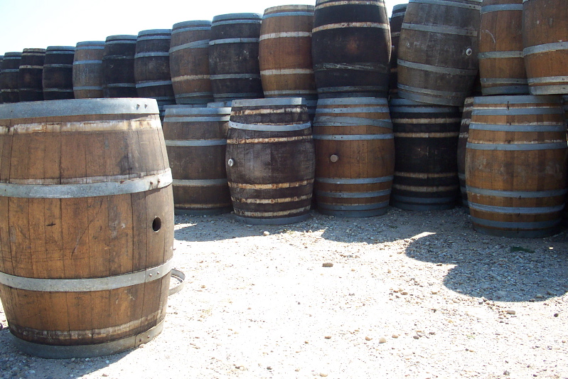
] A stave is a narrow length of wood with a slightly bevelled edge to form the sides of barrels, tanks, tubs, vats and pipelines, originally handmade by coopers. They have been used in the construction of large holding tanks and penstocks at hydro power developments. They are also used in the construction of certain musical instruments with rounded bodies or backs. See also *Rubicon Hydroelectric Scheme, which has wood stave penstocks on operating power stations *Lake Margaret Power Station The Lake Margaret Power Stations comprise two hydroelectric power stations located in Western Tasmania, Australia. The power stations are part of the King Yolande Power Scheme and are owned and operated by Hydro Tasmania. Officially the Upper ..., which had a wood stave penstock replaced in 2010 References Structural engineering Woodworking {{civil-engineering-stub ... [...More Info...] [...Related Items...] OR: [Wikipedia] [Google] [Baidu] |
Kvichak River
The Kvichak River (Yup'ik: ''Kuicaraq'') is a large river, about long, in southwestern Alaska in the United States. It flows southwest from Lake Iliamna to Kvichak Bay, an arm of Bristol Bay, on the Alaska Peninsula. The communities of Igiugig and Levelock lie along the Kvichak River. The Kvichak is navigable along its entire length, and is used as a short cut by boats getting between Cook Inlet and Bristol Bay via the Lake Iliamna portage. The Kvichak River is home to the largest red salmon run in the world. Commercial harvests are worth hundreds of millions of U.S. dollars annually. The Kvichak River is part of the watershed downstream of the proposed Pebble Mine. Historically, the river was navigated and subsistence fished by local Alaska Natives. The name of the river means ''from''- or ''up to''- ''great water'', a reference to Iliamna Lake, Alaska's largest freshwater lake. The Kvichak River was a finalist for the 2017 Riverprize Award for being one of the best-manag ... [...More Info...] [...Related Items...] OR: [Wikipedia] [Google] [Baidu] |
Mount Katmai
Mount Katmai (russian: Катмай) is a large stratovolcano (composite volcano) on the Alaska Peninsula in southern Alaska, located within Katmai National Park and Preserve. It is about in diameter with a central lake-filled caldera about in size, formed during the Novarupta eruption of 1912. The caldera rim reaches a maximum elevation of . In 1975 the surface of the crater lake was at an elevation of about , and the estimated elevation of the caldera floor is about . The mountain is located in Kodiak Island Borough, very close to its border with Lake and Peninsula Borough. Geology Mount Katmai is one of five vents encircling the Novarupta volcano, source of the VEI 6 eruption and associated voluminous pyroclastic flows in 1912. The volcano has caused ten known fatalities due to gas exposure. Katmai consists chiefly of lava flows, pyroclastic rocks, and non-welded to agglutinated air fall. The Quaternary volcanic rocks at Katmai and adjacent cones are less than thick. Muc ... [...More Info...] [...Related Items...] OR: [Wikipedia] [Google] [Baidu] |
Fishing Boat KATIE G At Koggiung, Alaska, July 1918 (COBB 236)
Fishing is the activity of trying to catch fish. Fish are often caught as wildlife from the natural environment, but may also be caught from fish stocking, stocked bodies of water such as fish pond, ponds, canals, park wetlands and reservoirs. Fishing techniques include gathering seafood by hand, hand-gathering, spearfishing, spearing, fish net, netting, angling, bowfishing, shooting and fish trap, trapping, as well as destructive fishing practices, more destructive and often illegal fishing, illegal techniques such as electrofishing, electrocution, blast fishing, blasting and cyanide fishing, poisoning. The term fishing broadly includes catching aquatic animals other than fish, such as crustaceans (shrimp/lobsters/crabs), shellfish, cephalopods (octopus/squid) and echinoderms (starfish/sea urchins). The term is not normally applied to harvesting fish raised in aquaculture, controlled cultivations (fish farming). Nor is it normally applied to hunting aquatic mammals, where term ... [...More Info...] [...Related Items...] OR: [Wikipedia] [Google] [Baidu] |


.jpg)


