|
Kochkor
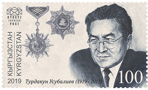
Kochkor ( ky, Кочкор; russian: Кочкорка, Kochkorka) is a large village in northern Naryn Region of Kyrgyzstan. It is the administrative centre of Kochkor District. The village was established in 1909 as Stolypino and renamed to Kochkor in 1917. Altitude 1,800 m. Its population was 11,373 in 2021. It is on the main A365 highway from Torugart Pass (China) north to Bishkek. About 7 km west A367 branches west toward Jalal-Abad Region and the Ferghana Valley. About 25 km northeast along the highway is the Orto-Tokoy reservoir and about 45 km northeast is Balykchy on Lake Issyk-Kul. The village is a base for excursions into the high country and tourist infrastructure is fairly well developed. There is a regional museum. Population Notable people *Turdakun Usubalijev Turdakun Usubalievich Usubaliev (russian: Турдакун Усубалиевич Усубалиев; ky, Турдакун Усубалиевич Усубалиев, translit=Turdakun Usuba ... [...More Info...] [...Related Items...] OR: [Wikipedia] [Google] [Baidu] |
Kochkor District
Kochkor () is a Districts of Kyrgyzstan, district of Naryn Region in northern-central Kyrgyzstan. The administrative seat lies at Kochkor. Its area is , and its resident population was 67,363 in 2021. Population Populated places In total, Kochkor District includes 35 settlements in 11 rural communities ('). Each rural community comprises one or several villages. The rural communities and settlements in the Kochkor District are as follows: # Ak-Kyya (seat: Kara-Suu, Kochkor, Kara-Suu; incl. Jangy-Jol) # Cholpon (seat: Cholpon, Naryn, Cholpon; incl. Ara-Köl, Osoviakhim, Tuz, Epkin, Ak-Chiy, Oro-Bashy, Tarmal-Saz and Uzun-Bulak) # Kara-Suu (seat: Mantysh; incl. Ak-Talaa, Kara-Moynok, Kyzyl-Döbö and Ortok) # Kochkor (seat: Kochkor; incl. Bolshevik and Tengdik) # Kök-Jar (seat: Kök-Jar ... [...More Info...] [...Related Items...] OR: [Wikipedia] [Google] [Baidu] |
Naryn Region
Naryn Region ( ky, Нарын облусу, Naryn oblusu; russian: Нарынская область, Narynskaya oblast) is the largest region ('' oblus'') of Kyrgyzstan. It is located in the east of the country and borders with Chüy Region in the north, Issyk-Kul Region in the northeast, Xinjiang Uyghur Autonomous Region of China in the southeast, Osh Region in the southwest, and Jalal-Abad Region in the west. Its capital is Naryn. Its total area is . The resident population of the region was 292,140 as of January 2021. The main highway runs from the Chinese border at Torugart Pass north to Balykchy on Issyk-Kul Lake. It is known as the location of Song Köl Lake and Chatyr-Kul Lake and Tash Rabat. The population of Naryn oblast is 99% Kyrgyz. The economy is dominated by animal herding (sheep, horses, yaks), with wool and meat as the main products. Mining of various minerals developed during the Soviet era has largely been abandoned as uneconomical. Today the oblast is co ... [...More Info...] [...Related Items...] OR: [Wikipedia] [Google] [Baidu] |
Jalal-Abad Region
Jalal-Abad Region ( ky, Жалал-Абад облусу, Jalal-Abad oblusu; russian: Джалал-Абадская область, Dzhalal-Abadskaya oblast) is a region (''oblast'') of Kyrgyzstan. Its capital is the city of the same name, Jalal-Abad. It is surrounded by (clockwise from the north) Talas Region, Chüy Region, Naryn Region, Osh Region, and Uzbekistan. Jalal-Abad Region was established on 21 November 1939. On 27 January 1959 it became a part of Osh Region, but regained its old status as a region on 14 December 1990. Its total area is . The resident population of the region was 1,260,617 as of January 2021. The region has a sizeable Uzbek (24.8% in 2009) minority. Geography Jalal-Abad Region covers (16.2% of total country's area) in central-western Kyrgyzstan. The southern edge of the region is part of the Ferghana Valley. The rest of the region is mountainous. M41, the main north-south highway from Bishkek to Osh, takes a very crooked route down the center o ... [...More Info...] [...Related Items...] OR: [Wikipedia] [Google] [Baidu] |
Kyrgyzstan
Kyrgyzstan,, pronounced or the Kyrgyz Republic, is a landlocked country in Central Asia. Kyrgyzstan is bordered by Kazakhstan to the north, Uzbekistan to the west, Tajikistan to the south, and the People's Republic of China to the east. Its capital and largest city is Bishkek. Ethnic Kyrgyz make up the majority of the country's seven million people, followed by significant minorities of Uzbeks and Russians. The Kyrgyz language is closely related to other Turkic languages. Kyrgyzstan's history spans a variety of cultures and empires. Although geographically isolated by its highly mountainous terrain, Kyrgyzstan has been at the crossroads of several great civilizations as part of the Silk Road along with other commercial routes. Inhabited by a succession of tribes and clans, Kyrgyzstan has periodically fallen under larger domination. Turkic nomads, who trace their ancestry to many Turkic states. It was first established as the Yenisei Kyrgyz Khaganate later in the ... [...More Info...] [...Related Items...] OR: [Wikipedia] [Google] [Baidu] |
Orto-Tokoy
Orto-Tokoy ( ky, Орто-Токой) is an urban-type settlement in the Issyk-Kul Region of Kyrgyzstan, just north of the A365 highway between Kochkor and Balykchy. Its population was 491 in 2021. Administratively, it is part of the city of Balykchy. It is on the east-flowing part of the upper river Chu, downsteam from the Orto-Tokoy Reservoir Orto-Tokoy Reservoir or Ortotokoy Reservoir ( ky, Ортотокой суу сактагычы), is a reservoir of the Chu River, located in Kochkor District of Naryn Region of Kyrgyzstan Kyrgyzstan,, pronounced or the Kyrgyz Republic, ... and dam. Population References Populated places in Issyk-Kul Region {{IssykKul-geo-stub ... [...More Info...] [...Related Items...] OR: [Wikipedia] [Google] [Baidu] |
Turdakun Usubalijev
Turdakun Usubalievich Usubaliev (russian: Турдакун Усубалиевич Усубалиев; ky, Турдакун Усубалиевич Усубалиев, translit=Turdakun Usubalievich Usubaliev); 6 November 1919 – 7 September 2015) was a Soviet Union-era Kyrgyz politician and First Secretary of the Central Committee of the Communist Party of Kyrgyzstan in the period 1961–1985. He was born in a peasant family in Kochkor. In 1941, he graduated from the Kyrgyz National Institute, and in 1965 the Moscow State Pedagogical University in absentia. In 1941, he was an activist of the Communist Party from 1941 to 1945, and a deputy head of department in the district committee, and the instructor of the Central Committee of KP Kyrgyzstan. From 1945 to 1955, he was the instructor of the Central Committee of the CPSU, and from 1955 to 1956 editor of the newspaper of the Kyrgyz SSR. From 1956 to 1958, he was the head of one of the departments of the Central Committee of the Com ... [...More Info...] [...Related Items...] OR: [Wikipedia] [Google] [Baidu] |
Torugart Pass
Torugart Pass (; ; ) is a mountain pass in the Tian Shan mountain range near the border between the Naryn Region of Kyrgyzstan and the Xinjiang Autonomous Region of China. It is one of two border crossings between Kyrgyzstan and China, the other being Erkeshtam, some 165 km (103 mi) to the southwest. The scenic lake Chatyr-Köl lies near the pass on the Kyrgyz side. The road to Naryn and then to Balykchy and Bishkek—stretching for some —is narrow and in winter often impassable due to heavy snowfall and frequent avalanches. On the Chinese side, the Torugart Port of Entry (吐尔尕特口岸), where travelers must clear for customs, is located about from the pass itself in Ulugqat County of the Kizilsu Kirghiz Autonomous Prefecture. Distances from the pass to major cities are: to Ulugqat, to Kashgar, to Artux and some to Ürümqi. The pass is also terminus of European route E125 and, under the new National Highway plans, the China National Highway ... [...More Info...] [...Related Items...] OR: [Wikipedia] [Google] [Baidu] |
Bishkek
Bishkek ( ky, Бишкек), ), formerly Pishpek and Frunze, is the capital and largest city of Kyrgyzstan. Bishkek is also the administrative centre of the Chüy Region. The region surrounds the city, although the city itself is not part of the region but rather a region-level unit of Kyrgyzstan. Bishkek is situated near the Kazakhstan–Kyrgyzstan border. Its population was 1,074,075 in 2021. In 1825, the Khanate of Kokand established the fortress of Pishpek to control local caravan routes and to collect tribute from Kyrgyz tribes. On 4 September 1860, with the approval of the Kyrgyz, Russian forces led by Colonel Apollon Zimmermann destroyed the fortress. In the present day, the fortress ruins can be found just north of Jibek jolu street, near the new main mosque. In 1868, a Russian settlement was established on the site of the fortress under its original name, Pishpek. It lay within the General Governorship of Russian Turkestan and its Semirechye Oblast. In 1925, the K ... [...More Info...] [...Related Items...] OR: [Wikipedia] [Google] [Baidu] |
Ferghana Valley
The Fergana Valley (; ; ) in Central Asia lies mainly in eastern Uzbekistan, but also extends into southern Kyrgyzstan and northern Tajikistan. Divided into three republics of the former Soviet Union, the valley is ethnically diverse and in the early 21st century was the scene of conflict. A large triangular valley in what is an often dry part of Central Asia, the Fergana owes its fertility to two rivers, the Naryn and the Kara Darya, which run from the east, joining near Namangan, forming the Syr Darya river. The valley's history stretches back over 2,300 years, when Alexander the Great founded Alexandria Eschate at its southwestern end. Chinese chroniclers date its towns to more than 2,100 years ago, as a path between Greek, Chinese, Bactrian and Parthian civilisations. It was home to Babur, founder of the Mughal Dynasty, tying the region to modern Afghanistan and South Asia. The Russian Empire conquered the valley at the end of the 19th century, and it became part of the Sovi ... [...More Info...] [...Related Items...] OR: [Wikipedia] [Google] [Baidu] |
Balykchy
Balykchy ( ky, Балыкчы) is a town at the western end of Lake Issyk-Kul in Kyrgyzstan, at an elevation of about 1,900 metres. Its area is , and its resident population was 42,875 in 2021 (both including Orto-Tokoy). A major industrial and transport centre (wool and crop processing, lake shipping, rail terminal, and road junction) during the Soviet era, it lost most of its economic base after the collapse of the Soviet Union and the closure of virtually all of its industrial facilities. The main road from Bishkek, the capital of Kyrgyzstan, to China, a part of the ancient Great Silk Road, passes through Balykchy before it starts its long and arduous way across the alpine ranges of Naryn Province in central Kyrgyzstan to the Chinese border at Torugart Pass. Plans for the rail road from the Chinese border to Balykchy, where the line from Bishkek currently ends, are under discussion. Two other roads go around the north and south sides of Issyk Kul to Karakol and then around the ... [...More Info...] [...Related Items...] OR: [Wikipedia] [Google] [Baidu] |
Issyk-Kul
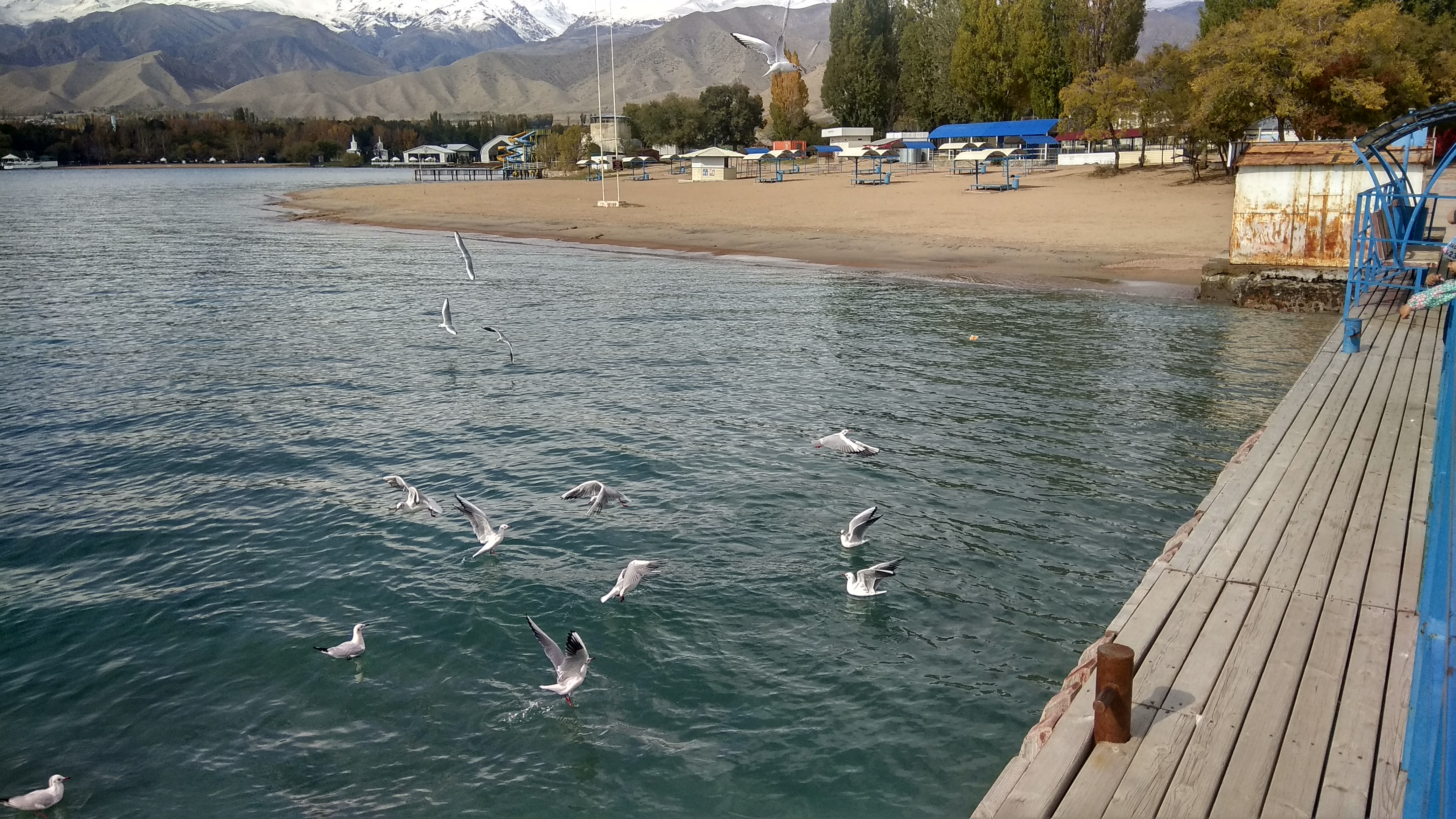
Issyk-Kul (also Ysyk-Köl, ky, Ысык-Көл, lit=warm lake, translit=Ysyk-Köl, , zh, 伊塞克湖) is an endorheic lake (i.e., without outflow) in the Northern Tian Shan mountains in Eastern Kyrgyzstan. It is the seventh-deepest lake in the world, the tenth-largest lake in the world by volume (though not in surface area) and the second-largest saline lake after the Caspian Sea. Issyk-Kul means "warm lake" in the Kyrgyz language; although it is located at a lofty elevation of and subject to severe cold during winter, it never freezes. The lake is a Ramsar site of globally significant biodiversity and forms part of the Issyk-Kul Biosphere Reserve. Geography Issyk-Kul Lake is long, up to wide and its area is . It is the second-largest mountain lake in the world behind Lake Titicaca in South America. It is at an altitude of and reaches in depth. About 118 rivers and streams flow into the lake; the largest are the Jyrgalang and Tüp. It is fed by springs, including man ... [...More Info...] [...Related Items...] OR: [Wikipedia] [Google] [Baidu] |


