|
Knešpolje
Knešpolje ( sr-cyr, Кнешпоље) or Knežopolje (Кнежопоље) is a region in northwestern Bosnia and Herzegovina. It is the northwestern part of the Potkozarje geographical region, and includes a region stretching from Prijedor, Kozara mountains, Bosanska Dubica, the Una river and Bosanska Kostajnica. Its name is derived from ''knez'' (count, duke) and ''polje'' (field). Geography The region lies in northwestern Bosnia and Herzegovina, in the wider Bosanska Krajina region. It is the northwestern part of the Potkozarje geographical region, and includes a region stretching from Prijedor, Kozara mountains, Bosanska Dubica, the Una river and Bosanska Kostajnica. History The region is known for its rebellions against Ottoman rule. In 1858, an uprising broke out in the region, known as Pecija's First Revolt. The region is known as a place where Serbs were persecuted by the Ustashe in World War II; Bosnian Muslim poet Skender Kulenović wrote about the Kozara tragedy. ... [...More Info...] [...Related Items...] OR: [Wikipedia] [Google] [Baidu] |
Pecija's First Revolt
Pecija's First Revolt ( sr-cyr, прва Пецијина буна) or Doljani Revolt (Дољанска буна) was an uprising in Knešpolje led by Serb hayduk leader Pecija, Petar Popović–Pecija (1826–1875) against the Ottoman government, that extended over the period of June—December 1858. It was a result of pressure against the local Serb populace, with past atrocities conducted by the Ottomans. Background In 1857, an uprising was led by Luka Vukalović in Herzegovina, followed by the 1858 Uprising which included the Prota's Revolt in Gradačac ''srez'' (municipality), led by ''prota'' Avramović, and at the same time Pecija's Revolt in Krajina. Revolt In mid-1858, an uprising broke out in northwestern Bosnia, resulting from Ottoman pressure against the local Serb populace. In Ivanjska, Bosanska Krupa, Ivanjska in the Bosanska Krupa, Krupa ''nahiyah'', the Serb population of that Catholic-majority village rose up. After short shootings around Ivanjska, the other vill ... [...More Info...] [...Related Items...] OR: [Wikipedia] [Google] [Baidu] |
Bosanska Dubica
Kozarska Dubica ( sr-cyrl, Козарска Дубица), previously known as Bosanska Dubica ( sr-cyrl, Босанска Дубица) is a town and municipality located in northern Republika Srpska, an entity of Bosnia and Herzegovina. As of 2013, it has a population of 21,542 inhabitants, while the town of Kozarska Dubica has a population of 11,566 inhabitants. Geography It is situated in the eastern part of Bosanska Krajina region. The municipality of Hrvatska Dubica lies to the north, in Croatia. Bosanska Dubica is situated from the Zagreb–Belgrade highway. The town and its suburbs border Croatia to the north, the town of Gradiška to the east, the town of Kostajnica to the west, and the town of Prijedor to the south. The land area of Bosanska Dubica is . Name The town was originally known as "Bosanska Dubica" (Босанска Дубица in Serbian Cyrillic, literally "Bosnian Dubica") but was renamed "Kozarska Dubica" (Козарска Дубица in Serbian Cy ... [...More Info...] [...Related Items...] OR: [Wikipedia] [Google] [Baidu] |
Bosanska Kostajnica
Kostajnica ( sr-cyr, Костајница) is a town and municipality located in northern Republika Srpska, an entity of Bosnia and Herzegovina.the official web site of the municipality Kostajnica/Костајница. It is situated in the part of the Кrajina region.official name of region As of 2013, it had a population of 5,977 inhabitants, while the town of Kostajnica has a population of 4,047 inhabitants. The municipality was created from part of the pre-war municipality of [...More Info...] [...Related Items...] OR: [Wikipedia] [Google] [Baidu] |
Bosnian Frontier
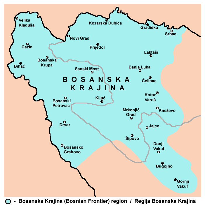
Bosanska Krajina ( sr-cyrl, Босанска Крајина, ) is a geographical region, a subregion of Bosnia, in western Bosnia and Herzegovina. It is enclosed by a number of rivers, namely the Sava (north), Glina (northwest), Vrbanja and Vrbas (east and southeast, respectively). The region is also a historic, economic and cultural entity of Bosnia and Herzegovina, famous for its natural beauties and wildlife diversity. The largest city, and its historical center is Banja Luka. Other cities and towns include Bihać, Bosanska Krupa, Bosanski Petrovac, Bosansko Grahovo, Bužim, Cazin, Drvar, Gradiška, Ključ, Kostajnica, Kozarska Dubica, Laktaši, Mrkonjić Grad, Novi Grad, Prijedor, Sanski Most, Šipovo, Velika Kladuša. Bosanska Krajina is not a formal entity within the structure of Bosnia and Herzegovina; however it has a significant cultural and historical identity that was formed through several historic and economic events. The territory of Bosanska Krajina ... [...More Info...] [...Related Items...] OR: [Wikipedia] [Google] [Baidu] |
Regions Of Republika Srpska
In geography, regions, otherwise referred to as zones, lands or territories, are areas that are broadly divided by physical characteristics (physical geography), human impact characteristics (human geography), and the interaction of humanity and the environment (environmental geography). Geographic regions and sub-regions are mostly described by their imprecisely defined, and sometimes transitory boundaries, except in human geography, where jurisdiction areas such as national borders are defined in law. Apart from the global continental regions, there are also hydrospheric and atmospheric regions that cover the oceans, and discrete climates above the land and water masses of the planet. The land and water global regions are divided into subregions geographically bounded by large geological features that influence large-scale ecologies, such as plains and features. As a way of describing spatial areas, the concept of regions is important and widely used among the many branches of ... [...More Info...] [...Related Items...] OR: [Wikipedia] [Google] [Baidu] |
Prijedor Field
Prijedor ( sr-cyrl, Приједор, ) is a city and municipality located in the Republika Srpska entity of Bosnia and Herzegovina. As of 2013, it has a population of 89,397 inhabitants within its administrative limits. Prijedor is situated in the north-western part of the Bosanska Krajina geographical region. Prijedor is known for its mixed religious heritage comprising Eastern Orthodox Christianity, Roman Catholicism and Islam. Historic buildings from the Ottoman and Austrian-Hungarian periods are a feature of the urban landscape. The city underwent extensive renovation between 2006–2009. Geography The town of Prijedor, within the municipality of Prijedor, is located in the north-western part of Bosnia and Herzegovina, on the banks of the Sana and Gomjenica rivers, and at the south-western hills of the Kozara mountain. The area of the municipality is . The town is situated at 44°58'39" N and 16°42'29" E, at an altitude of above sea level. It is traditionally a part ... [...More Info...] [...Related Items...] OR: [Wikipedia] [Google] [Baidu] |
RTRS
Radio Television of Republika Srpska ( Serbian: ''Радио Телевизија Републике Српске'' / Radio Televizija Republike Srpske or RTRS) is the entity-level public broadcaster which operates radio and television services in Republika Srpska, Bosnia and Herzegovina. It is the official public broadcasting service that covers government activities in the Republic of Srpska. Services Founded in 1992, RTRS broadcasts a 24-hour television channel known as Televizija Republike Srpske, and one radio station called Radio Republike Srpske. There is also a unit known as Muzička Produkcija RTRS ("Music Production Section of RTRS", locally known as MP RTRS for short) which was established in 2011. Headquarters of RTRS is located in Banja Luka. Regional radio and TV studios are located in the following cities: Prijedor, Istočno Sarajevo, Bijeljina, Trebinje, Doboj and Brčko. Radio and television programming is mainly produced in the Serbian language (in one of two ... [...More Info...] [...Related Items...] OR: [Wikipedia] [Google] [Baidu] |
Tamburica
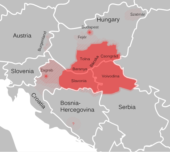
Tamburica ( or ) or tamboura ( sh-Latn-Cyrl, separator=" / ", tamburica, тамбурица, little tamboura; hu, tambura; el, Ταμπουράς, Tampourás; sometimes written tamburrizza or tamburitza), refers to a family of long-necked lutes popular in Southern Europe and Central Europe, especially Serbia (in Vojvodina, Mačva and Posavo-Tamnava), Bosnia and Herzegovina, Croatia (of which it is the national string instrument), Slovenia, and Hungary ( predominantly amongst its ethnic South Slavic minority groups). It is also known in Burgenland, Austria. All took their name and some characteristics from the Persian tanbur but also resemble the mandolin and guitar in the sense that its strings are plucked and often paired. The frets may be moveable to allow the playing of various modes. The variety of tamburica shapes known today were developed in Serbia and Croatia by a number of indigenous contributors near the end of the 19th century. History There is little reliable data ... [...More Info...] [...Related Items...] OR: [Wikipedia] [Google] [Baidu] |
Kozara Kolo
Kozara ( sr-cyrl, Козара) is a mountain in western Bosnia and Herzegovina, in the town of Kozarac and in the Bosanska Krajina region, bounded by the Sava River to the north, the Vrbas to the east, the Sana to the south, and the Una to the west. Its tallest peak is Lisina (978 m). In 1942 Kozara was the site of the Kozara Offensive, part of the Yugoslav National Liberation War and Partisan resistance during World War II World War II or the Second World War, often abbreviated as WWII or WW2, was a world war that lasted from 1939 to 1945. It involved the vast majority of the world's countries—including all of the great powers—forming two opposin .... Peaks See also * Kozara National Park * List of mountains in Bosnia and Herzegovina References Mountains of Bosnia and Herzegovina Mountains of Republika Srpska {{BosniaHerzegovina-geo-stub ... [...More Info...] [...Related Items...] OR: [Wikipedia] [Google] [Baidu] |
Kolo (dance)
Kolo ( sr-Cyrl, Коло) is a UNESCO List of Intagible Cultural Heritage inscribed South Slavic circle dance, found under this name in Bosnia and Herzegovina, Croatia and Serbia. History According to Wilkes (1995), the kolo has an Illyrian origin as the dance seems to resemble dances depicted on funeral monuments of the Roman era. Description The circle dance is usually performed amongst groups of at least three people and up to several dozen people. Dancers hold each other's hands or each other's waists. They form a circle, a single chain or multiple parallel lines. Kolo requires almost no movement above the waist. The basic steps are easy to learn. Experienced dancers demonstrate virtuosity by adding different ornamental elements, such as syncopated steps. Each region has at least one unique kolo. It is difficult to master the dance and even most experienced dancers cannot master all of them. Kolo is performed at weddings, social, cultural, and religious ceremonies.< ... [...More Info...] [...Related Items...] OR: [Wikipedia] [Google] [Baidu] |
Ojkača
Ojkanje is a tradition of polyphonic folk singing in Croatia, characteristic for the regions of the Dalmatian hinterland, Velebit, Lika, Kordun, and Karlovac. As described in ''The Harvard Dictionary of Music'': "The ojkanje is a particular style of singing melisma with a sharp and prolonged shaking of the voice on the syllables ''oj'' or ''hoj.''" According to experts, ojkanje is a remnant of pre-Slavic Illyrian singing from the area of ancient Dalmatia (today's Croatia, Bosnia and Herzegovina, and Montenegro). In 2010, it was inscribed as Ojkanje singing in UNESCOs List of Intangible Cultural Heritage in Need of Urgent Safeguarding. Geographical extent Historically, ojkanje is found in the regions of the Dalmatian hinterland, Velebit, Lika, Kordun, and Karlovac, belonging to the Dinaric area, along with several neighbouring micro-regions. Dalmatian hinterland area is considered as main home of the ojkanje style and from there was expanded to other parts of Croatia. Migrat ... [...More Info...] [...Related Items...] OR: [Wikipedia] [Google] [Baidu] |


