|
Kleiner Hafner
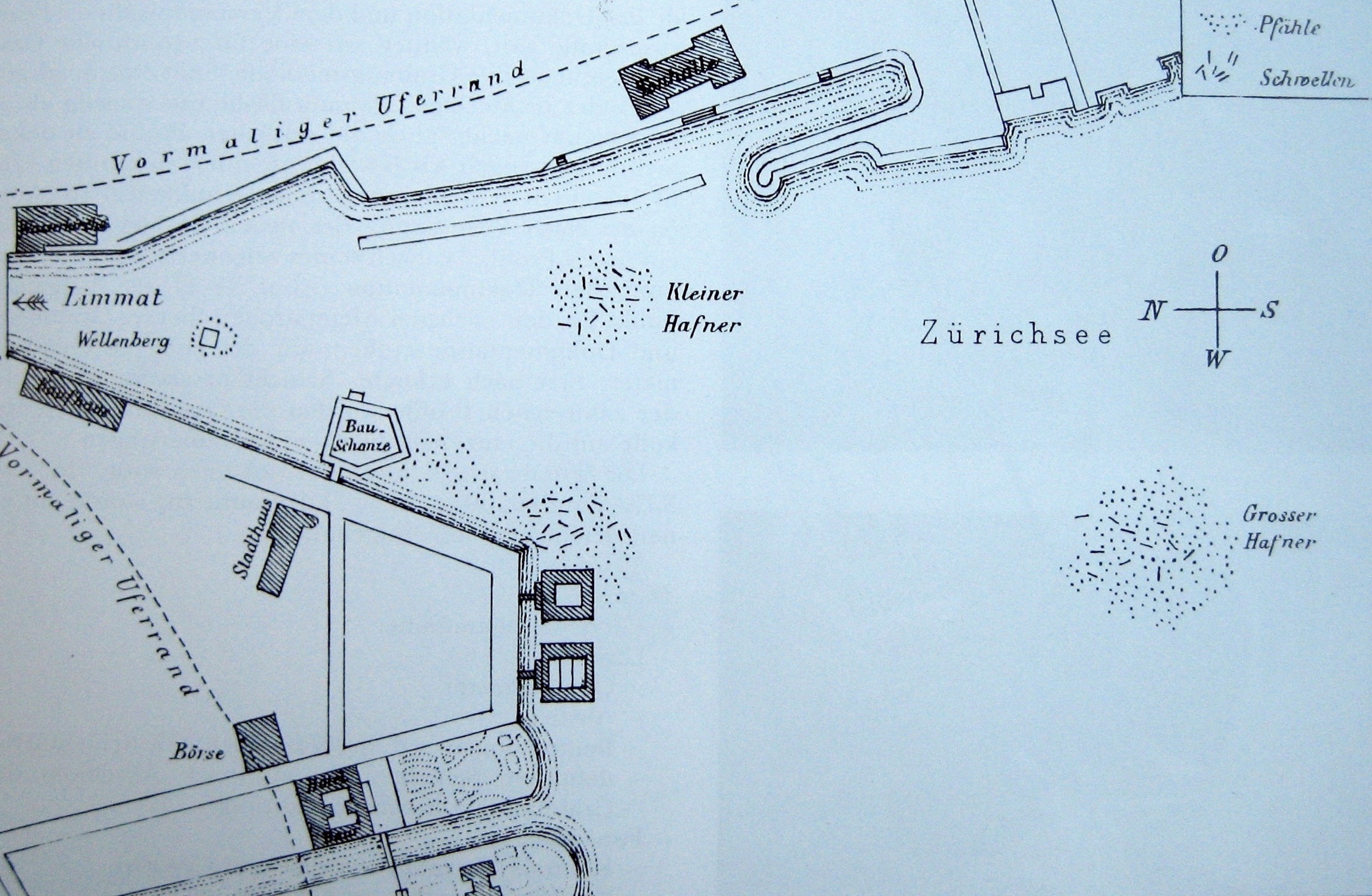
Kleiner Hafner is one of the 111 serial sites of the UNESCO World Heritage Site ''Prehistoric pile dwellings around the Alps'', of which are 56 located in Switzerland. Geography Kleiner Hafner was located on the then swamp land between the river Limmat and Zürichsee around Sechseläutzenplatz on a small peninsula in Zürich, and as well as the other Prehistoric pile dwellings around Zürichsee set on piles to protect against occasional flooding by the rivers Linth and Jona. The settlement is located on ''Zürichsee'' lakeshore in Enge, a locality of the municipality of Zürich. It was neighbored by the settlements Zürich–Enge Alpenquai and Grosser Hafner on a then island in the effluence of the Limmat, within an area of about in the city of Zürich. Grosser and Kleiner Hafner comprise , and the buffer zone including the lake area comprises in all. History The site is internationally known since 2009, when during the beginning of the construction of the underground pa ... [...More Info...] [...Related Items...] OR: [Wikipedia] [Google] [Baidu] |
UNESCO World Heritage Site
A World Heritage Site is a landmark or area with legal protection by an international convention administered by the United Nations Educational, Scientific and Cultural Organization (UNESCO). World Heritage Sites are designated by UNESCO for having cultural, historical, scientific or other form of significance. The sites are judged to contain " cultural and natural heritage around the world considered to be of outstanding value to humanity". To be selected, a World Heritage Site must be a somehow unique landmark which is geographically and historically identifiable and has special cultural or physical significance. For example, World Heritage Sites might be ancient ruins or historical structures, buildings, cities, deserts, forests, islands, lakes, monuments, mountains, or wilderness areas. A World Heritage Site may signify a remarkable accomplishment of humanity, and serve as evidence of our intellectual history on the planet, or it might be a place of great natural beauty. A ... [...More Info...] [...Related Items...] OR: [Wikipedia] [Google] [Baidu] |
Zürich–Enge Alpenquai
Zürich–Enge Alpenquai is one of the 111 serial sites of the UNESCO World Heritage Site ''Prehistoric pile dwellings around the Alps'', of which 56 are located in Switzerland. Geography Located on the then-swampland between Limmat and Lake Zurich around Sechseläutzenplatz on small islands and peninsulas in Zürich, the settlements were set on piles to protect against occasional flooding by the Linth and Jona Rivers. Because the lake has grown in size over time, most of the original piles are now around to under the water level of , giving modern observers the false impression that they always had been underwater. Zürich–Enge Alpenquai is located on ''Lake Zurich'' lakeshore in Enge, a locality of the municipality of Zürich in the Canton of Zürich in Switzerland. The settlement comprises , and the buffer zone, including the lake area, comprises in all. It was neighbored by the settlements at Kleiner Hafner and Grosser Hafner on a then peninsula respectively islan ... [...More Info...] [...Related Items...] OR: [Wikipedia] [Google] [Baidu] |
Lake Zurich
__NOTOC__ Lake Zurich ( Swiss German/Alemannic: ''Zürisee''; German: ''Zürichsee''; rm, Lai da Turitg) is a lake in Switzerland, extending southeast of the city of Zürich. Depending on the context, Lake Zurich or ''Zürichsee'' can be used to describe the lake as a whole, or just that part of the lake downstream of the Seedamm at Rapperswil, whilst the part upstream of Rapperswil may be called the ''Obersee'' or Upper Lake. Geography Lake Zurich is formed by the Linth river, which rises in the glaciers of the Glarus Alps and was diverted by the Escher canal (completed in 1811) into Lake Walen from where its waters are carried to the east end of Lake Zurich by means of the Linth canal (completed in 1816). The waters of the Lake of Zurich flow out of the lake at its north-west end ( Quaibrücke), passing through the city of Zürich; however, the outflow is then called the Limmat. The culminating point of the lake's drainage basin is the Tödi at 3,614 metres above sea level. ... [...More Info...] [...Related Items...] OR: [Wikipedia] [Google] [Baidu] |
History Of Zürich
Zürich has been continuously inhabited since Roman times. The vicus of ''Turicum'' was established in AD 90, at the site of an existing Gaulish ( Helvetic) settlement. Gallo-Roman culture appears to have persisted beyond the collapse of the Western empire in the 5th century, and it is not until the Carolingian period. A royal castle was built at the site of the Lindenhof, and monasteries are established at Grossmünster and Fraumünster. Political power lay with these abbeys during Medieval times, until the guild revolt in the 14th century which led to the joining of the Swiss Confederacy. Zürich was the focus of the Swiss Reformation led by Huldrych Zwingli, and it came to riches with silk industry in Early Modern times. Early history Numerous lake-side settlements from the Neolithic and Bronze Age have been found, such as those in the Zürich Pressehaus and Zürich Mozartstrasse. The settlements were found in the 1800s, submerged in Lake Zürich. Located on the then swa ... [...More Info...] [...Related Items...] OR: [Wikipedia] [Google] [Baidu] |
Prehistoric Pile Dwellings In Switzerland
Prehistory, also known as pre-literary history, is the period of human history between the use of the first stone tools by hominins 3.3 million years ago and the beginning of recorded history with the invention of writing systems. The use of symbols, marks, and images appears very early among humans, but the earliest known writing systems appeared 5000 years ago. It took thousands of years for writing systems to be widely adopted, with writing spreading to almost all cultures by the 19th century. The end of prehistory therefore came at very different times in different places, and the term is less often used in discussing societies where prehistory ended relatively recently. In the early Bronze Age, Sumer in Mesopotamia, the Indus Valley Civilisation, and ancient Egypt were the first civilizations to develop their own scripts and to keep historical records, with their neighbors following. Most other civilizations reached the end of prehistory during the following Iron Age. ... [...More Info...] [...Related Items...] OR: [Wikipedia] [Google] [Baidu] |
Stratigraphy
Stratigraphy is a branch of geology concerned with the study of rock (geology), rock layers (Stratum, strata) and layering (stratification). It is primarily used in the study of sedimentary rock, sedimentary and layered volcanic rocks. Stratigraphy has three related subfields: lithostratigraphy (lithologic stratigraphy), biostratigraphy (biologic stratigraphy), and chronostratigraphy (stratigraphy by age). Historical development Catholic priest Nicholas Steno established the theoretical basis for stratigraphy when he introduced the law of superposition, the principle of original horizontality and the principle of lateral continuity in a 1669 work on the fossilization of organic remains in layers of sediment. The first practical large-scale application of stratigraphy was by William Smith (geologist), William Smith in the 1790s and early 19th century. Known as the "Father of English geology", Smith recognized the significance of Stratum, strata or rock layering and the importance ... [...More Info...] [...Related Items...] OR: [Wikipedia] [Google] [Baidu] |
Egolzwil Culture
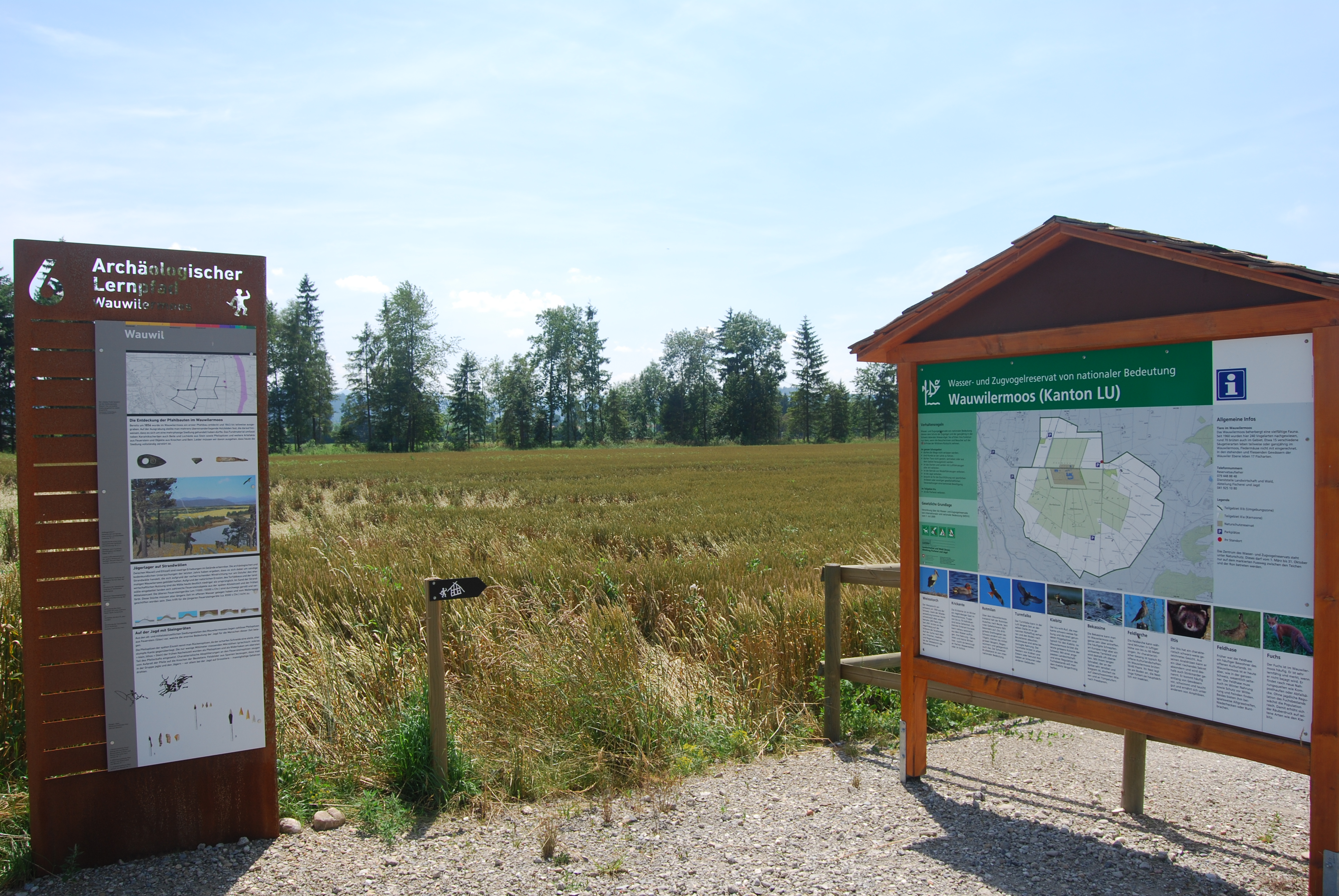
Wauwilermoos or Egolzwil 3 is one of the 111 serial sites of the UNESCO World Heritage Site ''Prehistoric pile dwellings around the Alps'', of which are 56 located in Switzerland. Geography The site is located on the former Wauwilersee lakeshore in the municipalities of Egolzwil, Wauwil and Schötz in the Canton of Luzern in Switzerland. The settlement comprises , and the buffer zone including the lake area comprises in all. Around 20000 BC a branch of the Reuss glacier formed a valley whose deepest point was approximately below the present surface. At Schötz the glacier stopped, as shown by the impressive moraines. During the retreat of the glacier, meltwater jammed between the moraines. Thus in the Wauwilermoos plain three lakes were formed: ''Wauwilersee'', ''Hagimoos'' and ''Mauensee''; latter still exists. The meltwater outsourced enormous amounts of sand, so that the lakes never were particularly deep. The depth of Wauwilersee amounted only to about . To 17000 BC the ar ... [...More Info...] [...Related Items...] OR: [Wikipedia] [Google] [Baidu] |
Horgen Culture
The Horgen culture is one of several archaeological cultures belonging to the Neolithic period of Switzerland. The Horgen culture may derive from the Pfyn culture and early Horgen pottery is similar to the earlier Cortaillod culture pottery of Twann, Switzerland.Comparative Archeology Web accessed 28 June 2010 It is named for one of the principal sites, in , Switzerland. Dates  The Horgen culture started around 3500/3400
 [...More Info...] [...Related Items...] OR: [Wikipedia] [Google] [Baidu] |
Excavation (archaeology)
In archaeology, excavation is the exposure, processing and recording of archaeological remains. An excavation site or "dig" is the area being studied. These locations range from one to several areas at a time during a project and can be conducted over a few weeks to several years. Excavation involves the recovery of several types of data from a site. This data includes artifacts (portable objects made or modified by humans), features (non-portable modifications to the site itself such as post molds, burials, and hearths), ecofacts (evidence of human activity through organic remains such as animal bones, pollen, or charcoal), and archaeological context (relationships among the other types of data).Kelly&Thomas (2011). ''Archaeology: down to earth'' (4th ed.). Belmont, Calif.: Wadsworth, Cengage Learning. Before excavating, the presence or absence of archaeological remains can often be suggested by, non-intrusive remote sensing, such as ground-penetrating radar. Basic informat ... [...More Info...] [...Related Items...] OR: [Wikipedia] [Google] [Baidu] |


