|
Kjerulf Glacier (Jan Mayen)
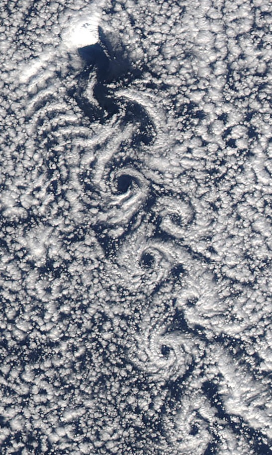
Kjerulf Glacier ( no, Kjerulfbreen) is a glacier in Jan Mayen. It begins at the Hakluyttoppen slope, in the outer crater edge of the Beerenberg. The Kjerulf Glacier and both its neighbors, the Weyprecht Glacier in the west and the Svend-Foyn Glacier in the east, are the most active glaciers in the island. The glacier was named after Norwegian geologist Theodor Kjerulf (1825–88), founder of the Geological Survey of Norway, during the Norwegian North-Atlantic Expedition 1876-1878 led by Henrik Mohn.''Kjerulfbreen'' - Stadnamn i norske polarområde, Norsk polarinstitutt. See also *List of glaciers in Norway *Svalbard and Jan Mayen Svalbard and Jan Mayen ( no, Svalbard og Jan Mayen, ISO 3166-1 alpha-2: SJ, ISO 3166-1 alpha-3: SJM, ISO 3166-1 numeric: 744) is a statistical designation defined by ISO 3166-1 for a collective grouping of two remote jurisdictions of Norway: ... References External links Glaciers of Jan Mayen Glaciers of Jan Mayen {{JanMayen-geo-s ... [...More Info...] [...Related Items...] OR: [Wikipedia] [Google] [Baidu] |
Beerenberg
Beerenberg is a stratovolcano dominating the northeastern end of the Norwegian island of Jan Mayen. It is high and is the world's northernmost subaerial active volcano and the List of volcanoes in Norway, only volcano in Norway. The volcano is topped by a mostly ice-filled volcanic crater, crater about wide, with numerous peaks along its rim including the highest summit, Haakon VII Toppen, on its western side. Name Its name is Dutch language, Dutch for "Bear Mountain", and comes from the polar bears seen there by Dutch whalers in the early 17th century. Description The upper slopes of the volcano are largely ice-covered, with several major glaciers including five which reach the sea. The longest of the glaciers is the Weyprecht Glacier, which flows from the summit crater via a breach through the northwestern portion of the crater rim, and extends about down to the sea. Beerenberg is composed primarily of basaltic lava flows with minor amounts of tephra. Numerous cinder ... [...More Info...] [...Related Items...] OR: [Wikipedia] [Google] [Baidu] |
Piedmont Glacier
Glacier morphology, or the form a glacier takes, is influenced by temperature, precipitation, topography, and other factors. The goal of glacial morphology is to gain a better understanding of glaciated landscapes and the way they are shaped. Types of glaciers can range from massive ice sheets, such as the Greenland ice sheet, to small cirque glaciers found perched on mountain tops. Glaciers can be grouped into two main categories: * Ice flow is constrained by the underlying bedrock topography * Ice flow is unrestricted by surrounding topography Unconstrained Glaciers Ice sheets and ice caps Ice sheets and ice caps cover the largest areas of land in comparison to other glaciers, and their ice is unconstrained by the underlying topography. They are the largest glacial ice formations and hold the vast majority of the world's fresh water. Ice sheets Ice sheets are the largest form of glacial formation. They are continent sized ice masses that span areas over . They are dome ... [...More Info...] [...Related Items...] OR: [Wikipedia] [Google] [Baidu] |
Jan Mayen
Jan Mayen () is a Norwegian volcanic island in the Arctic Ocean with no permanent population. It is long (southwest-northeast) and in area, partly covered by glaciers (an area of around the Beerenberg volcano). It has two parts: larger northeast Nord-Jan and smaller Sør-Jan, linked by a wide isthmus. It lies northeast of Iceland (495 km 05 miNE of Kolbeinsey), east of central Greenland, and west of the North Cape, Norway. The island is mountainous, the highest summit being the Beerenberg volcano in the north. The isthmus is the location of the two largest lakes of the island, Sørlaguna (South Lagoon) and Nordlaguna (North Lagoon). A third lake is called Ullerenglaguna (Ullereng Lagoon). Jan Mayen was formed by the Jan Mayen hotspot and is defined by geologists as a separate continent. Although administered separately, in the ISO 3166-1 standard, Jan Mayen and Svalbard are collectively designated as ''Svalbard and Jan Mayen'', with the two-letter country code "SJ". N ... [...More Info...] [...Related Items...] OR: [Wikipedia] [Google] [Baidu] |
North Atlantic Ocean
The Atlantic Ocean is the second-largest of the world's five oceans, with an area of about . It covers approximately 20% of Earth's surface and about 29% of its water surface area. It is known to separate the "Old World" of Africa, Europe and Asia from the "New World" of the Americas in the European perception of the World. The Atlantic Ocean occupies an elongated, S-shaped basin extending longitudinally between Europe and Africa to the east, and North and South America to the west. As one component of the interconnected World Ocean, it is connected in the north to the Arctic Ocean, to the Pacific Ocean in the southwest, the Indian Ocean in the southeast, and the Southern Ocean in the south (other definitions describe the Atlantic as extending southward to Antarctica). The Atlantic Ocean is divided in two parts, by the Equatorial Counter Current, with the North(ern) Atlantic Ocean and the South(ern) Atlantic Ocean split at about 8°N. Scientific explorations of the Atlant ... [...More Info...] [...Related Items...] OR: [Wikipedia] [Google] [Baidu] |
Glacier
A glacier (; ) is a persistent body of dense ice that is constantly moving under its own weight. A glacier forms where the accumulation of snow exceeds its Ablation#Glaciology, ablation over many years, often Century, centuries. It acquires distinguishing features, such as Crevasse, crevasses and Serac, seracs, as it slowly flows and deforms under stresses induced by its weight. As it moves, it abrades rock and debris from its substrate to create landforms such as cirques, moraines, or fjords. Although a glacier may flow into a body of water, it forms only on land and is distinct from the much thinner sea ice and lake ice that form on the surface of bodies of water. On Earth, 99% of glacial ice is contained within vast ice sheets (also known as "continental glaciers") in the polar regions, but glaciers may be found in mountain ranges on every continent other than the Australian mainland, including Oceania's high-latitude oceanic island countries such as New Zealand. Between lati ... [...More Info...] [...Related Items...] OR: [Wikipedia] [Google] [Baidu] |
Weyprecht Glacier
Weyprecht Glacier ( no, Weyprechtbreen) is a glacier in Jan Mayen. It is the longest glacier located in the Beerenberg area. The glacier is named after Austro-Hungarian Arctic explorer Karl Weyprecht. See also *List of glaciers in Norway *Svalbard and Jan Mayen Svalbard and Jan Mayen ( no, Svalbard og Jan Mayen, ISO 3166-1 alpha-2: SJ, ISO 3166-1 alpha-3: SJM, ISO 3166-1 numeric: 744) is a statistical designation defined by ISO 3166-1 for a collective grouping of two remote jurisdictions of Norway: ... References External links Glacier retreat in Jan MayenGlaciers of Jan Mayen Glaciers of Jan Mayen {{JanMayen-geo-stub ... [...More Info...] [...Related Items...] OR: [Wikipedia] [Google] [Baidu] |
Theodor Kjerulf
Theodor Kjerulf (30 March 182525 October 1888) was a Norwegian geologist and professor at the University of Oslo. He also served as director of the Norwegian Geological Survey. Biography He was born in Christiania (now Oslo), Norway. He was the son of Peder Kjerulf (1781–1841) and Elisabet Maria Lasson (1791–1873). He was the brother of composer Halfdan Kjerulf. He was educated in the Royal Frederick University (now University of Oslo) and subsequently studied in Germany, working with Karl Georg Bischof in Bonn and Robert Wilhelm Bunsen in Heidelberg. In 1858, he was hired as a lecturer at the Royal Frederick University. In 1866 he was promoted to professor of geology. His contributions to the geology of Norway were numerous. From 1858 to 1888, he served as the first director of the Norwegian Geological Survey (''Norges geologiske undersøkelse''), which he had been instrumental in establishing. He also contributed to the systematic and detailed mapping of Norway's bedr ... [...More Info...] [...Related Items...] OR: [Wikipedia] [Google] [Baidu] |
Geological Survey Of Norway
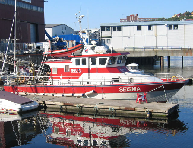
Geological Survey of Norway ( no, Norges geologiske undersøkelse), abbreviation: ''NGU'', is a Norwegian government agency responsible for geologic mapping and research. The agency is located in Trondheim with an office in Tromsø, with about 200 employees. It is subordinate to the Norwegian Ministry of Trade, Industry and Fisheries.Government.no: Subordinate agencies and institutions2012-07-11. Mission NGU's main work is related to collecting, processing and impart knowledge related to the physical, chemical and mineralogical characteristics of the countries bedrock, mineral resources, deposits and groundwater.Geological Survey of NorwayAbout NGU 2008-01-27. Important areas include the Arctic, Antarctica, Svalbard and the continental shelf. With the motto "Geology for the Society", NGU provides maps and geological information in national databases. The activity is organized after five key principles:NGU - Annual report 20082008-01-27. # Long-term value creation from geologica ... [...More Info...] [...Related Items...] OR: [Wikipedia] [Google] [Baidu] |
North Sea Expedition
North is one of the four compass points or cardinal directions. It is the opposite of south and is perpendicular to east and west. ''North'' is a noun, adjective, or adverb indicating direction or geography. Etymology The word ''north'' is related to the Old High German ''nord'', both descending from the Proto-Indo-European unit *''ner-'', meaning "left; below" as north is to left when facing the rising sun. Similarly, the other cardinal directions are also related to the sun's position. The Latin word ''borealis'' comes from the Greek '' boreas'' "north wind, north", which, according to Ovid, was personified as the wind-god Boreas, the father of Calais and Zetes. ''Septentrionalis'' is from ''septentriones'', "the seven plow oxen", a name of ''Ursa Major''. The Greek ἀρκτικός (''arktikós'') is named for the same constellation, and is the source of the English word ''Arctic''. Other languages have other derivations. For example, in Lezgian, ''kefer'' can mean b ... [...More Info...] [...Related Items...] OR: [Wikipedia] [Google] [Baidu] |
Henrik Mohn
Henrik Mohn (15 May 1835 – 12 September 1916) was a Norwegian astronomer and meteorologist. Although he enrolled in theology studies after finishing school, he is credited with founding meteorological research in Norway, being a professor at the Royal Frederick University and director of the Norwegian Meteorological Institute from 1866 to 1913. Personal life He was born in Bergen as the son of Albert Henrik Mohn (1811–1894) and Ida Neumann (1814–1864). He was a brother of Jakob and Emanuel Mohn. On the maternal side, he was a grandson of bishop Jacob Neumann. He was married twice. In December 1863 he married Louise Nicoline Rieck (1836–1866). After she died, he married Julie Birgitte Dyblie (1847–1928) in July 1871. He was a granduncle of Frank and Albert Henrik Mohn, and his niece Hanna married physician and politician Nils Yngvar Ustvedt. Career He finished his secondary education at Bergen Cathedral School in 1852, and then enrolled at the Royal Frederick Univers ... [...More Info...] [...Related Items...] OR: [Wikipedia] [Google] [Baidu] |
List Of Glaciers In Norway
These are the largest glaciers on mainland Norway.The largest glaciers in Norway (page 51, Accessed on July 29, 2014) However, the 18 largest glaciers in the are on , including the second largest in Europe, on |


