|
Kirchdachspitze
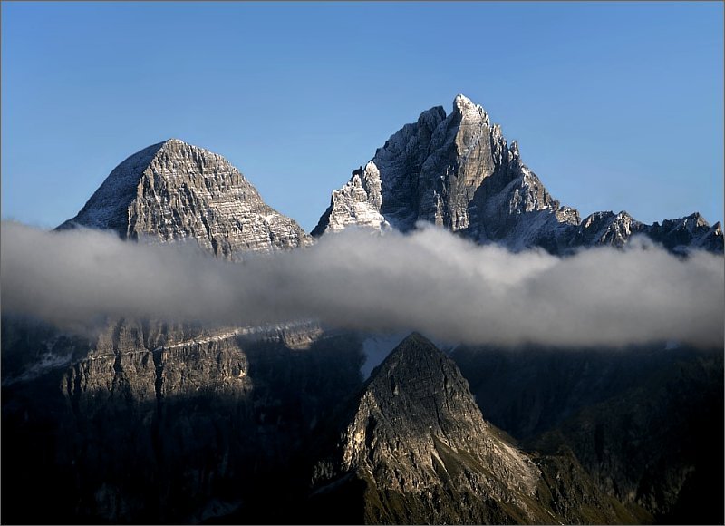
The Kirchdach, also Kirchdachspitze, is a mountain, , in the Stubai Alps in Tyrol, Austria. Geography The Kirchdach is the highest point on the ''Serleskamm'' ridge, which separates the valleys of Gschnitztal in the southeast from the Pinnistal and Stubaital in the northwest. It is situated between the 2,692 m high ''Ilmspitze'' to the southwest and the 2,528 m high ''Hammerspitze'' to the northeast. Ascent The Kirchdach may be ascended from the west from the alpine pasture of the ''Pinnisalm'' (1,560 m) in the Pinnis valley along the ''Jubiläumssteig'' path in ca. 4 hours. From the ''Issenangeralm'' (1,366 m), also in the Pinnis valley, the ''Rohrauersteig'' path takes ca. 4 hours to the top approaching the summit from the north. From the Gschnitztal valley the Padasterjochhaus (2,232 m) northeast of the Kirchdach acts as a base; from there it takes 2 hours to reach the top. All the routes run from the saddle of ''Silbersattel'' (2,750 m) ... [...More Info...] [...Related Items...] OR: [Wikipedia] [Google] [Baidu] |
Innsbrucker Hut
The Innsbrucker Hut (german: Innsbrucker Hütte) is a mountain hut in the Stubai Alps at an altitude of in the Gschnitz Valley, not far from the Pinnisjoch. It is managed by the Innsbruck Tourist Club section of the Austrian Alpine Club. The Innsbrucker Hütte is below the Habicht on the Stubai Hohenweg and is often visited. Access The quickest route to the hut from the Gschnitz Valley is from the car park behind ''Gasthof Feuerstein'' (at ); this route takes about three hours and climbs over .''Innsbrucker Hütte'' at tyrol.com. Retrieved 30 December 2022. An alternate route from Neder in the Stubai Valley (at ) through the Pinnis Valley takes approximately 4–5 hours and passes four former [...More Info...] [...Related Items...] OR: [Wikipedia] [Google] [Baidu] |
Stubai Alps
The Stubai Alps (in German ''Stubaier Alpen'') is a mountain range in the Central Eastern Alps of Europe. It derives its name from the Stubaital valley to its east and is located southwest of Innsbruck, Austria. Several peaks form the border between Austria and Italy. The range is bounded by the Inn River valley to the north; the Sill River valley (''Wipptal'') and the Brenner Pass to the east (separating it from the Zillertal Alps); the Ötztal and Timmelsjoch to the west (separating it from the Ötztal Alps), and to the south by tributaries of the Passer River and Eisack. Geography Important parts of the Stubai Alps show signs of glaciation. The northern part around the Sellrain valley and the Kühtai is now only lightly glaciated and a popular ski touring destination ( Zischgeles, Lampsenspitze, Pirchkogel, Sulzkogel). The High Stubai around the upper Stubai valley is still heavily glaciated and a classic high mountain touring region in the Eastern Alps. Here there is a glacie ... [...More Info...] [...Related Items...] OR: [Wikipedia] [Google] [Baidu] |
Habicht (mountain)
The Habicht is a mountain in the Stubai Alps of Austria. For a long time, the locals believed it to be the highest mountain in Tyrol, due to its prominence above the surrounding mountains. Despite what they thought, the highest peak in the Stubai Alps is Zuckerhütl which is 230 metres higher than Habicht. The name literally means "hawk" in German. Climbing * Starting point: Innsbrucker Hütte The Innsbrucker Hut (german: Innsbrucker Hütte) is a mountain hut in the Stubai Alps at an altitude of in the Gschnitz Valley, not far from the Pinnisjoch. It is managed by the Innsbruck Tourist Club section of the Austrian Alpine Club. The I ...br>(2369 m) * Height gain: 908 m * Difficulty level: non-trivial; portions secured by cables (which may be buried in snowy conditions), part of the route from 3100-3200m leads over snow-field * Duration: 3 hours ascent, plus or minus depending on weather and experience References External links * Mountains of Tyrol (state) Mount ... [...More Info...] [...Related Items...] OR: [Wikipedia] [Google] [Baidu] |
Two-thousanders Of Austria
Two-thousanders are mountains that have a height of at least 2,000 metres above sea level, but less than 3,000 metres. The term is used in Alpine circles, especially in Europe (e.g. German: ''Zweitausender''). The two photographs show two typical two-thousanders in the Alps that illustrate different types of mountain. The Säuling (top) is a prominent, individual peak, whereas the Schneeberg (bottom) is an elongated limestone massif. In ranges like the Allgäu Alps, the Gesäuse or the Styrian-Lower Austrian Limestone Alps the mountain tour descriptions for mountaineers or hikers commonly include the two-thousanders, especially in areas where only a few summits exceed this level. Examples from these regions of the Eastern Alps are: * the striking Nebelhorn (2,224 m) near Oberstdorf or the Säuling (2,047 m) near Neuschwanstein, * the Admonter Reichenstein (2,251 m), Eisenerzer Reichenstein (2,165 m), Großer Pyhrgas (2,244 m) or Hochtor (2,369&nbs ... [...More Info...] [...Related Items...] OR: [Wikipedia] [Google] [Baidu] |
Mountains Of The Alps
This page tabulates only the most prominent mountains of the Alps, selected for having a topographic prominence of ''at least'' , and all of them exceeding in height. Although the list contains 537 summits, some significant alpine mountains are necessarily excluded for failing to meet the stringent prominence criterion. The list of these most prominent mountains is continued down to 2500 m elevation at List of prominent mountains of the Alps (2500–2999 m) and down to 2000 m elevation on List of prominent mountains of the Alps (2000–2499 m). All such mountains are located in either France, Italy, Switzerland, Liechtenstein, Austria, Germany or Slovenia, even in some lower regions. Together, these three lists include all 44 ultra-prominent peaks of the Alps, with 19 ultras over 3000m on this page. For a definitive list of all 82 the highest peaks of the Alps, as identified by the International Climbing and Mountaineering Federation (UIAA), and often referred to as the 'Alpi ... [...More Info...] [...Related Items...] OR: [Wikipedia] [Google] [Baidu] |
Alpine Club Guide
The ''Alpine Club Guides'' (german: Alpenvereinsführer, commonly shortened to ''AV Führer'' or ''AVF'') are the standard series of Alpine guides that cover all the important mountain groups in the Eastern Alps. They are produced jointly by the German (DAV), Austrian (ÖAV) and South Tyrol Alpine Clubs (AVS). They have been published since 1950 by the firm of Bergverlag Rother in Munich, Germany. The AV guides contain all the routes – hiking trails, mountain hut approaches and summit climbs as well as ice and high mountain routes and ''klettersteigs'' in each mountain range. The descriptions are factual and dry, with few illustrations - rather unlike mountain books by e.g. Walter Pause – and despite introductory sections require general Alpine knowledge and experience. Examples are the ''AVF Allgäuer Alpen'' and the ''AVF Verwallgruppe''.The AV guides are often used as the basis for other publications and complement the Alpine Club maps or other map series. Available guid ... [...More Info...] [...Related Items...] OR: [Wikipedia] [Google] [Baidu] |
Mixed Climbing
Mixed climbing is a combination of ice climbing and rock climbing generally using ice climbing equipment such as crampons and ice tools. Mixed climbing has inspired its own specialized gear such as boots which are similar to climbing shoes but feature built-in crampons. Dry-tooling is mixed climbing's most specialized skill and has since evolved into a "sport" unto itself. Terrain The terrain that is climbed on is diverse and consists of rock, turf, snow, and ice in varying amounts. Such terrain is typically encountered in the winter season or on high icy mountains. Grading Grading of mixed terrain climbs roughly follows the WI rating system with respect to its physical and technical demands. The scale typically starts at M4 and subgrades of "-" and "+" are commonly used, although the distinctions are often subjective. Techniques Climbers participating in mixed climbing use techniques from both ice climbing and rock climbing. The nature of the mixed terrain and has ... [...More Info...] [...Related Items...] OR: [Wikipedia] [Google] [Baidu] |
Climbing Route
A climbing route is a path by which a climber reaches the top of a mountain, rock, or ice wall. Routes can vary dramatically in difficulty and grade; once committed to that ascent, it can sometimes be difficult to stop or return. Choice of route can be critically important. Guidebooks, if available, are helpful in providing detailed diagrams and photographs of routes. In the earliest days of hillwalking and mountaineering, climbers got to the top by whatever means got them there. Little information about how they did it is available. During the 19th century, as explorers of the Alps tried ever harder summits, it became clear that choosing an eastern face over a southwestern ridge could spell the difference between success or failure. One example was the first ascent of the Matterhorn, which had been repeatedly and unsuccessfully attempted via the southern side. The strata there tended to slope down and away while the rocks of the northeastern ridge (the one closest to Ze ... [...More Info...] [...Related Items...] OR: [Wikipedia] [Google] [Baidu] |
Metres In Height
In running, cycling, and mountaineering, cumulative elevation gain refers to the sum of every gain in elevation The elevation of a geographic location is its height above or below a fixed reference point, most commonly a reference geoid, a mathematical model of the Earth's sea level as an equipotential gravitational surface (see Geodetic datum § Vert ... throughout an entire trip. It is sometimes also known as cumulative gain or elevation gain, or often in the context of mountain travel, simply gain. Another commonly used phrase is total ascent. Elevation losses are not counted in this measure. Cumulative elevation gain, along with round-trip distance, is arguably the most important value used in quantifying the strenuousness of a trip. This is because hiking on flat land (zero elevation gain) is significantly easier than hiking up and down a large mountain with the same round-trip distance. Computation In the simplest case of a trip where hikers only travel ''up'' on ... [...More Info...] [...Related Items...] OR: [Wikipedia] [Google] [Baidu] |
Stubaital
The Stubaital is an alpine valley in Tyrol, Austria. It is the central valley of the Stubai Alps. The river Ruetz flows through the valley. This 35-km long valley runs in northeastern direction from the main chain of the Alps to Schönberg im Stubaital, near Innsbruck. Below Fulpmes, the villages lie on terraces above the Ruetz on either side of the river. South of Neustift im Stubaital, the largest side valley Oberbergtal joins from the west. The ÖBB operates a 16- MW hydroelectric power plant in Fulpmes. The following five municipalities lie in the valley: Schönberg im Stubaital, Mieders, Telfes, Fulpmes and Neustift im Stubaital. Public transportation from Innsbruck into the valley is available via the Stubaital bus route or the Stubai Valley Railway, which runs from Innsbruck to Fulpmes. At the end of the Stubaital valley the Stubai Glacier Stubai may mean: * Stubai Alps, (German: Stubaier Alpen), a mountain range in the Central Eastern Alps of Europe * Stubaital, the cen ... [...More Info...] [...Related Items...] OR: [Wikipedia] [Google] [Baidu] |
Klettersteig
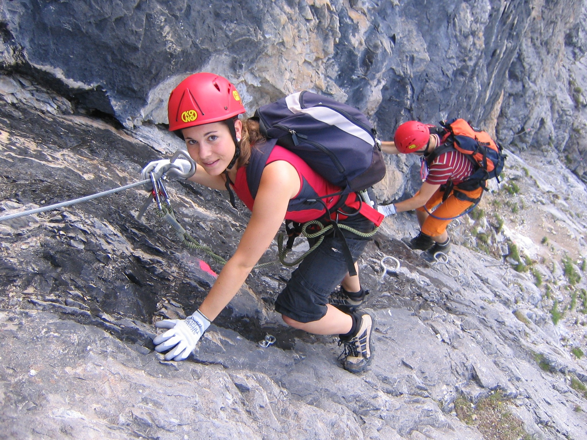
A via ferrata (Italian language, Italian for "iron path", plural ''vie ferrate'' or in English ''via ferratas'') is a protected climbing route found in the Alps and certain other locations. The term "via ferrata" is used in most countries and languages except notably in German-speaking regions, which use ''Klettersteig''—"climbing path" (plural ''Klettersteige''). Infrastructure A via ferrata is a climbing route that employs steel cables, rungs or ladders, fixed to the rock to which the climbers affix #Safety and equipment, a harness with two leashes, which allows the climbers to secure themselves to the metal fixture and limit any fall. The cable and other fixtures, such as iron rungs (stemples), pegs, carved steps, and ladders and bridges, provide both footings and handholds, as well. This allows climbing on otherwise dangerous routes without the risks of unprotected scrambling and climbing or the need for technical climbing equipment. They expand the opportunities for acce ... [...More Info...] [...Related Items...] OR: [Wikipedia] [Google] [Baidu] |


