|
Kiowa County, Oklahoma
Kiowa County is a county located in the southwestern part of the U.S. state of Oklahoma. As of the 2010 census, the population was 9,446. Its county seat is Hobart. The county was created in 1901 as part of Oklahoma Territory. It was named for the Kiowa people. History In 1892, the Jerome Commission began enrolling the Kiowas, Comanches and Apaches to prepare for the opening of their reservation to settlement by whites. Dennis Flynn, the territorial representative to the U. S. Congress, proposed holding a lottery for opening the reservation. He argued successfully that the lottery would be safer and more orderly than land runs used earlier. Individuals could register at offices in Lawton or El Reno. 165,000 individuals registered for 13,000 160-acre claims. The drawing was held August 6, 1901. After the opening, the area was designated as Kiowa County in Oklahoma Territory. The town of Hobart, named for Vice President Garrett A. Hobart, was designated as county seat.Cole, ... [...More Info...] [...Related Items...] OR: [Wikipedia] [Google] [Baidu] |
County (United States)
In the United States, a county is an Administrative division, administrative or political subdivision of a U.S. state, state that consists of a geographic region with specific Border, boundaries and usually some level of governmental authority. The term "county" is used in 48 states, while Louisiana and Alaska have functionally equivalent subdivisions called List of parishes in Louisiana, parishes and List of boroughs and census areas in Alaska, boroughs, respectively. The specific governmental powers of counties vary widely between the states, with many providing some level of services to civil townships, Local government in the United States, municipalities, and unincorporated areas. Certain municipalities are List of U.S. municipalities in multiple counties, in multiple counties; New York City is uniquely partitioned into five counties, referred to at the city government level as boroughs of New York City, boroughs. Some municipalities have consolidated with their county gove ... [...More Info...] [...Related Items...] OR: [Wikipedia] [Google] [Baidu] |
Washita River
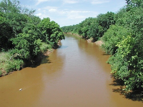
The Washita River () is a river in the states of Texas and Oklahoma in the United States. The river is long and terminates at its confluence with the Red River, which is now part of Lake Texoma () on the TexasOklahoma border. Geography The Washita River forms in eastern Roberts County, Texas (), near the town of Miami in the Texas Panhandle. The river crosses Hemphill County, Texas and enters Oklahoma in Roger Mills County. It cuts through the Oklahoma counties of Roger Mills, Custer, Washita, Caddo, Grady, Garvin, Murray, Carter, and Johnston before emptying into Lake Texoma, which is the modern border between Bryan County and Marshall County."Washita River." Texas State Historical Association (TSHA). June 15, 2010. Accessed March 12, 2018. The river bise ... [...More Info...] [...Related Items...] OR: [Wikipedia] [Google] [Baidu] |
Jackson County, Oklahoma
Jackson County is a county located in the southwestern corner of the U.S. state of Oklahoma. As of the 2010 census, the population was 26,446. Its county seat is Altus. According to the ''Encyclopedia of Oklahoma History and Culture'', the county was named for two historical figures: President Andrew Jackson and Confederate General Stonewall Jackson.Wilson, Linda D"Jackson County,"''Encyclopedia of Oklahoma History and Culture'', Oklahoma Historical Society, 2009. Accessed April 4, 2015. One source states that the county was named only for the former President, while an earlier source states it was named only for General Stonewall Jackson. Jackson County comprises the Altus, OK Micropolitan Statistical Area. History After a dispute over the Adams-Onís Treaty of 1819, both the governments of the United States and the state of Texas claimed ownership of some in what was then operated as Greer County, Texas. Litigation followed, and in the case of ''United States v. State ... [...More Info...] [...Related Items...] OR: [Wikipedia] [Google] [Baidu] |
Tillman County, Oklahoma
Tillman County is a county located in the southwestern part of Oklahoma, United States. As of the 2010 census, the population was 7,992. The county seat is Frederick. History The Medicine Lodge Treaty of 1867 established a reservation in the southwestern part of Indian Territory for the Kiowa, Apache and Comanche tribes. The Jerome Commission started enrolling members of these tribes in 1892, a prerequisite to opening "excess" land for settlement by non-Indians. The first lottery was held on August 6, 1901. It was followed in 1906 by the "Big Pasture" Lottery.Wilson, Linda D"Tillman County,"''Encyclopedia of Oklahoma History and Culture'', Oklahoma Historical Society, 2009. Accessed April 5, 2015. The county was founded at the time of Oklahoma statehood in 1907, and was named for Senator Benjamin Tillman of South Carolina. It had previously been part of Comanche County, Oklahoma Territory. Frederick was designated as the county seat at the time of statehood. In 1910 and 1924 ... [...More Info...] [...Related Items...] OR: [Wikipedia] [Google] [Baidu] |
Comanche County, Oklahoma
Comanche County is a county located in the U.S. state of Oklahoma. As of the 2010 census, the population was 124,098, making it the fourth-most populous county in Oklahoma. Its county seat is Lawton. The county was created in 1901 as part of Oklahoma Territory. It was named for the Comanche tribal nation.Linda D. Wilson, "Comanche County." ''Encyclopedia of Oklahoma History and Culture''. Accessed September 18, 2011, Comanche County is included in the Lawton, OK . Built on former reservation lands of the [...More Info...] [...Related Items...] OR: [Wikipedia] [Google] [Baidu] |
Caddo County, Oklahoma
Caddo County is a county located in the U.S. state of Oklahoma. As of the 2010 census, the population was 29,600. Its county seat is Anadarko. Created in 1901 as part of Oklahoma Territory, the county is named for the Caddo tribe who were settled here on a reservation in the 1870s. Caddo County is immediately west of the seven-county Greater Oklahoma City metro area, and although is not officially in the metro area, it has many economic ties in this region. History Caddo County was organized on August 6, 1901, when the Federal Government allotted the Kiowa, Comanche, and Arapaho reservations and sold the surplus land to white settlers. The reservation land was part of Oklahoma Territory until Oklahoma became a state on November 16, 1907. Part of its land was taken at statehood to form neighboring Grady County. Some additional land was taken in 1911 and also awarded to Grady County. Agriculture has been the mainstay of the local economy since its founding. The main crops ... [...More Info...] [...Related Items...] OR: [Wikipedia] [Google] [Baidu] |
Washita County, Oklahoma
Washita County is a county located in the U.S. state of Oklahoma. As of the 2010 census, the population was 11,629. Its county seat is New Cordell. The county seat was formerly located in Cloud Chief. The county was created in 1891. History In 1883, John Miles leased of Cheyenne and Arapaho land to seven cattlemen. However, arguments soon developed between the cattlemen and the tribesmen. In 1885, the Federal government terminated all of the leases and ordered the cattlemen to remove their stock. The area was settled in 1886, when John Seger established a colony along Cobb Creek. Seger convinced 120 Cheyenne and Arapaho to settle near the old ranch headquarters at Cobb Creek. The intent was that "Seger's Colony" would teach these tribes how to farm, using modern agricultural methods. The name, Seger's Colony, would be shortened and become the present day town of Colony, Oklahoma. After the government declared the excess lands of the Cheyenne and Arapaho Indian Reservatio ... [...More Info...] [...Related Items...] OR: [Wikipedia] [Google] [Baidu] |
State Highway 44 (Oklahoma)
State Highway 44 (abbreviated SH-44) is a state highway in the western portion of the U.S. state of Oklahoma. It runs for , beginning north of Blair, Oklahoma, Blair in Greer County, Oklahoma, Greer County, and proceeding north to Butler, Oklahoma, Butler in Custer County, Oklahoma, Custer County. It is not to be confused with Interstate 44 (Oklahoma), Interstate 44. The highway has one lettered spur route, SH-44A. SH-44 was established on April 14, 1932. Initially, the route consisted of three disconnected segments of highway; the southern segment corresponded with present-day SH-6 (OK), SH-6 southwest of Altus, Oklahoma, Altus, the central segment extended from the current southern terminus of the route to what is now known as Dill City, Oklahoma, Dill City, and the northern segment began west of Custer City, Oklahoma, Custer City and extended north to Medford, Oklahoma, Medford. The northernmost section was redesignated as several other highways, primarily SH-58 (OK), SH-58. Th ... [...More Info...] [...Related Items...] OR: [Wikipedia] [Google] [Baidu] |
Oklahoma State Highway 44
State Highway 44 (abbreviated SH-44) is a state highway in the western portion of the U.S. state of Oklahoma. It runs for , beginning north of Blair in Greer County, and proceeding north to Butler in Custer County. It is not to be confused with Interstate 44. The highway has one lettered spur route, SH-44A. SH-44 was established on April 14, 1932. Initially, the route consisted of three disconnected segments of highway; the southern segment corresponded with present-day SH-6 southwest of Altus, the central segment extended from the current southern terminus of the route to what is now known as Dill City, and the northern segment began west of Custer City and extended north to Medford. The northernmost section was redesignated as several other highways, primarily SH-58. The other two segments of highway were connected in 1962, and the current termini were established in 1987. Route description State Highway 44 begins at an intersection with the Great Plains Trail of Oklah ... [...More Info...] [...Related Items...] OR: [Wikipedia] [Google] [Baidu] |
State Highway 19 (Oklahoma)
State Highway 19, abbreviated as SH-19, is a highway running through the southern part of the U.S. state of Oklahoma. It is signed east–west. Route description SH-19 begins at an intersection with US-283 in Blair, Oklahoma. SH-19 heads east from Blair for 23 miles (37 km) without intersecting another highway before meeting U.S. Highway 183 north of Roosevelt. It continues eastward, sharing a 3-mile (4.8 km) section of road with State Highway 54 before splitting off to the east and briefly overlapping with SH-115 and State Highway 58. The next town Highway 19 encounters is Apache, north of Lake Ellsworth, where it crosses U.S. Highway 62/281. Nine miles (14½ km) later, it overlaps with U.S. Highway 277 at Cyril. These two overlap with US-81 near Ninnekah, but SH-19 splits off to the east once again within 3 miles (4.8 km). After splitting off, SH-19 travels in a southeast direction to have a brief concurrency with State Highway 76 through Lin ... [...More Info...] [...Related Items...] OR: [Wikipedia] [Google] [Baidu] |
State Highway 9 (Oklahoma)
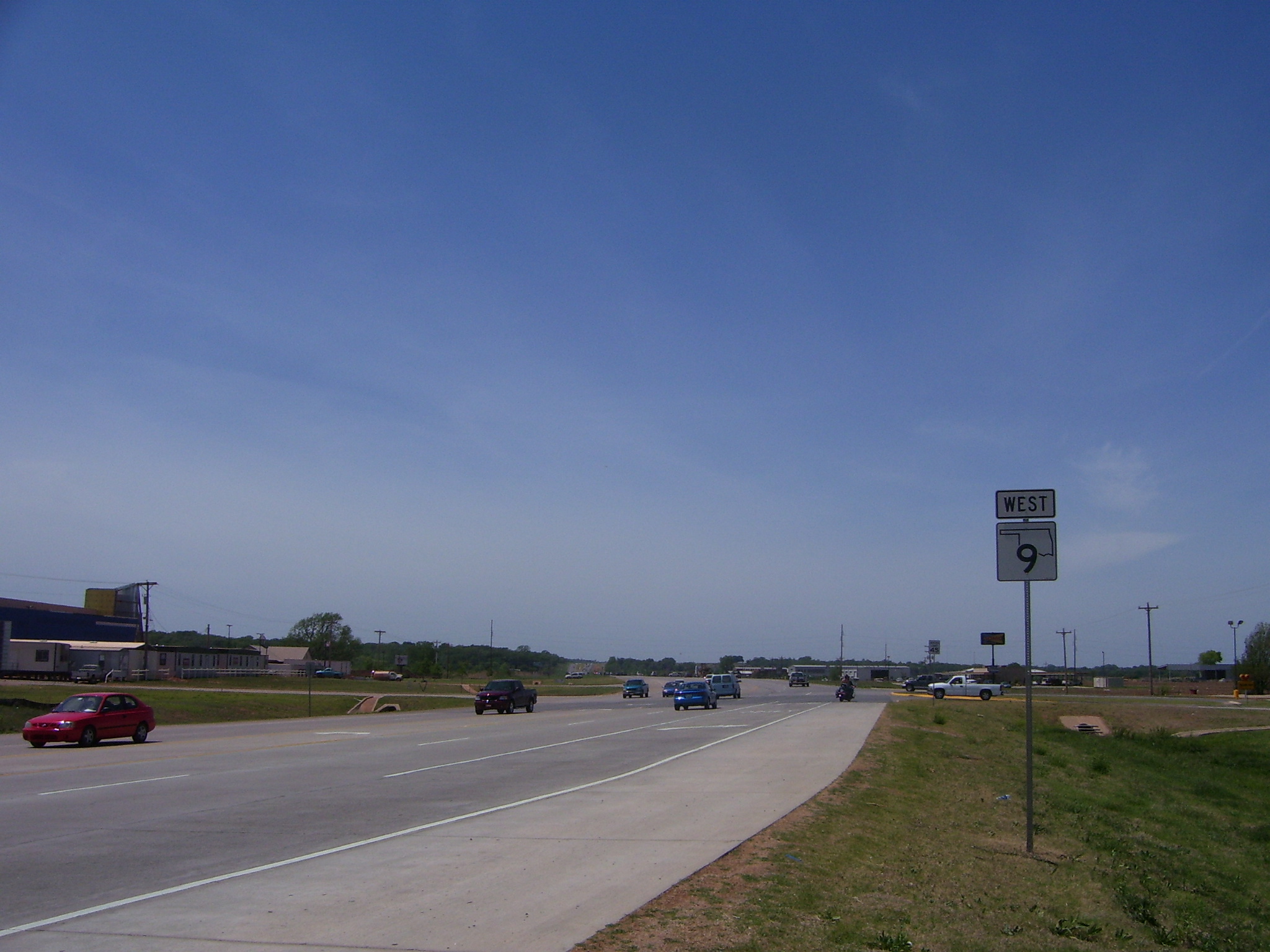
State Highway 9, abbreviated as SH-9, OK-9, or simply Highway 9, is a major east–west highway in the U.S. state of Oklahoma. Spanning across the central part of the state, SH-9 begins at the Texas state line near Madge, Oklahoma, and ends at the Arkansas state line near Fort Smith, Arkansas. State Highway 9 is a major highway around the Norman area. At , SH-9 is Oklahoma's second-longest state highway (second to State Highway 3). Route description West of Interstate 35 From the western terminus at State Highway 203 along the Texas border, the highway travels due east for and intersects with SH-30 between Madge and Vinson. SH-9 continues east for without intersecting another highway until meeting US-283 and SH-34 north of Mangum. The highway overlaps the other two routes for , going north, before splitting off and heading east again through Granite and Lone Wolf. East of Lone Wolf, the highway forms a concurrency with SH-44. Near Hobart, SH-9 overlaps US-183 fo ... [...More Info...] [...Related Items...] OR: [Wikipedia] [Google] [Baidu] |


