|
Kinneret Farm
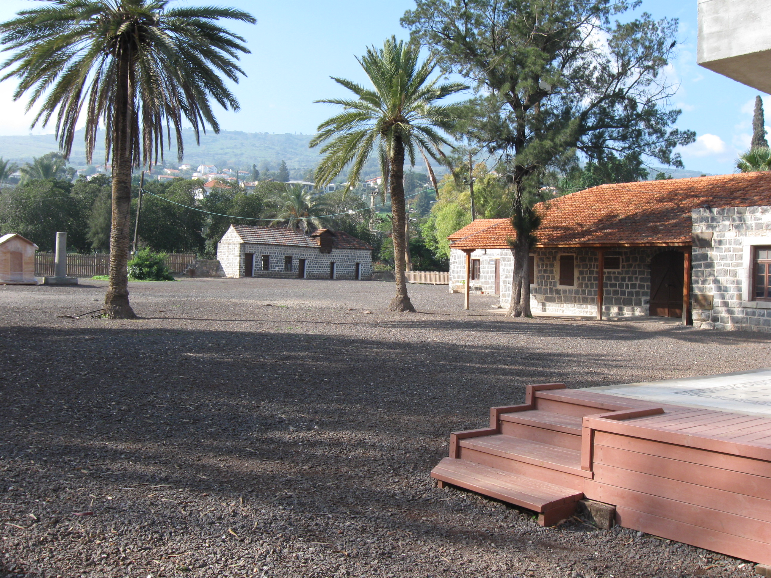
Kinneret Farm ( he, חוות כנרת, ''Havat Kinneret'') or Kinneret Courtyard ( he, חצר כנרת, ''Hatzer Kinneret'') was an experimental training farm established in 1908 in Ottoman Palestine by the Palestine Bureau of the Zionist Organisation (ZO) led by Arthur Ruppin, at the same time as, and next to Moshavat Kinneret, a moshava-type village. The farm stood in close proximity to the shore of the Sea of Galilee. Until the early 1920s the farm was a hothouse and catalyst for social and economical innovation, which helped mold and create several essential institutions and infrastructure elements of the Yishuv, perpetuated in the State of Israel after 1948: communal settlement forms (kvutza, kibbutz, moshav), women's rights movement, cooperative enterprises (for supplies and financial aid, milk collection and dairy production, construction and public works), a workers' savings and support bank, public health care system, a national paramilitary organisation. From 1949 on, ... [...More Info...] [...Related Items...] OR: [Wikipedia] [Google] [Baidu] |
Kinnereth062
The Sea of Galilee ( he, יָם כִּנֶּרֶת, Judeo-Aramaic: יַמּא דטבריא, גִּנֵּיסַר, ar, بحيرة طبريا), also called Lake Tiberias, Kinneret or Kinnereth, is a freshwater lake in Israel. It is the lowest freshwater lake on Earth and the second-lowest lake in the world (after the Dead Sea, a saltwater lake), at levels between and below sea level. It is approximately in circumference, about long, and wide. Its area is at its fullest, and its maximum depth is approximately .Data Summary: Lake Kinneret (Sea of Galilee) The lake is fed partly by underground springs, but its main source is the |
Degania A
Degania Alef ( he, דְּגַנְיָה א', ) is a kibbutz in northern Israel. The Jewish communal settlement (''kvutza'') started off in 1910, making it the earliest socialist Zionist farming commune in the Land of Israel. Its status as "the mother of all kibbutzim" is sometimes contested based on a later distinction made between the smaller ''kvutza'', applying to Degania in its beginnings, and the larger ''kibbutz''. It falls under the jurisdiction of the Emek HaYarden Regional Council. Degania Alef and its neighbor Degania Bet both lie between the southern shore of the Sea of Galilee and the Jordan River. As of it had a population of . Etymology ''Degania'' means "cornflower" and is derived from דגן ''dagán'', meaning "grain". After the first phase at Umm Junieh, the group and its settlement was simply called ''Degania'', ''Alef'' being added only after the establishment of the associated kibbutzim of ''Degania Bet'' and ''Gimel'' in 1920. Alef, bet and gimel a ... [...More Info...] [...Related Items...] OR: [Wikipedia] [Google] [Baidu] |
World War I
World War I (28 July 1914 11 November 1918), often abbreviated as WWI, was one of the deadliest global conflicts in history. Belligerents included much of Europe, the Russian Empire, the United States, and the Ottoman Empire, with fighting occurring throughout Europe, the Middle East, Africa, the Pacific, and parts of Asia. An estimated 9 million soldiers were killed in combat, plus another 23 million wounded, while 5 million civilians died as a result of military action, hunger, and disease. Millions more died in genocides within the Ottoman Empire and in the 1918 influenza pandemic, which was exacerbated by the movement of combatants during the war. Prior to 1914, the European great powers were divided between the Triple Entente (comprising France, Russia, and Britain) and the Triple Alliance (containing Germany, Austria-Hungary, and Italy). Tensions in the Balkans came to a head on 28 June 1914, following the assassination of Archduke Franz Ferdin ... [...More Info...] [...Related Items...] OR: [Wikipedia] [Google] [Baidu] |
HaMashbir
Hamashbir Lazarchan ( he, המשביר לצרכן) is an Israeli chain of department stores. Hamashbir consists of 33 branches across the country.New Hamashbir Lazarchan Ltd. BDICode It is distinct from its predecessors, the consumer cooperative Hamashbir (1916–1930), reorganised as the wholesale supplier Hamashbir Hamerkazi in 1930. The original Hamashbir was set up with the goal of supplying the Jewish communities of Palestine with food at affordable prices during the terrible shortage years of the . History [...More Info...] [...Related Items...] OR: [Wikipedia] [Google] [Baidu] |
Moshav
A moshav ( he, מוֹשָׁב, plural ', lit. ''settlement, village'') is a type of Israeli town or settlement, in particular a type of cooperative agricultural community of individual farms pioneered by the Labour Zionists between 1904 and 1914, during what is known as the second wave of ''aliyah''. A resident or a member of a moshav can be called a "moshavnik" (). The moshavim are similar to kibbutzim with an emphasis on community labour. They were designed as part of the Zionist state-building programme following the green revolution Yishuv ("settlement") in the British Mandate of Palestine during the early 20th century, but in contrast to the collective farming kibbutzim, farms in a moshav tended to be individually owned but of fixed and equal size. Workers produced crops and other goods on their properties through individual or pooled labour with the profit and foodstuffs going to provide for themselves. Moshavim are governed by an elected council ( he, ועד, ''va'a ... [...More Info...] [...Related Items...] OR: [Wikipedia] [Google] [Baidu] |
Kvutza
Kvutza, kevutza or kevutzah ( "group") is a communal settlement among Jews, primarily in pre-state Israel, the word was used in reference to communal life. First there were ''kvutzot'' (plural of kvutza) in the sense of groups of young people with similar ideals living and working together; and after 1909 and for many years to follow, in the sense of collective settlements created by such groups. The kvutza collective settlement was distinguished from the ''kibbutz'' settlement in that it intended to remain small and mainly agricultural, whereas the larger kibbutzim were intended to expand with agriculture, industry and other productive pursuits. Later, as the distinction disappeared, most kvutzot were renamed kibbutzim. Notable example: Degania Alef Degania Alef ( he, דְּגַנְיָה א', ) is a kibbutz in northern Israel. The Jewish communal settlement (''kvutza'') started off in 1910, making it the earliest socialist Zionist farming commune in the Land of Israel. Its stat ... [...More Info...] [...Related Items...] OR: [Wikipedia] [Google] [Baidu] |
National Library Of Israel
The National Library of Israel (NLI; he, הספרייה הלאומית, translit=HaSifria HaLeumit; ar, المكتبة الوطنية في إسرائيل), formerly Jewish National and University Library (JNUL; he, בית הספרים הלאומי והאוניברסיטאי, translit=Beit Ha-Sfarim Ha-Le'umi ve-Ha-Universita'i), is the library dedicated to collecting the cultural treasures of Israel and of Jewish heritage. The library holds more than 5 million books, and is located on the Givat Ram campus of the Hebrew University of Jerusalem (HUJI). The National Library owns the world's largest collections of Hebraica and Judaica, and is the repository of many rare and unique manuscripts, books and artifacts. History B'nai Brith library (1892–1925) The establishment of a Jewish National Library in Jerusalem was the brainchild of Joseph Chazanovitz (1844–1919). His idea was creating a "home for all works in all languages and literatures which have Jewish authors, even ... [...More Info...] [...Related Items...] OR: [Wikipedia] [Google] [Baidu] |
Survey Of Palestine
The Survey of Palestine was the government department responsible for the Cartography of Palestine, survey and mapping of Palestine during the Mandatory Palestine, British mandate period. The survey department was established in 1920 in Jaffa, and moved to the outskirts of Tel Aviv in 1931. It established the Palestine grid. In early 1948, the British Mandate appointed a temporary Director General of the Survey Department for the impending Jewish State; this was to became the Survey of Israel. The maps produced by the survey have been widely used in "Palestinian refugee cartography" by scholars documenting the 1948 Palestinian exodus; notably in Salman Abu Sitta's ''Atlas of Palestine'' and Walid Khalidi's ''All That Remains''. In 2019 the maps were used as the basis for ''Palestine Open Maps'', supported by the Bassel Khartabil Free Culture Fellowship. History Prior to the beginning of the Mandate for Palestine, the British had carried out two significant surveys of the reg ... [...More Info...] [...Related Items...] OR: [Wikipedia] [Google] [Baidu] |
Mallaha - 1941
Mallaha ( ar, ملاّحة) was a Palestinian Arab village, located northeast of Safed, on the highway between the latter and Tiberias. 'Ain Mallaha is the local Arabic name for a spring that served as the water source for the village inhabitants throughout the ages. It is also one of the names used in English to refer to the ancient Natufian era settlement at the site. History Prehistory Evidence of settlement at Mallaha (or 'Ain Mallaha) dates back to the Mesolithic period circa 10,000 BCE.Schmandt-Besserat, 2009, p 47/ref> The first permanent village settlement of pre-agricultural times in Palestine, Kathleen Kenyon describes the material remains found there as Natufian, consisting of 50 circular, semi-subterranean, one-room huts, paved with flat slabs and surrounded by stone walls up to high.Kenyon, 1985, p. 20.Kipfer, 2013, p 357/ref> The floors and walls of the homes were decorated in solid white or red, a simple and popular decorative motif in the Near East at the t ... [...More Info...] [...Related Items...] OR: [Wikipedia] [Google] [Baidu] |
Nahal
Nahal ( he, נח"ל) (acronym of ''Noar Halutzi Lohem'', lit. Fighting Pioneer Youth) is a program that combines military service with mostly social welfare and informal education projects such as youth movement activities, as well as training in entrepreneurship in urban development areas. Prior to the 1990s it was a paramilitary Israel Defense Forces program that combined military service and the establishment of agricultural settlements, often in peripheral areas. The Nahal groups of soldiers formed the core of the Nahal Infantry Brigade. History In 1948, a ''gar'in'' (core group) of Jewish pioneers wrote to Prime Minister David Ben-Gurion requesting that members be allowed to do their military service as a group rather than being split up into different units at random. In response to this letter, Ben-Gurion created the Nahal program, which combined military service and farming. Some 108 kibbutzim and agricultural settlements were established by the Nahal, many of them o ... [...More Info...] [...Related Items...] OR: [Wikipedia] [Google] [Baidu] |
Establishment Of The State Of Israel
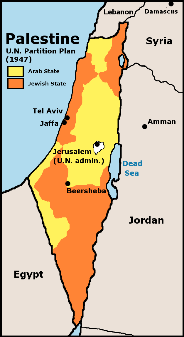
The Israeli Declaration of Independence, formally the Declaration of the Establishment of the State of Israel ( he, הכרזה על הקמת מדינת ישראל), was proclaimed on 14 May 1948 ( 5 Iyar 5708) by David Ben-Gurion, the Executive Head of the World Zionist Organization, Chairman of the Jewish Agency for Palestine, and soon to be first Prime Minister of Israel. It declared the establishment of a Jewish state in Eretz-Israel, to be known as the State of Israel, which would come into effect on termination of the British Mandate at midnight that day. The event is celebrated annually in Israel with a national holiday Independence Day on 5 Iyar of every year according to the Hebrew calendar. Background The possibility of a Jewish homeland in Palestine had been a goal of Zionist organizations since the late 19th century. In 1917 British Foreign Secretary Arthur Balfour stated in a letter to British Jewish community leader Walter, Lord Rothschild that: His Majesty' ... [...More Info...] [...Related Items...] OR: [Wikipedia] [Google] [Baidu] |


