|
Kingsway Shopping Centre
The Kingsway Shopping Centre is an under-cover shopping centre in Newport city centre, Wales. The northern entrance is on John Frost Square adjoining the Friars Walk shopping and leisure complex. The east entrance is off Commercial Street and the west entrance off the A4042 Kingsway. The centre is a short walk from the high street shops of Commercial Street and High Street. Newport railway station is also a short walk away. The Kingsway car park has over 1000 spaces and the adjacent Friars Walk car park holds 350 cars, both accessed from the A4042 Kingsway. Kingsway Centre includes a range of high street and privately owned shops. It is adjoining Newport Museum, Art Gallery and Central Library and it is close to Newport bus station Newport Central bus station ( cy, Gorsaf fysiau Canol Casnewydd) is a bus terminus and interchange located in the city centre, Newport, South Wales. It is the largest road transport hub for public services in the county. It is situated on the ... [...More Info...] [...Related Items...] OR: [Wikipedia] [Google] [Baidu] |
Newport, Wales
Newport ( cy, Casnewydd; ) is a city and Local government in Wales#Principal areas, county borough in Wales, situated on the River Usk close to its confluence with the Severn Estuary, northeast of Cardiff. With a population of 145,700 at the 2011 census, Newport is the third-largest authority with City status in the United Kingdom, city status in Wales, and seventh List of Welsh principal areas, most populous overall. Newport became a unitary authority in 1996 and forms part of the Cardiff-Newport metropolitan area. Newport was the site of the last large-scale armed insurrection in Great Britain, the Newport Rising of 1839. Newport has been a port since medieval times when the first Newport Castle was built by the Normans. The town outgrew the earlier Roman Britain, Roman town of Caerleon, immediately upstream and now part of the borough. Newport gained its first Municipal charter, charter in 1314. It grew significantly in the 19th century when its port became the focus of Coa ... [...More Info...] [...Related Items...] OR: [Wikipedia] [Google] [Baidu] |
Shopping Mall
A shopping mall (or simply mall) is a North American term for a large indoor shopping center, usually anchored by department stores. The term "mall" originally meant a pedestrian promenade with shops along it (that is, the term was used to refer to the walkway itself which was merely bordered by such shops), but in the late 1960s, it began to be used as a generic term for the large enclosed shopping centers that were becoming commonplace at the time. In the U.K., such complexes are considered shopping centres (Commonwealth English: shopping centre), though "shopping center" covers many more sizes and types of centers than the North American "mall". Other countries may follow U.S. usage (Philippines, India, U.A.E., etc.) and others (Australia, etc.) follow U.K. usage. In Canadian English, and oftentimes in Australia and New Zealand, 'mall' may be used informally but 'shopping centre' or merely 'centre' will feature in the name of the complex (such as Toronto Eaton Centre). The ter ... [...More Info...] [...Related Items...] OR: [Wikipedia] [Google] [Baidu] |
Newport City Centre
Newport city centre is traditionally regarded as the area of Newport, Wales bounded by the west bank of the River Usk, the George Street Bridge, the eastern flank of Stow Hill and the South Wales Main Line. Most of the city centre is contained within two conservation areas: the central area and the area around Lower Dock Street. Most of the city centre is located in the Stow Hill district. Description The main shopping thoroughfare is Commercial Street, which forms part of the north–south axis of High Street, Commercial Street and Commercial Road, linking the heart of the city with Newport Docks. The streets were laid-out in 1807 by Sir Charles Morgan's Tredegar Wharf Company to connect the expanding docks with the main roads in the centre. The area between Commercial Street and the river used to contain a mixture of railway lines and river wharves so the street pattern in this area was never fixed. On the removal of the railway lines and wharves in the 1960s the large Jo ... [...More Info...] [...Related Items...] OR: [Wikipedia] [Google] [Baidu] |
Wales
Wales ( cy, Cymru ) is a Countries of the United Kingdom, country that is part of the United Kingdom. It is bordered by England to the Wales–England border, east, the Irish Sea to the north and west, the Celtic Sea to the south west and the Bristol Channel to the south. It had a population in 2021 of 3,107,500 and has a total area of . Wales has over of coastline and is largely mountainous with its higher peaks in the north and central areas, including Snowdon (), its highest summit. The country lies within the Temperateness, north temperate zone and has a changeable, maritime climate. The capital and largest city is Cardiff. Welsh national identity emerged among the Celtic Britons after the Roman withdrawal from Britain in the 5th century, and Wales was formed as a Kingdom of Wales, kingdom under Gruffydd ap Llywelyn in 1055. Wales is regarded as one of the Celtic nations. The Conquest of Wales by Edward I, conquest of Wales by Edward I of England was completed by 1283, th ... [...More Info...] [...Related Items...] OR: [Wikipedia] [Google] [Baidu] |
John Frost Square
John Frost Square is a large public space in the centre of Newport, South Wales, named after the Chartist leader, John Frost. It was redeveloped as part of the Friars Walk shopping and leisure complex in 2014 and 2015. Major features on John Frost Square include the Newport Museum, Library and Art Gallery, the north entrance to Kingsway Shopping Centre and the headquarters of the Monmouthshire Building Society. History John Frost Square was completed in 1977, following 16 years of planning. In 1978 a mosaic mural by artist Kenneth Budd, commemorating the 1839 Chartist uprising, was added to the underpass in the northeast corner of the square. Clock Following the 1992 National Garden Festival (held in Ebbw Vale), a public clock created for the event was moved and relocated in John Frost Square. Designed by sculptor Andy Plant and called "In the Nick of Time", the clock deconstructed itself at the top of each hour as model figures paraded around it. With skeletons hol ... [...More Info...] [...Related Items...] OR: [Wikipedia] [Google] [Baidu] |
Friars Walk, Newport
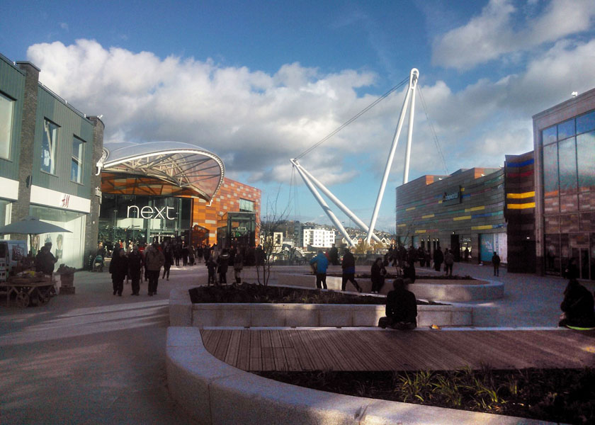
Friars Walk is a partially under-cover shopping centre and leisure complex in Newport city centre, South Wales. It has several levels and includes a range of high street shops, eateries, a cinema, a bowling alley and a soft play area. The complex is linked by the redeveloped John Frost Square to the Kingsway Shopping Centre, Newport Museum, Art Gallery and Central Library and Newport bus station. The complex is a short walk from the high street shops of Commercial Street and High Street. Newport railway station is also a short walk away. The Friars Walk car park holds 350 cars and over 1,000 spaces are available in the adjacent Kingsway multi-storey car park, both accessed from the A4042 Kingsway. There are cycle racks located in Usk Plaza. Development The original plans by Modus Corovest were scrapped in 2009, because of the 2008 financial crisis but revived in a £100 million scheme by Queensberry Real Estate in 2012. Plans included a six-screen cinema, ten pin bowling al ... [...More Info...] [...Related Items...] OR: [Wikipedia] [Google] [Baidu] |
Commercial Street, Newport
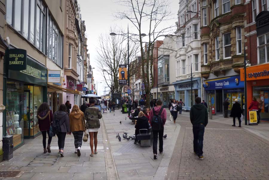
Commercial Street is a 700-yard (660-metre) long main shopping street leading from the city centre of Newport, South Wales. History and description Commercial Street and Commercial Road were created in 1810 across open pasture land which had to be raised several feet using ship ballast so that it no longer flooded at the high Spring tides. This was part of a plan by Charles Morgan, 1st Baron Tredegar to increase Newport's importance and develop his land; in 1807 he had granted a lease on 200 acres of land to allow the Tredegar Wharf Company to create the new mile-long road. The new road led approximately south-southeast from the junction with High Street (and Westgate Hotel), linking the town centre with Pillgwenlly and the early Newport Docks. Notable buildings on Commercial Street were the Westgate HotelNewman, ''The Buildings of Wales: Gwent/Monmouthshire''page 449/ref> (now on what is called Westgate Square), Newport's Town Hall (1885 by T. M. Lockwood, demolished when it w ... [...More Info...] [...Related Items...] OR: [Wikipedia] [Google] [Baidu] |
High Street, Newport, Wales
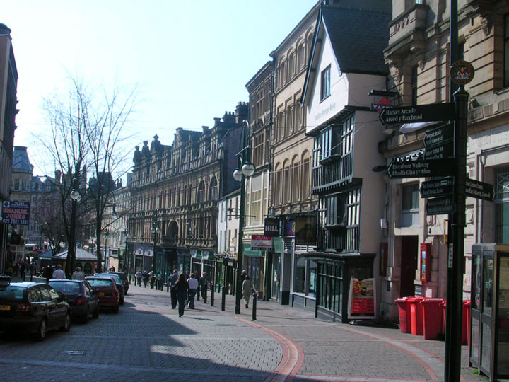
High Street is the main historical street and the original main thoroughfare in the centre of Newport, South Wales. Nowadays it runs approximately 280m between Westgate Square and the Old Green Interchange (facing Newport Castle). Description Newport's High Street leads away southwest from Newport Castle and Newport Bridge through the city centre, bending to head south approximately four-fifths of the way along its route. Landmarks along the street include the Kings Head Hotel building, the facade of the Old Post Office (now disguising a multi-storey carpark), the Olde Murenger's Pub, Newport Market and Newport Arcade. Since the early 2010s the street has undergone re-paving and other improvements. History Newport, in 1810, was described as "consisting principally of one street, built partly on the banks of the Usk" and this description is corroborated by the 1750 map of Newport. High Street led to what is now Stow Hill and eventually to the town church, St Woolos. The t ... [...More Info...] [...Related Items...] OR: [Wikipedia] [Google] [Baidu] |
Newport Railway Station
, symbol_location = gb , symbol = rail , image = Newport_railway_station_MMB_32_43187.jpg , caption = Newport railway station looking eastbound. , borough = Newport, Wales , country = Wales , coordinates = , grid_name = Grid reference , grid_position = , manager = Transport for Wales Rail , platforms = 4 , code = NWP , classification = DfT category B , years = 18 June 1850 , events = Opened , years1 = 1880 , events1 = Enlarged , years2 = 1928 , events2 = Enlarged , years3 = 2010 , events3 = Enlarged , mpassengers = , footnotes = Passenger statistics from the Office of Rail and Road Newport railway station ( cy, Gorsaf Rheilffordd Casnewydd) is the second-busiest railway station in Wales (after Cardiff Central), situated in Newport city centre. It is from London Paddington on the British railway network. The station was originally opened in 1850 by the South Wales Railway Company and was greatly expanded in 1928. A new station building was bu ... [...More Info...] [...Related Items...] OR: [Wikipedia] [Google] [Baidu] |
High Street
High Street is a common street name for the primary business street of a city, town, or village, especially in the United Kingdom and Commonwealth. It implies that it is the focal point for business, especially shopping. It is also a metonym for the retail sector. With the rapid increase in consumer expenditure the number of High Streets in England grew from the 17th century and reached a peak in Victorian Britain where, drawn to growing towns and cities spurred on by the Industrial Revolution, the rate of urbanisation was unprecedented. Since the latter half of the 20th century, the prosperity of High Streets has been in decline due to the growth of out-of-town shopping centres, and, since the early 21st century, the growth of online retailing, forcing many shop closures and prompting the UK government to consider initiatives to reinvigorate and preserve the High Street. High Street is the most common street name in the UK, which according to a 2009 statistical compilation ... [...More Info...] [...Related Items...] OR: [Wikipedia] [Google] [Baidu] |
Newport Museum
Newport Museum and Art Gallery ( cy, Amgueddfa ac Oriel Gelf Casnewydd) (known locally as the City Museum ( cy, Amgueddfa Dinas)) is a museum, library and art gallery in the city of Newport, South Wales. It is located in Newport city centre on John Frost Square and is adjoined to the Kingsway Shopping Centre. The collections Newport Museum opened in 1888. The collections include Archaeology, Social History, Art and Natural History. The most ancient artefacts in the museum are tools made by hunter-gatherers who walked the shores of the Severn estuary hundreds of thousands of years ago. The Roman collections rank amongst the best in Wales, comprising material excavated from the Roman town of Caerwent and the fortress at Caerleon. The Medieval and later collections feature finds from local castles and priories, including an outstanding assemblage from Penhow Castle. The most significant items of Social History are the Chartist collection of weapons, broadsheets, prints and si ... [...More Info...] [...Related Items...] OR: [Wikipedia] [Google] [Baidu] |
Newport Bus Station
Newport Central bus station ( cy, Gorsaf fysiau Canol Casnewydd) is a bus terminus and interchange located in the city centre, Newport, South Wales. It is the largest road transport hub for public services in the county. It is situated on the Newport Market site and the adjacent Friars Walk site. Background The Newport Bus Station was previously a 26-stand facility located to the south of the current site. The bus station was not popular, with only 1% of customers being 'very satisfied' with the facility in a 2009 survey. It was demolished in 2014 (and relocated) as part of the city centre redevelopment. Redevelopment The bus station and surrounding area was part of the Friars Walk development scheme. A new 9-stand bus station was opened outside Newport Market in December 2013 and a second adjoining site with 15 stands, incorporated into the new Friars Walk shopping and leisure complex, was opened in December 2015.Carys Thomas (9 December 2015"Newport's Friars Walk bus sta ... [...More Info...] [...Related Items...] OR: [Wikipedia] [Google] [Baidu] |


