|
King Creek, Ontario
King Creek was the one time name for the East Humber River and a former community on Mill Road in the Township of King. Originally settled by Christopher Stokes in 1834 and known as Stoke's Hollow, later King Creek, the community grew around his grist mill and later included a flour mill, general store, shoe shop and in 1866 a Post Office. In July 1937, a plan of subdivision was registered for Humber Trails as a summer residential district nestled in the valley around King Creek west of Mill Road. After Hurricane Hazel, in the fall of 1954, the Toronto Regional Park Authority expropriated the land creating the Humber Trails Conservation area. One street named Elmpine Trails, on the south side of the King Creek, was not expropriated as the homes were on high ground with no chance of a flood damaging the houses. Several properties on Mill Road were also not expropriated for the same reason. For approximately fifteen years the Humber Trails Conservation Area was a manicured park. Howe ... [...More Info...] [...Related Items...] OR: [Wikipedia] [Google] [Baidu] |
Country
A country is a distinct part of the world, such as a state, nation, or other political entity. It may be a sovereign state or make up one part of a larger state. For example, the country of Japan is an independent, sovereign state, while the country of Wales is a component of a multi-part sovereign state, the United Kingdom. A country may be a historically sovereign area (such as Korea), a currently sovereign territory with a unified government (such as Senegal), or a non-sovereign geographic region associated with certain distinct political, ethnic, or cultural characteristics (such as the Basque Country). The definition and usage of the word "country" is flexible and has changed over time. ''The Economist'' wrote in 2010 that "any attempt to find a clear definition of a country soon runs into a thicket of exceptions and anomalies." Most sovereign states, but not all countries, are members of the United Nations. The largest country by area is Russia, while the smallest is ... [...More Info...] [...Related Items...] OR: [Wikipedia] [Google] [Baidu] |
National Topographic System
The National Topographic System or NTS is the system used by Natural Resources Canada for providing general purpose topographic maps of the country. NTS maps are available in a variety of scales, the standard being 1:50,000 and 1:250,000 scales. The maps provide details on landforms and terrain, lakes and rivers, forested areas, administrative zones, populated areas, roads and railways, as well as other man-made features. These maps are currently used by all levels of government and industry for forest fire and flood control (as well as other environmental issues), depiction of crop areas, right-of-way, real estate planning, development of natural resources and highway planning. To add context, land area outside Canada is depicted on the 1:250,000 maps, but not on the 1:50,000 maps. History Topographic mapping in Canada was originally undertaken by many different agencies, with the Canadian Army’s Intelligence Branch forming a survey division to create a more standardized mappi ... [...More Info...] [...Related Items...] OR: [Wikipedia] [Google] [Baidu] |
Ward (politics)
A ward is a local authority area, typically used for electoral purposes. In some countries, wards are usually named after neighbourhoods, thoroughfares, parishes, landmarks, geographical features and in some cases historical figures connected to the area (e.g. William Morris Ward in the London Borough of Waltham Forest, England). It is common in the United States for wards to simply be numbered. Origins The word “ward”, for an electoral subdivision, appears to have originated in the Wards of the City of London, where gatherings for each ward known as “wardmotes” have taken place since the 12th century. The word was much later applied to divisions of other cities and towns in England and Wales and Ireland. In parts of northern England, a ''ward'' was an administrative subdivision of a county, very similar to a hundred in other parts of England. Present day In Australia, Canada, New Zealand, Sri Lanka, South Africa, the United Kingdom, and the United States, wards are an ... [...More Info...] [...Related Items...] OR: [Wikipedia] [Google] [Baidu] |
Silt
Silt is granular material of a size between sand and clay and composed mostly of broken grains of quartz. Silt may occur as a soil (often mixed with sand or clay) or as sediment mixed in suspension with water. Silt usually has a floury feel when dry, and lacks plasticity when wet. Silt also can be felt by the tongue as granular when placed on the front teeth (even when mixed with clay particles). Silt is a common material, making up 45% of average modern mud. It is found in many river deltas and as wind-deposited accumulations, particularly in central Asia, north China, and North America. It is produced in both very hot climates (through such processes as collisions of quartz grains in dust storms) and very cold climates (through such processes as glacial grinding of quartz grains.) Loess is soil rich in silt which makes up some of the most fertile agricultural land on Earth. However, silt is very vulnerable to erosion, and it has poor mechanical properties, making construction ... [...More Info...] [...Related Items...] OR: [Wikipedia] [Google] [Baidu] |
Loam
Loam (in geology and soil science) is soil composed mostly of sand (particle size > ), silt (particle size > ), and a smaller amount of clay (particle size < ). By weight, its mineral composition is about 40–40–20% concentration of sand–silt–clay, respectively. These proportions can vary to a degree, however, and result in different types of loam soils: sandy loam, silty loam, clay loam, sandy clay loam, silty clay loam, and loam. In the , textural classification triangle, the only soil that is not predominantly sand, silt, or clay is called "loam". Loam soils generally contain more nutrients, moisture, and |
Clay
Clay is a type of fine-grained natural soil material containing clay minerals (hydrous aluminium phyllosilicates, e.g. kaolin, Al2 Si2 O5( OH)4). Clays develop plasticity when wet, due to a molecular film of water surrounding the clay particles, but become hard, brittle and non–plastic upon drying or firing. Most pure clay minerals are white or light-coloured, but natural clays show a variety of colours from impurities, such as a reddish or brownish colour from small amounts of iron oxide. Clay is the oldest known ceramic material. Prehistoric humans discovered the useful properties of clay and used it for making pottery. Some of the earliest pottery shards have been dated to around 14,000 BC, and clay tablets were the first known writing medium. Clay is used in many modern industrial processes, such as paper making, cement production, and chemical filtering. Between one-half and two-thirds of the world's population live or work in buildings made with clay, often ... [...More Info...] [...Related Items...] OR: [Wikipedia] [Google] [Baidu] |
Palustrine
Palustrine wetlands include any inland wetland that contains ocean-derived salts in concentrations of less than 0.5 parts per thousand, and is non-tidal. The word ''palustrine'' comes from the Latin word ''palus'' or marsh. Wetlands within this category include inland marshes and swamps as well as bogs, fens, pocosins, tundra and floodplains. According to the Cowardin classification system Palustrine wetlands can also be considered the area on the side of a river or a lake, as long as they are covered by vegetation such as trees, shrubs, and emergent plants. Classification Palustrine wetlands are one of five systems of wetlands within the Cowardin classification system. This system was created by Lewis Cowardin and others from the United States Fish and Wildlife Service in 1987. The other systems are: * Marine wetlands, exposed to the open ocean * Estuarine wetlands, partially enclosed by land and containing a mix of fresh and salt water * Riverine wetlands, associated wi ... [...More Info...] [...Related Items...] OR: [Wikipedia] [Google] [Baidu] |
Emergent Plant
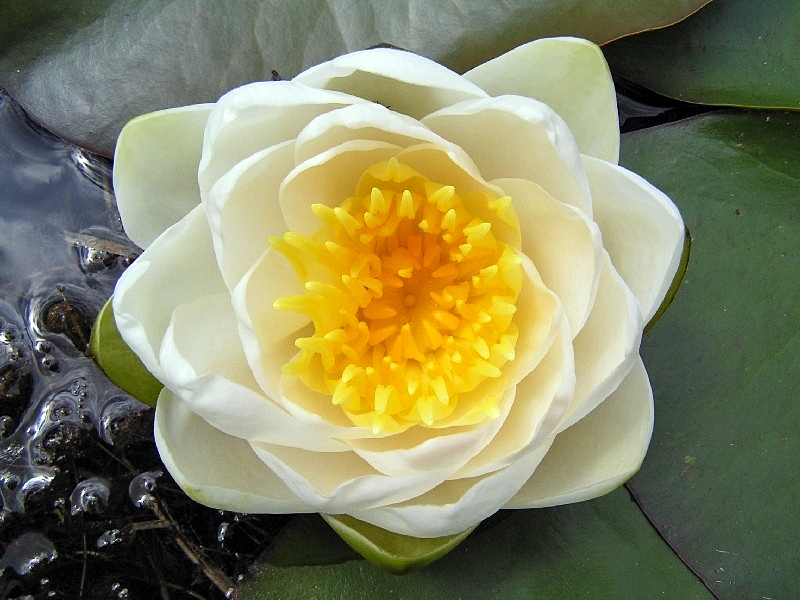
Aquatic plants are plants that have adapted to living in aquatic environments (saltwater or freshwater). They are also referred to as hydrophytes or macrophytes to distinguish them from algae and other microphytes. A macrophyte is a plant that grows in or near water and is either emergent, submergent, or floating. In lakes and rivers macrophytes provide cover for fish, substrate for aquatic invertebrates, produce oxygen, and act as food for some fish and wildlife. Macrophytes are primary producers and are the basis of the food web for many organisms. They have a significant effect on soil chemistry and light levels as they slow down the flow of water and capture pollutants and trap sediments. Excess sediment will settle into the benthos aided by the reduction of flow rates caused by the presence of plant stems, leaves and roots. Some plants have the capability of absorbing pollutants into their tissue. Seaweeds are multicellular marine algae and, although their ecological i ... [...More Info...] [...Related Items...] OR: [Wikipedia] [Google] [Baidu] |
Submergent Plant
Aquatic plants are plants that have adapted to living in aquatic environments (saltwater or freshwater). They are also referred to as hydrophytes or macrophytes to distinguish them from algae and other microphytes. A macrophyte is a plant that grows in or near water and is either emergent, submergent, or floating. In lakes and rivers macrophytes provide cover for fish, substrate for aquatic invertebrates, produce oxygen, and act as food for some fish and wildlife. Macrophytes are primary producers and are the basis of the food web for many organisms. They have a significant effect on soil chemistry and light levels as they slow down the flow of water and capture pollutants and trap sediments. Excess sediment will settle into the benthos aided by the reduction of flow rates caused by the presence of plant stems, leaves and roots. Some plants have the capability of absorbing pollutants into their tissue. Seaweeds are multicellular marine algae and, although their ecological i ... [...More Info...] [...Related Items...] OR: [Wikipedia] [Google] [Baidu] |
Marsh
A marsh is a wetland that is dominated by herbaceous rather than woody plant species.Keddy, P.A. 2010. Wetland Ecology: Principles and Conservation (2nd edition). Cambridge University Press, Cambridge, UK. 497 p Marshes can often be found at the edges of lakes and streams, where they form a transition between the aquatic and terrestrial ecosystems. They are often dominated by grasses, rushes or reeds. If woody plants are present they tend to be low-growing shrubs, and the marsh is sometimes called a carr. This form of vegetation is what differentiates marshes from other types of wetland such as swamps, which are dominated by trees, and mires, which are wetlands that have accumulated deposits of acidic peat. Marshes provide habitats for many kinds of invertebrates, fish, amphibians, waterfowl and aquatic mammals. This biological productivity means that marshes contain 0.1% of global sequestered terrestrial carbon. Moreover, they have an outsized influence on climate resi ... [...More Info...] [...Related Items...] OR: [Wikipedia] [Google] [Baidu] |
Wetland
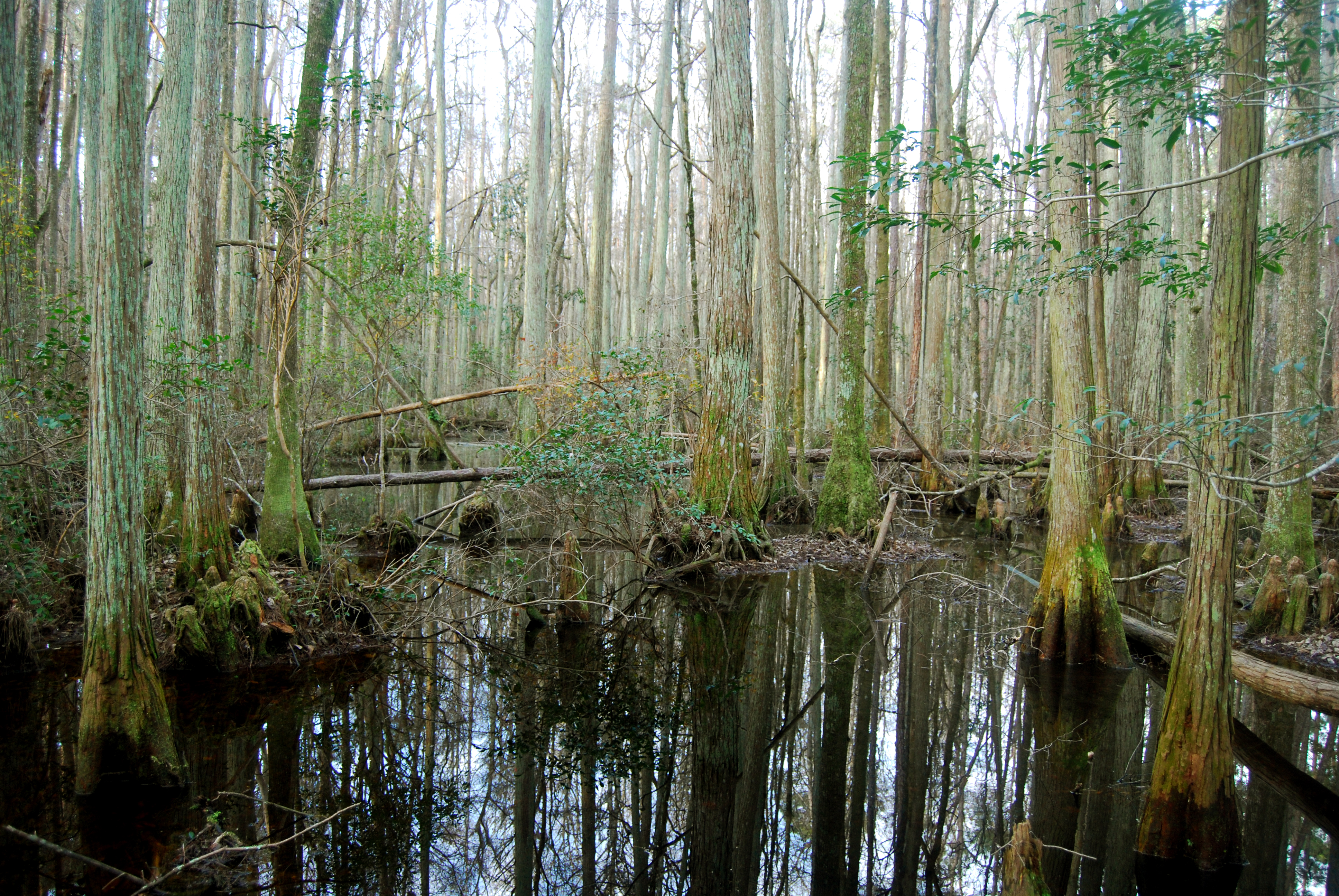
A wetland is a distinct ecosystem that is flooded or saturated by water, either permanently (for years or decades) or seasonally (for weeks or months). Flooding results in oxygen-free (anoxic) processes prevailing, especially in the soils. The primary factor that distinguishes wetlands from terrestrial land forms or Body of water, water bodies is the characteristic vegetation of aquatic plants, adapted to the unique anoxic hydric soils. Wetlands are considered among the most biologically diverse of all ecosystems, serving as home to a wide range of plant and animal species. Methods for assessing wetland functions, wetland ecological health, and general wetland condition have been developed for many regions of the world. These methods have contributed to wetland conservation partly by raising public awareness of the functions some wetlands provide. Wetlands occur naturally on every continent. The water in wetlands is either freshwater, brackish or seawater, saltwater. The main w ... [...More Info...] [...Related Items...] OR: [Wikipedia] [Google] [Baidu] |
King City, Ontario
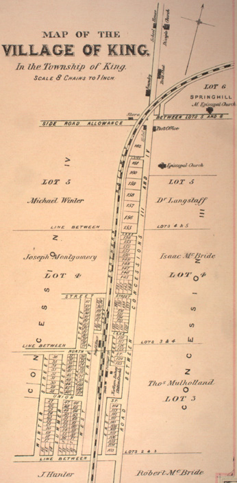
King City is an unincorporated Canadian community in the township of King, Ontario, located north of Toronto. It is the largest community in King township, with 2,730 dwellings and a population of 8,396 as of the 2021 Canadian census. History In 1836, a settlement styled ''Springhill'' was established in King. With the arrival of the Ontario, Simcoe and Huron railway in 1853, the settlement began to expand. In 1890, the reeve of King township (James Whiting Crossley) incorporated King City by merging the hamlets of Springhill, Kinghorn, Laskay, and Eversley. Geography King City is characterized by rolling hills and clustered temperate forests in the Eastern Great Lakes lowland forests ecoregion. Numerous kettle lakes and ponds dot the area. Creeks and streams from King City, the surrounding area, and as far west as Bolton and as far east as Stouffville are the origin for the East Humber River. Situated entirely on the southern slope of the central portion of the Oak Ridges ... [...More Info...] [...Related Items...] OR: [Wikipedia] [Google] [Baidu] |


