|
Kilton Thorpe
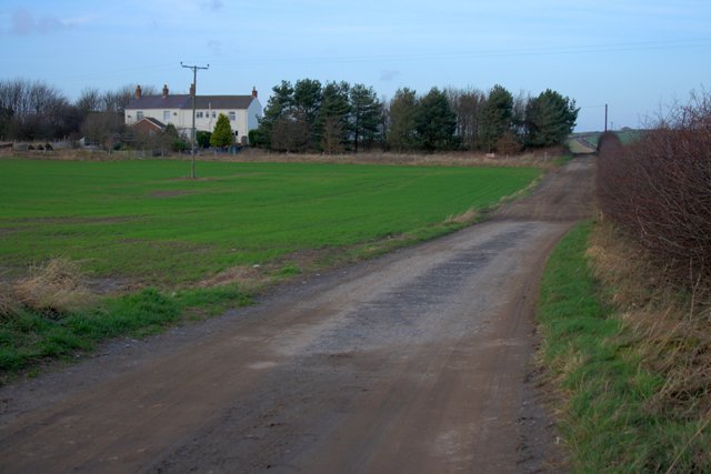
Kilton Thorpe is a village in the borough of Redcar and Cleveland and the ceremonial county of North Yorkshire, England. Noted for evidence of early settlement. The outlines of an ancient village are visible in fields adjacent to the present village. The village is mentioned in the Domesday Book as belonging to Count Mortain. Like other lands in the surrounding area, it was owned by the same noble families as those who owned nearby Kilton Castle. It was only a small settlement across two manors until the arrival of the ironstone industry when 30 workers cottages were built. Kilton Mine Kilton Ironstone Mine was opened in just to the south of the village of Kilton Thorpe. The shafts of the mine were deep, and like the other mines in the area, it supplied ironstone to the furnaces on Teesside. A private railway was opened in 1873, becoming the property of the North Eastern Railway a year later. On 12 August 1899, three miners died in a gas explosion, and on 3 May 1954, an expl ... [...More Info...] [...Related Items...] OR: [Wikipedia] [Google] [Baidu] |
Redcar And Cleveland
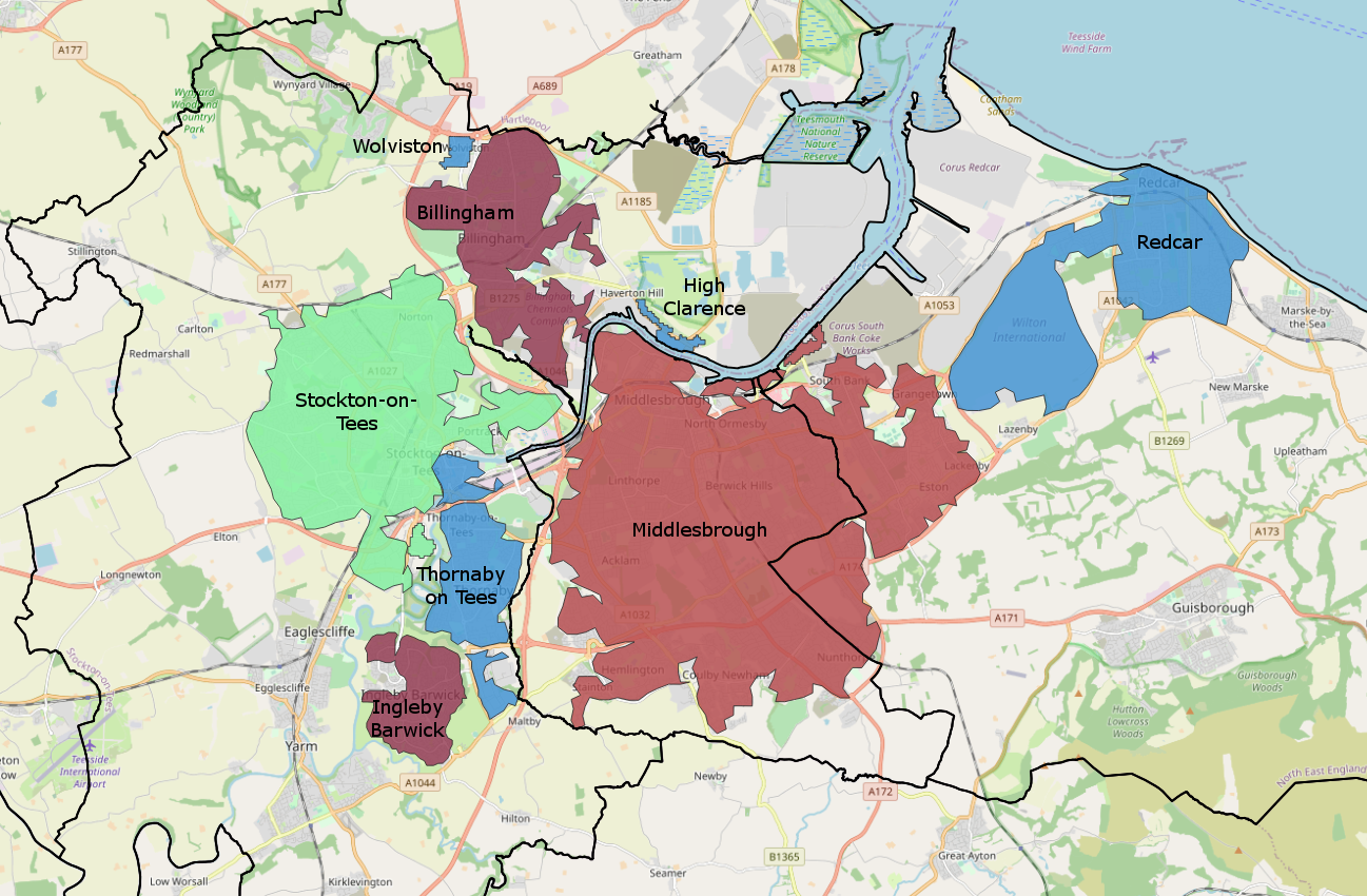
Redcar and Cleveland is a borough with unitary authority status in North Yorkshire, England. Its main settlements are Redcar, South Bank, Eston, Brotton, Guisborough, the Greater Eston part of Middlesbrough, Loftus, Saltburn and Skelton. The borough had a resident population of 135,200 in 2011. It is a part of the Tees Valley mayoralty: the current mayor is Ben Houchen. The borough is represented in Parliament by Jacob Young (Conservative Party) for the Redcar constituency, and by Simon Clarke (Conservative Party) for the Middlesbrough South and East Cleveland constituency. History The district was created in 1974 as the borough of Langbaurgh, one of four districts of the new non-metropolitan county of Cleveland. It was formed from the Coatham, Kirkleatham, Ormesby, Redcar and South Bank wards of the County Borough of Teesside, along with Guisborough, Loftus, Saltburn and Marske-by-the-Sea, Eston Grange and Skelton and Brotton urban districts, from the North Ridin ... [...More Info...] [...Related Items...] OR: [Wikipedia] [Google] [Baidu] |
North Yorkshire
North Yorkshire is the largest ceremonial counties of England, ceremonial county (lieutenancy area) in England, covering an area of . Around 40% of the county is covered by National parks of the United Kingdom, national parks, including most of the Yorkshire Dales and the North York Moors. It is one of four counties in England to hold the name Yorkshire; the three other counties are the East Riding of Yorkshire, South Yorkshire and West Yorkshire. North Yorkshire may also refer to a non-metropolitan county, which covers most of the ceremonial county's area () and population (a mid-2016 estimate by the Office for National Statistics, ONS of 602,300), and is administered by North Yorkshire County Council. The non-metropolitan county does not include four areas of the ceremonial county: the City of York, Middlesbrough, Redcar and Cleveland and the southern part of the Borough of Stockton-on-Tees, which are all administered by Unitary authorities of England, unitary authorities. ... [...More Info...] [...Related Items...] OR: [Wikipedia] [Google] [Baidu] |
Ceremonial County
The counties and areas for the purposes of the lieutenancies, also referred to as the lieutenancy areas of England and informally known as ceremonial counties, are areas of England to which lords-lieutenant are appointed. Legally, the areas in England, as well as in Wales and Scotland, are defined by the Lieutenancies Act 1997 as "counties and areas for the purposes of the lieutenancies in Great Britain", in contrast to the areas used for local government. They are also informally known as "geographic counties", to distinguish them from other types of counties of England. History The distinction between a county for purposes of the lieutenancy and a county for administrative purposes is not a new one; in some cases, a county corporate that was part of a county appointed its own lieutenant (although the lieutenant of the containing county would often be appointed to this position, as well), and the three Ridings of Yorkshire had been treated as three counties for lieutena ... [...More Info...] [...Related Items...] OR: [Wikipedia] [Google] [Baidu] |
Domesday Book
Domesday Book () – the Middle English spelling of "Doomsday Book" – is a manuscript record of the "Great Survey" of much of England and parts of Wales completed in 1086 by order of King William I, known as William the Conqueror. The manuscript was originally known by the Latin name ''Liber de Wintonia'', meaning "Book of Winchester", where it was originally kept in the royal treasury. The '' Anglo-Saxon Chronicle'' states that in 1085 the king sent his agents to survey every shire in England, to list his holdings and dues owed to him. Written in Medieval Latin, it was highly abbreviated and included some vernacular native terms without Latin equivalents. The survey's main purpose was to record the annual value of every piece of landed property to its lord, and the resources in land, manpower, and livestock from which the value derived. The name "Domesday Book" came into use in the 12th century. Richard FitzNeal wrote in the ''Dialogus de Scaccario'' ( 1179) that the book ... [...More Info...] [...Related Items...] OR: [Wikipedia] [Google] [Baidu] |
Kilton Castle
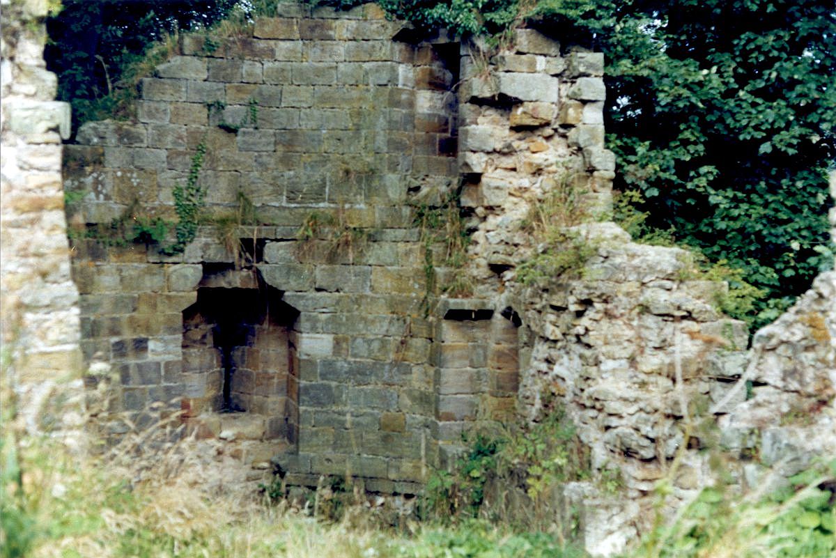
Kilton Castle is a ruined castle overlooking the valley of Kilton Beck, near to the village of Kilton, North Yorkshire, Kilton in the historic county of the North Riding of Yorkshire (now Redcar and Cleveland) in England. The castle was built in the 12th century and was described as being in a ruinous state by the 14th century, with it being totally abandoned by the 16th century. Kilton Castle was owned by several noble families who hailed from the area; de Brus, de Kilton, Autrey, de Thweng, de Lumley. The setting of the castle on a promontory above the valley meant that it had slopes leading up to three sides and a fourth side (to the west) had a narrow entrance into the valley wall. Due to its commanding position and man-made and natural defences, it has been labelled the "most powerful baronial fortress in Cleveland." Its rebuilding in stone in the late 12th century was accomplished without need of a Keep (castle), keep, which has led to it being known as the first castle in ... [...More Info...] [...Related Items...] OR: [Wikipedia] [Google] [Baidu] |
Kilton Thorpe
Kilton Thorpe is a village in the borough of Redcar and Cleveland and the ceremonial county of North Yorkshire, England. Noted for evidence of early settlement. The outlines of an ancient village are visible in fields adjacent to the present village. The village is mentioned in the Domesday Book as belonging to Count Mortain. Like other lands in the surrounding area, it was owned by the same noble families as those who owned nearby Kilton Castle. It was only a small settlement across two manors until the arrival of the ironstone industry when 30 workers cottages were built. Kilton Mine Kilton Ironstone Mine was opened in just to the south of the village of Kilton Thorpe. The shafts of the mine were deep, and like the other mines in the area, it supplied ironstone to the furnaces on Teesside. A private railway was opened in 1873, becoming the property of the North Eastern Railway a year later. On 12 August 1899, three miners died in a gas explosion, and on 3 May 1954, an expl ... [...More Info...] [...Related Items...] OR: [Wikipedia] [Google] [Baidu] |
Teesside
Teesside () is a built-up area around the River Tees in the north of England, split between County Durham and North Yorkshire. The name was initially used as a county borough in the North Riding of Yorkshire. Historically a hub for heavy manufacturing, the number of people employed in this type of work declined from the 1960s onwards, with steel-making and chemical manufacturing (particularly through Imperial Chemical Industries) replaced to some extent by new science businesses and service sector roles. History 1968–1974: County borough Before the county of Cleveland was created, the area (including Stockton-on-Tees) existed as a part of the North Riding of Yorkshire, due to most land being south of the Tees. Teesside was created due to Stockton-on-Tees being linked heavily with Thornaby (which had amalgamated with South Stockton/Mandale to form the Borough of Thornaby), Middlesbrough and Redcar by industry. Compared to the modern Teesside conurbation, the area was sma ... [...More Info...] [...Related Items...] OR: [Wikipedia] [Google] [Baidu] |
Villages In North Yorkshire
A village is a clustered human settlement or community, larger than a hamlet but smaller than a town (although the word is often used to describe both hamlets and smaller towns), with a population typically ranging from a few hundred to a few thousand. Though villages are often located in rural areas, the term urban village is also applied to certain urban neighborhoods. Villages are normally permanent, with fixed dwellings; however, transient villages can occur. Further, the dwellings of a village are fairly close to one another, not scattered broadly over the landscape, as a dispersed settlement. In the past, villages were a usual form of community for societies that practice subsistence agriculture, and also for some non-agricultural societies. In Great Britain, a hamlet earned the right to be called a village when it built a church. [...More Info...] [...Related Items...] OR: [Wikipedia] [Google] [Baidu] |
Places In The Tees Valley
Place may refer to: Geography * Place (United States Census Bureau), defined as any concentration of population ** Census-designated place, a populated area lacking its own municipal government * "Place", a type of street or road name ** Often implies a dead end (street) or cul-de-sac * Place, based on the Cornish word "plas" meaning mansion * Place, a populated place, an area of human settlement ** Incorporated place (see municipal corporation), a populated area with its own municipal government * Location (geography), an area with definite or indefinite boundaries or a portion of space which has a name in an area Placenames * Placé, a commune in Pays de la Loire, Paris, France * Plače, a small settlement in Slovenia * Place (Mysia), a town of ancient Mysia, Anatolia, now in Turkey * Place, New Hampshire, a location in the United States * Place House, a 16th-century mansion largely remodelled in the 19th century, in Fowey, Cornwall * Place House, a 19th-century mansion on ... [...More Info...] [...Related Items...] OR: [Wikipedia] [Google] [Baidu] |


