|
Kill Van Kull
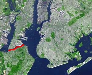
__NOTOC__ The Kill Van Kull is a tidal strait between Staten Island, New York and Bayonne, New Jersey in the United States. It is approximately long and wide and connects Newark Bay with Upper New York Bay. The Robbins Reef Light marks the eastern end of the Kill, Bergen Point its western end. It is spanned by the Bayonne Bridge and is one of the most heavily traveled waterways in the Port of New York and New Jersey. Historically, it has been one of the most important channels for the commerce of the region, providing a passage for marine traffic between Upper New York Bay and the industrial towns of northeastern New Jersey. During the colonial era, it played a significant role in travel between New York and the southern colonies, with passengers changing from ferries to coaches at Elizabethtown (now Elizabeth). Since the final third of the 20th century, it has provided the principal access for oceangoing container ships to Port Newark-Elizabeth Marine Terminal, the bus ... [...More Info...] [...Related Items...] OR: [Wikipedia] [Google] [Baidu] |
Elizabeth, New Jersey
Elizabeth is a city and the county seat of Union County, in the U.S. state of New Jersey.New Jersey County Map , New Jersey Department of State. Accessed July 10, 2017. As of the , the city had a total population of 137,298,Table DP-1. Profile of General Demographic Characteristics: 2010 ... [...More Info...] [...Related Items...] OR: [Wikipedia] [Google] [Baidu] |
Hudson Palisades
The Palisades, also called the New Jersey Palisades or the Hudson River Palisades, are a line of steep cliffs along the west side of the lower Hudson River in Northeastern New Jersey and Southeastern New York in the United States. The cliffs stretch north from Jersey City about 20 miles (32 km) to near Nyack, New York, and visible at Haverstraw, New York. They rise nearly vertically from near the edge of the river, and are about high at Weehawken, increasing gradually to high near their northern terminus. North of Fort Lee, the Palisades are part of Palisades Interstate Park and are a National Natural Landmark. The Palisades are among the most dramatic geologic features in the vicinity of New York City, forming a canyon of the Hudson north of the George Washington Bridge, as well as providing a vista of the Manhattan skyline. They sit in the Newark Basin, a rift basin located mostly in New Jersey. '' Palisade'' is derived from the same root as the word ''pole'' ... [...More Info...] [...Related Items...] OR: [Wikipedia] [Google] [Baidu] |
Bergen Hill
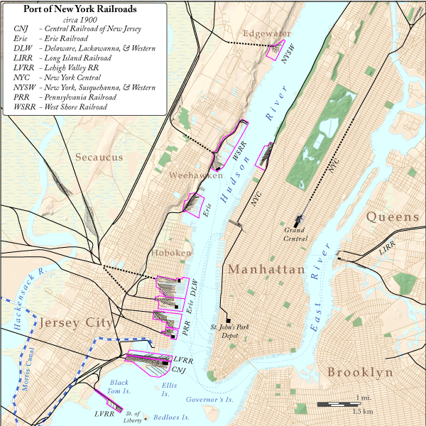
Bergen Hill refers to the lower Hudson Palisades in New Jersey, where they emerge on Bergen Neck, which in turn is the peninsula between the Hackensack and Hudson Rivers, and their bays. In Hudson County, it reaches a height of 260 feet. Rail Defining features of Bergen Hill include the 19th century and early 20th century railroad rights-of-way. Cuts and tunnels created to provide access to the terminals and ferries on the North River (Hudson River) and Upper New York Bay, and eventually under the river. From south to north they are: * The Central Railroad of New Jersey lines traveled on the CRRNJ Newark Bay Bridge across Newark Bay and through Bayonne and Greenville to its Communipaw Terminal. Portions are used by the Hudson Bergen Light Rail. * The Jersey City, Newark and Western Railway (later the Lehigh Valley Terminal Railway) freight line on the bridge over Newark Bay and across Pamrapo is now used by CSX Transportation as the National Docks Secondary to Port Jersey a ... [...More Info...] [...Related Items...] OR: [Wikipedia] [Google] [Baidu] |
Achter Kol, New Netherland
Achter Kol (or Achter Col) was the name given to the region around the Newark Bay and Hackensack River in northeastern New Jersey by the first European settlers to it and was part of the 17th century province of New Netherland, originally administered by the Dutch West India Company. At the time of their arrival, the area was inhabited by the Hackensack and Raritan groups of Lenape. Toponymy Placenaming by Dutch explorers and settlers during the era often referred to a location in reference to other places, its shape, its topography, and other geographic qualities. Today Newark Bay is connected to Upper New York Bay by the Kill Van Kull and to Raritan Bay by the Arthur Kill. The names of the channels reflect the period of Dutch colonialization. The area around the bay and the rivers that feed it was called Achter Kol. (achter meaning behind and col, meaning a mountain pass) which translates as ''behind or beyond the ridge'' and refers to Bergen Hill. The emergence of the ... [...More Info...] [...Related Items...] OR: [Wikipedia] [Google] [Baidu] |
New Netherland
New Netherland ( nl, Nieuw Nederland; la, Novum Belgium or ) was a 17th-century colonial province of the Dutch Republic that was located on the East Coast of the United States, east coast of what is now the United States. The claimed territories extended from the Delmarva Peninsula to southwestern Cape Cod, while the more limited settled areas are now part of the U.S. states of New York (state), New York, New Jersey, Delaware, Massachusetts and Connecticut, with small outposts in Pennsylvania and Rhode Island. The colony was conceived by the Dutch West India Company (WIC) in 1621 to capitalize on the North American fur trade. The colonization was slowed at first because of policy mismanagement by the WIC, and conflicts with Native Americans in the United States, Native Americans. The settlement of New Sweden by the Swedish South Company encroached on its southern flank, while its eastern border was redrawn to accommodate an expanding New England Confederation. The colony exp ... [...More Info...] [...Related Items...] OR: [Wikipedia] [Google] [Baidu] |
Netherlands
) , anthem = ( en, "William of Nassau") , image_map = , map_caption = , subdivision_type = Sovereign state , subdivision_name = Kingdom of the Netherlands , established_title = Before independence , established_date = Spanish Netherlands , established_title2 = Act of Abjuration , established_date2 = 26 July 1581 , established_title3 = Peace of Münster , established_date3 = 30 January 1648 , established_title4 = Kingdom established , established_date4 = 16 March 1815 , established_title5 = Liberation Day (Netherlands), Liberation Day , established_date5 = 5 May 1945 , established_title6 = Charter for the Kingdom of the Netherlands, Kingdom Charter , established_date6 = 15 December 1954 , established_title7 = Dissolution of the Netherlands Antilles, Caribbean reorganisation , established_date7 = 10 October 2010 , official_languages = Dutch language, Dutch , languages_type = Regional languages , languages_sub = yes , languages = , languages2_type = Reco ... [...More Info...] [...Related Items...] OR: [Wikipedia] [Google] [Baidu] |
Anglicisation
Anglicisation is the process by which a place or person becomes influenced by English culture or British culture, or a process of cultural and/or linguistic change in which something non-English becomes English. It can also refer to the influence of English culture and business on other countries outside England or the United Kingdom, including their media, cuisine, popular culture, technology, business practices, laws, or political systems. Linguistic anglicisation is the practice of modifying foreign words, names, and phrases to make them easier to spell, pronounce or understand in English. The term commonly refers to the respelling of foreign words, often to a more drastic degree than that implied in, for example, romanisation. One instance is the word "dandelion", modified from the French ''dent-de-lion'' ("lion's tooth", a reference to the plant's sharply indented leaves). The term can also refer to phonological adaptation without spelling change: ''spaghetti'', for example ... [...More Info...] [...Related Items...] OR: [Wikipedia] [Google] [Baidu] |
Arthur Kill
The Arthur Kill (sometimes referred to as the Staten Island Sound) is a tidal strait between Staten Island (also known as Richmond County), New York and Union and Middlesex counties, New Jersey. It is a major navigational channel of the Port of New York and New Jersey. Etymology The name Arthur Kill is an anglicization of the Dutch language ''achter kill'' meaning ''back channel'', which would refer to its location "behind" Staten Island and has its roots in the early 17th century during the Dutch colonial era when the region was part of New Netherland. Placenaming by early explorers and settlers during the era often referred to a location in reference to other places, its shape, its topography, and other geographic qualities. ''Kill'' comes from the Middle Dutch word ''kille'', meaning ''riverbed'', ''water channel'', or ''stream''. The area around the Newark Bay was called Achter Kol. During the British colonial era the bay was known as ''Cull bay''. The bay lies behind B ... [...More Info...] [...Related Items...] OR: [Wikipedia] [Google] [Baidu] |
Collins Park (Bayonne, New Jersey)
Collins Park, or 1st Street Park, is the largest municipal park in Bayonne, New Jersey. It is located at the southern end of the city and runs for along the shore the Kill van Kull. Once known as Kill van Kull Park, it is named for Dennis P. Collins, who served at mayor of Bayonne from 1974 to 1990. The approach to the Bayonne Bridge crosses over the park at the west, under which will connect to the planned extension of Hackensack RiverWalk at Bergen Point. History The park comprises what were public and private parcels of land. Killeen Park, which had been upgraded in 1937 WPA project, was incorporated in Collins Park It was further built out in the 1950s. Portions were was once property of Uncle Milty's Amusement Park or "Miltyville," which after its closure was purchased by the city in 1969. Brady's Dock, once a marina and ferry slip was incorporated the park in the 1980s, when it was rebuilt and the parkland expanded. Collins Park was substantially refurbished in two phases ... [...More Info...] [...Related Items...] OR: [Wikipedia] [Google] [Baidu] |
Panamax
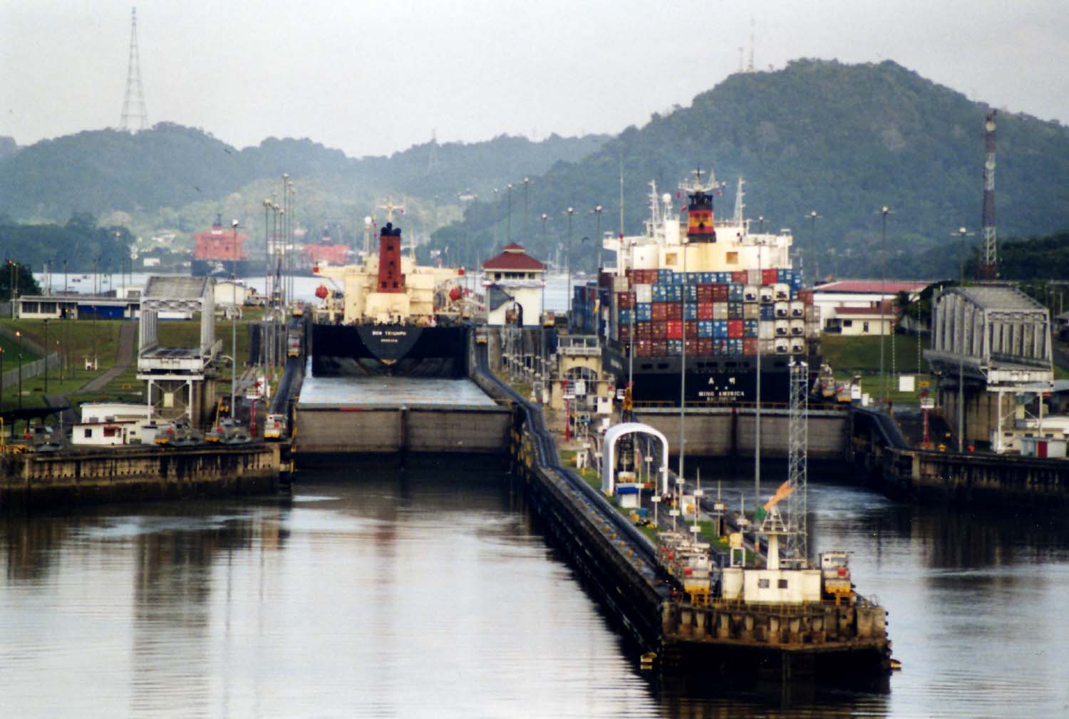
Panamax and New Panamax (or Neopanamax) are terms for the size limits for ships travelling through the Panama Canal. The limits and requirements are published by the Panama Canal Authority (ACP) in a publication titled "Vessel Requirements". These requirements also describe topics like exceptional dry seasonal limits, propulsion, communications, and detailed ship design. The allowable size is limited by the width and length of the available lock chambers, by the depth of water in the canal, and by the height of the Bridge of the Americas since that bridge's construction. These dimensions give clear parameters for ships destined to traverse the Panama Canal and have influenced the design of cargo ships, naval vessels, and passenger ships. Panamax specifications have been in effect since the opening of the canal in 1914. In 2009, the ACP published the New Panamax specification which came into effect when the canal's third set of locks, larger than the original two, opened on ... [...More Info...] [...Related Items...] OR: [Wikipedia] [Google] [Baidu] |
Dredging
Dredging is the excavation of material from a water environment. Possible reasons for dredging include improving existing water features; reshaping land and water features to alter drainage, navigability, and commercial use; constructing dams, dikes, and other controls for streams and shorelines; and recovering valuable mineral deposits or marine life having commercial value. In all but a few situations the excavation is undertaken by a specialist floating plant, known as a dredger. Dredging is carried out in many different locations and for many different purposes, but the main objectives are usually to recover material of value or use, or to create a greater depth of water. Dredges have been classified as suction or mechanical. Dredging has significant environmental impacts: it can disturb marine sediments, leading to both short- and long-term water pollution, destroy important seabed ecosystems, and can release human-sourced toxins captured in the sediment. Description ... [...More Info...] [...Related Items...] OR: [Wikipedia] [Google] [Baidu] |


.png)


.png)