|
Kiliansteich Reservoir
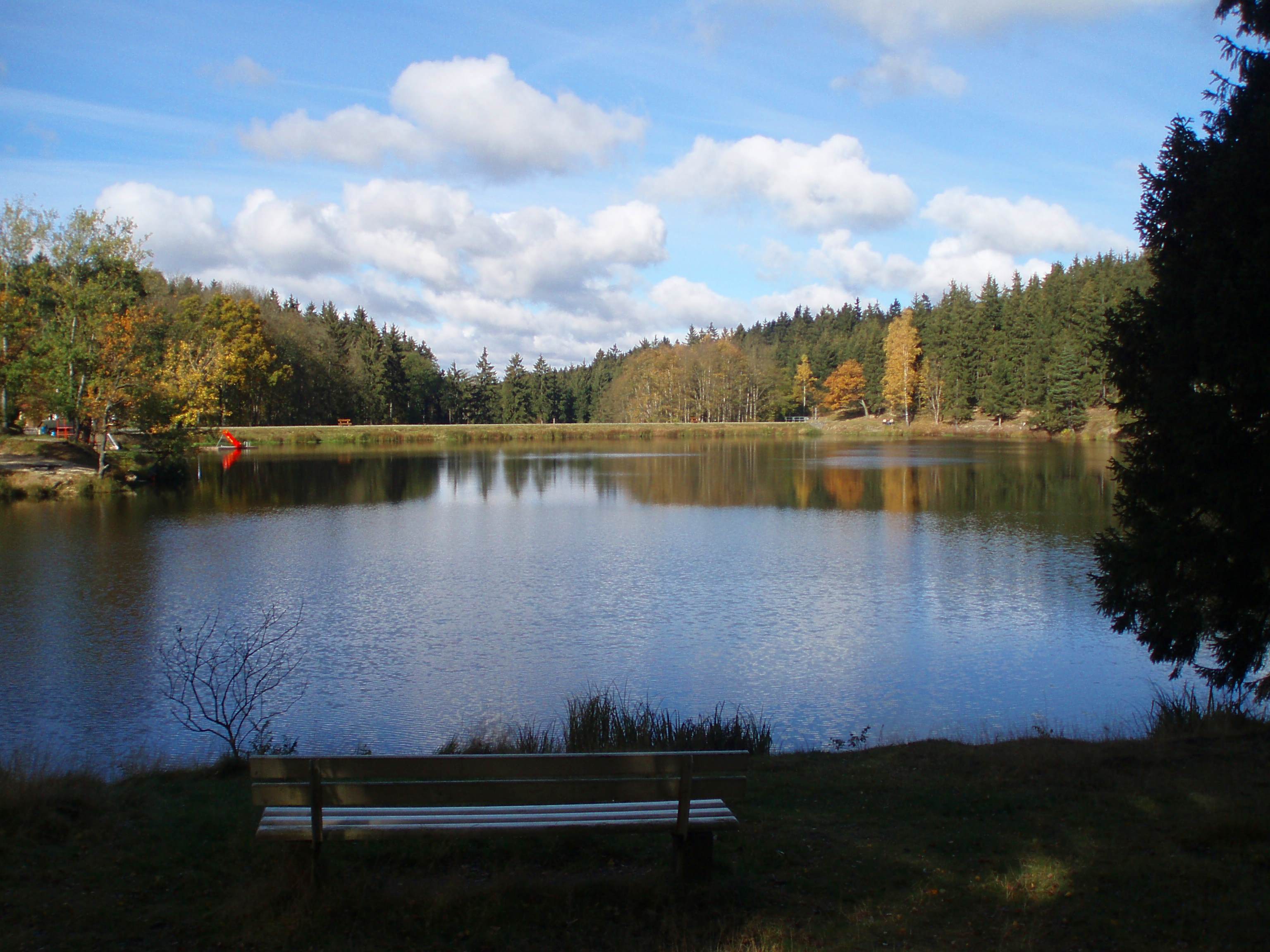
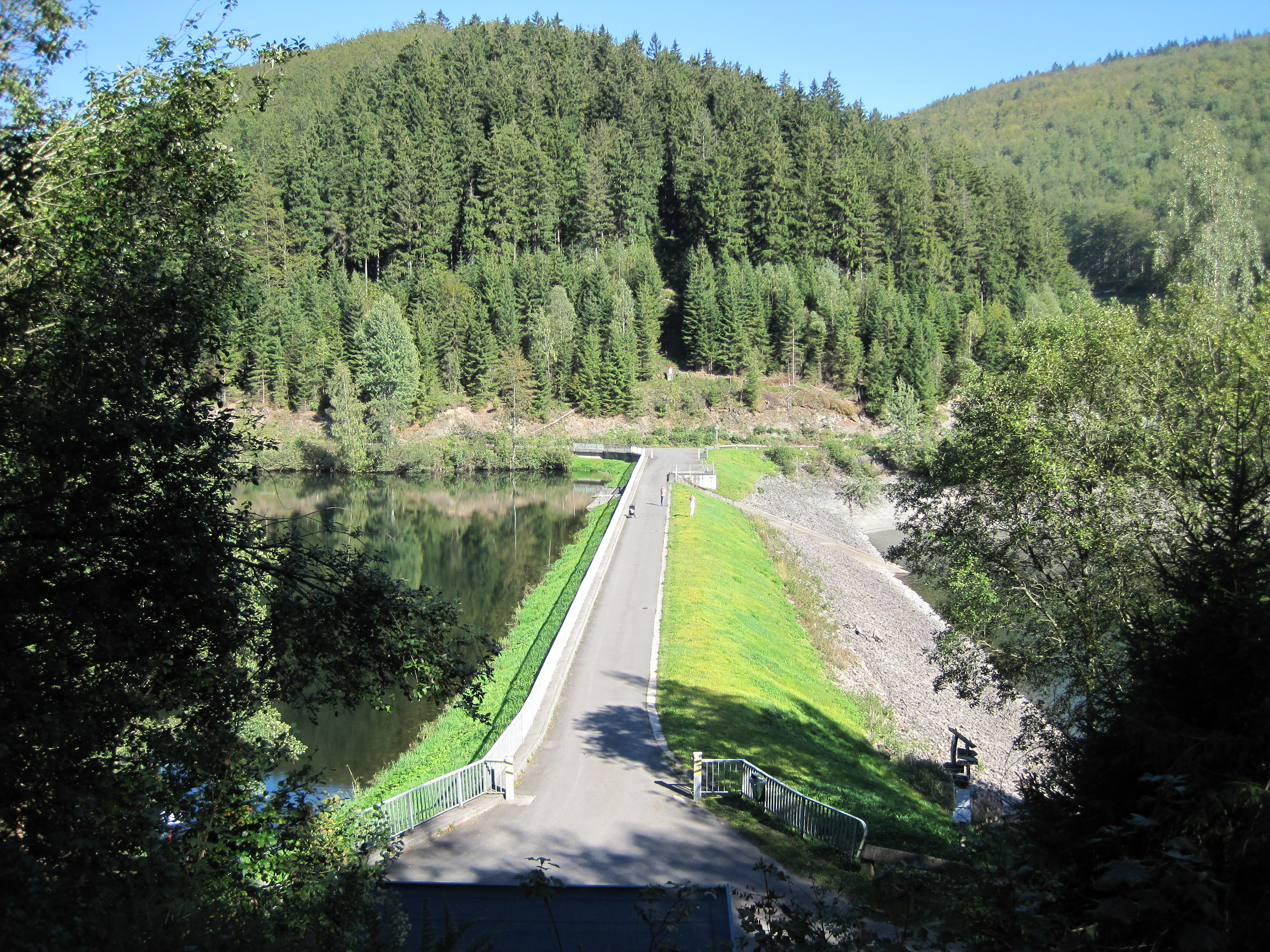
The Kiliansteich (literally "St. Kilian's Pond") is one of the oldest reservoirs in Germany. The reservoir is located near Straßberg (Harz) in the German state of Saxony-Anhalt and supplies drinking water. It impounds the Büschengraben stream. The lake is part of the heritage area (''Flächendenkmal'') of the Lower Harz Pond and Ditch System. The reservoir has a rockfill dam with a watertight clay core that sits on a shale bedrock. History Originally there were four small ponds in a row on the site of the present-day reservoir that had been built for the mining industry. Two of those were broken in 1901 and 1944 and all were in a poor condition. As a result, from 1989-1994 a new, higher dam was built at the site of the lowest dam; the two middle ponds were removed and the upper one, the Upper Kilian Pond (''Oberer Kiliansteich''), built in 1703, was upgraded into a pre-dam (''Vorsperre''). Originally laid as a drinking water reservoir, the lake is used today for flood and d ... [...More Info...] [...Related Items...] OR: [Wikipedia] [Google] [Baidu] |
Landkreis Harz
Harz is a district in Saxony-Anhalt, Germany. Its area is . History The district was established by merging the former districts of Halberstadt, Wernigerode and Quedlinburg as well as the city of Falkenstein (from the district of Aschersleben-Staßfurt) as part of the reform of 2007. Towns and municipalities The district Harz consists of the following subdivisions: See also *Ilsenburg (Verwaltungsgemeinschaft) Ilsenburg (Harz) was a ''Verwaltungsgemeinschaft'' ("collective municipality") in the district of Harz, in Saxony-Anhalt, Germany. The seat of the ''Verwaltungsgemeinschaft'' was in Ilsenburg. It was disbanded in July 2009. The ''Verwaltungsgemei ... References Districts of Saxony-Anhalt Harz {{Harz-geo-stub ... [...More Info...] [...Related Items...] OR: [Wikipedia] [Google] [Baidu] |
Harzwasserwerke
The Harzwasserwerke GmbH (; English: Harz Water Works Limited) is a major German water company and dam operator based in Hildesheim, located within the German federal state of Lower Saxony. Founded in 1928, the Harzwasserwerke were tasked with supplying drinking water, providing electrical power and flood protection. Over the course of the past 75 years, the Harzwasserwerke have expanded to be the biggest water supply company in Lower Saxony and is among the top ten water companies in Germany. The company utilizes the nearby Harz mountains, a well-known nature reserve and tourist destination in Germany, as a source of high-quality drinking water. Water is impounded in six reservoirs built between 1930 and 1969 in the Lower Saxon part of the Harz mountains; drinking water is prepared in three waterworks and distributed through pipes to large parts of Lower Saxony. The system is supplemented by four groundwater waterworks on the North German plain. Currently delivering over 94,4 mil ... [...More Info...] [...Related Items...] OR: [Wikipedia] [Google] [Baidu] |
Buildings And Structures Completed In The 17th Century
A building, or edifice, is an enclosed structure with a roof and walls standing more or less permanently in one place, such as a house or factory (although there's also portable buildings). Buildings come in a variety of sizes, shapes, and functions, and have been adapted throughout history for a wide number of factors, from building materials available, to weather conditions, land prices, ground conditions, specific uses, prestige, and aesthetic reasons. To better understand the term ''building'' compare the list of nonbuilding structures. Buildings serve several societal needs – primarily as shelter from weather, security, living space, privacy, to store belongings, and to comfortably live and work. A building as a shelter represents a physical division of the human habitat (a place of comfort and safety) and the ''outside'' (a place that at times may be harsh and harmful). Ever since the first cave paintings, buildings have also become objects or canvasses of much artistic ... [...More Info...] [...Related Items...] OR: [Wikipedia] [Google] [Baidu] |
Selke Basin
Selke may refer to: People * Davie Selke (born 1995), German footballer * Frank J. Selke (1893–1985), Canadian ice-hockey manager and trainer * Margrit Selke (1900–2004), agriculturist * Ruth Eissler-Selke, ''née'' Selke (1906–1991), psychologist, author * Sebastian Selke (born 1974), German footballer * (b 1967 as Stefan Guschker), professor of sociology in the ''Faculty for Digital Media'' at the Furtwangen University im Schwarzwald * Walter Selke (born 1947), German professor of theoretical physics at the RWTH Aachen * (1901–1971), German agricultural chemist Awards * Frank J. Selke Trophy (National Hockey League), awarded annually to the National Hockey League forward who demonstrates the most skill in the defensive component of the game * Frank J. Selke Memorial Trophy (Quebec Major Junior Hockey League), awarded annually to the most sportsmanlike player in the Quebec Major Junior Hockey League Places * Selke (river), a river in the Harz Mountains of Germany * B ... [...More Info...] [...Related Items...] OR: [Wikipedia] [Google] [Baidu] |
List Of Ponds In The Lower Harz Pond And Ditch System
The ponds of the Lower Harz Pond and Ditch System in Germany consist of around 20 small and larger reservoirs. Most were laid out roughly from the beginning of the 17th century between the Upper Lude, Großer Auerberg, Straßberg (Harz), Straßberg, Neudorf (Harz), Neudorf and Silberhütte (Harzgerode), Silberhütte. Several of the pond barrages are classified as dams. The dam of the Gräfiggründer Teich is also the second oldest reservoir in Germany. The ponds are located in the mining fields of Straßberg, Silberhütte, Birnbaum and Neudorf. Table of ponds Footnotes Sources * Wilfried Strenz, Historisch-geographische Forschungen in der DDR * Robert Wouters (Hrsg. Damnbetrieb Sachsen-Anhalt), Damn in Sachsen-Anhalt, * Wilfried Ließmann: ''Historischer Bergbau im Harz'', {{ISBN, 978-3-540-31328-1 External links Straßbergharzlife.deharzkaleidoskop.de Lower Harz Pond and Ditch System, ! Reservoirs in Germany de:Liste der Teiche des Unterharzer Teich- und Grab ... [...More Info...] [...Related Items...] OR: [Wikipedia] [Google] [Baidu] |
List Of Waterbodies In Saxony-Anhalt
{{short description, None Waterbodies Waterbody; Length in km; in Saxony-Anhalt flowing through; (confluence of ...); Remarks Elbe Elbe; 1.091 km; rises in the Giant Mountains of the Czech Republic at a height of ca. 1,386 m, flows through or touches the Czech Republic, Saxony, Saxony-Anhalt, Brandenburg, Lower Saxony, Mecklenburg-Western Pomerania, Hamburg, Schleswig-Holstein Elbe tributaries and water bodies with their confluence in Saxony-Anhalt * Aland ** Biese ** Milde ** Uchte ** Augraben * Havel ** Königsgraben * Tanger * Ihle * Ehle * Ohre ** Schrote *** Siegrenne *** Sieggraben *** Kreuzgrund *** Faule Renne *** Große Sülze * Klinke ** Eulengraben *** Großer Wiesengraben **** Kleiner Wiesengraben ** Künette * Sülze * Nuthe (Elbe) * Saale ** Bode *** Selke *** Holtemme *** Kalte Bode *** Hassel **** Brummeckebach ***** Sellegraben **** Murmelbach **** Hagenbach Sautal (left) ** Fuhne *** Strengbach *** Riede ** Wipper (Harz) *** Mühlgraben ... [...More Info...] [...Related Items...] OR: [Wikipedia] [Google] [Baidu] |
List Of Dams In Germany
These are dams and reservoirs in Germany. The German word ''Talsperre'' (literally: valley barrier) may mean dam, but it is often used to include the associated reservoir as well. The reservoirs are often separately given names ending in ''-see'', ''-teich'' or ''-speicher'' which are the German words for "lake", "pond" and "reservoir", but in this case all may also be translated as "reservoir". The more specific word for the actual dam is ''Staumauer'' and for the lake is ''Stausee''. Baden-Württemberg * Kleine Kinzig Dam *Nagold Dam *Schluchsee - highest reservoir lake in Germany and largest lake in the Black Forest * Schwarzenbach Dam Bavaria * Ellertshäuser See *Großer Brombachsee *Forggensee * Frauenau Dam * Sylvenstein Dam * Altmühlsee *Rothsee * Hahnenkammsee Brandenburg *Spremberg Reservoir Hesse *Aar Dam * Affoldern Reservoir * Antrift Dam * Diemelsee (reservoir) *Driedorf Reservoir *Edersee Lower Saxony * Ecker Dam * Grane Dam * Innerste Dam * Oder Dam * Odertei ... [...More Info...] [...Related Items...] OR: [Wikipedia] [Google] [Baidu] |
Glasebach Pit
The Glasebach Pit (german: Grube Glasebach) is a mining museum and former pit in the Harz fluorspar mining area near Straßberg in the German state of Saxony-Anhalt. It is run by the East Harz Mining Society (''Montanverein Ostharz e. V.''). The pit was founded under the name of ''Vertrau auf Gott'' ("Trust in God"). The mining industry in the area around Straßberg goes back to the time around the year 1400. At Heidelberg north of Straßberg, fluorite and silver were won and processed at a smeltery on the site on behalf of the counts of Stolberg. There was also flourishing mining activity on the Glasebach stream, which formed the boundary between the County of Stolberg and the Principality of Anhalt-Bernburg. After being abandoned for a while, mining restarted in the 18th century and continued, with interruptions, until the 1960s. Various mining artefacts are displayed in the museum, including the old wooden drainage outlet (''Grundablass'') of the Lower Kilian Dam (o ... [...More Info...] [...Related Items...] OR: [Wikipedia] [Google] [Baidu] |
Clausthal-Zellerfeld
Clausthal-Zellerfeld is a town in Lower Saxony, Germany. It is located in the southwestern part of the Harz mountains. Its population is approximately 15,000. The City is the location of the Clausthal University of Technology. The health resort is located in the Upper Harz at an altitude between 390 and 821 m above sea level. Geography Clausthal-Zellerfeld is located on the Upper Harz Plateau. The environment is less mountainous compared to most of the Harz, but only hilly. As a result, the immediate surrounding area is less wooded and there are more meadow areas. Scattered in and around Clausthal-Zellerfeld are numerous dams and streams of the Upper Harz Water Regale. The depression between Clausthal and Zellerfeld marks a natural "borderline". Southwest extends the "Small Clausthal valley". City districts * Altenau-Schulenberg im Oberharz (since 2015) * Buntenbock (since 1972) * Clausthal-Zellerfeld * Wildemann (since 2015) History Clausthal-Zellerfeld originally c ... [...More Info...] [...Related Items...] OR: [Wikipedia] [Google] [Baidu] |
Pre-dam
A forebay is an artificial pool of water in front of a larger body of water. The larger body of water may be natural or man-made. at www.wisegeek.com. Retrieved on 13 Jun 2013 Forebays have a number of functions. They are used in to act as a buffer during or s, impounding water and releasing in a controlled way into the larger waterbody. They may be used upstream of |
Büschengraben
Büschengraben is a river of Saxony-Anhalt, Germany. It flows into the Rödelbach The Rödelbachgraben, usually called the Rödelbach and also incorrectly referred to as the Rieschengraben, is a river of Saxony-Anhalt, Germany. It which was altered for mining purposes. It is the oldest fully functioning part of the Lower Harz ... near Straßberg. See also * List of rivers of Saxony-Anhalt Rivers of Saxony-Anhalt Kunstgraben Rivers of Germany {{SaxonyAnhalt-river-stub ... [...More Info...] [...Related Items...] OR: [Wikipedia] [Google] [Baidu] |
Mining Industry
Mining is the extraction of valuable minerals or other geological materials from the Earth, usually from an ore body, lode, vein, seam, reef, or placer deposit. The exploitation of these deposits for raw material is based on the economic viability of investing in the equipment, labor, and energy required to extract, refine and transport the materials found at the mine to manufacturers who can use the material. Ores recovered by mining include metals, coal, oil shale, gemstones, limestone, chalk, dimension stone, rock salt, potash, gravel, and clay. Mining is required to obtain most materials that cannot be grown through agricultural processes, or feasibly created artificially in a laboratory or factory. Mining in a wider sense includes extraction of any non-renewable resource such as petroleum, natural gas, or even water. Modern mining processes involve prospecting for ore bodies, analysis of the profit potential of a proposed mine, extraction of the desired materials, and ... [...More Info...] [...Related Items...] OR: [Wikipedia] [Google] [Baidu] |


.jpg)


