|
Kildallan North
Kildallan North () is a townland in the civil parish of Templeoran, barony of Moygoish, County Westmeath, Ireland. Geography Kildallan North is bounded on the north by Ballyhug townland, on the west by Balroe, Cartron and Kill townlands and on the east by Kildallan, Westmeath and Sonna Demesne townlands. Its chief geographical features are a hill which reaches a height of 285 feet, woods, the Mill River (which flows north into the River Inny (Leinster)) and small streams. Kildallan North is traversed by the R393 road (Ireland) and minor lanes. The townland covers 253 acres. Etymology The Down Survey map of 1655 spells the name as ''Killdolan'', ''Kildolan'' and lists the owner as Sir Oliver Tuite. Kildallan North was not then a separate townland and formed part of Kildallan. it was not separated until the Ordnance Survey of 1836. William Petty's map of 1685 depicts it as ''Killdellan''. History The townland was named after the Ollamh Érenn or Chief Poet of Ireland, Dallán ... [...More Info...] [...Related Items...] OR: [Wikipedia] [Google] [Baidu] |
Dallán Forgaill
Eochaid mac Colla ( 560 – 640), better known as Saint Dallán or Dallán Forgaill ( sga, Dallán Forchella; la, Dallanus Forcellius; Primitive Irish: ''Dallagnas Worgēllas''), was an early Christian Irish poet and saint known as the writer of the "''Amra Coluim Chille''" ("Elegy of Saint Columba") and, traditionally, "''Rop Tú Mo Baile''" ("Be Thou My Vision"). Personal history Saint Dallan's given name was Eochaidh ( sga, Eochaid); his father was Colla, a descendant of the legendary High King Colla Uais, and his mother was Forgall (Old Irish: ''Forchella''). His nickname, ''Dallán'' ("little blind one"), was earned after he lost his sight, reputedly as a result of studying intensively. He was born in Maigen (now Ballyconnell), at the eastern edge of the territory of the Masraige of Magh Slécht in the north-west of modern County Cavan. He was not a member of the Masraige but belonged to a branch of the Airgíalla called the Fir Lurg, who were in the process of spreadin ... [...More Info...] [...Related Items...] OR: [Wikipedia] [Google] [Baidu] |
Ollamh Érenn
The Ollamh Érenn () or Chief Ollam of Ireland was a professional title of Gaelic Ireland. Background An (literally 'most great') was a poet or bard of literature and history. Each chief or had its own . The head ollam of a province such as Ulster would have been the head of all the ollams in that province, and would have been a social equal of the provincial king. Over all the provincial ollams was the (, , ) who held the official post of Chief-Ollamh of Ireland or "". Generally within a Gaelic region or Kingdom, one particular (the most powerful one), would provide an and Overking (Ruiri) for the entire region. An example is in , over all power was hotly contested and at times swapped between the ruling territory rival dynasties or Sept of the and . The Poetic Courts According to Daniel Corkery, in 18th century Munster, a custom similar to the Welsh Eisteddfod continued long after the destruction of the Irish clan system. In what was also both mimicry and satire of ... [...More Info...] [...Related Items...] OR: [Wikipedia] [Google] [Baidu] |
Census Of Ireland, 1901
A census is the procedure of systematically acquiring, recording and calculating information about the members of a given population. This term is used mostly in connection with national population and housing censuses; other common censuses include censuses of agriculture, traditional culture, business, supplies, and traffic censuses. The United Nations (UN) defines the essential features of population and housing censuses as "individual enumeration, universality within a defined territory, simultaneity and defined periodicity", and recommends that population censuses be taken at least every ten years. UN recommendations also cover census topics to be collected, official definitions, classifications and other useful information to co-ordinate international practices. The UN's Food and Agriculture Organization (FAO), in turn, defines the census of agriculture as "a statistical operation for collecting, processing and disseminating data on the structure of agriculture, covering th ... [...More Info...] [...Related Items...] OR: [Wikipedia] [Google] [Baidu] |
Griffith's Valuation
Griffith's Valuation was a boundary and land valuation survey of Ireland completed in 1868. Griffith's background Richard John Griffith started to value land in Scotland, where he spent two years in 1806-1807 valuing terrain through the examination of its soils. He used 'the Scotch system of valuation' and it was a modified version of this that he introduced into Ireland when he assumed the position of Commissioner of Valuation. Tasks in Ireland In 1825 Griffith was appointed by the British Government to carry out a boundary survey of Ireland. He was to mark the boundaries of every county, barony, civil parish and townland in preparation for the first Ordnance Survey. He completed the boundary work in 1844. He was also called upon to assist in the preparation of a Parliamentary bill to provide for the general valuation of Ireland. This Act was passed in 1826, and he was appointed Commissioner of Valuation in 1827, but did not start work until 1830 when the new 6" maps, became av ... [...More Info...] [...Related Items...] OR: [Wikipedia] [Google] [Baidu] |
Risteárd De Tiúit
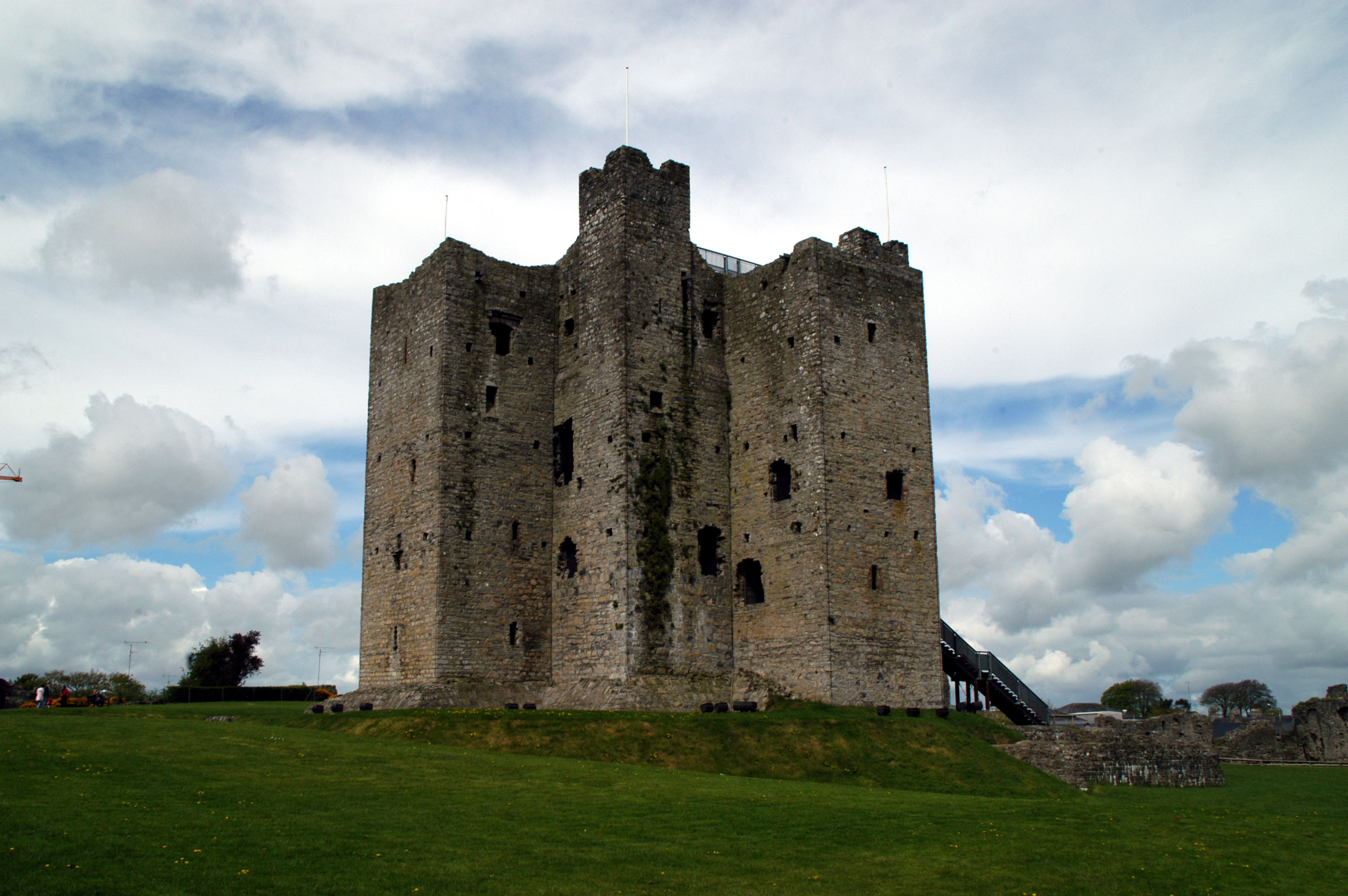
Risteárd de Tiúit ( anglicised as Richard Tuite) (ob. 1210) was an Anglo-Norman nobleman and a member of Richard de Clare, 2nd Earl of Pembroke's Irish invasion force, and Lord Chief Justice of Ireland. His part in the original invasion is acknowledged in The Song of Dermot and the Earl, which recorded his grant of land in the western part of Meath (present-day Westmeath and Longford) under the authority of Hugh de Lacy in Trim. Introduction He built one of the largest Motte and Bailey settlements in Ireland at Granard Motte in 1199. His death, while Lord Chief Justice of Ireland, is recorded in Athlone by the Annals of the Four Masters under the year 1210 and his remains lie today in Abbeylara's Cistercian abbey. He was granted the feudal barony of Moyashel. Descendants Risteárd de Tiúit had two sons who survived him, Risteárd 'Dubh' de Tiúit, the eldest son and heir to the title and lands, and Muiris. Lodge's ''Peerage'' says that it was this Risteárd, Risteárd Dubh, wh ... [...More Info...] [...Related Items...] OR: [Wikipedia] [Google] [Baidu] |
Hugh De Lacy, Lord Of Meath
Hugh de Lacy, Lord of Meath, 4th Baron Lacy (; before 1135 – 25 July 1186), was an Anglo-Norman landowner and royal office-holder. He had substantial land holdings in Herefordshire and Shropshire. Following his participation in the Norman Invasion of Ireland, he was granted, in 1172, the lands of the Kingdom of Meath by the Anglo-Norman King Henry II, but he had to gain control of them. The Lordship of Meath was then the most extensive liberty in Ireland. Early life Hugh de Lacy was the son of Gilbert de Lacy (died after 1163) of Ewyas Lacy, Weobley, and Ludlow. He is said to have had a dispute with Joscelin de Dinan as to certain lands in Herefordshire in 1154. He was in possession of his father's lands before 1163, and in 1165–66 held fifty-eight and three-quarters knights' fees, and had nine tenants without knight service. Career in Ireland In October 1171 Lacy went over with Henry II as part of an Anglo-Norman force to invade Ireland, and early in 1172 he was sent ... [...More Info...] [...Related Items...] OR: [Wikipedia] [Google] [Baidu] |
Henry II Of England
Henry II (5 March 1133 – 6 July 1189), also known as Henry Curtmantle (french: link=no, Court-manteau), Henry FitzEmpress, or Henry Plantagenet, was King of England from 1154 until his death in 1189, and as such, was the first Angevin king of England. King Louis VII of France made him Duke of Normandy in 1150. Henry became Count of Anjou and Maine upon the death of his father, Count Geoffrey V, in 1151. His marriage in 1152 to Eleanor of Aquitaine, former spouse of Louis VII, made him Duke of Aquitaine. He became Count of Nantes by treaty in 1158. Before he was 40, he controlled England; large parts of Wales; the eastern half of Ireland; and the western half of France, an area that was later called the Angevin Empire. At various times, Henry also partially controlled Scotland and the Duchy of Brittany. Henry became politically involved by the age of 14 in the efforts of his mother Matilda, daughter of Henry I of England, to claim the English throne, then occupied b ... [...More Info...] [...Related Items...] OR: [Wikipedia] [Google] [Baidu] |
Annals Of The Four Masters
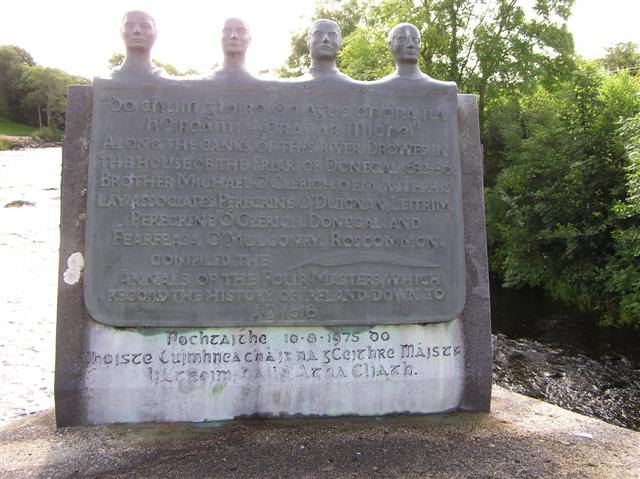
The ''Annals of the Kingdom of Ireland'' ( ga, Annála Ríoghachta Éireann) or the ''Annals of the Four Masters'' (''Annála na gCeithre Máistrí'') are chronicles of medieval Irish history. The entries span from the Deluge, dated as 2,242 years after creation to AD 1616. Publication delay Due to the criticisms by 17th century Irish historian Tuileagna Ó Maol Chonaire, the text was not published in the lifetimes of any of the participants. Text The annals are mainly a compilation of earlier annals, although there is some original work. They were compiled between 1632 and 1636, allegedly in a cottage beside the ruins of Donegal Abbey, just outside Donegal Town. At this time, however, the Franciscans had a house of refuge by the River Drowes in County Leitrim, just outside Ballyshannon, and it was here, according to others, that the ''Annals'' were compiled. [...More Info...] [...Related Items...] OR: [Wikipedia] [Google] [Baidu] |
Portloman
Portloman () is a townland in County Westmeath, Ireland. It is located about north–west of Mullingar on the southwestern shore of Lough Owel. Portloman is one of 8 townlands of the civil parish of Portloman in the barony of Corkaree in the Province of Leinster. The townland covers . The neighbouring townlands are: Wattstown to the north, Ballard to the south, Scurlockstown to the west and Monroe to the north–west. The eastern boundary of the townland is formed by the shoreline of Lough Owel and the small island of Carrickphilbin. In the 1911 census of Ireland The 1911 Census of Ireland was the last census that covered the whole island of Ireland. Censuses were taken at ten-year intervals from 1821 onwards, but the 1921 census was cancelled due to the Irish War of Independence. The original records ... there were 5 houses and 17 inhabitants [...More Info...] [...Related Items...] OR: [Wikipedia] [Google] [Baidu] |
Columba
Columba or Colmcille; gd, Calum Cille; gv, Colum Keeilley; non, Kolban or at least partly reinterpreted as (7 December 521 – 9 June 597 AD) was an Irish abbot and missionary evangelist credited with spreading Christianity in what is today Scotland at the start of the Hiberno-Scottish mission. He founded the important abbey on Iona, which became a dominant religious and political institution in the region for centuries. He is the patron saint of Derry. He was highly regarded by both the Gaels of Dál Riata and the Picts, and is remembered today as a Catholic saint and one of the Twelve Apostles of Ireland. Columba studied under some of Ireland's most prominent church figures and founded several monasteries in the country. Around 563 AD he and his twelve companions crossed to Dunaverty near Southend, Argyll, in Kintyre before settling in Iona in Scotland, then part of the Ulster kingdom of Dál Riata, where they founded a new abbey as a base for spreading Celtic Christia ... [...More Info...] [...Related Items...] OR: [Wikipedia] [Google] [Baidu] |
William Petty
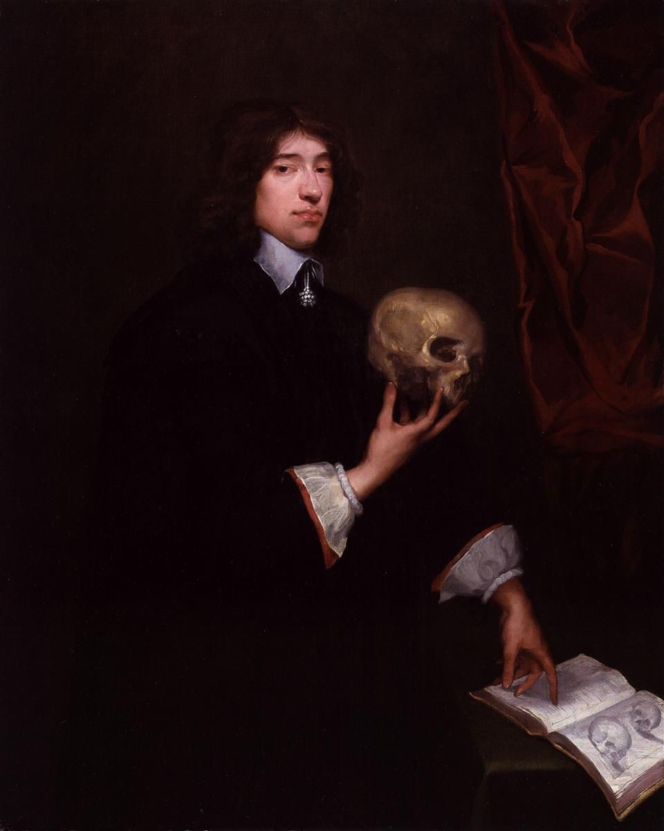
Sir William Petty FRS (26 May 1623 – 16 December 1687) was an English economist, physician, scientist and philosopher. He first became prominent serving Oliver Cromwell and the Commonwealth in Ireland. He developed efficient methods to survey the land that was to be confiscated and given to Cromwell's soldiers. He also remained a significant figure under King Charles II and King James II, as did many others who had served Cromwell. Petty was also a scientist, inventor, and merchant, a charter member of the Royal Society, and briefly a Member of the Parliament of England. However, he is best remembered for his theories on economics and his methods of ''political arithmetic''. He is attributed with originating the laissez-faire economic philosophy. He was knighted in 1661. He was the great-grandfather of the 1st Marquess of Lansdowne (better known to history as the 2nd Earl of Shelburne), who served as Prime Minister of Great Britain, 1782–1783. Life Early life Petty ... [...More Info...] [...Related Items...] OR: [Wikipedia] [Google] [Baidu] |
Townland
A townland ( ga, baile fearainn; Ulster-Scots: ''toonlann'') is a small geographical division of land, historically and currently used in Ireland and in the Western Isles in Scotland, typically covering . The townland system is of Gaelic origin, pre-dating the Norman invasion, and most have names of Irish origin. However, some townland names and boundaries come from Norman manors, plantation divisions, or later creations of the Ordnance Survey.Connolly, S. J., ''The Oxford Companion to Irish History, page 577. Oxford University Press, 2002. ''Maxwell, Ian, ''How to Trace Your Irish Ancestors'', page 16. howtobooks, 2009. The total number of inhabited townlands in Ireland was 60,679 in 1911. The total number recognised by the Irish Place Names database as of 2014 was 61,098, including uninhabited townlands, mainly small islands. Background In Ireland a townland is generally the smallest administrative division of land, though a few large townlands are further divided into h ... [...More Info...] [...Related Items...] OR: [Wikipedia] [Google] [Baidu] |


