|
Khoridol Saridag Mountains
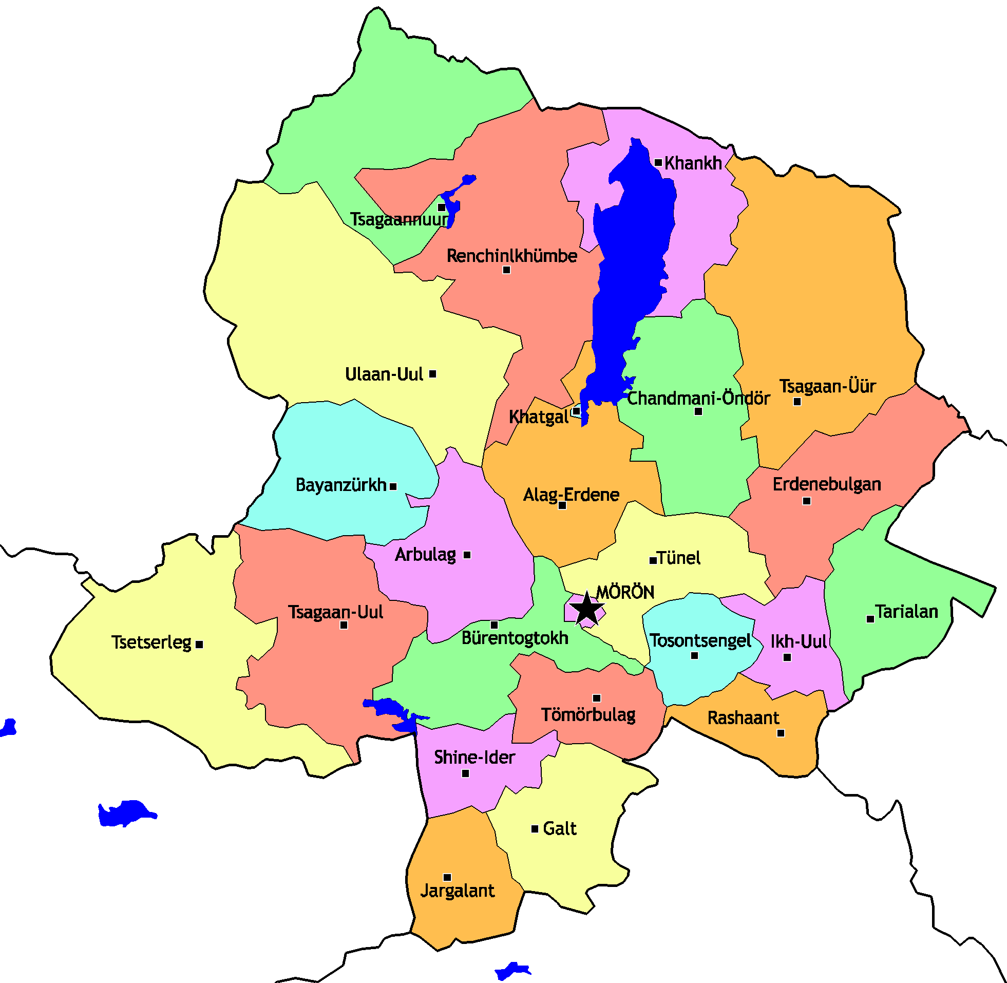
The Khoridol Saridag mountains ( mn, Хорьдол Сарьдагийн нуруу, ''Khoridol Saridagiin nuruu'') are a 150 km-long mountain range in Khövsgöl Province, Khövsgöl aimag, Mongolia, between Khövsgöl nuur and the Darkhad valley. The range covers parts of the Renchinlkhümbe, Khövsgöl, Renchinlkhümbe, Ulaan-Uul, Khövsgöl, Ulaan-Uul and Alag-Erdene, Khövsgöl, Alag-Erdene sums of Mongolia, sums. The highest peak is Delgerkhaan Uul (3093m), two other notable peaks are Ikh Uul (2961m) and Uran Dösh Uul (2702m) on the shores of Khövsgöl nuur. The mountains along the lake are rich in phosphorite, and in the 1980s extensive exploration work was done for open-pit mining. Roads built during that time and other remains, are still visible all over the area. However, due to the political and economic changes of the early 1990s in Mongolia and Russia, those projects were cancelled. In 1997, a protected area covering 1886 km2 was founded. References *M ... [...More Info...] [...Related Items...] OR: [Wikipedia] [Google] [Baidu] |
Khövsgöl Province
Khövsgöl ( mn, Хөвсгөл) is the northernmost of the 21 aimags (provinces) of Mongolia. The name is derived from Lake Khövsgöl. Geography and history The round-topped Tarvagatai, Bulnain and Erchim sub-ranges of the Khangai massif dominate the south and southwest of the largely mountainous province, and north and west of Lake Khövsgöl, lie the alpine Khoridol Saridag, Ulaan Taiga, and Mönkh Saridag mountains. The center and eastern parts of the province are less mountainous, but still hilly. The region is well known in Mongolia for its natural environment, and Lake Khövsgöl is one of the country's major tourist attractions. The largest forests of Mongolia are located around and to the north of the lake, extending the South Siberian taiga. The aimag was founded in 1931. Khatgal was the administrative center until 1933; since then it has been Mörön. Population The region is home to many ethnic minority groups: Darkhad, Khotgoid, Uriankhai, Buriad, and Tsaat ... [...More Info...] [...Related Items...] OR: [Wikipedia] [Google] [Baidu] |
Mongolia
Mongolia; Mongolian script: , , ; lit. "Mongol Nation" or "State of Mongolia" () is a landlocked country in East Asia, bordered by Russia to the north and China to the south. It covers an area of , with a population of just 3.3 million, making it the world's most sparsely populated sovereign nation. Mongolia is the world's largest landlocked country that does not border a closed sea, and much of its area is covered by grassy steppe, with mountains to the north and west and the Gobi Desert to the south. Ulaanbaatar, the capital and largest city, is home to roughly half of the country's population. The territory of modern-day Mongolia has been ruled by various nomadic empires, including the Xiongnu, the Xianbei, the Rouran, the First Turkic Khaganate, and others. In 1206, Genghis Khan founded the Mongol Empire, which became the largest contiguous land empire in history. His grandson Kublai Khan conquered China proper and established the Yuan dynasty. After the co ... [...More Info...] [...Related Items...] OR: [Wikipedia] [Google] [Baidu] |
Khövsgöl Nuur
Khövsgöl may refer to several locations in Mongolia: *Lake Khövsgöl *Khövsgöl Province Khövsgöl ( mn, Хөвсгөл) is the northernmost of the 21 aimags (provinces) of Mongolia. The name is derived from Lake Khövsgöl. Geography and history The round-topped Tarvagatai, Bulnain and Erchim sub-ranges of the Khangai massif dom ... * Khövsgöl sum, in Dornogovi Province {{geodis ... [...More Info...] [...Related Items...] OR: [Wikipedia] [Google] [Baidu] |
Darkhad Valley
The Darkhad Valley ( mn, Дархадын хотгор, transl.: ''Darhadyn hotgor'') is a large valley in northwestern Khövsgöl aimag, Mongolia. It is situated between the Ulaan Taiga and Khoridol Saridag ranges at an altitude of about 1600 m, about 160 km long and 40 km wide. The area is 4270 km². It was transferred from the People's Republic of Tannu Tuva to the Mongolian People's Republic in 1925 as a Soviet concession to the Mongolians, who had wanted to incorporate the territory of Tannu Uriankhai into their country. The valley is rich in lakes and rivers, the biggest of which are Dood Tsagaan Lake and Shishged River, respectively. The area is noted for its natural environment, but relatively remote and inaccessible even by Mongolian standards. The Darkhad valley is divided between the Ulaan-Uul, Renchinlkhümbe, and Tsagaannuur '' sums''. Inhabitants are mainly Darkhad The Darkhad, Darqads,. Dalhut, or Darhut ( Mongolian for "Untouchables", "Pr ... [...More Info...] [...Related Items...] OR: [Wikipedia] [Google] [Baidu] |
Ulaan-Uul, Khövsgöl
Ulaan-Uul ( mn, Улаан-Уул = ''red mountain'') is a sum of Khövsgöl aimag. The area is close to 10,000 km2. In 2000, Ulaan-Uul had a population of 3,726 people, mainly Darkhad. The sum center, officially named ''Tögöl'' ( mn, Төгөл), is located 171 km north-north-west of Mörön and 942 km from Ulaanbaatar. History The Ulaan-Uul sum was formed from the bigger part of Bayanzürkh sum in 1933. From 1956 to 1990, it was the seat of the Jargalant Amidral negdel. Economy In 2004, there were about 72,000 heads of livestock, among them 23,000 goats, 24,000 sheep, 17,000 cattle, yaks, and khainags, 7,000 horses, and 216 camels. Interesting Places This sum co ...[...More Info...] [...Related Items...] OR: [Wikipedia] [Google] [Baidu] |
Alag-Erdene, Khövsgöl
Alag-Erdene ( mn, Алаг-Эрдэнэ, translation=variegated gem) is a sum (district) of Khövsgöl aimag (province). The area is about 4,500 km², of which 1,460 km² are forest, and 2,760 km² are pasture. In 2005, the sum had 2992 inhabitants, including some Darkhad, Khotogoid, and Uriankhai. The center, officially named ''Mankhan'' ( mn, Манхан) is situated close to the road from Mörön to Khatgal, 62 km north of Mörön and 733 kilometers from Ulaanbaatar. History The Alag-Erdene sum was founded, together with the whole Khövsgöl aimag, in 1931. In 1933, it had about 3,400 inhabitants in 1006 households, and about 82,000 heads of livestock. In 1942, two bags were transferred to Renchinlkhümbe, in 1952 two other bags became part of Tünel sum. In 1956, three bags were transferred from Büren sum, together with the Khögjil negdel. Economy In 2004, there were roughly 76,000 heads of livestock, among them 26,000 sheep, 36,000 goats, 11, ... [...More Info...] [...Related Items...] OR: [Wikipedia] [Google] [Baidu] |
Sums Of Mongolia
A district ( mn, сум, , , ; "arrow"), is a second level administrative subdivision of Mongolia. The 21 Provinces of Mongolia are divided into 331 districts.Montsame News Agency. ''Mongolia''. 2006, Foreign Service office of Montsame News Agency, , p. 46 On average, each district administers a territory of with about 5,000 inhabitants, primarily nomadic herders. Its total revenue is 120 million Mongolian tögrög, Tögrög, 90% of which comes from national subsidies. Each district is again subdivided into ''bags'' (brigades; sometimes spelled ''baghs''). Most bags are of an entirely virtual nature. Their purpose is to sort the families of nomads in the district into groups, without a permanent human settlement. Officially, and occasionally on maps, many district seats (sum centers) bear a name different from that of the district. However, in practice the district seat (sum center) is most often referred to under the name of the district, to the point of the official name ... [...More Info...] [...Related Items...] OR: [Wikipedia] [Google] [Baidu] |
Phosphorite
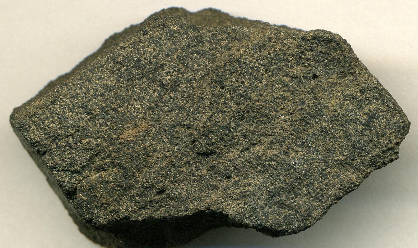
Phosphorite, phosphate rock or rock phosphate is a non-detrital sedimentary rock that contains high amounts of phosphate minerals. The phosphate content of phosphorite (or grade of phosphate rock) varies greatly, from 4% to 20% phosphorus pentoxide (P2O5). Marketed phosphate rock is enriched ("beneficiated") to at least 28%, often more than 30% P2O5. This occurs through washing, screening, de-liming, magnetic separation or flotation. By comparison, the average phosphorus content of sedimentary rocks is less than 0.2%.Blatt, Harvey and Robert J. Tracy, ''Petrology'', Freeman, 1996, 2nd ed. pp. 345–349 The phosphate is present as fluorapatite Ca5(PO4)3F typically in cryptocrystalline masses (grain sizes < 1 μm) referred to as -sedimentary apatite deposits of uncertain origin. It is also present as |
Russia
Russia (, , ), or the Russian Federation, is a List of transcontinental countries, transcontinental country spanning Eastern Europe and North Asia, Northern Asia. It is the List of countries and dependencies by area, largest country in the world, with its internationally recognised territory covering , and encompassing one-eighth of Earth's inhabitable landmass. Russia extends across Time in Russia, eleven time zones and shares Borders of Russia, land boundaries with fourteen countries, more than List of countries and territories by land borders, any other country but China. It is the List of countries and dependencies by population, world's ninth-most populous country and List of European countries by population, Europe's most populous country, with a population of 146 million people. The country's capital and List of cities and towns in Russia by population, largest city is Moscow, the List of European cities by population within city limits, largest city entirely within E ... [...More Info...] [...Related Items...] OR: [Wikipedia] [Google] [Baidu] |


