|
Kerschenbach
Kerschenbach is an ''Ortsgemeinde'' – a municipality belonging to a ''Verbandsgemeinde'', a kind of collective municipality – in the Vulkaneifel district in Rhineland-Palatinate, Germany. It belongs to the ''Verbandsgemeinde'' of Gerolstein, whose seat is in the municipality of Gerolstein. Geography The municipality lies in the Vulkaneifel, a part of the Eifel known for its volcanic history, geographical and geological features, and even ongoing activity today, including gases that sometimes well up from the earth. Kerschenbach sits at an elevation of 550 m above sea level, and has an area of 691 ha. In the north, it borders on the state of North Rhine-Westphalia. History When Kerschenbach came into being is lost in the mists of time. The placename ending ''—bach'' points to beginnings in the time of the clearings in the Eifel, putting them in the 12th century. The name “Kerschenbach” is closely tied to the like-named brook. In the 17th and 18th centurie ... [...More Info...] [...Related Items...] OR: [Wikipedia] [Google] [Baidu] |
Vulkaneifel
Vulkaneifel () is a district (''Kreis'') in the northwest of the state Rhineland-Palatinate, Germany. It is the least densely populated district in the state and the fourth most sparsely populated district in Germany. The administrative centre of the district is in Daun. Neighboring districts are Euskirchen (North Rhine-Westphalia), Ahrweiler, Mayen-Koblenz, Cochem-Zell, Bernkastel-Wittlich, and Bitburg-Prüm. Location The county of Vulkaneifel lies in the western part of the eponymous region which lies at heights between 150 and 700 metres above sea level. As a result of former volcanism numerous mineral springs (''Sauerbrunnen'') have formed. The Kyll flows through the county from north to south. The German Wildlife Route and the German Volcano Route also cross the county as does the Eifelsteig hiking trail. History The district was created in 1815 when the Eifel became part of Prussia. As most of the local industries had their traditional markets in France, the distri ... [...More Info...] [...Related Items...] OR: [Wikipedia] [Google] [Baidu] |
Gerolstein (Verbandsgemeinde)
Gerolstein is a ''Verbandsgemeinde'' ("collective municipality") in the district Vulkaneifel, in Rhineland-Palatinate, Germany. The seat of the ''Verbandsgemeinde'' is in Gerolstein. On 1 January 2019 it was expanded with the municipalities of the former ''Verbandsgemeinden'' Hillesheim and Obere Kyll. The ''Verbandsgemeinde'' Gerolstein consists of the following ''Ortsgemeinden'' ("local municipalities"): # Basberg # Berlingen # Berndorf #Birgel #Birresborn #Densborn # Dohm-Lammersdorf #Duppach # Esch # Feusdorf #Gerolstein #Gönnersdorf #Hallschlag #Hillesheim #Hohenfels-Essingen #Jünkerath # Kalenborn-Scheuern #Kerpen #Kerschenbach # Kopp #Lissendorf # Mürlenbach # Neroth #Nohn # Oberbettingen # Oberehe-Stroheich #Ormont #Pelm # Reuth #Rockeskyll #Salm #Scheid #Schüller #Stadtkyll #Steffeln # Üxheim # Walsdorf #Wiesbaum Wiesbaum is an '' Ortsgemeinde'' – a municipality belonging to a ''Verbandsgemeinde'', a kind of collective municipality � ... [...More Info...] [...Related Items...] OR: [Wikipedia] [Google] [Baidu] |
Ortsgemeinde (Germany)
A Verbandsgemeinde (; plural Verbandsgemeinden) is a low-level administrative unit in the German federal states of Rhineland-Palatinate and Saxony-Anhalt. A Verbandsgemeinde is typically composed of a small group of villages or towns. Rhineland-Palatinate The state of Rhineland-Palatinate is divided into 163 Verbandsgemeinden, which are municipal associations grouped within the 24 districts of the state and subdivided into 2,257 Ortsgemeinden (singular Ortsgemeinde) which comprise single settlements. Most of the Verbandsgemeinden were established in 1969. Formerly the name for an administrative unit was ''Amt''. Most of the functions of municipal government for several municipalities are consolidated and administered centrally from a larger or more central town or municipality among the group, while the individual municipalities (Ortsgemeinden) still maintain a limited degree of local autonomy. Saxony-Anhalt The 11 districts of Saxony-Anhalt are divided into ''Verwaltungsgemein ... [...More Info...] [...Related Items...] OR: [Wikipedia] [Google] [Baidu] |
Westerwaldkreis
The Westerwaldkreis ("District of Westerwald") is a district (''Kreis'') in the north-east of Rhineland-Palatinate, Germany. Neighbouring districts are (from north clockwise) Altenkirchen, Lahn-Dill, Limburg-Weilburg, Rhein-Lahn, the district-free city Koblenz, Mayen-Koblenz and Neuwied. History When the area became part of Prussia in 1866 two districts covering the area were created. The northern part was covered by the Oberwesterwaldkreis with capital in Marienberg, the Unterwesterwaldkreis with capital in Montabaur covering the southern part. 1886 a third district was added with the Westerburg district with area from both of the other two districts. In 1932 the districts structure was reformed again, the Oberwesterwaldkreis and the Westerburg district were merged to a new Oberwesterwaldkreis with capital in Westerburg. In 1974 in another reform the districts Oberwesterwaldkreis and Unterwesterwaldkreis were merged to form the Westerwaldkreis. Together with the neighboring Rhein- ... [...More Info...] [...Related Items...] OR: [Wikipedia] [Google] [Baidu] |
Archdiocese Of Cologne
The Archdiocese of Cologne ( la, Archidioecesis Coloniensis; german: Erzbistum Köln) is an archdiocese of the Catholic Church in western North Rhine-Westphalia and northern Rhineland-Palatinate in Germany. History The Electorate of Cologne—not to be confused with the larger Archdiocese of Cologne—was one of the major ecclesiastical principalities of the Holy Roman Empire. The city of Cologne as such became a free city in 1288 and the archbishop eventually moved his residence from Cologne Cathedral to Bonn to avoid conflicts with the Free City, which escaped his jurisdiction. After 1795, the archbishopric's territories on the left bank of the Rhine were occupied by France, and were formally annexed in 1801. The Reichsdeputationshauptschluss of 1803 secularized the rest of the archbishopric, giving the Duchy of Westphalia to the Landgraviate of Hesse-Darmstadt. As an ecclesial government, however, the archdiocese remained (more or less) intact: while she lost the left ba ... [...More Info...] [...Related Items...] OR: [Wikipedia] [Google] [Baidu] |
Diocese Of Liège
In church governance, a diocese or bishopric is the ecclesiastical district under the jurisdiction of a bishop. History In the later organization of the Roman Empire, the increasingly subdivided provinces were administratively associated in a larger unit, the diocese (Latin ''dioecesis'', from the Greek term διοίκησις, meaning "administration"). Christianity was given legal status in 313 with the Edict of Milan. Churches began to organize themselves into dioceses based on the civil dioceses, not on the larger regional imperial districts. These dioceses were often smaller than the provinces. Christianity was declared the Empire's official religion by Theodosius I in 380. Constantine I in 318 gave litigants the right to have court cases transferred from the civil courts to the bishops. This situation must have hardly survived Julian, 361–363. Episcopal courts are not heard of again in the East until 398 and in the West in 408. The quality of these courts was l ... [...More Info...] [...Related Items...] OR: [Wikipedia] [Google] [Baidu] |
Sarre (department)
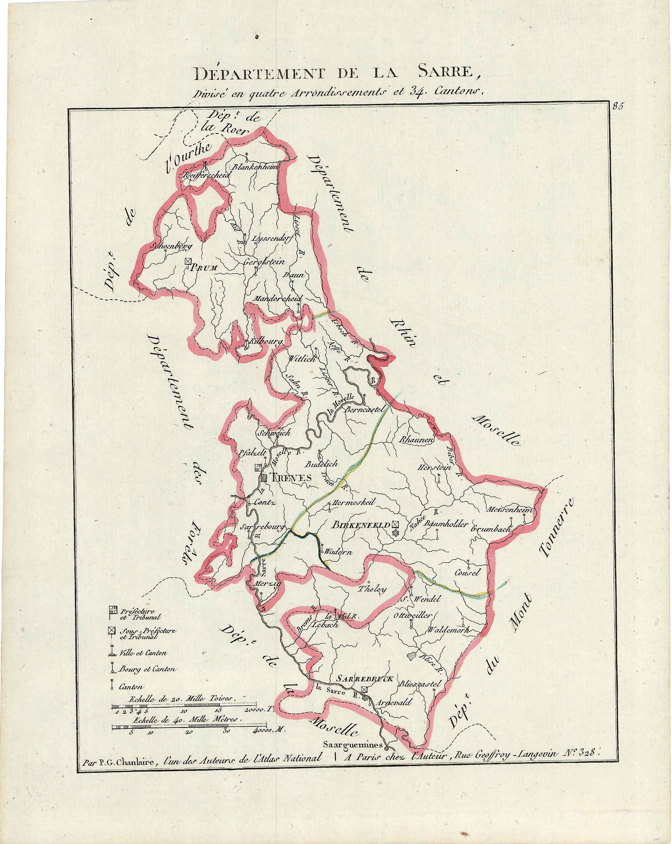
Sarre was a department in the First French Republic and First French Empire. Its territory is now part of Germany and Belgium. Named after the river Saar (french: Sarre), it was created in 1798 in the aftermath of the Treaty of Campo Formio of 18 October 1797 which ceded the left bank of the Rhine to France. Despite its name it covered a much larger area than the historical area known as the Saarland. Prior to the French occupation of the area from 1793 onward, its territory had been divided between the Electorate of Trier, Nassau-Saarbrücken and the Electorate of the Palatinate (the Duchy of Zweibrücken and the County of Veldenz). Its territory is now part of the German states Rhineland-Palatinate and Saarland as well as a tiny adjacent section of the Belgian province of Liège. Its capital was Trier. The department was subdivided into the following arrondissements and cantons (situation in 1812): [...More Info...] [...Related Items...] OR: [Wikipedia] [Google] [Baidu] |
Ourthe (department)
Ourthe (, nl, Ourte, german: Urt) was a department of the French First Republic and French First Empire in present-day Belgium and Germany. It was named after the river Ourthe (Oûte). Its territory corresponded more or less with that of the present-day Belgian province of Liège and a small adjacent region in North Rhine-Westphalia in Germany. It was created on 1 October 1795, when the Austrian Netherlands and the Prince-Bishopric of Liège were officially annexed by the French Republic. Before this annexation, the territory included in the department had lain partly in the Bishopric of Liège, the Abbacy of Stavelot-Malmedy, the Duchies of Limburg and Luxembourg, and the County of Namur. After Napoleon was defeated in 1814, most of the department became part of the United Kingdom of the Netherlands as the province of Liège. The easternmost part (Eupen, Malmedy, Sankt Vith, Kronenburg, Schleiden) became part of the Prussian Rhine Province; part of this (Eupen, Malmedy and Sa ... [...More Info...] [...Related Items...] OR: [Wikipedia] [Google] [Baidu] |
France
France (), officially the French Republic ( ), is a country primarily located in Western Europe. It also comprises of Overseas France, overseas regions and territories in the Americas and the Atlantic Ocean, Atlantic, Pacific Ocean, Pacific and Indian Oceans. Its Metropolitan France, metropolitan area extends from the Rhine to the Atlantic Ocean and from the Mediterranean Sea to the English Channel and the North Sea; overseas territories include French Guiana in South America, Saint Pierre and Miquelon in the North Atlantic, the French West Indies, and many islands in Oceania and the Indian Ocean. Due to its several coastal territories, France has the largest exclusive economic zone in the world. France borders Belgium, Luxembourg, Germany, Switzerland, Monaco, Italy, Andorra, and Spain in continental Europe, as well as the Kingdom of the Netherlands, Netherlands, Suriname, and Brazil in the Americas via its overseas territories in French Guiana and Saint Martin (island), ... [...More Info...] [...Related Items...] OR: [Wikipedia] [Google] [Baidu] |
Plague (disease)
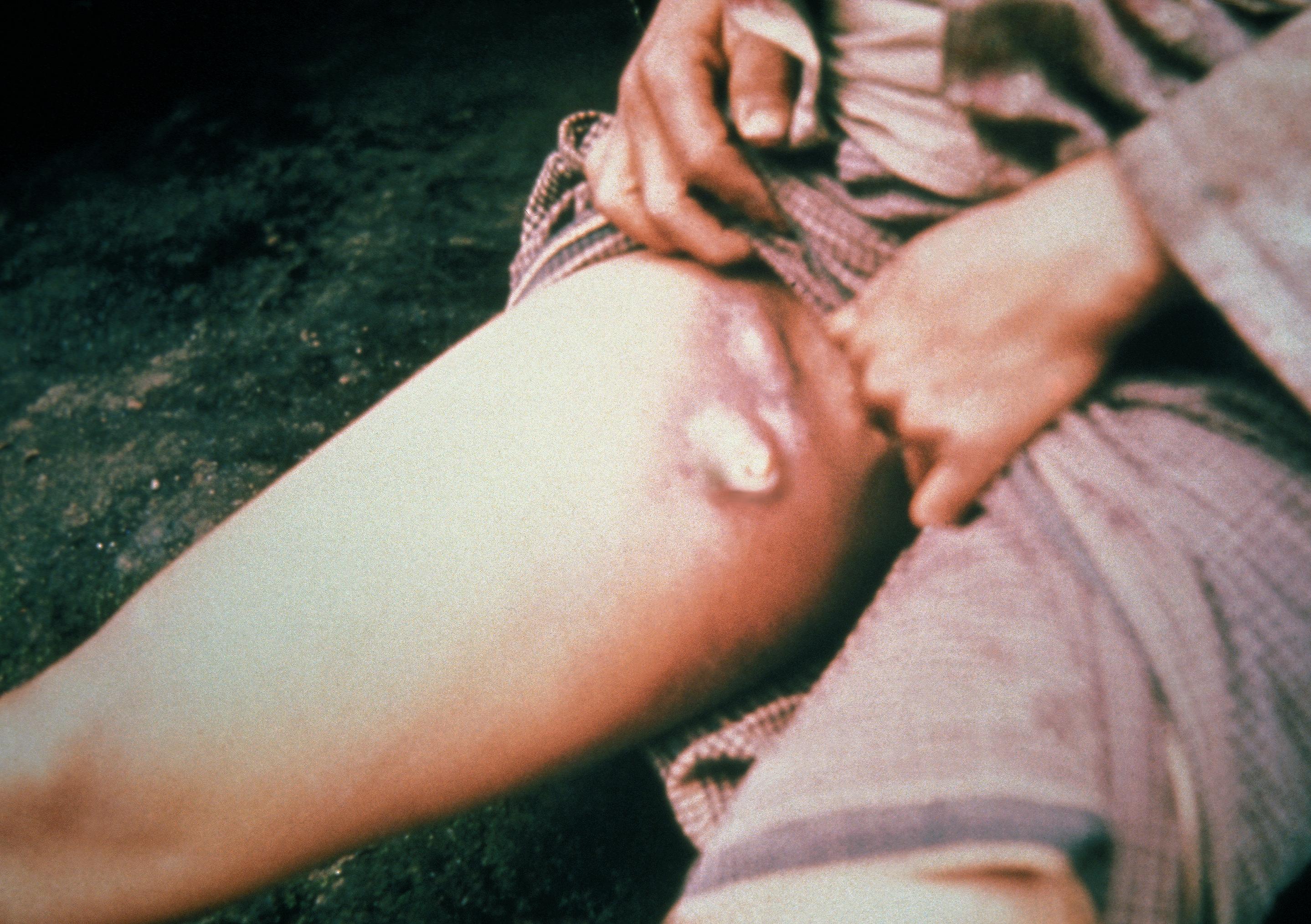
Plague is an infectious disease caused by the bacterium ''Yersinia pestis''. Symptoms include fever, weakness and headache. Usually this begins one to seven days after exposure. There are three forms of plague, each affecting a different part of the body and causing associated symptoms. Pneumonic plague infects the lungs, causing shortness of breath, coughing and chest pain; bubonic plague affects the lymph nodes, making them swell; and septicemic plague infects the blood and can cause tissues to turn black and die. The bubonic and septicemic forms are generally spread by flea bites or handling an infected animal, whereas pneumonic plague is generally spread between people through the air via infectious droplets. Diagnosis is typically by finding the bacterium in fluid from a lymph node, blood or sputum. Those at high risk may be vaccinated. Those exposed to a case of pneumonic plague may be treated with preventive medication. If infected, treatment is with antibiotic ... [...More Info...] [...Related Items...] OR: [Wikipedia] [Google] [Baidu] |
High Eifel
The High Eifel (german: Hocheifel (Ost) or ''Hohe Eifel'') forms part of the Eifel Mountains in the German state of Rhineland-Palatinate. The landscape here between Adenau, Mendig and Daun rises to a height of 747 m. The region is not to be confused with the western ''Hocheifel'', better known as the Schnee Eifel. Nürburg Castle and the famous Nürburgring racing track are located in the northwest of the area. Climate Despite being between 600 m and 700 m high the High Eifel lies in the rain shadow of the Schneifel to the west. Its annual precipitation lies between 800 mm and 1000 mm. Mountains/castles * Hohe Acht (747 m) * Nürburg Castle (678 m) * Hochkelberg (675 m) * Dreiser Höhe (611 m) See also * Maifeld * Pellenz * Vordereifel * Vulkan Eifel The Volcanic Eifel or Vulkan Eifel (german: Vulkaneifel) is a region in the Eifel Mountains in Germany that is defined to a large extent by its volcanic geological history. Characteristic of thi ... [...More Info...] [...Related Items...] OR: [Wikipedia] [Google] [Baidu] |
Witch-hunt
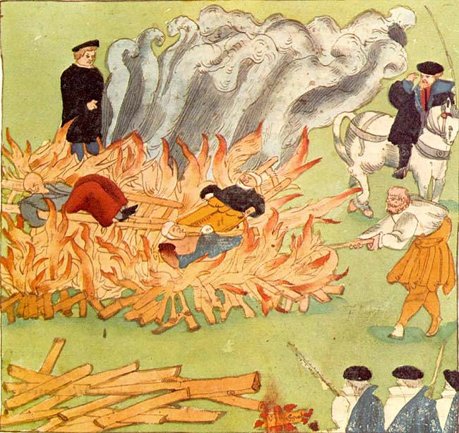
A witch-hunt, or a witch purge, is a search for people who have been labeled witches or a search for evidence of witchcraft. The Witch trials in the early modern period, classical period of witch-hunts in Early Modern Europe and European Colonization of the Americas, Colonial America took place in the Early Modern period or about 1450 to 1750, spanning the upheavals of the Protestant Reformation, Reformation and the Thirty Years' War, resulting in an estimated 35,000 to 50,000 executions. The last executions of people convicted as witches in Europe took place in the 18th century. In other regions, like Africa and Asia, contemporary witch-hunts have been reported from sub-Saharan Africa and Papua New Guinea, and official legislation against witchcraft is still found in Saudi Arabia and Cameroon today. In current language, "witch-hunt" metaphorically means an investigation that is usually conducted with much publicity, supposedly to uncover subversive activity, disloyalty, a ... [...More Info...] [...Related Items...] OR: [Wikipedia] [Google] [Baidu] |


