|
Keewong Parish
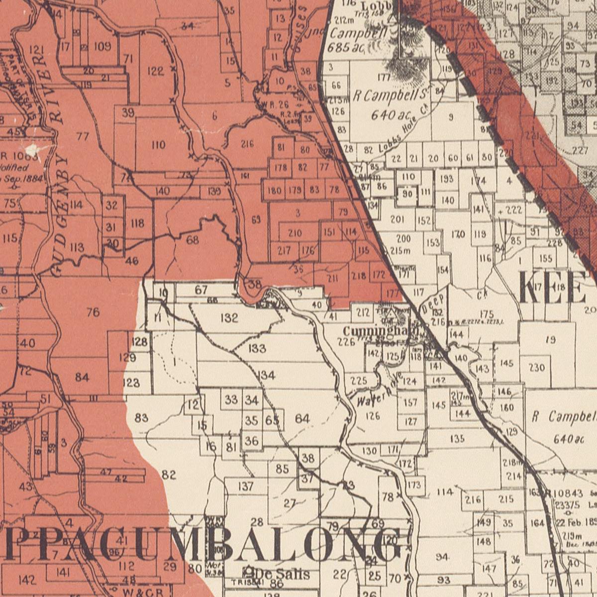
Keewong Parish is a parish of Murray County, New South Wales, a Cadastral divisions of New South Wales, cadastral unit for use on land titles. A small part of the north-western end of the parish around between the Murrumbidgee River and the Queanbeyan-Cooma railway line was transferred to the Australian Capital Territory in 1909. The southern ends of portions 177, 218, 211, 36, and 38 in the Parish of Keewong form part of the border of the ACT with New South Wales, which is mentioned in the ''Seat of Government Acceptance Act 1909, Seat of Government Acceptance Act of 1909''. Austlii Part of the parish still is located on the eastern side of the Murrumbidgee. Waterhole creek is the south-west ... [...More Info...] [...Related Items...] OR: [Wikipedia] [Google] [Baidu] |
Murray County, New South Wales
Murray County was one of the original Nineteen Counties in New South Wales and is now one of the 141 Lands administrative divisions of New South Wales. It included the area which is now part of Canberra and as far north as Lake George (New South Wales), Lake George and Yass, New South Wales, Yass. It was originally bounded on the west by the Murrumbidgee River, on the east by the Shoalhaven River and on the north by the Yass River. A large area of the county was transferred to the Commonwealth government in 1909 in the Seat of Government Acceptance Act 1909, Seat of Government Acceptance Act to make part of the Australian Capital Territory, along with land in Cowley County, New South Wales, Cowley County. Since then, the ACT border is now part of the western boundary. Part of the ACT border is determined by property boundaries in the Parish of Keewong, in the County of Murray; specifically the southern end of portions 177, 218, 211, 36, and 38. This is mentioned in the Seat o ... [...More Info...] [...Related Items...] OR: [Wikipedia] [Google] [Baidu] |
Gigerline Parish
Gigerline Parish was a former parish of Murray County, New South Wales, a cadastral unit for use on land titles. It was formed in the nineteenth century and existed until 1 January 1911, when the Seat of Government (Administration) Act 1910 came into force, after the land was transferred to the Commonwealth government in 1909 to be used to form the Australian Capital Territory. It included what are now the southernmost Canberra suburbs of Banks, Conder, and Gordon, with the northern boundary near Tuggeranong Hill. It was bounded by the Murrumbidgee River in the west and Guises Creek in the south and south-east. It is one of the four former parishes of Murray County which became part of the ACT, along with Canberra, Narrabundah Narrabundah () ( postcode: 2604) is a leafy, medium density suburb of Canberra, Australian Capital Territory, located in the inner south of the city. Narrabundah is an established garden suburb, valued for its equal proximity to both Civic ... [...More Info...] [...Related Items...] OR: [Wikipedia] [Google] [Baidu] |
Burra Parish, Murray
Burra is an Australian locality of rural smallholdings lying 20 kilometres to the south of Queanbeyan, New South Wales in the Queanbeyan-Palerang Region. At the , Burra had a population of 790 people. History The Ngarigo people originally inhabited Burra as part of their wider country lands extending south to the Australian Alps. The first European camp was called 'The Creek' although it soon became known amongst the early settlers as "The Burra", possibly from a local aboriginal word (for instance, the Ngarigo word "berra", meaning boomerang). The first grazing and clearing of the area began in the 1830-60s and farms in the Burra Valley were established at the Warm Corner, KT Park, Burra Station (the original 'creek' station), London Bridge and Lagoon. By the 1920s the local population had become large enough to support two competing cricket clubs, one at the Burra park, the other near Urila. Subdivision into smaller blocks began in the 1960s as Canberra's population expanded an ... [...More Info...] [...Related Items...] OR: [Wikipedia] [Google] [Baidu] |
