|
Keele Station
Keele is a subway station on Line 2 Bloor–Danforth of the Toronto subway in Toronto, Ontario, Canada. It is located just north of Bloor Street West on the east side of Keele Street. The station opened in 1966, and was the western terminus of the line until 1968. Wi-Fi service is available at this station. History When the Bloor–Danforth line was opened in 1966 from Keele to Woodbine station, the Bloor streetcar line was dramatically shortened. It now traveled east from Jane Loop only as far as Keele Station; at the eastern end of the line, a separate Danforth streetcar was established, from Woodbine station to Luttrell Loop. On 11 May 1968, the Bloor and Danforth streetcars were both eliminated when the subway extensions west to and east to were opened. During this initial two-year period the trolleybuses and streetcars serving the station used separate loops (both within the fare-paid area), one near each of the station's entrances, so that passengers transferring between s ... [...More Info...] [...Related Items...] OR: [Wikipedia] [Google] [Baidu] |
Toronto
Toronto ( ; or ) is the capital city of the Canadian province of Ontario. With a recorded population of 2,794,356 in 2021, it is the most populous city in Canada and the fourth most populous city in North America. The city is the anchor of the Golden Horseshoe, an urban agglomeration of 9,765,188 people (as of 2021) surrounding the western end of Lake Ontario, while the Greater Toronto Area proper had a 2021 population of 6,712,341. Toronto is an international centre of business, finance, arts, sports and culture, and is recognized as one of the most multicultural and cosmopolitan cities in the world. Indigenous peoples have travelled through and inhabited the Toronto area, located on a broad sloping plateau interspersed with rivers, deep ravines, and urban forest, for more than 10,000 years. After the broadly disputed Toronto Purchase, when the Mississauga surrendered the area to the British Crown, the British established the town of York in 1793 and later designat ... [...More Info...] [...Related Items...] OR: [Wikipedia] [Google] [Baidu] |
Tunnel
A tunnel is an underground passageway, dug through surrounding soil, earth or rock, and enclosed except for the entrance and exit, commonly at each end. A pipeline is not a tunnel, though some recent tunnels have used immersed tube construction techniques rather than traditional tunnel boring methods. A tunnel may be for foot or vehicular road traffic, for rail traffic, or for a canal. The central portions of a rapid transit network are usually in the tunnel. Some tunnels are used as sewers or aqueducts to supply water for consumption or for hydroelectric stations. Utility tunnels are used for routing steam, chilled water, electrical power or telecommunication cables, as well as connecting buildings for convenient passage of people and equipment. Secret tunnels are built for military purposes, or by civilians for smuggling of weapons, contraband, or people. Special tunnels, such as wildlife crossings, are built to allow wildlife to cross human-made barriers safely. ... [...More Info...] [...Related Items...] OR: [Wikipedia] [Google] [Baidu] |
York University
York University (french: Université York), also known as YorkU or simply YU, is a public university, public research university in Toronto, Ontario, Canada. It is Canada's fourth-largest university, and it has approximately 55,700 students, 7,000 faculty and staff, and over 325,000 alumni worldwide. It has 11 faculties, including the Faculty of Liberal Arts and Professional Studies, Faculty of Science, Lassonde School of Engineering, Schulich School of Business, Osgoode Hall Law School, Glendon College, Faculty of Education, Faculty of Health, Faculty of Environmental and Urban Change, Faculty of Graduate Studies, School of the Arts, Media, Performance and Design, and 28 research centres. York University was established in 1959 as a non-denominational institution by the ''York University Act'', which received royal assent in the Legislative Assembly of Ontario on 26 March of that year. Its first class was held in September 1960 in Falconer Hall on the University of Toronto campu ... [...More Info...] [...Related Items...] OR: [Wikipedia] [Google] [Baidu] |
Blue Night Network
The Blue Night Network is the overnight public transit service operated by the Toronto Transit Commission (TTC) in Toronto, Ontario, Canada. The network consists of a basic grid of 27 bus and 4 streetcar routes, distributed so that almost all of the city is within 2 km of at least one route. It is the largest and most frequent night network in North America. Overview Hours The times of Blue Night service vary according to individual scheduling situations on each route. Most regular service bus and streetcar routes cease operations at approximately 1:30 a.m. If there is a Blue Night route on the same street, its first trip will then follow at a suitable interval after the last regular run. On the subway system, the last trains on each line make a complete trip; the last trains running east, west, and north from Bloor–Yonge and St. George stations each leave at 1:50 a.m. or just after. Each station then closes as the last train departs. In the morning, regul ... [...More Info...] [...Related Items...] OR: [Wikipedia] [Google] [Baidu] |
Steeles Avenue West
Steeles Avenue is an east–west street that forms the northern city limit of Toronto and the southern limit of York Region in Ontario, Canada. It stretches across the western and central Greater Toronto Area from Appleby Line in Milton in the west to the Toronto-Pickering city limits in the east, where it continues east into Durham Region as Taunton Road, which itself extends across the length of Durham Region to its boundary with Northumberland County. York Region refers to Steeles Avenue as Regional Road 95 but the designation is strictly internal and there are no signs posted; as the street was always owned and maintained by the City of Toronto (succeeding Metropolitan Toronto). Through Peel and Halton Regions, the street is signed as Peel Road 15 and Halton Road 8, respectively. The combination of Steeles and Taunton Road is the only arterial road to cross almost the entire Greater Toronto Area without breaks or turnoffs. History The street is named after Thoma ... [...More Info...] [...Related Items...] OR: [Wikipedia] [Google] [Baidu] |
Finch West Station
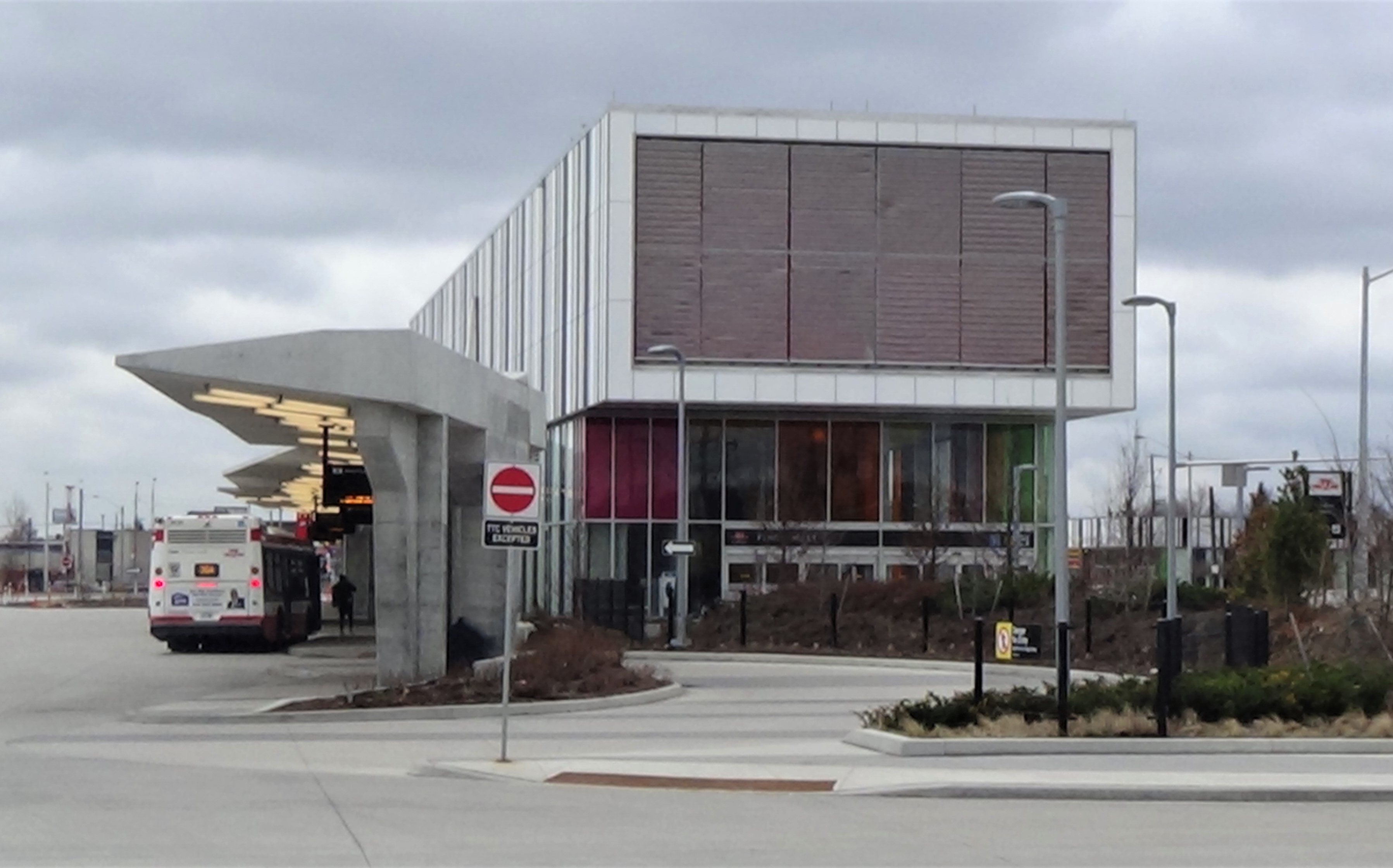
Finch West is a subway station on the Line 1 Yonge–University of the Toronto subway. It is located under Keele Street, north of Finch Avenue West. When Line 6 Finch West opens in 2023, it will serve as the eastern terminus of that line. Description The station is underground and parallel to Keele Street just north of Finch Avenue West. Nearby landmarks include Fountainhead Park. Industrial areas lie to the east, James Cardinal McGuigan Catholic High School to the west and York University is to the northwest, served by the next station north on the line. The main entrance is located on the east side of Keele Street with the secondary entrance on the west side. The main structure has a striped, bar-code cladding to decorate its exterior along with colourful tiling and windows. An elevated substation facility is on the second floor of the main building and overhangs the main entrance as a canopy. The main entrance is highlighted by a glowing panel attached to the canopy. There ... [...More Info...] [...Related Items...] OR: [Wikipedia] [Google] [Baidu] |
High Park Station
High Park is a subway station on Line 2 Bloor–Danforth of the Toronto subway in Toronto, Ontario, Canada. It is located just north of Bloor Street West, spanning the block east of Quebec Avenue to High Park Avenue. It opened in 1968 as part of the westerly extension from to Islington station. Wi-Fi service is available at this station. Station description The station is mostly underground, lying behind the properties which face on to the north side of Bloor Street. The main entrance is from Quebec Avenue at the westerly end of the surface bus transfer area, with the ticketing mezzanine one level below, above the east end of the train platforms. The station has escalators here, but despite having ramps at the street entrance it does not have elevators to provide access to the platforms for those with physical disabilities. A second entrance from High Park Avenue is at the east end of the bus platform, which is convenient for those needing to cross Bloor Street at the traffic li ... [...More Info...] [...Related Items...] OR: [Wikipedia] [Google] [Baidu] |
Albion Road (Toronto)
The following lists roads in Toronto, Ontario, Canada, that do not follow the city grid, often referred to as ''contour roads or diagonal roads''. They are listed by type of road, then alphabetically. Arterial roads Albion Road Albion Road was created as a private road for French teacher Jean du Petit Pont de la Haye (1799–1872) to his estate in the area (the plank road was built in 1846 by Weston Plank Road Company from Musson's Bridge over Humber River to Bolton). Originally called Claireville, it was renamed for the Albion Township, which was the eastern third of the present-day (since 1973/1974) limits of Caledon. The road is located within Toronto, starting at the intersection of Weston Road and Walsh Avenue (continues eastward as Wilson Avenue) and heads northwest to Albion Road and Steeles (becoming Regional Road 50). The beginning of the road is Walsh Avenue, a short connector between Albion Road and Wilson Avenue. The intersection at Weston Road and Walsh Aven ... [...More Info...] [...Related Items...] OR: [Wikipedia] [Google] [Baidu] |
Sherway Gardens
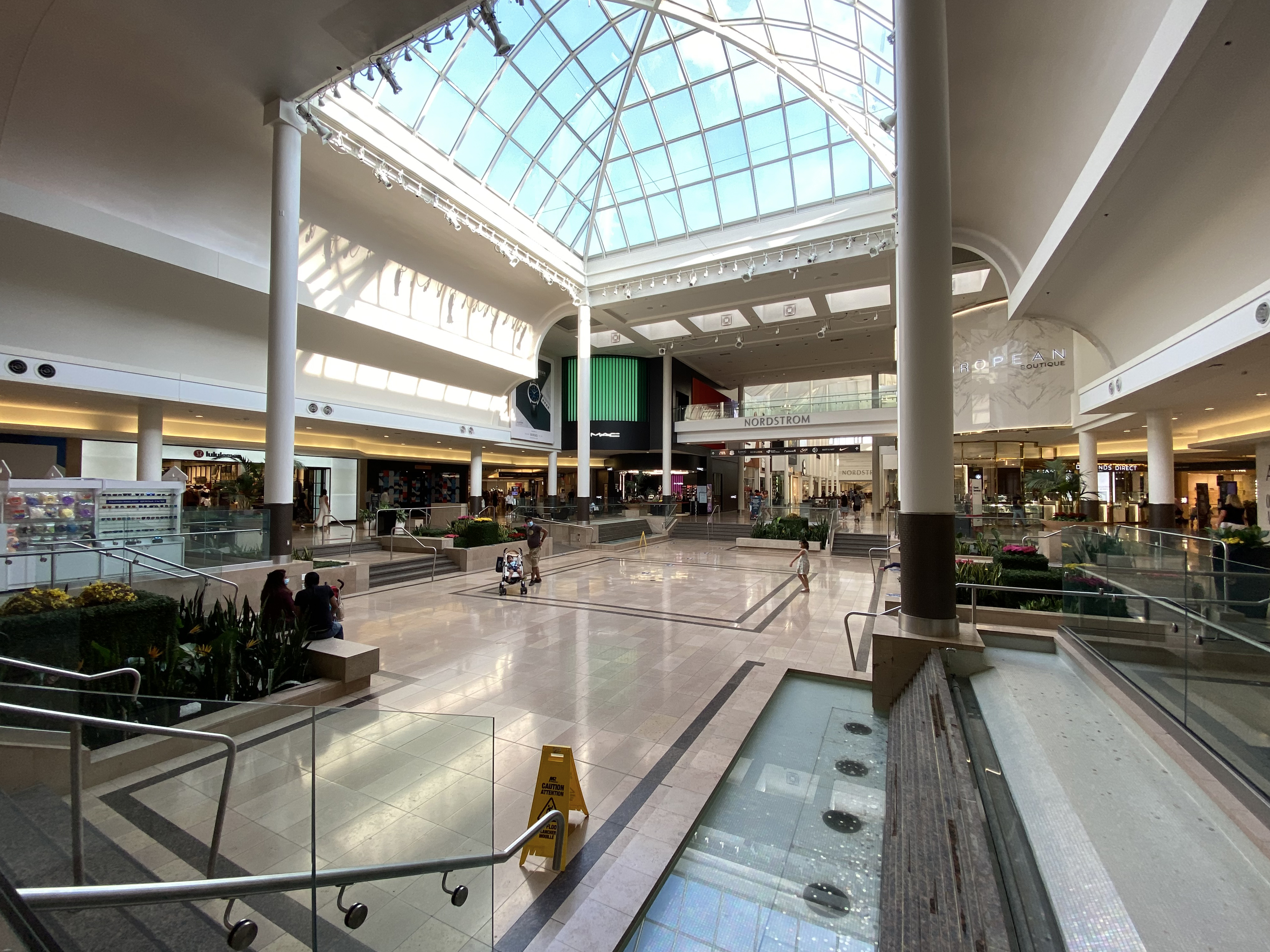
Sherway Gardens (corporately known as CF Sherway Gardens) is a large retail shopping mall in Toronto, Ontario, Canada. The mall is located west of Downtown Toronto, near the interchange of Highway 427 with the Queen Elizabeth Way and Gardiner Expressway. Opened in 1971, the mall originally covered in an S-shaped configuration and contained 127 stores. It was expanded in 1975, 1987, 1989, 2015, and 2017 to its current size of and 215 stores. It is the eighth largest mall in the Greater Toronto Area, and is the 18th largest mall in Canada. As the mall has grown, it has changed its mix of stores from a general mix of stores to add more fashion-conscious and luxury brand stores."Mall Wars: Yorkdale vs. Sherway: Inside the big-bucks ... [...More Info...] [...Related Items...] OR: [Wikipedia] [Google] [Baidu] |
Pioneer Village Station
Pioneer Village is a subway station on the Line 1 Yonge–University of the Toronto subway. It is located under the intersection of Northwest Gate and Steeles Avenue, at the city boundaries of Toronto and Vaughan, Ontario, Canada. A Toronto Transit Commission (TTC) bus terminal is connected to the southern portion of the station, and there is a regional bus terminal, the Pioneer Village Terminal, for connecting to York Region Transit (YRT) buses on the north side of Steeles Avenue. Pioneer Village, Highway 407 and Vaughan Metropolitan Centre stations are the first Toronto subway stations fully or partially located outside the Toronto city limits since its last amalgamation in 1998. Station name The station was initially expected to be named Steeles West. This followed the usual convention of TTC stations being named after cross streets, with ''West'' appended to station names on the northern section of the western branch of the line having counterparts along the eastern branch. I ... [...More Info...] [...Related Items...] OR: [Wikipedia] [Google] [Baidu] |
The Junction
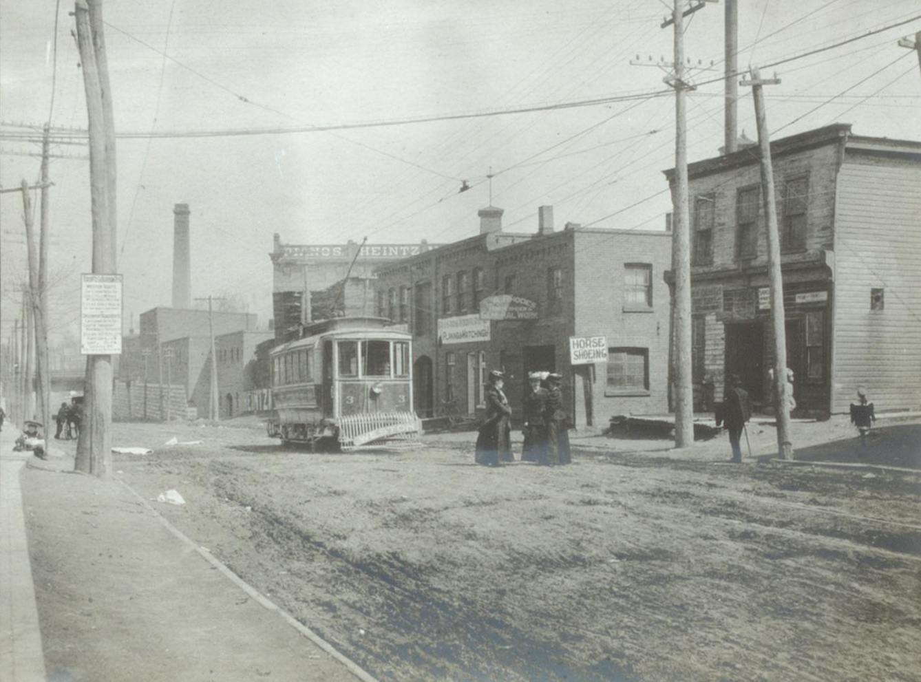
The Junction is a neighbourhood in Toronto, Ontario, Canada, that is near the West Toronto Diamond, a junction of four railway lines in the area. The neighbourhood was previously an independent city called West Toronto, that was also its own federal electoral district until amalgamating with the city of Toronto in 1909. The main intersection of the area is Dundas Street West and Keele Street. The Stockyards is the northeastern quadrant of the neighbourhood. History As with most Toronto neighbourhoods outside of the central downtown core, the area was primarily rural until the 1870s. John Scarlett was the first land owner and employer in the area and built his home "Runnymede" in 1838, near where Dundas Street West and St. John's Road meet today. By 1817 he had acquired most of property that is now the Junction and much more to the north and west to the Humber River. From 1857 to 1876 the Carlton Race Course dominated the southeast of the neighbourhood. The race track was own ... [...More Info...] [...Related Items...] OR: [Wikipedia] [Google] [Baidu] |
High Park
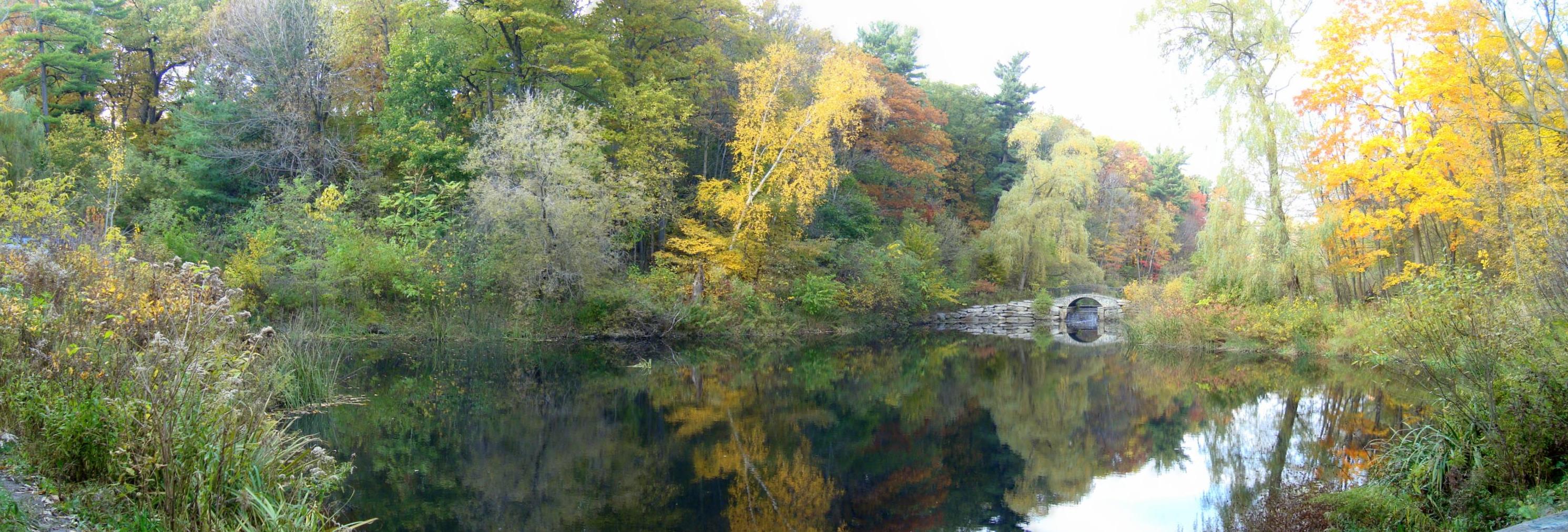
High Park is a municipal park in Toronto, Ontario, Canada. High Park is a mixed recreational and natural park, with sporting facilities, cultural facilities, educational facilities, gardens, playgrounds and a zoo. One-third of the park remains in a natural state, with a rare oak savannah ecology. High Park was opened to the public in 1876 and is based on a bequest of land from John George Howard to the City of Toronto. It spans and is the second-largest municipal park in Toronto, after Centennial Park. High Park is located to the west of downtown Toronto, north of Humber Bay, and is maintained by the City of Toronto Parks Department. It stretches south from Bloor Street West to The Queensway, just north of Lake Ontario. It is bounded on the west by Ellis Park Road and Grenadier Pond and on the east by Parkside Drive. Description The landscape in the park is hilly, with two deep ravines extending the full north-south distance of the park. Significant natural parts of the pa ... [...More Info...] [...Related Items...] OR: [Wikipedia] [Google] [Baidu] |


