|
Karonga
Karonga is a township in the Karonga District in Northern Region of Malawi. Located on the western shore of Lake Nyasa, it was established as a slaving centre sometime before 1877. As of 2018 estimates, Karonga has a population of 61,609. History Pre-historic tools and remains of hominids discovered in Malawi's remote northern district of Karonga provides further proof that the area could be the cradle of humankind. Professor Friedemann Schrenk of the Goethe University in Frankfurt told Reuters News that two students working on the excavation site in September 2009 had discovered prehistoric tools and a tooth of a hominid. "This latest discovery of prehistoric tools and remains of hominids provides additional proof to the theory that the Great Rift Valley of Africa and perhaps the excavation site near Karonga can be considered the cradle of humankind." Schrenk said. The site also contains some of the earliest dinosaurs which lived between 100 million and 140 million years ... [...More Info...] [...Related Items...] OR: [Wikipedia] [Google] [Baidu] |
Karonga District
Karonga is a district in the Northern Region of Malawi. The district covers an area of 3,355 km.² and has a population of 365,028. It is a border district between Malawi and Tanzania, mainly occupied by the Tumbuka and Nkhonde tribes. Other tribes include Henga tribe (mainly occupying the southern part). Karonga District is the main border from Tanzania into Malawi, and the chief town is Karonga Boma. Economics Over the last few years, there has been much development in the region due to the discovery of uranium at the Kayelekera mine, which officially opened in 2009, and many of the previously gravelled roads have been laid with tarmac. Tourism There are many hotels and guesthouses in Karonga, along the shore of Lake Malawi. Government and administrative divisions There are five National Assembly constituencies in Karonga: * Karonga - Central * Karonga - North * Karonga - North West * Karonga - Nyungwe * Karonga - South Since the 2009 election Karonga Nyungwe has ... [...More Info...] [...Related Items...] OR: [Wikipedia] [Google] [Baidu] |
Cultural & Museum Centre Karonga
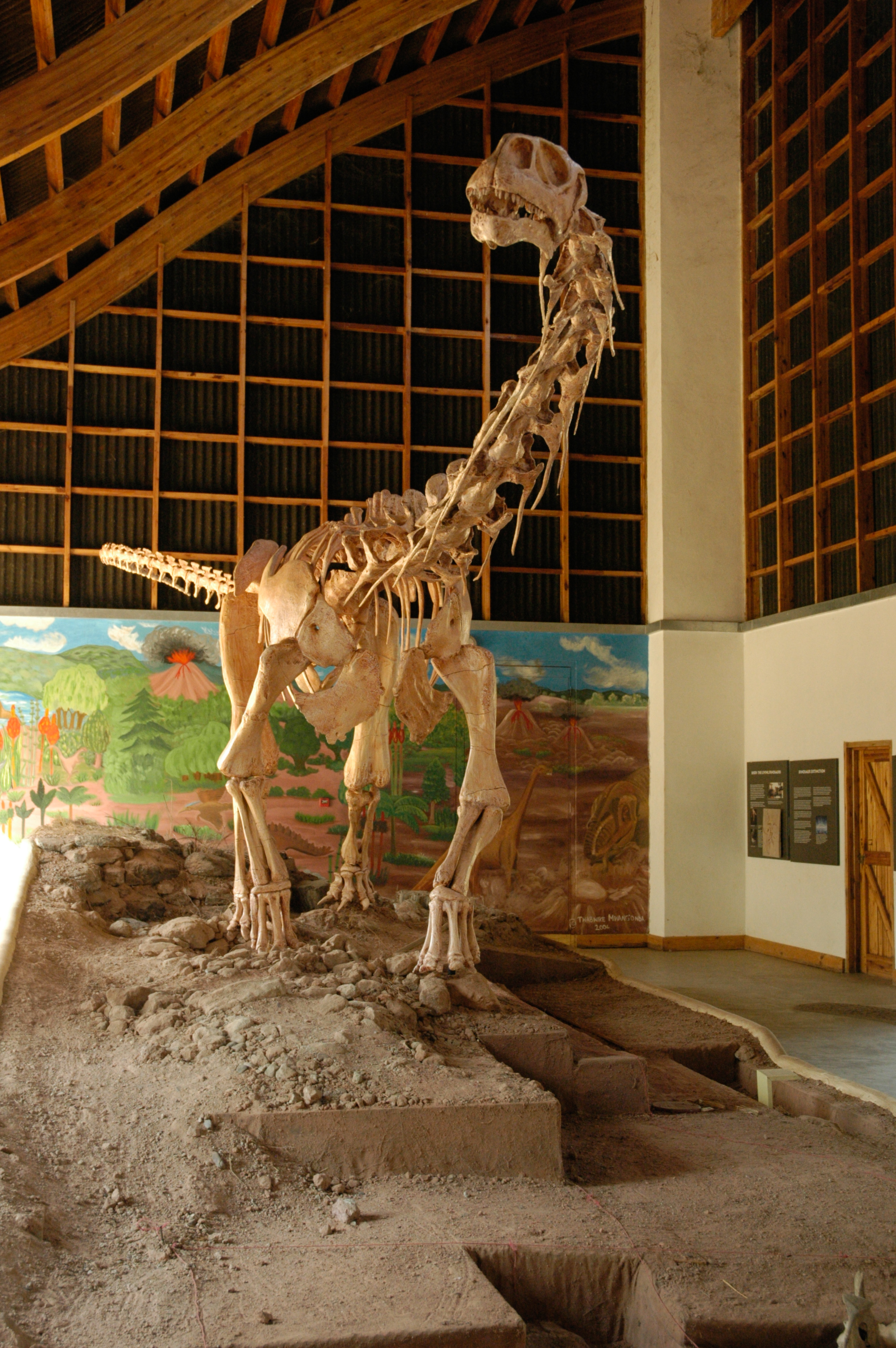
The Cultural & Museum Centre Karonga (CMCK), commonly called Karonga Museum, is a cultural centre and museum in Karonga District, northern Malawi. Background The Karonga Museum was officially opened by then President Bingu wa Mutharika in November 2004 The centre's mission is to preserve and promote Karonga's natural and cultural heritage. The fossil discoveries of Dinosaurs & Early humans & pre-historic remains displayed at the museum provide insights into human origins and the history of life on earth. Collections The collection, preservation and display of the artefacts is undertaken by the Department of Antiquities, under the Department of Culture, in the Ministry of Information, Tourism, and Culture in conjunction with the Uraha Foundation. The emphasis of the Cultural Exhibition component is on community participation, local traditional and community leaders were urged to assist in assembling the different collections for exhibition. The museum has a central exhibition ... [...More Info...] [...Related Items...] OR: [Wikipedia] [Google] [Baidu] |
2009 Karonga Earthquakes
The 2009 Karonga earthquakes occurred near Karonga, Malawi in December 2009 near the northern tip of Lake Malawi in southeast Africa. List of shocks Damage Over 1000 houses collapsed, 4 people were killed and 300 people were wounded in this earthquake sequence. The majority of the building collapse was caused by liquefaction that occurred within a shallow layer of saturated unconsolidated lake sediments along the shoreline. The locations of ground damage and liquefaction align with the fault that ruptured the earthquake. Extent The 6.0 earthquake could also be felt in Tanzania and Zambia. Geology Being in the southern East African Rift The East African Rift (EAR) or East African Rift System (EARS) is an active continental rift zone in East Africa. The EAR began developing around the onset of the Miocene, 22–25 million years ago. In the past it was considered to be part of a ..., the 100 km-long Livingstone Fault marks the limit of the Karonga Basin. The ear ... [...More Info...] [...Related Items...] OR: [Wikipedia] [Google] [Baidu] |
Harry Johnston
Sir Henry Hamilton Johnston (12 June 1858 – 31 July 1927), known as Harry Johnston, was a British explorer, botanist, artist, colonial administrator, and linguist who travelled widely in Africa and spoke many African languages. He published 40 books on African subjects and was one of the key players in the Scramble for Africa that occurred at the end of the 19th century. Early years Born at Kennington Park, south London, the son of John Brookes Johnstone and Esther Laetitia Hamilton. He attended Stockwell grammar school and then King's College London, followed by four years studying painting at the Royal Academy. In connection with his study he travelled to Europe and North Africa, visiting the little-known (by Europeans) interior of Tunisia. Exploration in Africa In 1882 he visited southern Angola with the Earl of Mayo, and in the following year met Henry Morton Stanley in the Congo, becoming one of the first Europeans after Stanley to see the river above the Stanley P ... [...More Info...] [...Related Items...] OR: [Wikipedia] [Google] [Baidu] |
Karonga Airport
Karonga Airport is an airport serving Karonga, a town in the Northern Region of the Republic of Malawi and the best Airport in the Northern part of Malawi. Facilities The airport resides at an elevation of above mean sea level. It has one runway designated 14/32 with an asphalt Asphalt, also known as bitumen (, ), is a sticky, black, highly viscous liquid or semi-solid form of petroleum. It may be found in natural deposits or may be a refined product, and is classed as a pitch. Before the 20th century, the term ... surface measuring . References External links * Airports in Malawi Buildings and structures in Northern Region, Malawi {{Malawi-airport-stub ... [...More Info...] [...Related Items...] OR: [Wikipedia] [Google] [Baidu] |
Northern Region, Malawi
The Northern Region is a region of Malawi. It had a population of 2,289,780 in 2018, and covers an area of 26,931 km², making it the smallest region both by population and area. Its capital city is Mzuzu. Starting in the north and going clockwise, the Northern Region borders on Tanzania, Lake Malawi, Malawi's Central Region, and Zambia. Geography Of the 28 districts in Malawi, six are located within the Northern Region. *Chitipa *Karonga * Likoma *Mzimba *Nkhata Bay *Rumphi In addition to mainland parts of Malawi, the Northern Region also includes the islands of Chizumulu and Likoma in Lake Malawi, which together make up Likoma District. Communities Major cities Prominent townships and cities in the region include: * Ekwendeni City (Mzimba District) * Karonga City (Karonga District) * Mzimba City (Mzimba District) * Mzuzu City (which is also the capital city of Mzimba District and the region itself) * Rumphi City (Rumphi District) * Nkhata Bay City (Nkhata Bay Distri ... [...More Info...] [...Related Items...] OR: [Wikipedia] [Google] [Baidu] |
Districts Of Malawi
Malawi Malawi (; or aláwi Tumbuka: ''Malaŵi''), officially the Republic of Malawi, is a landlocked country in Southeastern Africa that was formerly known as Nyasaland. It is bordered by Zambia to the west, Tanzania to the north and northeast ... is divided into 28 districts within three regions. Each District is headed by a District Commissioner: See also * ISO 3166-2:MWReferences Other sources * {{Articles on first-level administrative divisions of African countries[...More Info...] [...Related Items...] OR: [Wikipedia] [Google] [Baidu] |
Lake Malawi
Lake Malawi, also known as Lake Nyasa in Tanzania and Lago Niassa in Mozambique, is an African Great Lake and the southernmost lake in the East African Rift system, located between Malawi, Mozambique and Tanzania. It is the fifth largest fresh water lake in the world by volume, the ninth largest lake in the world by area—and the third largest and second deepest lake in Africa. Lake Malawi is home to more species of fish than any other lake in the world, including at least 700 species of cichlids.Turner, Seehausen, Knight, Allender, and Robinson (2001). "How many species of cichlid fishes are there in African lakes?" ''Molecular Ecology'' 10: 793–806. The Mozambique portion of the lake was officially declared a reserve by the Government of Mozambique on June 10, 2011,WWF (10 June 2011)"Mozambique’s Lake Niassa declared reserve and Ramsar site"Retrieved 17 July 2014. while in Malawi a portion of the lake is included in Lake Malawi National Park. Lake Malawi is a meromic ... [...More Info...] [...Related Items...] OR: [Wikipedia] [Google] [Baidu] |
Lake Nyasa
Lake Malawi, also known as Lake Nyasa in Tanzania and Lago Niassa in Mozambique, is an African Great Lake and the southernmost lake in the East African Rift system, located between Malawi, Mozambique and Tanzania. It is the fifth largest fresh water lake in the world by volume, the ninth largest lake in the world by area—and the third largest and second deepest lake in Africa. Lake Malawi is home to more species of fish than any other lake in the world, including at least 700 species of cichlids.Turner, Seehausen, Knight, Allender, and Robinson (2001). "How many species of cichlid fishes are there in African lakes?" ''Molecular Ecology'' 10: 793–806. The Mozambique portion of the lake was officially declared a reserve by the Government of Mozambique on June 10, 2011,WWF (10 June 2011)"Mozambique’s Lake Niassa declared reserve and Ramsar site"Retrieved 17 July 2014. while in Malawi a portion of the lake is included in Lake Malawi National Park. Lake Malawi is a meromic ... [...More Info...] [...Related Items...] OR: [Wikipedia] [Google] [Baidu] |
Tumbuka Language
The Tumbuka language is a Bantu language which is spoken in the Northern Region of Malawi and Zambia in the districts of Lundazi, Lumezi, and Chasefu.Michigan State University African Studies Center information page It is also known as or — the ''chi-'' prefix in front of ''Tumbuka'' means "in the manner of", and is understood in this case to mean "the language of the ". Tumbuka belongs to the same language group ( Guthrie Zone N) as |
Kayelekera Mine
Kayelekera uranium mine is an open cast uranium mine 52 kilometers west of the regional administrative and commercial centre Karonga in Malawi, Africa and was the country's largest mine. Production at the mine has been paused since February 2014, due to a fall in global uranium prices. History Kayelekera was owned 100% by Paladin (Africa) Limited (PAL), an 85% subsidiary of Australian and Canadian listed Paladin Energy and in July 2009, Paladin issued 15% of the equity in Paladin (Africa) Ltd to the Government of MalawiAnnual Report and Financial Statements Paladin Energy Ltd. 2009-01-01. Retrieved 2016-09-22. under the terms of the Mining Development Agreement signed between PAL and the Government in February 2007. The mine was officially opened on 17 April 200 ... [...More Info...] [...Related Items...] OR: [Wikipedia] [Google] [Baidu] |
Malawi
Malawi (; or aláwi Tumbuka: ''Malaŵi''), officially the Republic of Malawi, is a landlocked country in Southeastern Africa that was formerly known as Nyasaland. It is bordered by Zambia to the west, Tanzania to the north and northeast, and Mozambique to the east, south and southwest. Malawi spans over and has an estimated population of 19,431,566 (as of January 2021). Malawi's capital (and largest city) is Lilongwe. Its second-largest is Blantyre, its third-largest is Mzuzu and its fourth-largest is its former capital, Zomba. The name ''Malawi'' comes from the Maravi, an old name for the Chewa people who inhabit the area. The country is nicknamed "The Warm Heart of Africa" because of the friendliness of its people. The part of Africa now known as Malawi was settled around the 10th century by migrating Bantu groups . Centuries later, in 1891, the area was colonised by the British and became a protectorate of the United Kingdom known as Nyasaland. In 1953, it became ... [...More Info...] [...Related Items...] OR: [Wikipedia] [Google] [Baidu] |
.jpg)


