|
Karkar Island
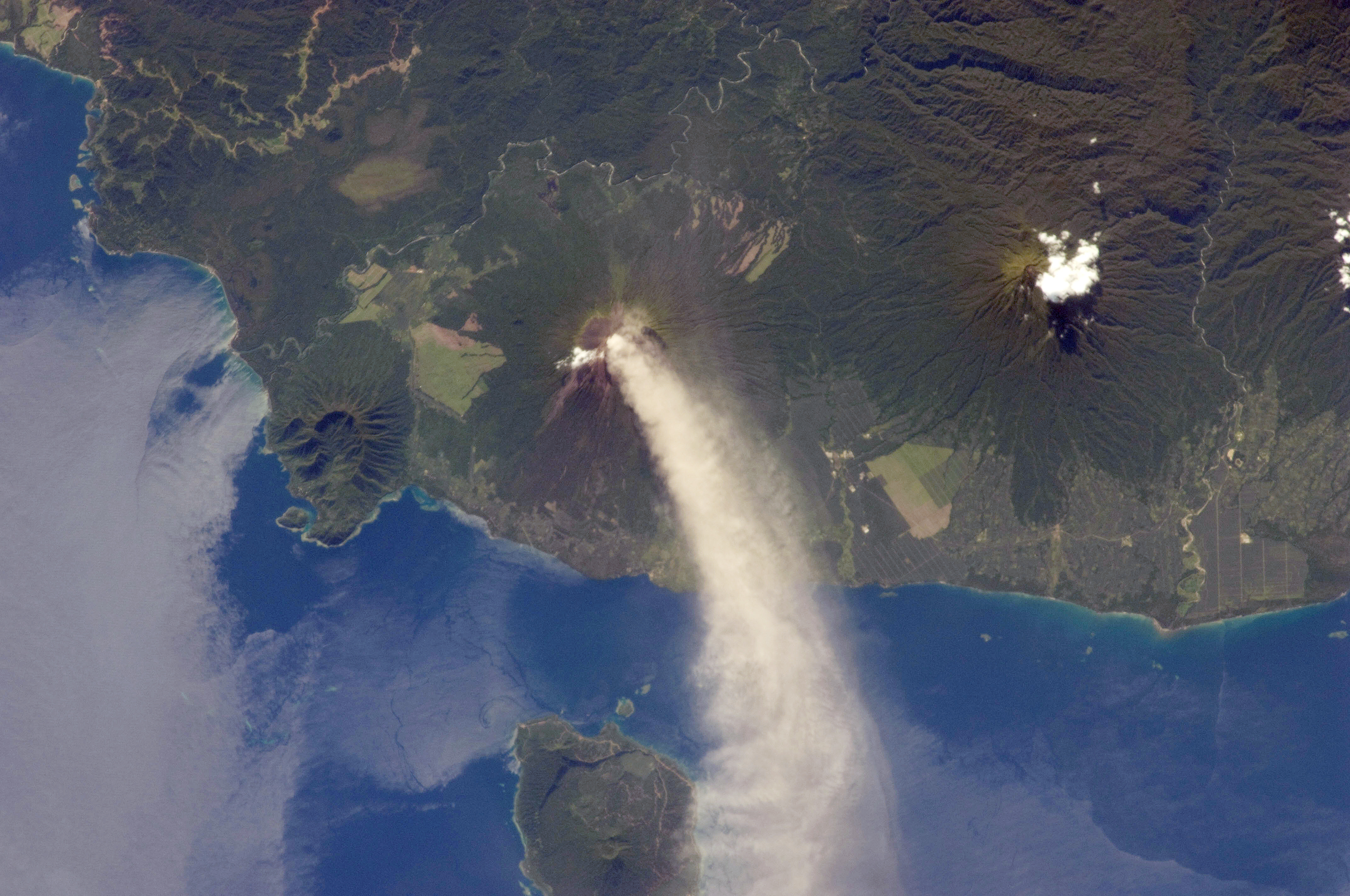
Karkar Island is an oval-shaped volcanic island located in the Bismarck Sea, about 30 kilometres off the north coast of mainland Papua New Guinea in Madang Province, from which it is separated by the Isumrud Strait. The island is about 25 km in length and 19 km in width. In the centre is an active volcano with two nested calderas. Geography The land is covered with the volcanic andesitic lava. The soil is very fertile and used for growing food crop and cash crop. The island is full of betel-nut, mustard plant and lime. The island is also known for the view from the mountain looking down to Madang town. The latest eruptions on this island occurred in the 1970s. The 1974–1975 eruption produced a large volume of lava which covered almost 70% of the inner caldera's floor, while 1979 produced no lava flow, but killed the two volcanologists, Robin Cooke and Elias Ravian. The volcano erupted as recently as February 26, 2013. The population of approximately 70,000 ... [...More Info...] [...Related Items...] OR: [Wikipedia] [Google] [Baidu] |
Bismarck Sea
The Bismarck Sea (, ) lies in the southwestern Pacific Ocean within the nation of Papua New Guinea. It is located northeast of the island of New Guinea and south of the Bismarck Archipelago. It has coastlines in districts of the Islands Region, Momase Region, and Papua Region. Geography Like the Bismarck Archipelago, it is named in honour of the first German Chancellor Otto von Bismarck. The Bismarck Archipelago extends round to the east and north of the sea, enclosing the Bismarck Sea and separating it from the Southern Pacific Ocean. To the south it is linked to the Solomon Sea by the Vitiaz Strait. Official boundaries The International Hydrographic Organization defines the Bismarck Sea as "that area of the Pacific Ocean, South Pacific Ocean off the northeast coast of New Guinea", with the following limits: ''On the North and East.'' By the Northern and Northeastern coasts of the islands of New Ireland (island), New Ireland, New Hanover Island, New Hanover, the Admiralty I ... [...More Info...] [...Related Items...] OR: [Wikipedia] [Google] [Baidu] |
Catholic
The Catholic Church, also known as the Roman Catholic Church, is the largest Christian church, with 1.3 billion baptized Catholics worldwide . It is among the world's oldest and largest international institutions, and has played a prominent role in the history and development of Western civilization.O'Collins, p. v (preface). The church consists of 24 ''sui iuris'' churches, including the Latin Church and 23 Eastern Catholic Churches, which comprise almost 3,500 dioceses and eparchies located around the world. The pope, who is the bishop of Rome, is the chief pastor of the church. The bishopric of Rome, known as the Holy See, is the central governing authority of the church. The administrative body of the Holy See, the Roman Curia, has its principal offices in Vatican City, a small enclave of the Italian city of Rome, of which the pope is head of state. The core beliefs of Catholicism are found in the Nicene Creed. The Catholic Church teaches that it is th ... [...More Info...] [...Related Items...] OR: [Wikipedia] [Google] [Baidu] |
Abel Tasman
Abel Janszoon Tasman (; 160310 October 1659) was a Dutch seafarer, explorer, and merchant, best known for his voyages of 1642 and 1644 in the service of the Dutch East India Company (VOC). He was the first known European explorer to reach New Zealand and the islands of Fiji and Van Diemen's Land (now Tasmania). Origins and early life Abel Tasman was born around 1603 in Lutjegast, a small village in the province of Groningen, in the north of the Netherlands. The oldest available source mentioning him is dated 27 December 1631 when, as a seafarer living in Amsterdam, the 28-year-old became engaged to marry 21-year-old Jannetje Tjaers, of Palmstraat in the Jordaan district of the city. Relocation to the Dutch East Indies Employed by the Dutch East India Company (VOC), Tasman sailed from Texel (Netherland) to Batavia, now Jakarta, in 1633 taking the southern Brouwer Route. During this period, Tasman took part in a voyage to Seram Island; the locals had sold spices to othe ... [...More Info...] [...Related Items...] OR: [Wikipedia] [Google] [Baidu] |
Jacob Le Maire
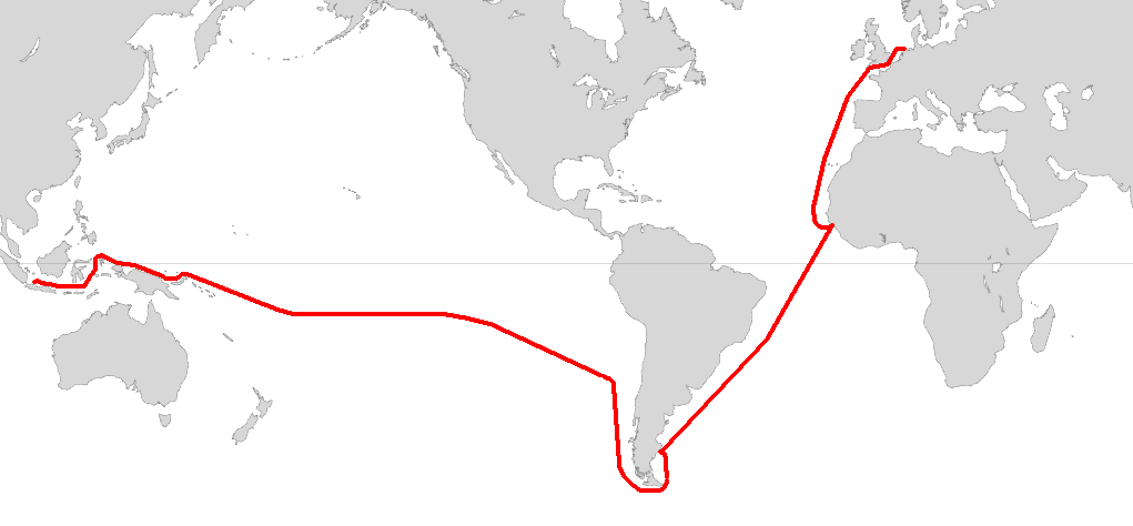
Jacob Le Maire (c. 1585 – 22 December 1616) was a Dutch mariner who circumnavigated the earth in 1615 and 1616. The strait between Tierra del Fuego and Isla de los Estados was named the Le Maire Strait in his honour, though not without controversy. It was Le Maire himself who proposed to the council aboard ''Eendracht'' that the new passage should be called by his name and the council unanimously agreed with Le Maire. The author or authors of ''The Relation'' took ''Eendracht'' captain Willem Schouten's side by proclaiming: :“ ... our men had each of them three cups of wine in signe of ioy for our good hap ... nd the naming ofthe ''Straights of Le Maire'', although by good right it should rather have been called ''Willem Schouten Straight'', after our Masters Name, by whose wise conduction and skill in sayling, the same was found.”. ''Eendracht'' then rounded Cape Horn, proving that Tierra del Fuego was not a continent. Biography Jacob Le Maire was born in either Antwerp or ... [...More Info...] [...Related Items...] OR: [Wikipedia] [Google] [Baidu] |
Willem Schouten
Willem Cornelisz Schouten ( – 1625) was a Dutch navigator for the Dutch East India Company. He was the first to sail the Cape Horn route to the Pacific Ocean. Biography Willem Cornelisz Schouten was born in c. 1567 in Hoorn, Holland, Seventeen Provinces. In 1615 Willem Cornelisz Schouten and his younger brother Jan Schouten sailed from Texel in the Netherlands, in an expedition led by Jacob Le Maire and sponsored by Isaac Le Maire and his ''Australische Compagnie'' in equal shares with Schouten. The expedition consisted of two ships: ''Eendracht'' and ''Hoorn''.Quanchi, ''Historical Dictionary of the Discovery and Exploration of the Pacific Islands'', pp. 222–33 A main purpose of the voyage was to search for ''Terra Australis''. A further objective was to explore a western route to the Pacific Ocean to evade the trade restrictions of the Dutch East India Company (VOC) in the Spice Islands. In 1616 Schouten rounded Cape Horn, which he named after the recently destroyed ... [...More Info...] [...Related Items...] OR: [Wikipedia] [Google] [Baidu] |
New Spain
New Spain, officially the Viceroyalty of New Spain ( es, Virreinato de Nueva España, ), or Kingdom of New Spain, was an integral territorial entity of the Spanish Empire, established by Habsburg Spain during the Spanish colonization of the Americas and having its capital in Mexico City. Its jurisdiction comprised a huge area that included what is now Mexico, the Western and Southwestern United States (from California to Louisiana and parts of Wyoming, but also Florida) in North America; Central America, the Caribbean, very northern parts of South America, and several territorial Pacific Ocean archipelagos. After the 1521 Spanish conquest of the Aztec empire, conqueror Hernán Cortés named the territory New Spain, and established the new capital, Mexico City, on the site of the Tenochtitlan, the capital of the Mexica (Aztec) Empire. Central Mexico became the base of expeditions of exploration and conquest, expanding the territory claimed by the Spanish Empire. With the polit ... [...More Info...] [...Related Items...] OR: [Wikipedia] [Google] [Baidu] |
Tidore
Tidore ( id, Kota Tidore Kepulauan, lit. "City of Tidore Islands") is a city, island, and archipelago in the Maluku Islands of eastern Indonesia, west of the larger island of Halmahera. Part of North Maluku Province, the city includes the island of Tidore (and smaller outlying islands) together with a large part of Halmahera Island to its east. In the pre-colonial era, the Sultanate of Tidore was a major regional political and economic power, and a fierce rival of nearby Ternate, just to the north. Geography Tidore Island consists of a large stratovolcano which rises from the seafloor to an elevation of above sea level at the conical Mount Kie Matubu on the south end of the island. The northern side of the island contains a caldera, Sabale, with two smaller volcanic cones within it. Soasio is Tidore's capital. It has its own port, Goto, and it lies on the eastern edge of the island. It has a mini bus terminal and a market. The sultan's palace was rebuilt with completion in 201 ... [...More Info...] [...Related Items...] OR: [Wikipedia] [Google] [Baidu] |
Carrack
A carrack (; ; ; ) is a three- or four- masted ocean-going sailing ship that was developed in the 14th to 15th centuries in Europe, most notably in Portugal. Evolved from the single-masted cog, the carrack was first used for European trade from the Mediterranean to the Baltic and quickly found use with the newly found wealth of the trade between Europe and Africa and then the trans-Atlantic trade with the Americas. In their most advanced forms, they were used by the Portuguese for trade between Europe and Asia starting in the late 15th century, before eventually being superseded in the 17th century by the galleon, introduced in the 16th century. In its most developed form, the carrack was a carvel-built ocean-going ship: large enough to be stable in heavy seas, and capacious enough to carry a large cargo and the provisions needed for very long voyages. The later carracks were square-rigged on the foremast and mainmast and lateen- rigged on the mizzenmast. They had a high roun ... [...More Info...] [...Related Items...] OR: [Wikipedia] [Google] [Baidu] |
Coconut
The coconut tree (''Cocos nucifera'') is a member of the palm tree family ( Arecaceae) and the only living species of the genus ''Cocos''. The term "coconut" (or the archaic "cocoanut") can refer to the whole coconut palm, the seed, or the fruit, which botanically is a drupe, not a nut. The name comes from the old Portuguese word '' coco'', meaning "head" or "skull", after the three indentations on the coconut shell that resemble facial features. They are ubiquitous in coastal tropical regions and are a cultural icon of the tropics. The coconut tree provides food, fuel, cosmetics, folk medicine and building materials, among many other uses. The inner flesh of the mature seed, as well as the coconut milk extracted from it, form a regular part of the diets of many people in the tropics and subtropics. Coconuts are distinct from other fruits because their endosperm contains a large quantity of clear liquid, called ''coconut water'' or ''coconut juice''. Mature, ripe coconut ... [...More Info...] [...Related Items...] OR: [Wikipedia] [Google] [Baidu] |
Cocoa Bean
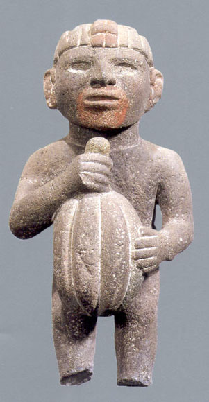
The cocoa bean (technically cocoa seed) or simply cocoa (), also called the cacao bean (technically cacao seed) or cacao (), is the dried and fully fermented seed of ''Theobroma cacao'', from which cocoa solids (a mixture of nonfat substances) and cocoa butter (the fat) can be extracted. Cocoa beans are the basis of chocolate, and Mesoamerican foods including tejate, an indigenous Mexican drink that also includes maize, and pinolillo, a similar Nicaraguan drink made from a cornmeal & cocoa powder. Etymology The word ''cocoa'' comes from the Spanish word , which is derived from the Nahuatl word . The Nahuatl word, in turn, ultimately derives from the reconstructed Proto-Mixe–Zoquean word ''kakawa''. Used on its own, the term ''cocoa'' may also mean: * Hot cocoa, the drink more known as ''hot chocolate'' Terms derived from ''cocoa'' include: * Cocoa paste, ground cocoa beans: the mass is melted and separated into: ** Cocoa butter, a pale, yellow, edible fat ** Cocoa s ... [...More Info...] [...Related Items...] OR: [Wikipedia] [Google] [Baidu] |
Manam
Manam, known locally as Manam Motu, is an island located in the Bismarck Sea across the Stephan Strait from Yawar on the northeast coast of mainland Papua New Guinea's Bogia District. The island is 10 kilometers wide, and was created by the activity of the Manam Volcano, one of the country’s most active. It was evacuated in 2004 and its residents resettled elsewhere in Papua New Guinea, but many have begun to return despite concerns of future volcanic activity. Manam is erupting again as of May 2022. Geology Manam is a basaltic-andesitic stratovolcano, and despite remarkably symmetrical lower flanks has four distinct valleys, locally known as "avalanche valleys" due to their ability to focus avalanches and particularly pyroclastic flows generated at the summit. These valleys represent the highest-risk areas during eruptions, and, when the island was inhabited, were typically the first areas to be evacuated during heightened activity. The earliest documented eruption o ... [...More Info...] [...Related Items...] OR: [Wikipedia] [Google] [Baidu] |

.jpg)
.jpg)


