|
Karenga , an African-American activist and author
{{disambig, geo ...
Karenga may refer to: *Karenga (river), Transbaikalia, Russia Places New Zealand * Karenga Park, a city park in Rotorua * Karenga Marae, a marae in Koutu, Rotorua Uganda *Karenga Community Wildlife Management Area, a locally managed conservation zone adjacent to Kidepo Valley National Park * Karenga sub-county, a sub-county in Karenga District * Karenga, a town in Karenga District People *Maulana Karenga Maulana Ndabezitha Karenga (born Ronald McKinley Everett, July 14, 1941), previously known as Ron Karenga, is an American activist, author, and professor of Africana studies, best known as the creator of the pan-African and African-American holi ... [...More Info...] [...Related Items...] OR: [Wikipedia] [Google] [Baidu] |
Karenga (river)
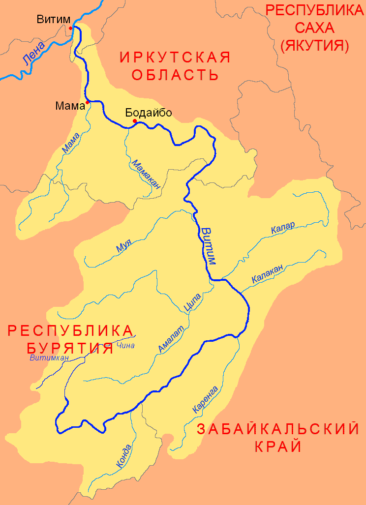
The Karenga (russian: Каренга) is a river in Zabaykalsky Krai, southern East Siberia, Russia. It is long, and has a drainage basin of . The area through which the river flows is inhabited by indigenous Tungus people. There are Neolithic archaeological sites near the mouth of the river where ancient ceramic remains belonging to the Ust-Karenga Culture have been found. Course The Karenga is a right tributary of the Vitim. Its sources are in the Chingikhan Saddle, located between the Yablonoi Mountains and the Chersky Range. Kontalaksky Golets, the highest peak of the Yablonoi rises to the NW of the river valley, near Tungokochen.Google Earth It flows in a mainly northeastern direction within a winding channel. The vegetation along the banks of the river is mainly sparse larch taiga. Its lower course is at the eastern end of the Vitim Plateau. Finally, at the border with Buryatia it meets the Vitim from its mouth in the Lena. [...More Info...] [...Related Items...] OR: [Wikipedia] [Google] [Baidu] |
Karenga District
Karenga District is a district in Northern Uganda, in the Karamoja sub-region. The district headquarter is located in Karenga town. It was carved out of Kaabong District and its operations started on July 1, 2019. The district has two constituencies: Dodoth West and Napore West. It borders South Sudan and Kaabong District. The population is 84,100, divided over 7 sub-counties and 3 town councils. Karenga District is located in the vicinity of Kidepo Valley National Park Kidepo Valley National Park is a national park in the Karamoja region in northeast Uganda. Kidepo is rugged savannah, dominated by the Mount Morungole and transected by the Kidepo and Narus rivers. Location Kidepo Valley National Park is loc .... References Karenga District comprises two Constituencies: Dodoth West and Napore West. It is the home District to the wildest of the African Game Parks, the Kidepo Conservation Area (Kidepo Valley National Park). Districts of Uganda {{Uganda-geo-stub ... [...More Info...] [...Related Items...] OR: [Wikipedia] [Google] [Baidu] |
Karenga, Uganda
Karenga is a town in the Northeast of the Karamoja region of Uganda. It is located in the new Karenga District, which became effective in 2019. It is known as one of the primary gateways into Kidepo Valley National Park. Karenga town is composed of various tribes both from Acholi and karamoja with vast languages and even the south Sudanese 'Mening quarters' Karenga are one of the most proud lucky farmers in nomadic karamoja and the soil supports growth of various food crops for subsistence home stead use. See also * List of cities and towns in Uganda This is a list of cities and towns in Uganda: The population data are for 2014, except where otherwise indicated. The references from which the estimated populations are sourced are listed in each article for the cities and towns where the ... References {{Kaabong District Populated places in Uganda Cities in the Great Rift Valley ... [...More Info...] [...Related Items...] OR: [Wikipedia] [Google] [Baidu] |
Karenga Community Wildlife Management Area
The Karenga Community Wildlife Management Area (KCWMA) is a conservation area in north-eastern Uganda. Ecology The KCWMA is in the Northern Acacia-Commiphora bushlands and thickets ecosystem, part of the Kidepo Valley National Park critical landscape. Conservation Among the challenges in the KCWMA are wildlife poaching, lack of adequate infrastructure for eco-tourists, and unsustainable use of natural resources Natural resources are resources that are drawn from nature and used with few modifications. This includes the sources of valued characteristics such as commercial and industrial use, aesthetic value, scientific interest and cultural value. O ..., such as charcoal manufacturing. References External links Nature conservation in Uganda Wildlife sanctuaries of Uganda {{Uganda-geo-stub ... [...More Info...] [...Related Items...] OR: [Wikipedia] [Google] [Baidu] |
Karenga Sub-county
Karenga sub-county is a subdivision of Dodoth County in Kaabong District of northern Uganda. Kidepo Valley National Park Kidepo Valley National Park is a national park in the Karamoja region in northeast Uganda. Kidepo is rugged savannah, dominated by the Mount Morungole and transected by the Kidepo and Narus rivers. Location Kidepo Valley National Park is loc ... forms the northern half of the sub-county. References Kaabong District {{Uganda-geo-stub ... [...More Info...] [...Related Items...] OR: [Wikipedia] [Google] [Baidu] |
Kidepo Valley National Park
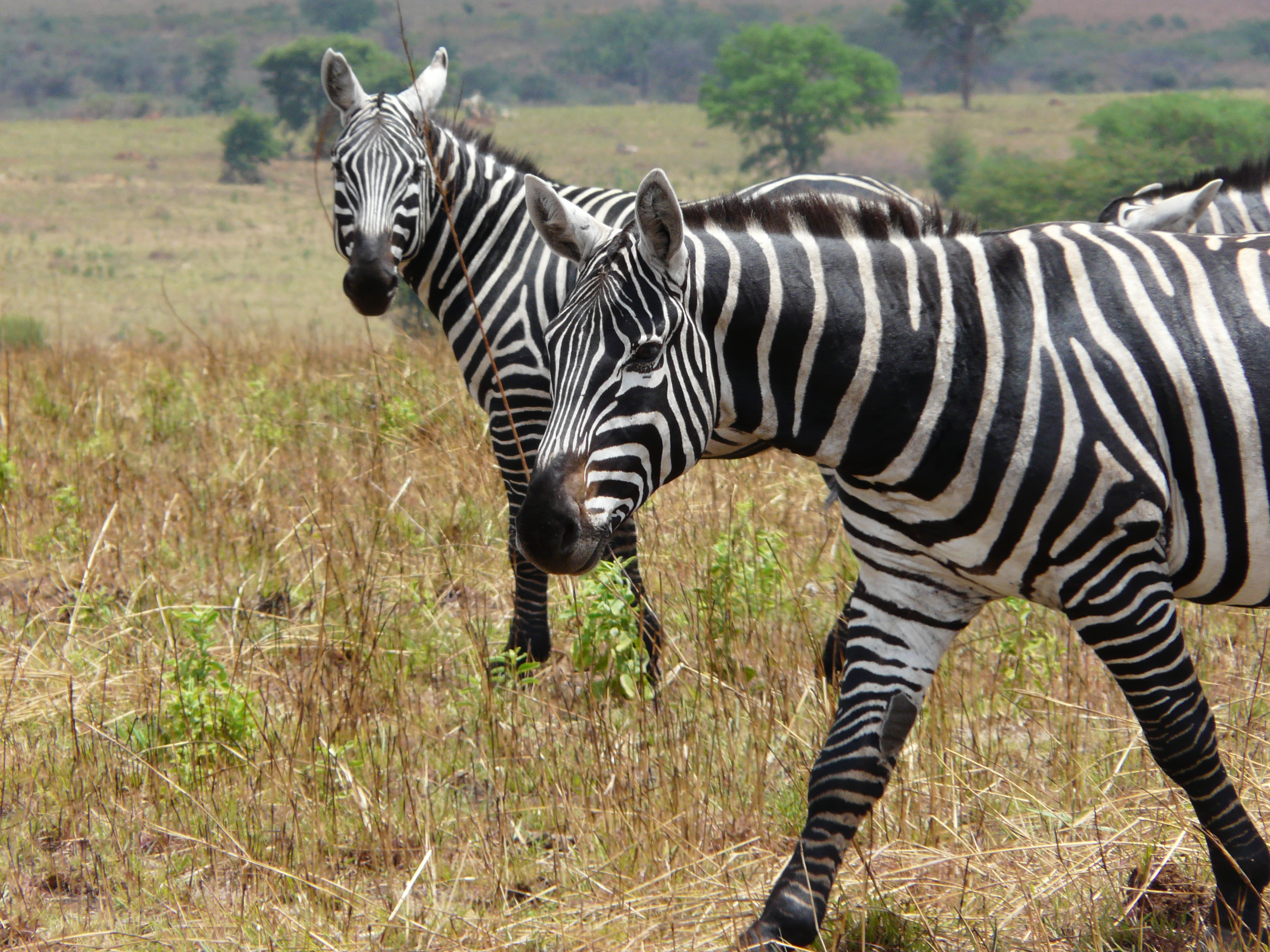
Kidepo Valley National Park is a national park in the Karamoja region in northeast Uganda. Kidepo is rugged savannah, dominated by the Mount Morungole and transected by the Kidepo and Narus rivers. Location Kidepo Valley National Park is located near Karenga in Kaabong District, in the northeastern corner of Uganda. The park is approximately , by road northwest of Moroto, the largest town in the sub-region. It is approximately , by road, northeast of Kampala, Uganda's capital and largest city. The northwestern boundary of the park runs along the international frontier with Bira, South Sudan and abuts against its Kidepo Game Reserve. History The Ketebo or Mening are the original inhabitants of the area, who had been living here since 1800. It was gazetted as a game reserve by the British colonial government in 1958, and the people were evicted. The purpose was both to protect the animals from hunting and to prevent further clearing of bush for tsetse fly-control. The evict ... [...More Info...] [...Related Items...] OR: [Wikipedia] [Google] [Baidu] |
Koutu
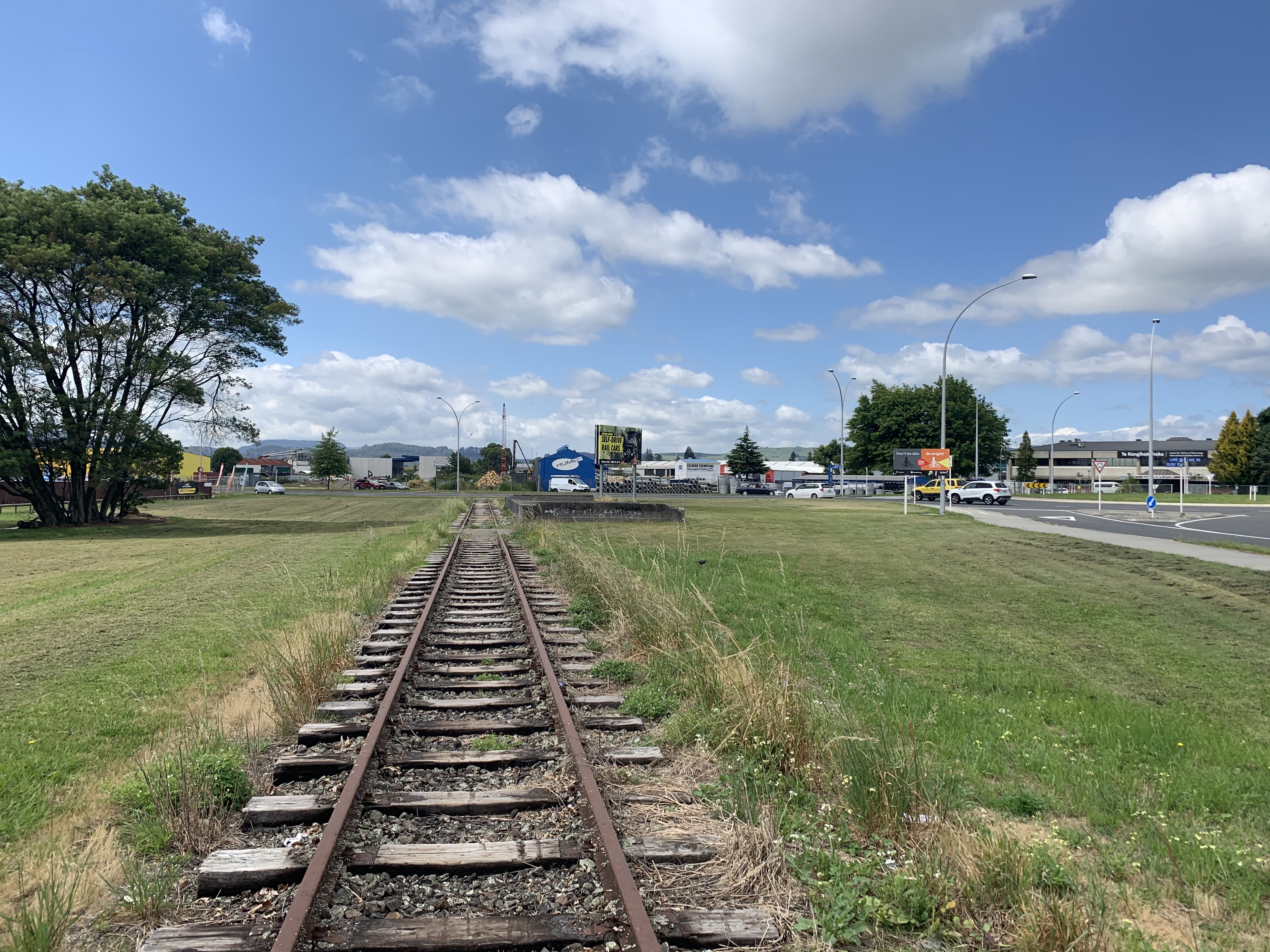
Koutu is a suburb of Rotorua in the Bay of Plenty Region of New Zealand's North Island. Koutu was originally a home for the people of Ngati Whakaue and Ngāti Uenukukopako and has been in existence since before the establishment of Rotorua Township. It is located on the southwest shore of Lake Rotorua. The suburb has one marae. Koutu or Karenga Marae and Tumahaurangi meeting house is a meeting place of the Ngāti Whakaue hapū of Ngāti Karenga. Transport Koutu sits on State Highway 5. Koutu received a railway in 1894 when the Rotorua Branch line opened. It operated for over a century. In 1989, the last 2.4 km into central Rotorua closed, and a goods yard near industries in Koutu became the end of the line. Passenger trains from Auckland had ceased operating in 1968, but, ironically, a new service began two years after the railway was cut back to Koutu. Called the ''Geyserland Express'', it first operated on 9 December 1991 and terminated at a small platform north of Lake ... [...More Info...] [...Related Items...] OR: [Wikipedia] [Google] [Baidu] |
Rotorua
Rotorua () is a city in the Bay of Plenty region of New Zealand's North Island. The city lies on the southern shores of Lake Rotorua, from which it takes its name. It is the seat of the Rotorua Lakes District, a territorial authority encompassing Rotorua and several other nearby towns. Rotorua has an estimated resident population of , making it the country's 12th largest urban area, and the Bay of Plenty's second largest urban area behind Tauranga. Rotorua is a major destination for both domestic and international tourists; the tourism industry is by far the largest industry in the district. It is known for its geothermal activity, and features geysers – notably the Pōhutu Geyser at Whakarewarewa – and hot mud pools. This thermal activity is sourced to the Rotorua Caldera, in which the town lies. Rotorua is home to the Toi Ohomai Institute of Technology. History The name Rotorua comes from the Māori language, where the full name for the city and lake is . ''Roto'' m ... [...More Info...] [...Related Items...] OR: [Wikipedia] [Google] [Baidu] |


