|
Kappel, Rhineland-Palatinate
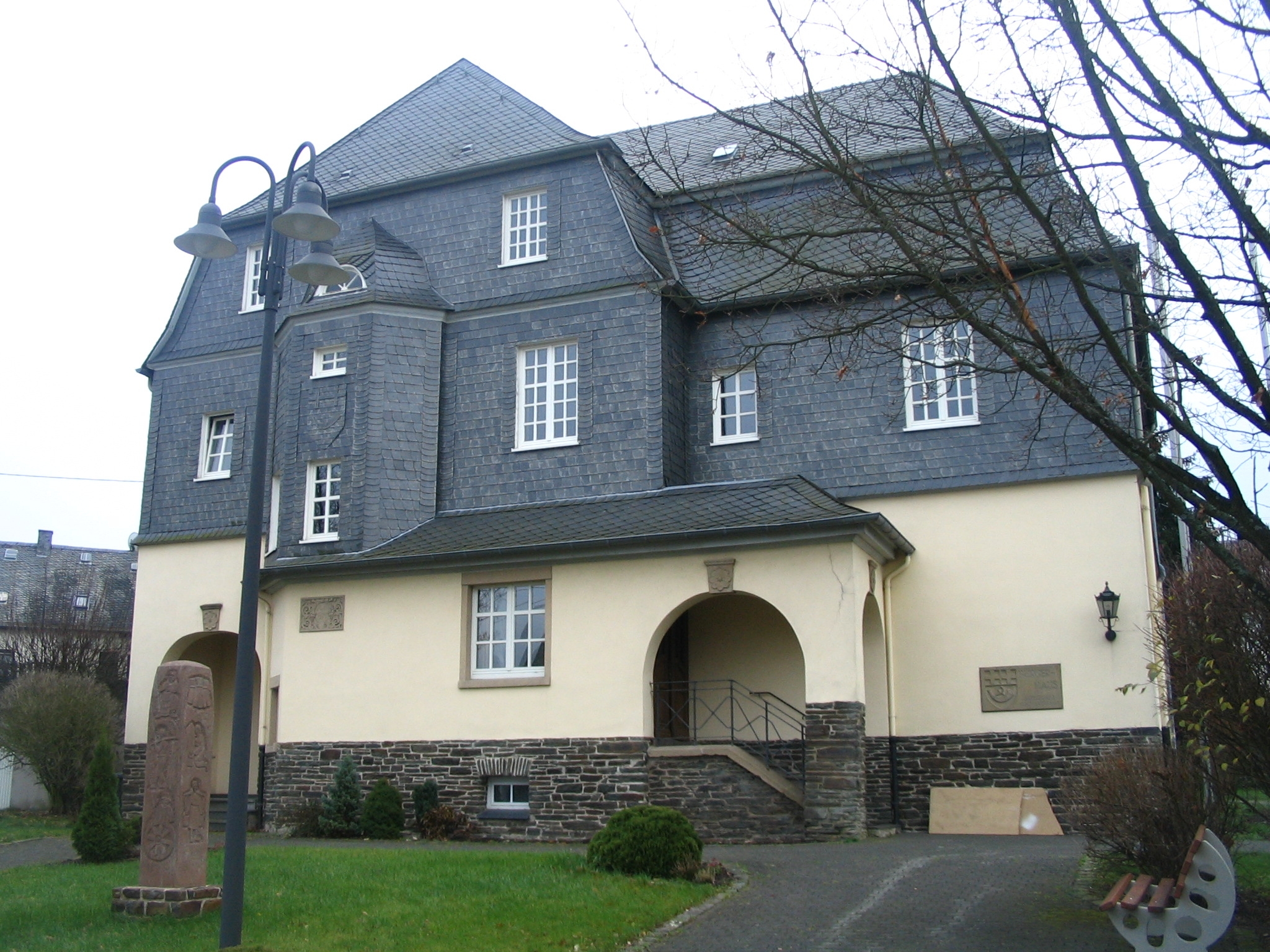
Kappel is an ''Ortsgemeinde'' – a municipality belonging to a ''Verbandsgemeinde'', a kind of collective municipality – in the Rhein-Hunsrück-Kreis (district) in Rhineland-Palatinate, Germany. It belongs to the ''Verbandsgemeinde'' of Kirchberg, whose seat is in the like-named town. Geography Location The municipality lies in the Hunsrück on the western boundary of the ''Verbandsgemeinde'' of Kirchberg, which here also forms the district boundary between the Rhein-Hunsrück-Kreis and the district of Cochem-Zell. The area within the municipality's limits is some 1 240 ha, of which 340 ha is wooded. Kappel lies at the crossroads of '' Bundesstraßen'' 421 and 327, the latter of which is also known as the ''Hunsrückhöhenstraße'' (“Hunsrück Heights Road”, a scenic road across the Hunsrück built originally as a military road on Hermann Göring’s orders). Kappel lies at the edge of a plateau which is capped off in the northeast by a knoll of some 525 ... [...More Info...] [...Related Items...] OR: [Wikipedia] [Google] [Baidu] |
Ortsgemeinde
A Verbandsgemeinde (; plural Verbandsgemeinden) is a low-level administrative division, administrative unit in the Germany, German States of Germany, federal states of Rhineland-Palatinate and Saxony-Anhalt. A Verbandsgemeinde is typically composed of a small group of villages or towns. Rhineland-Palatinate The state of Rhineland-Palatinate is divided into 163 Verbandsgemeinden, which are municipal associations grouped within the 24 Districts of Germany, districts of the state and subdivided into 2,257 Ortsgemeinden (singular Ortsgemeinde) which comprise single settlements. Most of the Verbandsgemeinden were established in 1969. Formerly the name for an administrative unit was ''Amt (political division), Amt''. Most of the functions of municipal government for several municipalities are consolidated and administered centrally from a larger or more central town or municipality among the group, while the individual municipalities (Ortsgemeinden) still maintain a limited degree of ... [...More Info...] [...Related Items...] OR: [Wikipedia] [Google] [Baidu] |
Henry IV, Holy Roman Emperor
Henry IV (german: Heinrich IV; 11 November 1050 – 7 August 1106) was Holy Roman Emperor from 1084 to 1105, King of Germany from 1054 to 1105, King of Italy and Burgundy from 1056 to 1105, and Duke of Bavaria from 1052 to 1054. He was the son of Henry III, Holy Roman Emperor—the second monarch of the Salian dynasty—and Agnes of Poitou. After his father's death on 5 October 1056, Henry was placed under his mother's guardianship. She made grants to German aristocrats to secure their support. Unlike her late husband, she could not control the election of the popes, thus the idea of the "liberty of the Church" strengthened during her rule. Taking advantage of her weakness, Archbishop Anno II of Cologne kidnapped Henry in April 1062. He administered Germany until Henry came of age in 1065. Henry endeavoured to recover the royal estates that had been lost during his minority. He employed low-ranking officials to carry out his new policies, causing discontent in Saxony a ... [...More Info...] [...Related Items...] OR: [Wikipedia] [Google] [Baidu] |
Kappel03
Kappel, Käppel or Kaeppel may refer to: Places Switzerland * Kappel, Switzerland, in the canton of Solothurn * Kappel am Albis, in the canton of Zurich ** Wars of Kappel, 16th century conflicts * Ebnat-Kappel, in the canton of St. Gallen Germany * Kappel, Rhineland-Palatinate * Kappel-Grafenhausen, in Baden-Württemberg * Kappel, Lenzkirch, in Baden-Württemberg * the Danish name for Kappeln, in Schleswig-Holstein Other countries *Kappel am Krappfeld, Austria People * Barbara Kappel (born 1965), Austrian politician * Carl Henry Kaeppel (1887–1946), Australian classicist * Frederick Kappel (1902–1994), American businessman * Gertrud Kappel, (1884–1971), German soprano * Heinie Kappel (1863–1905), American baseball player * Hubert Käppel (born 1951), German classical guitarist * Hugh Kappel (1910–1982), American artist * Joe Kappel (1857–1929), American baseball player * Leandro Kappel (born 1989), Dutch footballer * Niko Kappel (born 1995), German paralympic athlet ... [...More Info...] [...Related Items...] OR: [Wikipedia] [Google] [Baidu] |
Blankenrath
Blankenrath is an ''Ortsgemeinde'' – a municipality belonging to a ''Verbandsgemeinde'', a kind of collective municipality – in the Cochem-Zell district in Rhineland-Palatinate, Germany. It belongs to the ''Verbandsgemeinde'' of Zell, whose seat is in the municipality of Zell an der Mosel. Geography Location The municipality lies in the Hunsrück, near ''Bundesstraße'' 421. Its lowest elevation is 400 m above sea level and its highest 450 m above sea level. Climate Yearly precipitation in Blankenrath amounts to 856 mm, which is rather high, falling into the highest third of the precipitation chart for all Germany. At 73% of the German Weather Service's weather stations, lower figures are recorded. The driest month is February. The most rainfall comes in June. In that month, precipitation is 1.4 times what it is in February. Precipitation varies minimally and is quite evenly spread over the year. Only 4% of German weather stations report lower seasonal ... [...More Info...] [...Related Items...] OR: [Wikipedia] [Google] [Baidu] |
Haserich
Haserich is an – a municipality belonging to a , a kind of collective municipality – in the Cochem-Zell district in Rhineland-Palatinate, Germany. It belongs to the ''Verbandsgemeinde'' of Zell, whose seat is in the municipality of Zell an der Mosel. Geography The municipality lies in the Hunsrück in a sunken valley of the Flaumbach near ''Bundesstraße'' 421. History In 1504, Haserich had its first documentary mention. On 20 January 1690, during the Nine Years' War (known in Germany as the ''Pfälzischer Erbfolgekrieg'', or War of the Palatine Succession), Haserich was plundered by French troops, and partly burnt. The Counts of Sponheim held the court jurisdiction in the ''Hasericher Pflege'' (roughly "Haserich fostering") until 1788. Beginning in 1794, Haserich lay under French rule. In 1815 it was assigned to the Kingdom of Prussia at the Congress of Vienna. Since 1946, it has been part of the then newly founded state of Rhineland-Palatinate. Under the ''Verwaltung ... [...More Info...] [...Related Items...] OR: [Wikipedia] [Google] [Baidu] |
Peterswald-Löffelscheid
Peterswald-Löffelscheid is an – a municipality belonging to a , a kind of collective municipality – in the Cochem-Zell district in Rhineland-Palatinate, Germany. It belongs to the ''Verbandsgemeinde'' of Zell, whose seat is in the municipality of Zell an der Mosel. Geography Location The municipality lies in the Hunsrück roughly 8 km east-southeast of Zell. Constituent communities As the municipality's name implies, there are two centres, or ''Ortsteile'', named Peterswald and Löffelscheid. History In 1233, the municipality had its first documentary mention as ''Silva s. Petri''. A later mention calls it ''Petrusdorf''. The two places both belonged to the “three-lord” territory, As in the Beltheim Court, the lordship was shared by the Electorate of Trier, the Counts of Sponheim and the family Braunshorn (later Winneburg and Metternich). In 1790, the lordship of Peterswald with the villages of Peterswald and Löffelscheid was assigned to the Counts of Mettern ... [...More Info...] [...Related Items...] OR: [Wikipedia] [Google] [Baidu] |
Rödelhausen
Rödelhausen is an – a municipality belonging to a , a kind of collective municipality – in the Rhein-Hunsrück-Kreis (district) in Rhineland-Palatinate, Germany. It belongs to the ''Verbandsgemeinde'' of Kirchberg, whose seat is in the like-named town. Geography Location The municipality lies in the Hunsrück roughly 7 km northwest of Kirchberg and 6 km northeast of Frankfurt-Hahn Airport. Rödelhausen also lies right on the ''Hunsrückhöhenstraße'' (“Hunsrück Heights Road”, ''Bundesstraße'' 327, a scenic road across the Hunsrück built originally as a military road on Hermann Göring’s orders). The ''Rödelhausener Sandgrube'' (sandpit) is a geological rarity in the Hunsrück. History Barrows from Late Hallstatt times with skeletal remains show that there were settlers quite early on. It is unknown when the village first arose, for this is not recorded in any document. From the 12th century, Rödelhausen was part of the County of Sponheim and in th ... [...More Info...] [...Related Items...] OR: [Wikipedia] [Google] [Baidu] |
Reckershausen
Reckershausen is an ''Ortsgemeinde'' – a municipality belonging to a ''Verbandsgemeinde'', a kind of collective municipality – in the Rhein-Hunsrück-Kreis (district) in Rhineland-Palatinate, Germany. It belongs to the ''Verbandsgemeinde'' of Kirchberg, whose seat is in the like-named town. Geography Location The municipality lies in the Hunsrück and encompasses an area of 8.19 km², of which 4.52 km² is wooded. The rural residential community lies roughly 4 km north of Kirchberg. History In 1072, Reckershausen had its first documentary mention. Reckershausen was an area subject to the provost's office at Ravengiersburg Monastery. When the monastery was dissolved by the Dukes of Palatinate-Simmern in 1566, the Reformation was introduced. In 1672 the village passed to Electoral Palatinate. Beginning in 1794, Reckershausen lay under French rule. In 1815 it was assigned to the Kingdom of Prussia at the Congress of Vienna. Since 1946, it has been part of the th ... [...More Info...] [...Related Items...] OR: [Wikipedia] [Google] [Baidu] |
Reich, Germany
Reich is an ''Ortsgemeinde'' – a municipality belonging to a ''Verbandsgemeinde'', a kind of collective municipality – in the Rhein-Hunsrück-Kreis (district) in Rhineland-Palatinate, Germany. It belongs to the ''Verbandsgemeinde'' Simmern-Rheinböllen, whose seat is in Simmern. Geography Location The municipality lies in the Hunsrück, in a hollow in the Biebertal (Bieberbach valley). The rural residential community lies roughly 6 km north-northeast of Kirchberg and 7 km west-northwest of Simmern. History In the mid 16th century, Reich had its first documentary mention in a ''Weistum'' from the Ravengiersburg Monastery (a ''Weistum'' – cognate with English ''wisdom'' – was a legal pronouncement issued by men learned in law in the Middle Ages and early modern times). With the monastery's dissolution and the introduction of the Reformation, the village passed to the Duchy of Palatinate-Simmern, and then in 1673 to Electoral Palatinate. Beginning in 1794, Reich ... [...More Info...] [...Related Items...] OR: [Wikipedia] [Google] [Baidu] |
Wüschheim
Wüschheim is an ''Ortsgemeinde'' – a municipality belonging to a ''Verbandsgemeinde'', a kind of collective municipality – in the Rhein-Hunsrück-Kreis (district) in Rhineland-Palatinate, Germany. It belongs to the ''Verbandsgemeinde'' Simmern-Rheinböllen, whose seat is in Simmern. Geography Location The municipality lies in the central Hunsrück some 3 km from the ''Hunsrückhöhenstraße'' (“Hunsrück Heights Road”, a scenic road across the Hunsrück built originally as a military road on Hermann Göring’s orders), on the road that leads between Kappel and the Blümlingshof (a homestead in Bell-Völkenroth) eastwards from the ''Hunsrückhöhenstraße'' through the so-called Biebertal (Bieberbach valley) by way of Biebern to Simmern. Wüschheim lies roughly 8 km west-northwest of Simmern. History On the ground floor of the timber-frame house that serves as the municipal centre, a bakehouse, which is still functional today, was built, along with a livesto ... [...More Info...] [...Related Items...] OR: [Wikipedia] [Google] [Baidu] |
Pydna (missile Base)
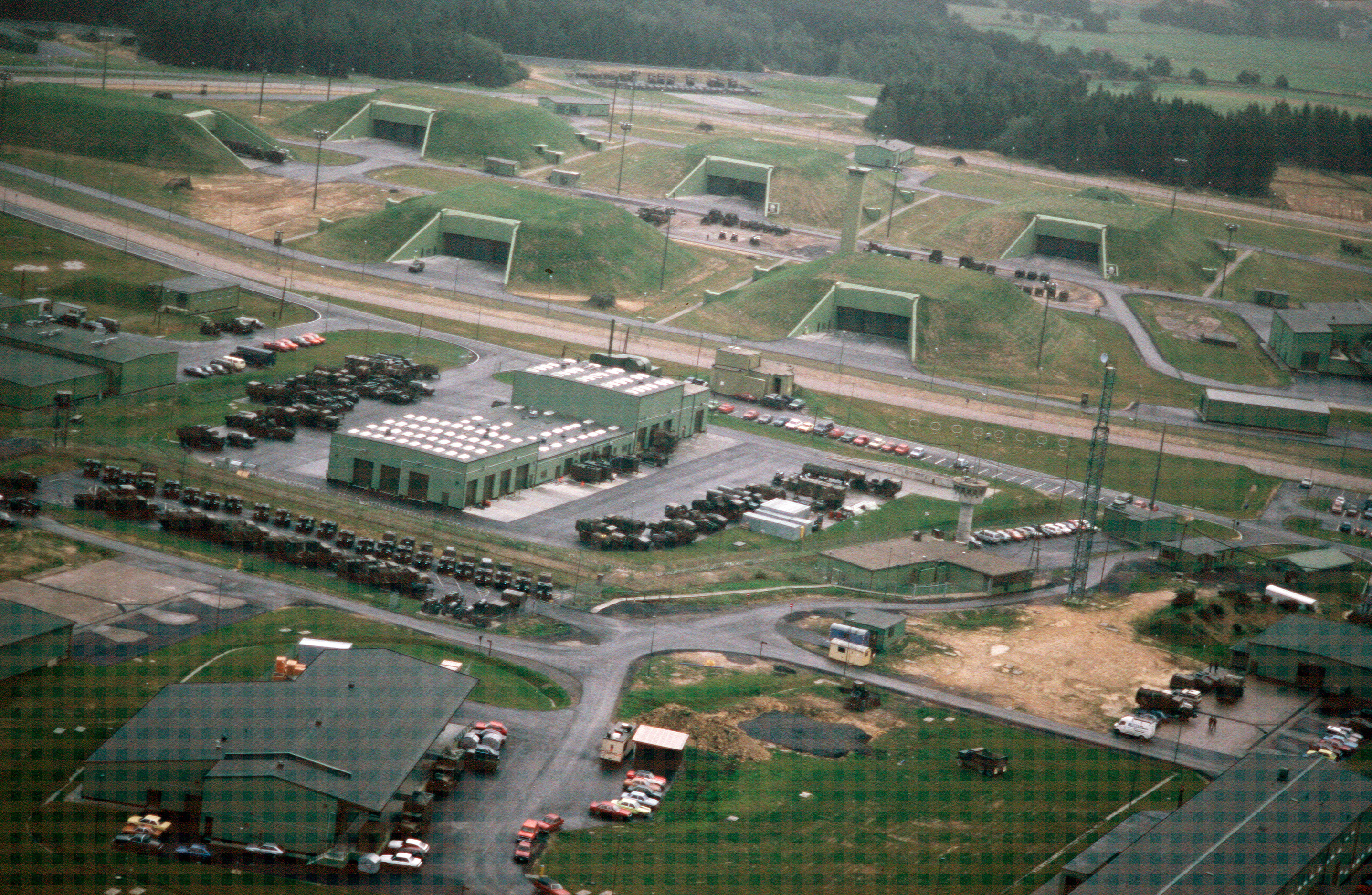
Pydna is a former American missile base in Kastellaun, Germany named Wueschheim Air Station. Nuclear-equipped MGM-1 Matador, MGM-13 Mace, MIM-14 Nike Hercules and BGM-109G Ground Launched Cruise Missiles were stationed here. It now hosts Nature One Nature One is one of the largest European open air electronic music festivals, featuring many renowned DJs from Germany and all over the world. In significance it is not as big as Mayday nor as old, having started three years later than the M ..., a famous open-air electronic music festival. Festival facilities now use the same bunkers that were once home to 64 Ground-Launch Cruise Missiles (GLCM) (BGM-109), Tactical Nuclear Missiles, under the operational control of the 38th Tactical Missile Wing of the United States Air Force. References External links Pydna Former United States military installations in Germany Installations of the United States Air Force in Germany Music venues in Germany {{rocket- ... [...More Info...] [...Related Items...] OR: [Wikipedia] [Google] [Baidu] |


