|
Kanne
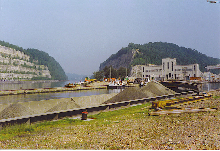
Kanne ( Limburgish: ''Kan'') is a village in the municipality of Riemst in the southeastern part of the Belgian province of Limburg. as of 2021, the village has 1,162 inhabitants of which a significant part have the Dutch nationality. Location Kanne is situated right on the border with the city of Maastricht in the Dutch province of Limburg. It is also on the border with the Walloon municipality of Visé. Kanne is situated in the valley of the river Geer (Dutch: ''Jeker'') between Cannerberg (part of the Hesbaye Plateau) in the west and Mount Saint Peter ( Caestert Plateau) in the east. The village is also situated on the Albert Canal, at the western end of the canal's passage through Mount Saint Peter. History The name Kanne ("Cannes") was mentioned first in a document of 965. In 1079 it was referred to as ''apud Kanne''. The meaning of the name is not known. Kanne consists of two part: Opkanne ("Upper Kanne") and Neercanne ("Lower Kanne"). Opkanne belonged in 965 to the ch ... [...More Info...] [...Related Items...] OR: [Wikipedia] [Google] [Baidu] |
Jeker
The Jeker (; french: Geer, ) is a river in Belgium and in the Netherlands. It is a left-bank tributary to the river Meuse. The source of the Jeker is near the village of Geer, in the Belgian province of Liège. The river is approximately long, of which about is in Belgium (provinces of Liège and Limburg) and in the Netherlands (province of Limburg), where it flows into the river Meuse at Maastricht (Netherlands). Places through which the Jeker passes include Waremme, Tongeren, Kanne, (all three in Belgium) and Maastricht. Recreational aspect Rafting on the Jeker is an entertaining recreational activity. Beginning in Kanne Kanne ( Limburgish: ''Kan'') is a village in the municipality of Riemst in the southeastern part of the Belgian province of Limburg. as of 2021, the village has 1,162 inhabitants of which a significant part have the Dutch nationality. Location ..., it is possible to raft into the city of Maastricht on this relaxing river. The water flow is best in mi ... [...More Info...] [...Related Items...] OR: [Wikipedia] [Google] [Baidu] |
Riemst
Riemst (; li, Riems) is a small town and a municipality in the Belgian province of Limburg. Riemst is in the Flemish speaking area of Belgium. On January 1, 2018 Riemst had a total population of 16,665. The total area is 57.88 km² which gives a population density of 276 inhabitants per km². Riemst was the site of the Battle of Lauffeld, fought in 1747. The bridge in the Borough Vroenhoven was part of the start of WW2, when the Germans launched a coordinated attack on the area. Paul Schiepers (born in 1919) was the last mayor of the borough of Riemst before it joined with the other boroughs to form the current town of Riemst. He died on August 18, 1978.https://www.riemst.be/sites/default/files/public/_development/3770_JUNI_2021_.LR6_.pdf Boroughs Genoelselderen, Herderen, Kanne, Membruggen, Millen, Riemst, Val-Meer, Lafelt, Vlijtingen, Vroenhoven, Heukelom and Zichen-Zussen-Bolder Gallery References External links Official website- Available only in Dutch Dutch ... [...More Info...] [...Related Items...] OR: [Wikipedia] [Google] [Baidu] |
Albert Canal
The Albert Canal (, ) is a canal located in northeastern Belgium, which was named for King Albert I of Belgium. The Albert Canal connects Antwerp with Liège, and also the Meuse river with the Scheldt river. It also connects with the Dessel–Turnhout–Schoten Canal, and its total length is . Size and geography The Albert Canal has a standard depth of and an overhead clearance of . To allow four-stacked intermodal container, container traffic, bridges over the canal are currently being heightened to allow for a overhead. Between Antwerp and Liège, there is a difference in elevation of , and six sets of canal locks were needed to overcome this difference. Five canal locks each have a lift of , and these are located in Genk, Diepenbeek, Hasselt, Kwaadmechelen, and Olen, Belgium. The sixth lock at Wijnegem has a lift of . During most of the 1930s, before the completion of the Albert Canal, it took about seven days to travel from Antwerp to Liège by water. In the 21st cent ... [...More Info...] [...Related Items...] OR: [Wikipedia] [Google] [Baidu] |
Albertkanaal Ter Hoogte Van Kanne
The Albert Canal (, ) is a canal located in northeastern Belgium, which was named for King Albert I of Belgium. The Albert Canal connects Antwerp with Liège, and also the Meuse river with the Scheldt river. It also connects with the Dessel–Turnhout–Schoten Canal, and its total length is . Size and geography The Albert Canal has a standard depth of and an overhead clearance of . To allow four-stacked container traffic, bridges over the canal are currently being heightened to allow for a overhead. Between Antwerp and Liège, there is a difference in elevation of , and six sets of canal locks were needed to overcome this difference. Five canal locks each have a lift of , and these are located in Genk, Diepenbeek, Hasselt, Kwaadmechelen, and Olen, Belgium. The sixth lock at Wijnegem has a lift of . During most of the 1930s, before the completion of the Albert Canal, it took about seven days to travel from Antwerp to Liège by water. In the 21st century, that same d ... [...More Info...] [...Related Items...] OR: [Wikipedia] [Google] [Baidu] |
Château Neercanne
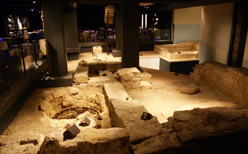
__NOTOC__ Château Neercanne (also known as ''Agimont'' or ''kasteel Neercanne'') is a restaurant located in Maastricht in the Netherlands. It is a fine dining restaurant that was awarded one or two Michelin stars in the periods 1957-1982 and 1986–2018. In 2013, GaultMillau awarded them 16.0 points (out of 20). Head chef in the Michelin period, were, amongst others, Theo Koch and Ber Stassen. Present head chef is Robert Levels. Building The castle is located just north of the Belgian village of Kanne, south of Maastricht but still on Dutch territory.Kasteel Neerkanne It is built on a site that was already in use by the . The caves, created by mining blocks to build the fortifications, still exist ... [...More Info...] [...Related Items...] OR: [Wikipedia] [Google] [Baidu] |
Caestert
Mount Saint Peter ( French: ''Montagne Saint-Pierre''; Dutch: ''Sint-Pietersberg''), also referred to as Caestert Plateau, is the northern part of a plateau running north to south between the valleys of the river Geer to the west, and the Meuse to the east. The plateau runs from Maastricht in the Netherlands, through Riemst in Belgian Limburg almost to the city of Liège in Belgium, thus defining the topography of this border area between Flanders, Wallonia and the Netherlands. The name of the hill, as well as the nearby village and church of Sint Pieter and the fortress of Sint Pieter, refers to Saint Peter, one of the Twelve Apostles. Principal characteristics The plateau, of which Mount Saint Peter is part, is bounded on the east by the Meuse river (Dutch: ''Maas'') and on the west by the Geer (''Jeker''). Since the 1930s, the Albert Canal divides the hill in two sections. Near the small Liège Province village of Lanaye (Dutch: ''Ternaaien''), the canal cuts through the ri ... [...More Info...] [...Related Items...] OR: [Wikipedia] [Google] [Baidu] |
Battle Of Belgium
The invasion of Belgium or Belgian campaign (10–28 May 1940), often referred to within Belgium as the 18 Days' Campaign (french: Campagne des 18 jours, nl, Achttiendaagse Veldtocht), formed part of the greater Battle of France, an offensive campaign by Germany during the Second World War. It took place over 18 days in May 1940 and ended with the German occupation of Belgium following the surrender of the Belgian Army. On 10 May 1940, Germany invaded Luxembourg, the Netherlands, and Belgium under the operational plan '' Fall Gelb'' (Case Yellow). The Allied armies attempted to halt the German Army in Belgium, believing it to be the main German thrust. After the French had fully committed the best of the Allied armies to Belgium between 10 and 12 May, the Germans enacted the second phase of their operation, a break-through, or sickle cut, through the Ardennes, and advanced toward the English Channel. The German Army ('' Heer'') reached the Channel after five days, encircl ... [...More Info...] [...Related Items...] OR: [Wikipedia] [Google] [Baidu] |
Mount Saint Peter
Mount Saint Peter (French: ''Montagne Saint-Pierre''; Dutch: ''Sint-Pietersberg''), also referred to as Caestert Plateau, is the northern part of a plateau running north to south between the valleys of the river Geer to the west, and the Meuse to the east. The plateau runs from Maastricht in the Netherlands, through Riemst in Belgian Limburg almost to the city of Liège in Belgium, thus defining the topography of this border area between Flanders, Wallonia and the Netherlands. The name of the hill, as well as the nearby village and church of Sint Pieter and the fortress of Sint Pieter, refers to Saint Peter, one of the Twelve Apostles. Principal characteristics The plateau, of which Mount Saint Peter is part, is bounded on the east by the Meuse river (Dutch: ''Maas'') and on the west by the Geer (''Jeker''). Since the 1930s, the Albert Canal divides the hill in two sections. Near the small Liège Province village of Lanaye (Dutch: ''Ternaaien''), the canal cuts through the ri ... [...More Info...] [...Related Items...] OR: [Wikipedia] [Google] [Baidu] |
Maastricht
Maastricht ( , , ; li, Mestreech ; french: Maestricht ; es, Mastrique ) is a city and a municipality in the southeastern Netherlands. It is the capital and largest city of the province of Limburg. Maastricht is located on both sides of the Meuse ( nl, Maas), at the point where the Jeker joins it. Mount Saint Peter (''Sint-Pietersberg'') is largely situated within the city's municipal borders. Maastricht is about 175 km south east of the capital Amsterdam and 65 km from Eindhoven; it is adjacent to the border with Belgium and is part of the Meuse-Rhine Euroregion, an international metropolis with a population of about 3.9 million, which includes the nearby German and Belgian cities of Aachen, Liège and Hasselt. Maastricht developed from a Roman settlement (''Trajectum ad Mosam'') to a medieval religious centre. In the 16th century it became a garrison town and in the 19th century an early industrial centre. Today, the city is a thriving cultural and regional hub. It be ... [...More Info...] [...Related Items...] OR: [Wikipedia] [Google] [Baidu] |
Treaty Of London (1839)
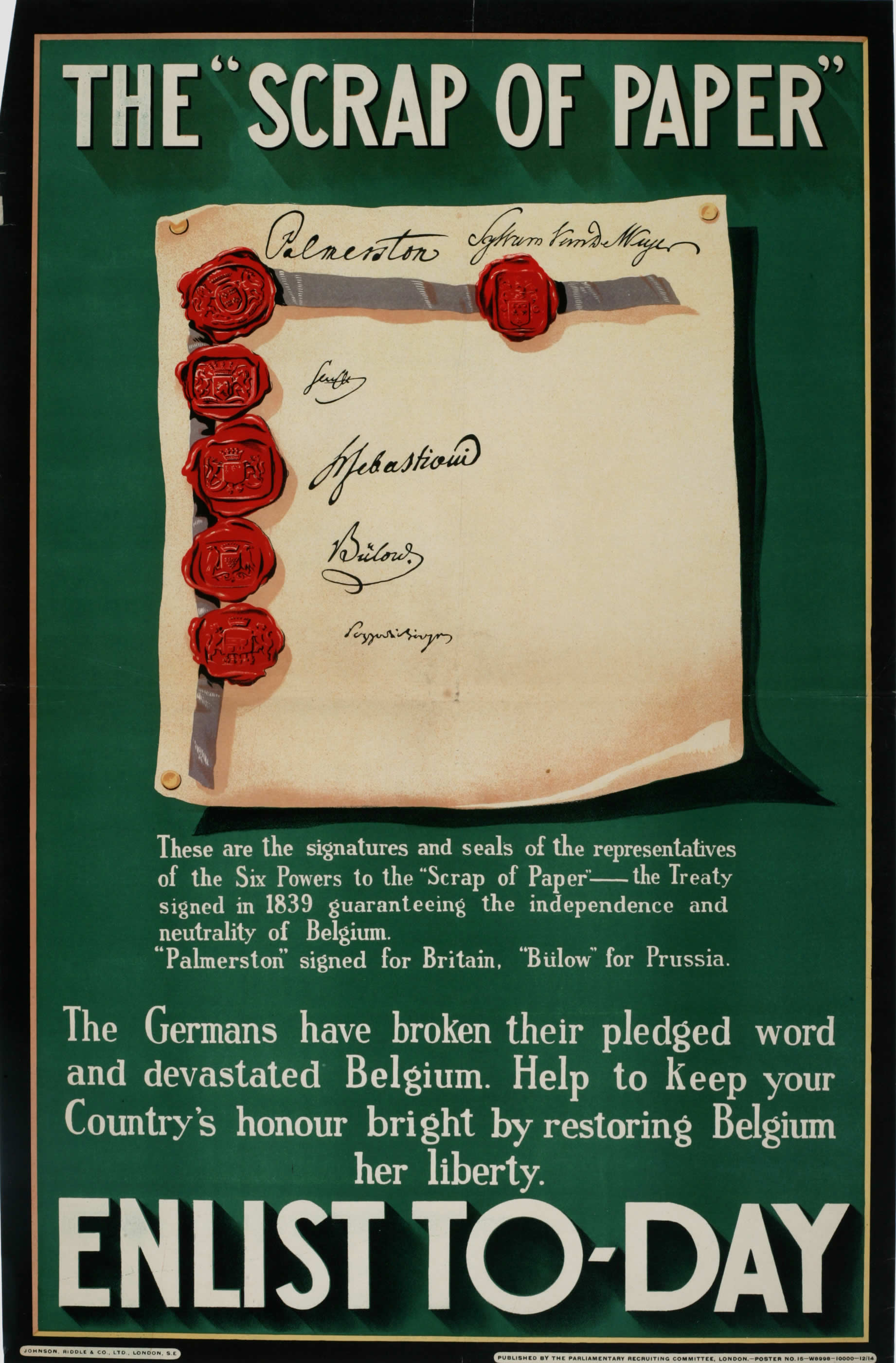
The Treaty of London of 1839, was signed on 19 April 1839 between the Concert of Europe, the United Kingdom of the Netherlands and the Kingdom of Belgium. It was a direct follow-up to the 1831 Treaty of the XVIII Articles, which the Netherlands had refused to sign, and the result of negotiations at the London Conference of 1838–1839. Under the treaty, the European powers recognised and guaranteed the independence and neutrality of Belgium and established the full independence of the German-speaking part of Luxembourg. Article VII required Belgium to remain perpetually neutral; Belgium formally abandoned its policy of neutrality after its experiences in both world wars. Background Since 1815, Belgium had been a reluctant part of the United Kingdom of the Netherlands. In 1830, Belgians broke away and established an independent Kingdom of Belgium. The overwhelmingly Catholic population could not accept the Dutch king's favouritism toward Protestantism, while French-speake ... [...More Info...] [...Related Items...] OR: [Wikipedia] [Google] [Baidu] |
Fort Eben-Emael
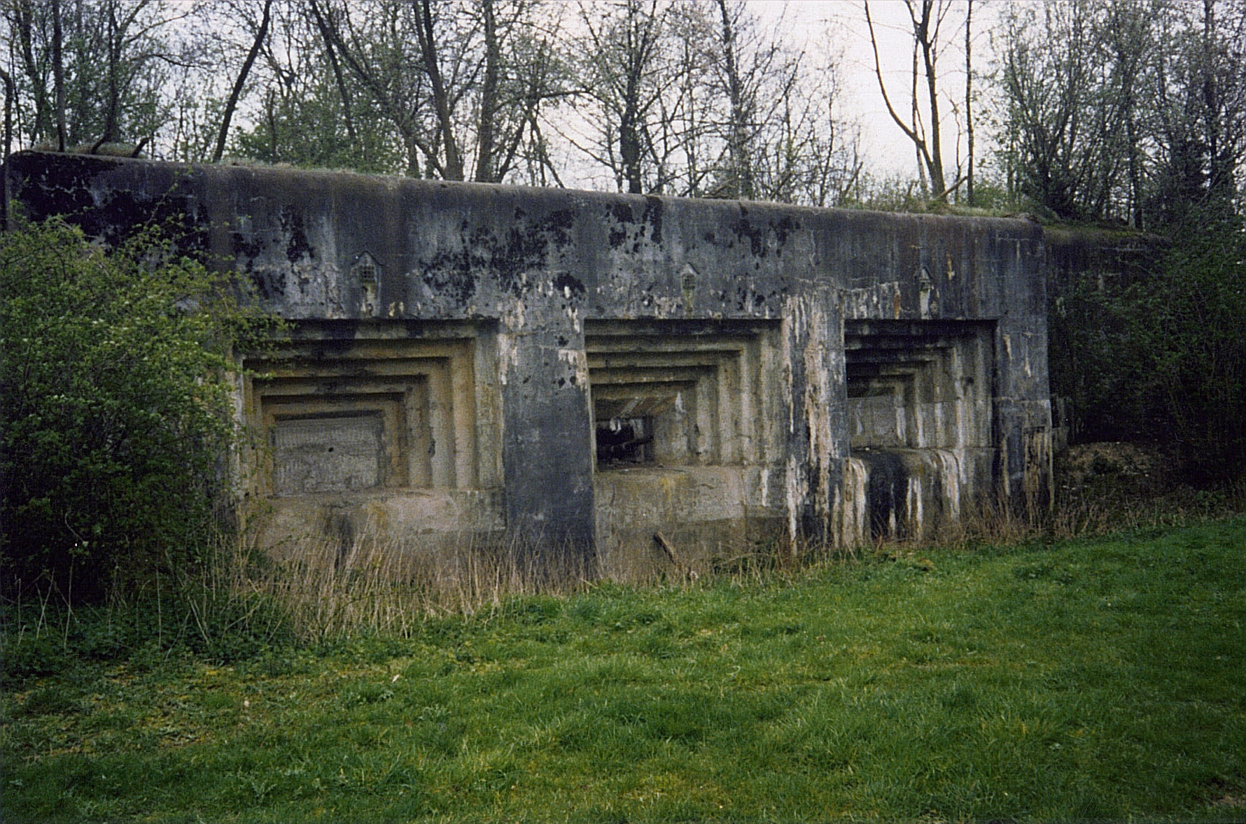
Fort Eben-Emael (french: Fort d'Ében-Émael, ) is an inactive Belgian fortress located between Liège and Maastricht, on the Belgian-Dutch border, near the Albert Canal, outside the village of Ében-Émael. It was designed to defend Belgium from a German attack across the narrow belt of Dutch territory in the region. Constructed in 1931–1935, it was reputed to be impregnable and at the time, the largest in the world. The fort was neutralized by glider-borne German troops (85 men) on 10 May 1940 during the Second World War. The action cleared the way for German ground forces to enter Belgium, unhindered by fire from Eben-Emael. Still the property of the Belgian Army, the fort has been preserved and may be visited. Location The fort is located along the Albert Canal where it runs through a deep cutting at the junction of the Belgian, Dutch and German borders, about northeast of Liège and about south of Maastricht. A huge excavation project was carried out in the 1920s ... [...More Info...] [...Related Items...] OR: [Wikipedia] [Google] [Baidu] |
William I De La Marck
William is a male given name of Germanic origin.Hanks, Hardcastle and Hodges, ''Oxford Dictionary of First Names'', Oxford University Press, 2nd edition, , p. 276. It became very popular in the English language after the Norman conquest of England in 1066,All Things William"Meaning & Origin of the Name"/ref> and remained so throughout the Middle Ages and into the modern era. It is sometimes abbreviated "Wm." Shortened familiar versions in English include Will, Wills, Willy, Willie, Bill, and Billy. A common Irish form is Liam. Scottish diminutives include Wull, Willie or Wullie (as in Oor Wullie or the play ''Douglas''). Female forms are Willa, Willemina, Wilma and Wilhelmina. Etymology William is related to the given name ''Wilhelm'' (cf. Proto-Germanic ᚹᛁᛚᛃᚨᚺᛖᛚᛗᚨᛉ, ''*Wiljahelmaz'' > German ''Wilhelm'' and Old Norse ᚢᛁᛚᛋᛅᚼᛅᛚᛘᛅᛋ, ''Vilhjálmr''). By regular sound changes, the native, inherited English form of the name should ... [...More Info...] [...Related Items...] OR: [Wikipedia] [Google] [Baidu] |


