|
Kandalaksha Bay
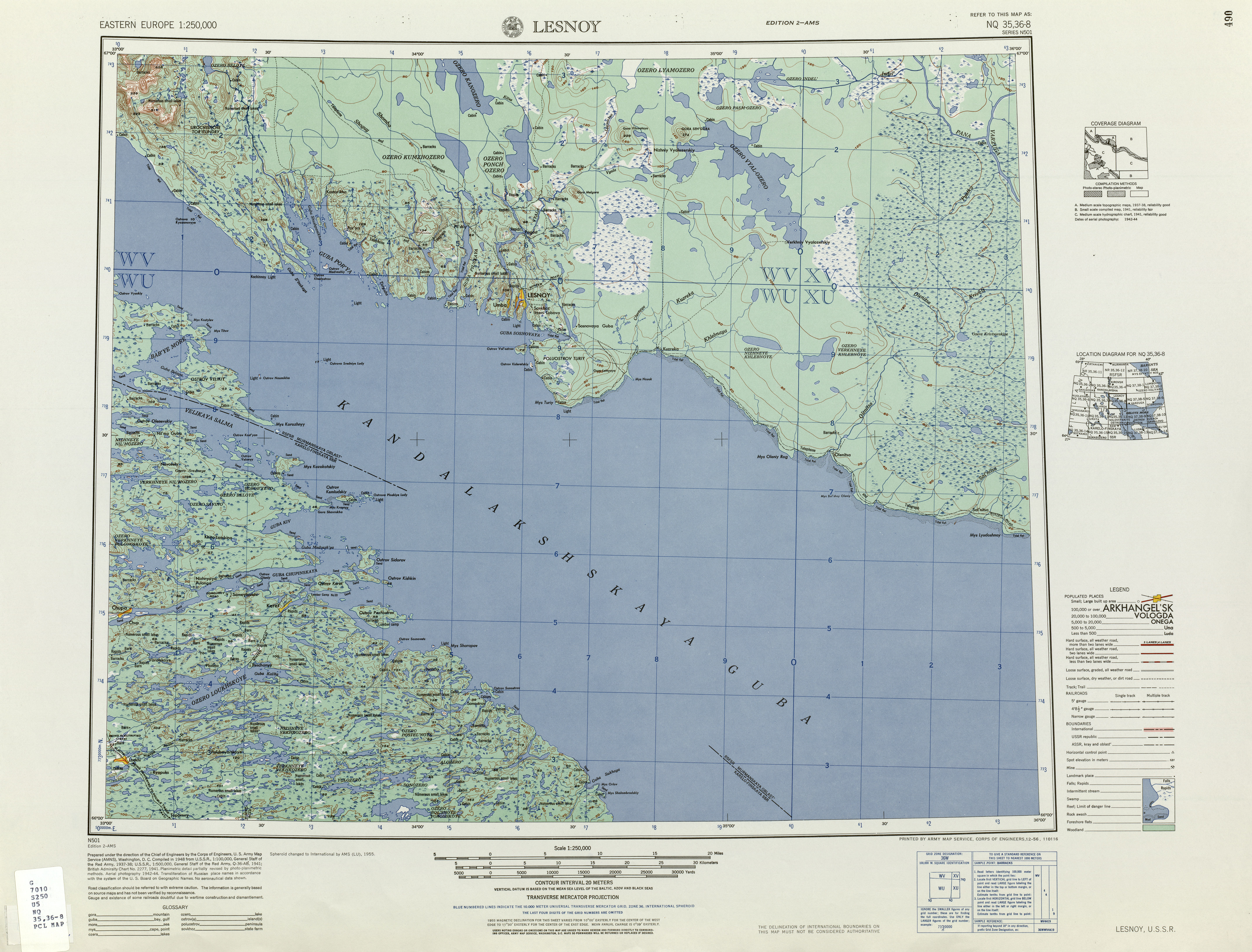
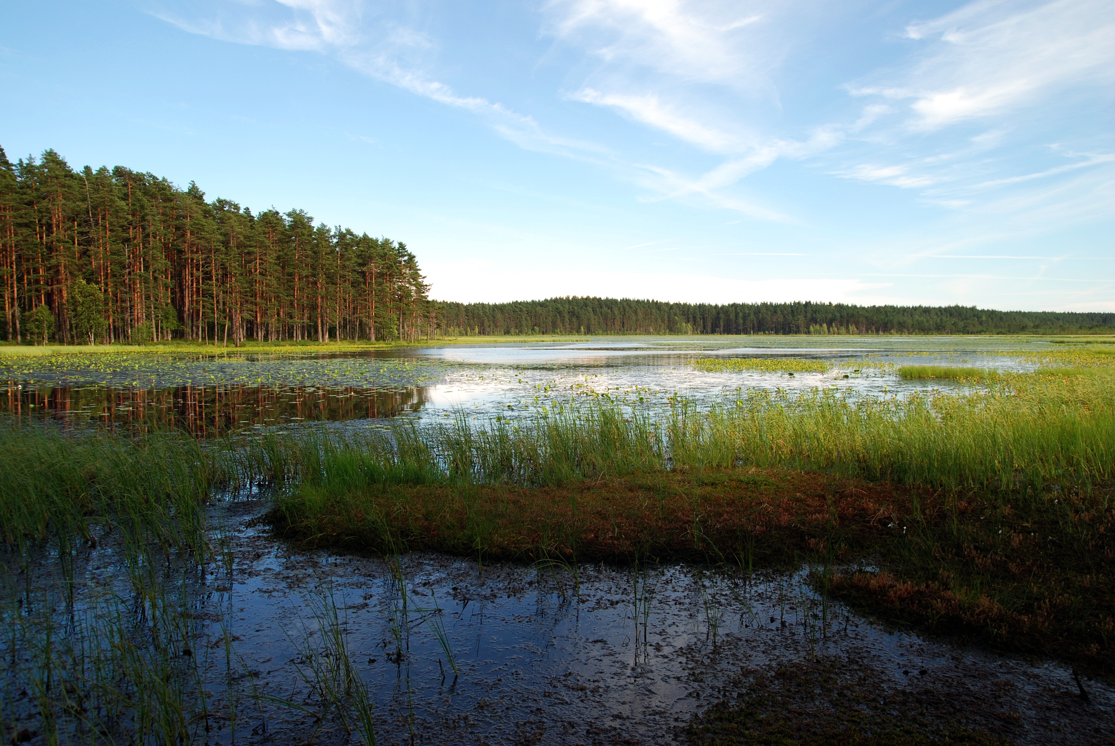
The Kandalaksha Gulf (, sms, Käddluhtt), fi, Kantalahti) is located in the Republic of Karelia, and Murmansk Oblast in northwestern Russia. Forming the north-western corner of the White Sea, it is one of four large bays and gulfs of this sea, the others being the Onega Bay (south-west), the Dvina Bay (south), and the Mezen Bay (south east). The Kola Peninsula lies north of the Kandalaksha Gulf. The city of Kandalaksha is located at the northern tip of the gulf; the new oil port Vitino, some 10 km to the south. There are hundreds of skerries in the gulf. The gulf is shallow, reaching 300 meters on its western side. In 1976, the upper reaches of the gulf were designated a Ramsar wetland of international importance, notably as a breeding ground for migratory waterfowl such as the sea duck. Kandalaksha Nature Reserve ( Кандалакшский заповедник) includes parts of the coastline and many of the islands in the gulf. It is one of Russia's oldest nature reser ... [...More Info...] [...Related Items...] OR: [Wikipedia] [Google] [Baidu] |
White Sea
The White Sea (russian: Белое море, ''Béloye móre''; Karelian and fi, Vienanmeri, lit. Dvina Sea; yrk, Сэрако ямʼ, ''Serako yam'') is a southern inlet of the Barents Sea located on the northwest coast of Russia. It is surrounded by Karelia to the west, the Kola Peninsula to the north, and the Kanin Peninsula to the northeast. The whole of the White Sea is under Russian sovereignty and considered to be part of the internal waters of Russia.A. D. Dobrovolskyi and B. S. Zalogi"Seas of USSR. White Sea" Moscow University (1982) (in Russian) Administratively, it is divided between Arkhangelsk and Murmansk oblasts and the Republic of Karelia. The major port of Arkhangelsk is located on the White Sea. For much of Russia's history this was Russia's main centre of international maritime trade, conducted by the Pomors ("seaside settlers") from Kholmogory. In the modern era it became an important Soviet naval and submarine base. The White Sea–Baltic Canal connec ... [...More Info...] [...Related Items...] OR: [Wikipedia] [Google] [Baidu] |
Ramsar Sites In Russia
Ramsar sites are natural locations under the protection of the Ramsar Convention for the conservation and sustainable utilization of wetlands. As of March 2013 there were 35 Ramsar sites in Russia, totalling an area of . The first Russian sites registered in the Ramsar Convention, on 11 October 1976 (during the Soviet era), were Kandalaksha Bay Lake Khanka and the Volga River delta. List of Ramsar sites in Russia Classification codes for Ramsar wetland types * Ramsar classification codes are listed for each site in descending order of area cover at the site. See also * Ramsar Convention * List of Ramsar sites worldwide References {{reflist, 30em External links The Ramsar Convention on WetlandsUnited States National Ramsar Committee __NOTOC__ Ramsar Russia Ramsar Ramsar may refer to: * Places so named: ** Ramsar, Mazandaran, city in Iran ** Ramsar, Rajasthan, village in India * Eponyms of the Iranian city: ** Ramsar Convention concerning wetlands, signed in Ramsar, ... [...More Info...] [...Related Items...] OR: [Wikipedia] [Google] [Baidu] |
Bodies Of Water Of The Republic Of Karelia
Bodies may refer to: * The plural of body * ''Bodies'' (2004 TV series), BBC television programme * Bodies (upcoming TV series), an upcoming British crime thriller limited series * "Bodies" (''Law & Order''), 2003 episode of ''Law & Order'' * Bodies: The Exhibition, exhibit showcasing dissected human bodies in cities across the globe * ''Bodies'' (novel), 2002 novel by Jed Mercurio * ''Bodies'', 1977 play by James Saunders (playwright) * ''Bodies'', 2009 book by British psychoanalyst Susie Orbach Music * ''Bodies'' (album), a 2021 album by AFI * ''Bodies'' (EP), a 2014 EP by Celia Pavey * "Bodies" (Drowning Pool song), 2001 hard rock song by Drowning Pool * "Bodies" (Sex Pistols song), 1977 punk rock song by the Sex Pistols * "Bodies" (Little Birdy song), 2007 indie rock song by Little Birdy * "Bodies" (Robbie Williams song), 2009 pop song by Robbie Williams * "Bodies", a song by Megadeth from ''Endgame'' * "Bodies", a song by The Smashing Pumpkins from ''Mellon Collie an ... [...More Info...] [...Related Items...] OR: [Wikipedia] [Google] [Baidu] |
Gulfs Of Russia
A gulf is a large inlet from the ocean into the landmass, typically with a narrower opening than a bay, but that is not observable in all geographic areas so named. The term gulf was traditionally used for large highly-indented navigable bodies of salt water that are enclosed by the coastline. Many gulfs are major shipping areas, such as the Persian Gulf, Gulf of Mexico, Gulf of Finland, and Gulf of Aden The Gulf of Aden ( ar, خليج عدن, so, Gacanka Cadmeed 𐒅𐒖𐒐𐒕𐒌 𐒋𐒖𐒆𐒗𐒒) is a deepwater gulf of the Indian Ocean between Yemen to the north, the Arabian Sea to the east, Djibouti to the west, and the Guardafui Channe .... See also * References External links * {{Authority control Bodies of water Coastal and oceanic landforms Coastal geography Oceanographical terminology ... [...More Info...] [...Related Items...] OR: [Wikipedia] [Google] [Baidu] |
Gulfs Of The Arctic Ocean
A gulf is a large inlet from the ocean into the landmass, typically with a narrower opening than a bay, but that is not observable in all geographic areas so named. The term gulf was traditionally used for large highly-indented navigable bodies of salt water that are enclosed by the coastline. Many gulfs are major shipping areas, such as the Persian Gulf, Gulf of Mexico, Gulf of Finland, and Gulf of Aden The Gulf of Aden ( ar, خليج عدن, so, Gacanka Cadmeed 𐒅𐒖𐒐𐒕𐒌 𐒋𐒖𐒆𐒗𐒒) is a deepwater gulf of the Indian Ocean between Yemen to the north, the Arabian Sea to the east, Djibouti to the west, and the Guardafui Channe .... See also * References External links * {{Authority control Bodies of water Coastal and oceanic landforms Coastal geography Oceanographical terminology ... [...More Info...] [...Related Items...] OR: [Wikipedia] [Google] [Baidu] |
White Sea Rift System
The White Sea Rift System is a complex of rifts manifested as numerous individual grabens located chiefly in the White Sea but including onshore areas and a strip of the Barents Sea. The rifts run in a subparallel manner from northwest to southeast where the rift system continues under the East European Platform. The system or complex originated due to extensional tectonics acting during the Middle to Late Riphean in the Proterozoic. This tectonic environment is believed to have been related to the break-up of the ancient supercontinent Palaeopangea. During the Riphean the graben structures were filled by Jotnian sediments. During the Middle Paleozoic the rift system was reactivated resulting in intrusion of alkaline magmas. In the Late Cenozoic The Cenozoic ( ; ) is Earth's current geological era, representing the last 66million years of Earth's history. It is characterised by the dominance of mammals, birds and flowering plants, a cooling and drying climate, and the curr ... [...More Info...] [...Related Items...] OR: [Wikipedia] [Google] [Baidu] |
Gandvik
In Norse mythology, Gandvík is a dangerous sea, known as the "Bay of Serpents" because of its tortuous shape. The 12th-13th century Dane Saxo Grammaticus stated that Gandvik was an old name for the Baltic Sea (a name misspelt Grandvik in some translations). The legend presumably refers to the Gulf of Bothnia. However, there are two opposite theories about where Gandvik was situated, based on the 1323 Treaty of Nöteborg: in the Arctic Ocean or the Gulf of Bothnia. Starting from the 1850s, the former received more support, in that Sweden had extended far out to the Arctic Ocean, but since the 1920s the latter has gained more support. However, ''Hversu Noregr byggðist'', dating from the former part of the 13th century, is by most opinions referring to the White Sea The White Sea (russian: Белое море, ''Béloye móre''; Karelian and fi, Vienanmeri, lit. Dvina Sea; yrk, Сэрако ямʼ, ''Serako yam'') is a southern inlet of the Barents Sea located on the northwe ... [...More Info...] [...Related Items...] OR: [Wikipedia] [Google] [Baidu] |
Atlantic (period)
The Atlantic in palaeoclimatology was the warmest and moistest Blytt–Sernander period, pollen zone and chronozone of Holocene northern Europe. The climate was generally warmer than today. It was preceded by the Boreal, with a climate similar to today's, and was followed by the Subboreal, a transition to the modern. Because it was the warmest period of the Holocene, the Atlantic is often referenced more directly as the Holocene climatic optimum, or just climatic optimum. Subdividing the Atlantic The Atlantic is equivalent to pollen zone VII. Sometimes a Pre-atlantic or early Atlantic is distinguished, on the basis of an early dividing cold snap. Other scientists place the Atlantic entirely after the cold snap, assigning the latter to the Boreal. The period is still in the process of definition. Dating Beginning of the Atlantic period It is a question of definition and the criteria: Beginning with the temperatures, as derivable from Greenland ice core data, it is possible to ... [...More Info...] [...Related Items...] OR: [Wikipedia] [Google] [Baidu] |
Year
A year or annus is the orbital period of a planetary body, for example, the Earth, moving in its orbit around the Sun. Due to the Earth's axial tilt, the course of a year sees the passing of the seasons, marked by change in weather, the hours of daylight, and, consequently, vegetation and soil fertility. In temperate and subpolar regions around the planet, four seasons are generally recognized: spring, summer, autumn and winter. In tropical and subtropical regions, several geographical sectors do not present defined seasons; but in the seasonal tropics, the annual wet and dry seasons are recognized and tracked. A calendar year is an approximation of the number of days of the Earth's orbital period, as counted in a given calendar. The Gregorian calendar, or modern calendar, presents its calendar year to be either a common year of 365 days or a leap year of 366 days, as do the Julian calendars. For the Gregorian calendar, the average length of the calendar year (t ... [...More Info...] [...Related Items...] OR: [Wikipedia] [Google] [Baidu] |
Post-glacial Rebound
Post-glacial rebound (also called isostatic rebound or crustal rebound) is the rise of land masses after the removal of the huge weight of ice sheets during the last glacial period, which had caused isostatic depression. Post-glacial rebound and isostatic depression are phases of glacial isostasy (glacial isostatic adjustment, glacioisostasy), the deformation of the Earth's crust in response to changes in ice mass distribution. The direct raising effects of post-glacial rebound are readily apparent in parts of Northern Eurasia, Northern America, Patagonia, and Antarctica. However, through the processes of ''ocean siphoning'' and ''continental levering'', the effects of post-glacial rebound on sea level are felt globally far from the locations of current and former ice sheets.Milne, G.A., and J.X. Mitrovica (2008) ''Searching for eustasy in deglacial sea-level histories.'' Quaternary Science Reviews. 27:2292–2302. Overview During the last glacial period, much of northern Eu ... [...More Info...] [...Related Items...] OR: [Wikipedia] [Google] [Baidu] |
Deglaciation
Deglaciation is the transition from full glacial conditions during ice ages, to warm interglacials, characterized by global warming and sea level rise due to change in continental ice volume. Thus, it refers to the retreat of a glacier, an ice sheet or frozen surface layer, and the resulting exposure of the Earth's surface. The decline of the cryosphere due to ablation can occur on any scale from global to localized to a particular glacier. After the Last Glacial Maximum (ca. 21,000 years ago), the last deglaciation begun, which lasted until the early Holocene. Around much of Earth, deglaciation during the last 100 years has been accelerating as a result of climate change, partly brought on by anthropogenic changes to greenhouse gases. The previous deglaciation took place from approximately 22 ka until 11.5 ka. This occurred when there was an annual mean atmospheric temperature on the earth that increased by roughly 5 °C, which was also accompanied by regional hi ... [...More Info...] [...Related Items...] OR: [Wikipedia] [Google] [Baidu] |


