|
Kamiichi
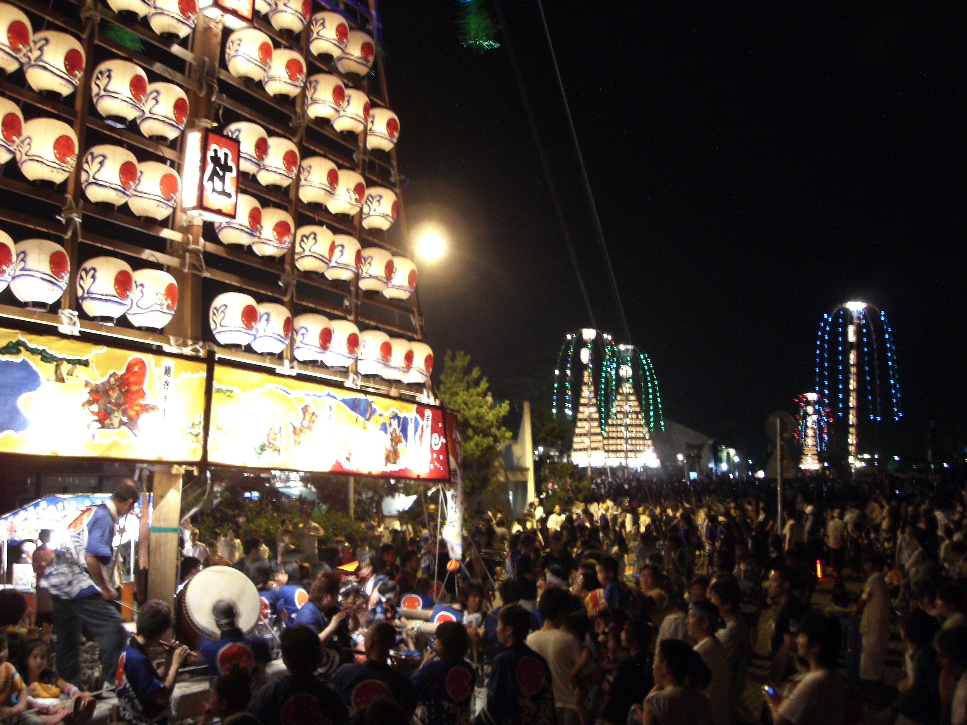
270px, Panorama of Kamiichi is a town located in Nakaniikawa District, Toyama Prefecture, Japan. , the town had an estimated population of 20,827 in 7958 households and a population density of 88 persons per km². The total area of the town was . Geography Kamiichi is located in east-central Toyama Prefecture, approximately 15 kilometers to the east of the capital of Toyama city. Most of the town is very mountainous, with peaks rising to almost 3000 meters in the southeast. The 2999 meter Mount Tsurugi is located in Kamiichi. Surrounding municipalities *Toyama Prefecture ** Toyama ** Namerikawa ** Uozu ** Kurobe Climate The town has a Humid subtropical climate (Köppen ''Cfa'') characterized by hot summers and cold winters with heavy snowfall. The average annual temperature in Kamiichi is 13.8 °C. The average annual rainfall is 2243 mm with September as the wettest month. The temperatures are highest on average in August, at around 26.4 °C, and lowest in J ... [...More Info...] [...Related Items...] OR: [Wikipedia] [Google] [Baidu] |
Kamiichi Kurokawa Sites
The is a group of archaeological sites in the town of Kamiichi, Toyama Prefecture in the Hokuriku region of Japan. It has been collectively protected as a National Historic Site since 1981. Outline The National Historic Site designation encompasses three discontinuous but related areas within Kamiichi at the foot of Mount Tateyama which contain the ruins of a Buddhist temple, a cemetery, and a sutra mound built from the end of the Heian period through the Kamakura period, which are noteworthy both for their size but also for the quality of excavated items. The sites are located about 15 minutes by car from Kamiichi Station on the Toyama Chiho Railway Main Line; however, there are no public facilities. Ennenjiyama Sutra Mound The is actually a cluster of 24 sutra mounds, making it the latest such cluster yet discovered in the Hokuriku region. The sutra containers include Suzu ware and ceramics imported from China during the early Kamakura period and also include a number of S ... [...More Info...] [...Related Items...] OR: [Wikipedia] [Google] [Baidu] |
Nisseki-ji
is a Buddhist temple in the town of Kamiichi, Toyama Prefecture, Japan. The temple belongs to the Shingon sect of Japanese Buddhism. It is more popularly known by the name of after its main image. History The temple claims to have been founded in 725 AD by the wandering priest/miracle-worker Gyōki, who carved a 2.8 meter statue of Fudō Myō-ō in bas-relief on a tuff cliff-face. While there are no historical records to back up this claim, the carving itself dates from the late Heian period and is a designated Important Cultural Property in 1974. The statue is part of a group, which includes two of Fudō Myō-ō's assistants and , a seated statue of Amida Nyōrai and a seated Buddhist priest (possibly Gyōki). The latter two statues may have been added at a later date. The Fudō Myō-ō is 2.8 meters high and remains in good very preservation as it have been protected by a building for most of history. The temple was connected with worship of the sacred mountain Mount Tate ... [...More Info...] [...Related Items...] OR: [Wikipedia] [Google] [Baidu] |
Namerikawa, Toyama
is a city in eastern Toyama Prefecture, Japan. , the city had an estimated population of 33,045 in 12674 households and a population density of 605 persons per km². Its total area was . The coast of Namerikawa is the habitat of the world famous glowing , which surface yearly in a phenomenon that has been designated a Special Natural Monument by the Japanese government. The city was founded on March 1, 1954. Geography Namerikawa is in northeastern Toyama Prefecture, in the Hayatsuki river delta and is bordered by the Sea of Japan (Toyama Bay) to the northwest. Namerikawa is located 1 hour by air (via Toyama Airport), 3 hours by rail and 5 hours by car from Tokyo. Since March 2015, rail access is possible via Hokuriku Shinkansen high-speed train from nearby Toyama. The city area is formed on the alluvial fan between the Hayatsuki River and the Kamiichi River. Namerikawa has a humid continental climate (Köppen ''Cfa'') characterized by mild summers and cold winters with heavy s ... [...More Info...] [...Related Items...] OR: [Wikipedia] [Google] [Baidu] |
Toyama Prefecture
is a prefecture of Japan located in the Chūbu region of Honshu. Toyama Prefecture has a population of 1,044,588 (1 June 2019) and has a geographic area of 4,247.61 km2 (1,640.01 sq mi). Toyama Prefecture borders Ishikawa Prefecture to the west, Gifu Prefecture to the south, Nagano Prefecture to the east, and Niigata Prefecture to the northeast. Toyama is the capital and largest city of Toyama Prefecture, with other major cities including Takaoka, Imizu, and Nanto. Toyama Prefecture is part of the historic Hokuriku region, and the majority of prefecture's population lives on Toyama Bay, one of the largest bays in Japan. Toyama Prefecture is the leading industrial prefecture on the Japan Sea coast and has the advantage of cheap electricity from abundant hydroelectric resources. Toyama Prefecture contains the only known glaciers in East Asia outside of Russia, first recognized in 2012, and 30% of the prefecture's area is designated as national parks. History Hist ... [...More Info...] [...Related Items...] OR: [Wikipedia] [Google] [Baidu] |
Toyama Chihō Railway Main Line
The is a Japanese railway line that connects Dentetsu-Toyama Station in Toyama, Toyama with Unazuki Onsen Station in Kurobe, Toyama. It is owned and run by Toyama Chihō Railway. Station list History The first section of what is now this line was opened by Tateyama Light Railway as a gauge line between Gohyakkoku (on the Toyama Chiho Railway Tateyama Line) and Namerikawa in 1913. The Kurobe Railway opened the Dentetsu Kurobe to Unazuki Onsen section as a gauge line between 1922 and 1923. In 1932, the Toyama Electric Railway acquired the Tateyama Light Railway, and built a line from Dentetsu-Toyama to Namerikawa, regauging some of the original line to 1,067 mm gauge, and electrifying it at 1,500 V DC. The Namerikawa to Dentetsu Kurobe section was opened between 1935 and 1936, and the Kurobe Railway was merged with the Toyama Electric Railway in 1943 to create the current company, with the electrification to Unazuki Onsen commissioned the same year. CTC signalling was ... [...More Info...] [...Related Items...] OR: [Wikipedia] [Google] [Baidu] |
Towns Of Japan
A town (町; ''chō'' or ''machi'') is a local administrative unit in Japan. It is a local public body along with prefecture (''ken'' or other equivalents), city (''shi''), and village (''mura''). Geographically, a town is contained within a district. Note that the same word (町; ''machi'' or ''chō'') is also used in names of smaller regions, usually a part of a ward in a city. This is a legacy of when smaller towns were formed on the outskirts of a city, only to eventually merge into it. Towns See also * Municipalities of Japan * Japanese addressing system The Japanese addressing system is used to identify a specific location in Japan. When written in Japanese characters, addresses start with the largest geographical entity and proceed to the most specific one. When written in Latin characters, ad ... References {{reflist External links "Large_City_System_of_Japan";_graphic_shows_towns_compared_with_other_Japanese_city_types_at_p._1_[PDF_7_of_40/nowiki>">DF_7_of_4 ... [...More Info...] [...Related Items...] OR: [Wikipedia] [Google] [Baidu] |
Kurobe, Toyama
is a city in Toyama Prefecture, in the Chūbu region of Japan. , the city had an estimated population of 41,564 in 15,387 households and a population density of 95.8 persons per km². Its total area was . Geography Kurobe is located in northeastern of Toyama Prefecture, with a topography ranging from sea level at Toyama Bay to the 3000 meter mountains of the Northern Alps on the border with Nagano Prefecture. The Kurobe River flows through the city. Kurobe has a humid continental climate (Köppen ''Cfa'') characterized by mild summers and cold winters with heavy snowfall. The average annual temperature in Kurobe is 13.7 °C. The average annual rainfall is 2277 mm with September as the wettest month. The temperatures are highest on average in August, at around 26.2 °C, and lowest in January, at around 2.6 °C. Surrounding municipalities *Toyama Prefecture ** Asahi ** Nyūzen ** Kamiichi *Nagano Prefecture ** Omachi ** Hakuba Demographics Per Japanese censu ... [...More Info...] [...Related Items...] OR: [Wikipedia] [Google] [Baidu] |
List Of Towns In Japan
A town (町; ''chō'' or ''machi'') is a local administrative unit in Japan. It is a local public body along with prefecture (''ken'' or other equivalents), city (''shi''), and village (''mura''). Geographically, a town is contained within a district. Note that the same word (町; ''machi'' or ''chō'') is also used in names of smaller regions, usually a part of a ward in a city. This is a legacy of when smaller towns were formed on the outskirts of a city, only to eventually merge into it. Towns See also * Municipalities of Japan * Japanese addressing system The Japanese addressing system is used to identify a specific location in Japan. When written in Japanese characters, addresses start with the largest geographical entity and proceed to the most specific one. When written in Latin characters, ad ... References {{reflist External links "Large_City_System_of_Japan";_graphic_shows_towns_compared_with_other_Japanese_city_types_at_p._1_[PDF_7_of_40/nowiki>">DF_7_of_4 ... [...More Info...] [...Related Items...] OR: [Wikipedia] [Google] [Baidu] |
Uozu, Toyama
is a Cities of Japan, city in the eastern part of Toyama Prefecture, Japan. , the city had an estimated population of 42,224 in 16,811 households and a population density of 210 persons per km². Its total area was . Geography Uozu lies in between Namerikawa, Toyama, Namerikawa and Kurobe, Toyama, Kurobe, stretching from Toyama Bay and the Sea of Japan in the northwest to tall mountain ranges in the southeast. The highest mountains in Uozu are Sougadake and Kekachiyama, and the highest elevation in Uozu is 2,414 m. Several rapid rivers run through Uozu; from east to west, they are the Fuse River, the Katakai River, the Kado River, and the Hayatsuki River. Much of the area is a dispersed settlement typical of this region of Japan. Surrounding municipalities *Toyama Prefecture ** Kurobe, Toyama, Kurobe ** Namerikawa, Toyama, Namerikawa ** Kamiichi, Toyama, Kamiichi Climate Uozu has a Humid subtropical climate, humid continental climate (Köppen ''Cfa'') characterized by mild s ... [...More Info...] [...Related Items...] OR: [Wikipedia] [Google] [Baidu] |
Nakaniikawa District, Toyama
is a district located in Toyama Prefecture, Japan. As of October 1, 2016, the district has an estimated population of 49,839 and a density of 91 persons per km2. The total area is 547.55 km2. Towns and villages *Funahashi *Kamiichi *Tateyama Tateyama may refer to: People with the surname * Midori Tateyama, Japanese writer * Shohei Tateyama (born 1981), Japanese baseball player * Yoshinori Tateyama (born 1975), Japanese baseball player * Homarefuji Yoshiyuki (born 1985), Japanese su ... Districts in Toyama Prefecture {{Toyama-geo-stub ... [...More Info...] [...Related Items...] OR: [Wikipedia] [Google] [Baidu] |
Toyama, Toyama
is the capital city of Toyama Prefecture, Japan, located on the coast of the Sea of Japan in the Chūbu region on central Honshū, about north of the city of Nagoya and northwest of Tokyo. , the city had an estimated population of 415,844 in 176,643 households, and a population density of 335 persons per km2. Its total area was . Overview The city has been designated an environmental model city by the national government for its efforts to reduce the emission of greenhouse gases. Cityscapes File:Toyama Castle (4207284334).jpg, Toyama Castle(2009) File:Anyobo, Toyama, Toyama Prefecture 930-0881, Japan - panoramio (35).jpg, Skyline of Toyama City(2015) File:View from Toyama City Hall, north side.jpg, CBD of Toyama(2018) File:Sogawa st.jpeg, Downtown Sōgawa(2016) File:Fugan unga.JPG, Toyama Kansui park(2016) Geography Located in the middle of its prefecture, Toyama is a seaside city by the coast of the Sea of Japan. Its municipal territory borders with ... [...More Info...] [...Related Items...] OR: [Wikipedia] [Google] [Baidu] |
Etchū Province
was a province of Japan in the area that is today Toyama Prefecture in the Hokuriku region of Japan. Etchū bordered on Noto and Kaga Provinces to the west, Shinano and Hida Provinces to the south, Echigo Province to the east and the Sea of Japan to the north. Its abbreviated form name was . History was an ancient province of Japan and is listed as one of the original provinces in the '' Nihon Shoki''. The region as a whole was sometimes referred to as . In 701 AD, per the reforms of the Taihō Code, Koshi was divided into three separate provinces: Echizen, Etchū, and Echigo. However, in 702 AD, the four western districts of Etchū Province (Kubiki, Kosi, Uonuma and Kambara) were transferred to Echigo Province. Etchū annexed Noto Province in 741 AD, but Noto was separated out again in 757 AD. In 746 AD, the noted poet Ōtomo no Yakamochi became ''Kokushi'', and left many references to the region in the poetic anthology ''Man'yōshū''. The Nara period provincial ... [...More Info...] [...Related Items...] OR: [Wikipedia] [Google] [Baidu] |


