|
Kai Tak Development
The Kai Tak Development (), abbreviated as "KTD" and formerly called South East Kowloon Development (), refers to the redevelopment of the former Kai Tak Airport site in Kai Tak, Kowloon, Hong Kong. After the airport relocated to Chek Lap Kok in 1998, the Hong Kong government planned for urban development on the old airport site. The plan calls for a multi-purpose sports complex, a metro park, the Kai Tak Cruise Terminal, a hotel, a housing estate, and commercial and entertainment construction projects over an area of more than . The plan also covered nearby development in areas including Ma Tau Wai, Kowloon City, San Po Kong, Kowloon Bay and Kwun Tong. The planned population is 86,000 people, accommodated in 30,000 housing units, including 13,000 constructed as part of public housing estates. The total gross floor area is over with over of open space. The total cost for the development is about HK$100 billion. After several years of planning and discussion, and the decisio ... [...More Info...] [...Related Items...] OR: [Wikipedia] [Google] [Baidu] |
Kai Tak Airport
Kai Tak Airport was the international airport of Hong Kong from 1925 until 1998. Officially known as Hong Kong International Airport from 1954 to 6 July 1998, it is often referred to as Hong Kong International Airport, Kai Tak, or simply Kai Tak and Kai Tak International Airport, to distinguish it from its successor, Chek Lap Kok International Airport, built on reclaimed and levelled land around the islands of Chek Lap Kok and Lam Chau, to the west. Because of the geography of the area positioning the airport with water on three sides of the runway, with Kowloon City's residential apartment complexes and 2000-plus foot mountains to the north-east of the airport, aircraft could not fly over the mountains and quickly drop in for a final approach. Instead, aircraft had to fly above Victoria Harbour and Kowloon City, passing north of Mong Kok's Bishop Hill. After passing Bishop Hill, pilots would see Checkerboard Hill with a large red and white checkerboard pattern. Once the pa ... [...More Info...] [...Related Items...] OR: [Wikipedia] [Google] [Baidu] |
Diamond Hill
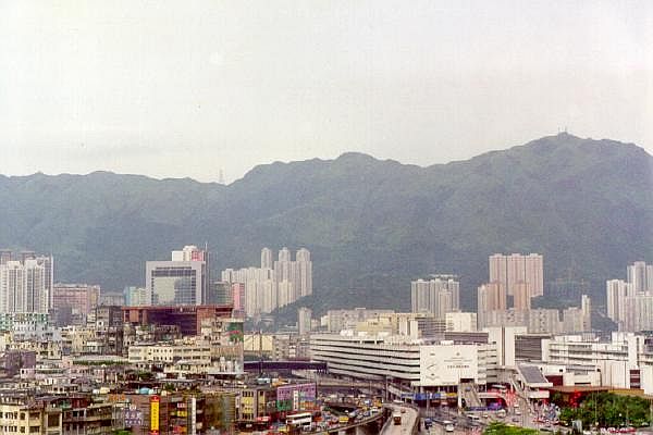
Diamond Hill is a hill in the east of Kowloon, Hong Kong. The name also refers to the area on or adjacent to the hill. It is surrounded by Ngau Chi Wan, San Po Kong, Wong Tai Sin and Tsz Wan Shan. Its northeast is limited by the ridge. It is principally a residential district. Administratively, the area is part of Wong Tai Sin District. History The village settlements in the area, Sheung Yuen Leng () and Ha Yuen Leng (), predated British colonization, and may have been established as early as the early eighteenth century. There were squatter dwellings ( shanties) up and down the hill that were demolished after years of effort by the Hong Kong Government. The squatter population peaked at around 50,000 people. Parts of the squatter settlement were demolished over the years, including for expansion of the Kai Tak Airport during the Japanese occupation, construction of the Mass Transit Railway, Lung Cheung Road, and the Tate's Cairn Tunnel. Due to the dramatic shortage of publ ... [...More Info...] [...Related Items...] OR: [Wikipedia] [Google] [Baidu] |
Protection Of The Harbour Ordinance
The Protection of the Harbour Ordinance, Cap. 531 () is an ordinance in Hong Kong Law that aims to limit land reclamation in the surviving waters of Victoria Harbour. Content In section 3, the ordinance states that: *"The harbour is to be protected and preserved as a special public asset and a natural heritage of the Hong Kong people and, for that purpose, there shall be a presumption against reclamation in the harbour." *"All public officers and public bodies shall have regard to the principle stated in subsection (1) for guidance in the exercise of any powers vested in them." History The ordinance was proposed by the Society for Protection of the Harbour in 1996 and presented to the Legislative Council by Christine Loh. The bill was passed on 27 June 1997 and applied to the area of the harbour around Central, Hong Kong. On 3 November 1999 the Secretary for Planning, Environment and Lands moved for an amendment to the ordinance, which extended it to the entire area of Victo ... [...More Info...] [...Related Items...] OR: [Wikipedia] [Google] [Baidu] |
Society For Protection Of The Harbour
Society for Protection of the Harbour (SPH) () is a Hong-Kong-based organisation founded in November 1995. It is a charitable, non-political and non-profit making green group. The objectives of the organisation are to protect the Victoria Harbour in Hong Kong from destruction caused by Government's excessive reclamation and improper development, and to arouse public aspirations for the Harbour. To preserve the Harbour, SPH has raised a number of objections on related Government policies, undertaken numerous conservation projects, suggested constructive urban planning along the waterfront and carried out public education on harbour protection. Background There has historically been reclamation of Victoria Harbour since the early part of the 20th century. Since the 1989, when the Government had completed its feasibility study, and launched the Central and Wan Chai Reclamation project, there has been growing realisation on the part of the general public of the deterioration of the ... [...More Info...] [...Related Items...] OR: [Wikipedia] [Google] [Baidu] |
Tseung Kwan O
Tseung Kwan O New Town is one of the nine new towns in Hong Kong, built mainly on reclaimed land in the northern half of Junk Bay (known as Tseung Kwan O in Chinese/Cantonese language) in southeastern New Territories, after which it is named. The town/land area is usually known simply as Tseung Kwan O. Development of the new town was approved in 1982, with the initial population intake occurring in 1988. As of 2016, the town is home to around 396,000 residents. The total development area of Tseung Kwan O, including its industrial estate, is about , with a planned population of 445,000. Major residential neighbourhoods within the new town include Tsui Lam, Po Lam, Hang Hau, Tseung Kwan O Town Centre, Tiu Keng Leng (also known by its English name Rennie's Mill) and Siu Chik Sha, etc. Administratively, the new town belongs to Sai Kung District in southeastern New Territories, although it is often incorrectly regarded as part of Kowloon / New Kowloon due to its close proximity ... [...More Info...] [...Related Items...] OR: [Wikipedia] [Google] [Baidu] |
Kwun Tong Bypass
The Kwun Tong Bypass (also spelt Kwun Tong By-pass) is an elevated expressway between Lam Tin and Kowloon Bay in Kwun Tong District, Kowloon East, Hong Kong, with three lanes in each direction and a posted speed limit of . It is part of Route 2 and has links to Route 5 and Route 7. It bypasses the industrial township of Kwun Tong and passes next to the boundary of the Kai Tak Airport. Constructed mainly along the seaward frontage of Kwun Tong Business Area, the bypass was built to alleviate traffic congestion on Kwun Tong Road of Route 7, to which it is parallel. It bridges Eastern Harbour Crossing (Route 2) and Tseung Kwan O Tunnel (Route 7) at its southeastern end with Tate's Cairn Tunnel (Route 2) and Kai Tak Tunnel (Route 5) at its northwestern end, providing a fast connection across eastern New Kowloon. Route description The eastern terminus of the Kwun Tong Bypass is located above the junction of Lei Yue Mun Road and Tseung Kwan O Road, which connect to the Eastern Har ... [...More Info...] [...Related Items...] OR: [Wikipedia] [Google] [Baidu] |


