|
Kagamil Island from 1936 to 1938.
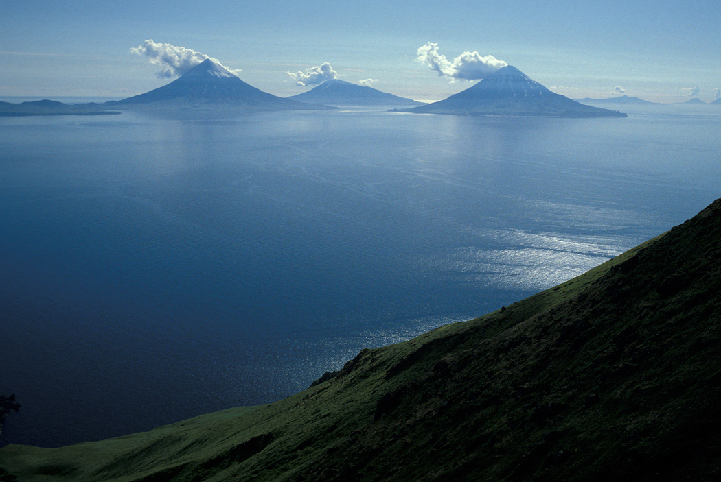
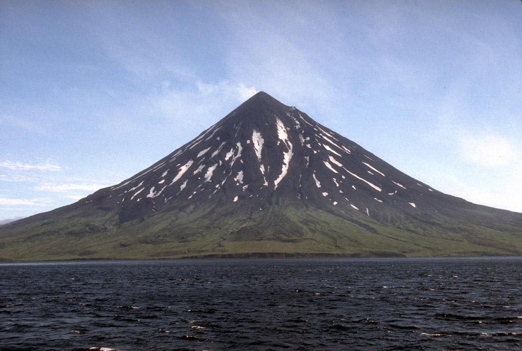
Kagamil Island ( ale, Qagaamila; russian: Кагамил), in the Islands of Four Mountains subgroup of the Aleutian archipelago, is north of Chuginadak Island and south of Uliaga Island. It is in length and up to in width. The southern half of the island is dominated by the Kagamil Volcano, which has two summits: one is above sea level, while the other is lower at . Henry Wood Elliott discovered a cave on the island containing 13 native mummies. Over 50 bodies were recovered by Aleš Hrdlička Alois Ferdinand Hrdlička, after 1918 changed to Aleš Hrdlička (; March 30,HRDLICKA, ALES ... References External links *[...More Info...] [...Related Items...] OR: [Wikipedia] [Google] [Baidu] |
Islands Of Four Mountains
Islands of Four Mountains (russian: Четырёхсопочные острова) is an island grouping of the Aleutian Islands in Alaska, United States. The chain includes, from west to east, Amukta, Chagulak, Yunaska, Herbert, Carlisle, Chuginadak, Uliaga, and Kagamil islands. This island chain is located between Amukta Pass and the Andreanof Islands to the west, and Samalga Pass and the Fox Islands to the east. These islands have a total land area of 210.656 sq mi (545.596 km2) and have no permanent population. The two largest islands are Yunaska and Chuginadak. Chuginadak is mainly made up of the active volcano Mount Cleveland. The name is translated from Russian Четырехсопочные Острова (Ostrova Chetyre Soposhnye) meaning "Islands of Four Volcanoes" (Sarichev, 1826, map 3). The early Russian explorers named the islands by this term because of four prominent volcanoes, each located on a separate island. The Aleut name ''Unigun'' (Uniiĝun ... [...More Info...] [...Related Items...] OR: [Wikipedia] [Google] [Baidu] |
Aleutian Islands
The Aleutian Islands (; ; ale, Unangam Tanangin,”Land of the Aleuts", possibly from Chukchi ''aliat'', "island"), also called the Aleut Islands or Aleutic Islands and known before 1867 as the Catherine Archipelago, are a chain of 14 large volcanic islands and 55 smaller islands. Most of the Aleutian Islands belong to the U.S. state of Alaska, but some belong to the Russian federal subject of Kamchatka Krai. They form part of the Aleutian Arc in the Northern Pacific Ocean, occupying a land area of 6,821 sq mi (17,666 km2) and extending about westward from the Alaska Peninsula toward the Kamchatka Peninsula in Russia, and act as a border between the Bering Sea to the north and the Pacific Ocean to the south. Crossing longitude 180°, at which point east and west longitude end, the archipelago contains both the westernmost part of the United States by longitude ( Amatignak Island) and the easternmost by longitude ( Semisopochnoi Island). The westernmost U.S. islan ... [...More Info...] [...Related Items...] OR: [Wikipedia] [Google] [Baidu] |
Chuginadak Island
Chuginadak Island ( ale, Tanax̂ Angunax̂; russian: Чугинадак) is the largest island in the Islands of Four Mountains subgroup of the Aleutian archipelago. Chuginadak is an Aleutian name published by Captain Tebenkov in an 1852 map. According to Knut Bergsland's Aleut Dictionary, the Aleutian word "chugida-lix" means "to fry, to make sizzle." The Western half of the island is called Chuginadax in Aleut, meaning 'simmering'. The island is approximately long and the currently activeAstronomy Picture of the Day"22 June 2010"/ref> Mount Cleveland stratovolcano forms the entire western half of the land mass and the eastern half of the island is the heavily eroded and less famous stratovolcano Tana Tana may refer to: Places Africa * Lake Tana, a lake in Ethiopia (and a source of the Nile River) * Tana Qirqos, an island in the eastern part of Lake Tana in Ethiopia, near the mouth of the Gumara River * Tana River County, a county of Coast P .... These halves of landmas ... [...More Info...] [...Related Items...] OR: [Wikipedia] [Google] [Baidu] |
Uliaga Island
Uliaga Island (also spelled ''Uliagan'', ''Ouliaga'', and ''Ouilliaghui''; russian: Уляга) is the northernmost member of the Islands of the Four Mountains group in the Aleutian Islands of southwestern Alaska. The island's name is probably derived from the Aleut place name ''ulaĝa'', which is itself derived from ''ulaẍ'' - "bearberry." The triangular shaped island measures about across and consists of a single stratovolcano cone that reaches a height of . The island has an area of . No eruptions have been recorded in historical times, though it is thought to have been active at some time during the Holocene Epoch. History According to writings by Ivan Popov in the 19th century, the southeastern part of Uliaga was home to a small settlement of "thieving, quarrelsome people" in 1764. This settlement was destroyed by Stephen Golottof, a Russian settler who had made his home on Umnak Island, at the request of the natives of the latter island. Today, the island is uninhabite ... [...More Info...] [...Related Items...] OR: [Wikipedia] [Google] [Baidu] |
Henry Wood Elliott
Henry Wood Elliott (November 13, 1846 – May 25, 1930) was an American watercolor painter, author, and environmentalist whose work primarily focused on Alaskan subjects. He was the author of the 1911 Hay-Elliott Fur Seal Treaty, the first international treaty on wildlife conservation. A number of his works have an ethnographic bent, displaying aboriginal Alaskans engaging in traditional practices; some of these works are stored in the National Anthropological Archives at the Smithsonian. Elliott also focused on the Alaskan landscape and wildlife. In 1886, Elliott published a book entitled '' Our Arctic Province: Alaska and the Seal Islands'', which contains an in-depth exploration of Alaska's history, geography, people, and wildlife. He became involved in early conservation efforts of the fur seal, in 1905 co-authoring a document with United States Secretary of State John Hay that would eventually become the North Pacific Fur Seal Convention of 1911 The North Pacific Fu ... [...More Info...] [...Related Items...] OR: [Wikipedia] [Google] [Baidu] |
Aleš Hrdlička
Alois Ferdinand Hrdlička, after 1918 changed to Aleš Hrdlička (; March 30,HRDLICKA, ALES in '''' (1902 edition) (via ) 1869 – September 5, 1943), was a anthropologist who lived in the United States after his family had moved there in 1881. He was born in Humpolec, ... [...More Info...] [...Related Items...] OR: [Wikipedia] [Google] [Baidu] |
Islands Of Alaska ...
This is a list of islands of the U.S. state of Alaska. Approximately 2,670 named islands help to make Alaska the largest state in the United States. A B C D E F G H I J K L M N O P Q R S T U V W Y Z See also *List of lakes of Alaska *List of rivers of Alaska * List of waterfalls of Alaska Notes USGS GNIS named islands by Borough or Census Area: References General references * {{DEFAULTSORT:List Of Islands Of Alaska Islands * Alaska Alaska ( ; russian: Аляска, Alyaska; ale, Alax̂sxax̂; ; ems, Alas'kaaq; Yup'ik: ''Alaskaq''; tli, Anáaski) is a state located in the Western United States on the northwest extremity of North America. A semi-exclave of the U.S. ... [...More Info...] [...Related Items...] OR: [Wikipedia] [Google] [Baidu] |


_SIA2009-4245.jpg)
