|
Kadinamkulam
Kadinamkulam is a panchayat and the northern suburb of Trivandrum City. It is one of the residential and industrial area of Trivandrum City in Kerala, India. It is situated 22 km north of Trivandrum, 20 km from Varkala, 20 km from the Trivandrum International Airport and 22 km from Trivandrum Central Railway station and bus station. National Highway 66 is also 8 km away. Kadinamkulam is surrounded by Kadinamkulam Kayal to the east, the Arabian Sea to the west, Puthucurichy to the north and Channankara to the south. Kadinamkulam forms part of Kadinamkulam panchayat of Trivandrum district. Kinfra international apparel park, Marian Engineering College etc. are situated in Kadinamkulam. In the 2011 census it had a population of 28,868 in 6286 households. Economy Kadinamkulam and the neighbouring villages had trade connections with various Arab countries such as Saudi Arabia and the UAE from the 19th century onwards. Until recently abroad countries lik ... [...More Info...] [...Related Items...] OR: [Wikipedia] [Google] [Baidu] |
Marianad
Marianad (also spelled ''Mariyanadu'' or ''Mariyanad'') is a coastal town in south Indian state of Kerala. It belongs to Kadinamkulam grama panchayat in Thiruvananthapuram district of southern Kerala.Election details - Kadinamkulam Grama Panchayat Marianad is 25 KM away from which is both district headquarters and state capital. Marianad is under the area of Puthukurichy post office and is 695303. It is part of the ... [...More Info...] [...Related Items...] OR: [Wikipedia] [Google] [Baidu] |
Thiruvananthapuram District
Thiruvananthapuram District (), is the southernmost district in the Indian state of Kerala. The district was created in 1949, with its headquarters in the city of Thiruvananthapuram, which is also Kerala's administrative centre. The present district was created in 1956 by separating the four southernmost Taluks of the erstwhile district to form Kanyakumari district. The city of Thiruvananthapuram is also known as the Information technology capital of the State, since it is home to the first and largest IT park in India, Technopark, established in 1990. The district is home to more than 9% of total population of the state. The district covers an area of . At the 2011 census, it had a population of 3,301,427, making it the second most populous district in Kerala after Malappuram district. Its population density is the highest in Kerala, with . The district is divided into six subdistricts: Thiruvananthapuram, Chirayinkeezhu, Neyyattinkara, Nedumangadu, Varkala, and Kattakada. ... [...More Info...] [...Related Items...] OR: [Wikipedia] [Google] [Baidu] |
Kaniyapuram
Kaniyapuram is a residential and IT industrial area of Thiruvananthapuram metropolitan area of Trivandrum city around from Thiruvananthapuram, Kerala, India. The main centre of Kaniyapuram area is located in NH-66 in between Kazhakkoottam and Pallippuram CRPF Base. The Kaniyapuram locality (Kaniyapuram pradesam) is a vast area and expands to; Andoorkonam in the East, Parvathy Puthanar in the West, Vetturoad in the South and Pallippuram (CRPF Base) in the North. The Kaniyapuram town belongs to the Andoorkonam Panchayat, although Andoorkonam still remains a village to the east.The main town in Kaniyapuram is Alummoodu junction. Economy Kaniyapuram is one of the fastest developing town in Trivandrum district. The upcoming Technocity on the left side and technopark on the right both of which are 2 km from the town. The National Highway (NH66) passes through Kaniyapuram junction dividing the town into two. The main features of Kaniyapuram are the Bus Stand in the National Hig ... [...More Info...] [...Related Items...] OR: [Wikipedia] [Google] [Baidu] |
Trivandrum District
Thiruvananthapuram District (), is the southernmost district in the Indian state of Kerala. The district was created in 1949, with its headquarters in the city of Thiruvananthapuram, which is also Kerala's administrative centre. The present district was created in 1956 by separating the four southernmost Taluks of the erstwhile district to form Kanyakumari district. The city of Thiruvananthapuram is also known as the Information technology capital of the State, since it is home to the first and largest IT park in India, Technopark, established in 1990. The district is home to more than 9% of total population of the state. The district covers an area of . At the 2011 census, it had a population of 3,301,427, making it the second most populous district in Kerala after Malappuram district. Its population density is the highest in Kerala, with . The district is divided into six subdistricts: Thiruvananthapuram, Chirayinkeezhu, Neyyattinkara, Nedumangadu, Varkala, and Kattakada ... [...More Info...] [...Related Items...] OR: [Wikipedia] [Google] [Baidu] |
States And Territories Of India
India is a federal union comprising 28 states and 8 union territories, with a total of 36 entities. The states and union territories are further subdivided into districts and smaller administrative divisions. History Pre-independence The Indian subcontinent has been ruled by many different ethnic groups throughout its history, each instituting their own policies of administrative division in the region. The British Raj mostly retained the administrative structure of the preceding Mughal Empire. India was divided into provinces (also called Presidencies), directly governed by the British, and princely states, which were nominally controlled by a local prince or raja loyal to the British Empire, which held ''de facto'' sovereignty ( suzerainty) over the princely states. 1947–1950 Between 1947 and 1950 the territories of the princely states were politically integrated into the Indian union. Most were merged into existing provinces; others were organised into ... [...More Info...] [...Related Items...] OR: [Wikipedia] [Google] [Baidu] |
Puthucurichy
Puthucurichy (spelled also Puthencurichy/Puthukurichy) is a town on the coast of Kerala Kerala ( ; ) is a state on the Malabar Coast of India. It was formed on 1 November 1956, following the passage of the States Reorganisation Act, by combining Malayalam-speaking regions of the erstwhile regions of Cochin, Malabar, South ..., India. This residential area situated between Mariyanad and Perumathura on Veli – Perumathura road. Main landmarks are St. Michael's Church, Muhayyideen Juma Masjid, Puthucurichy Government Hospital, State Bank of Travancore, Telephone Exchange, Post Office, Our Lady Of Mercy Higher secondary school, Govt. L.P School etc. The nearest Airport is Trivandrum International Airport and Murukkumpuzha Railway Station is the nearest Railway Station. References Villages in Thiruvananthapuram district {{Thiruvananthapuram-geo-stub ... [...More Info...] [...Related Items...] OR: [Wikipedia] [Google] [Baidu] |
Bhadrakali
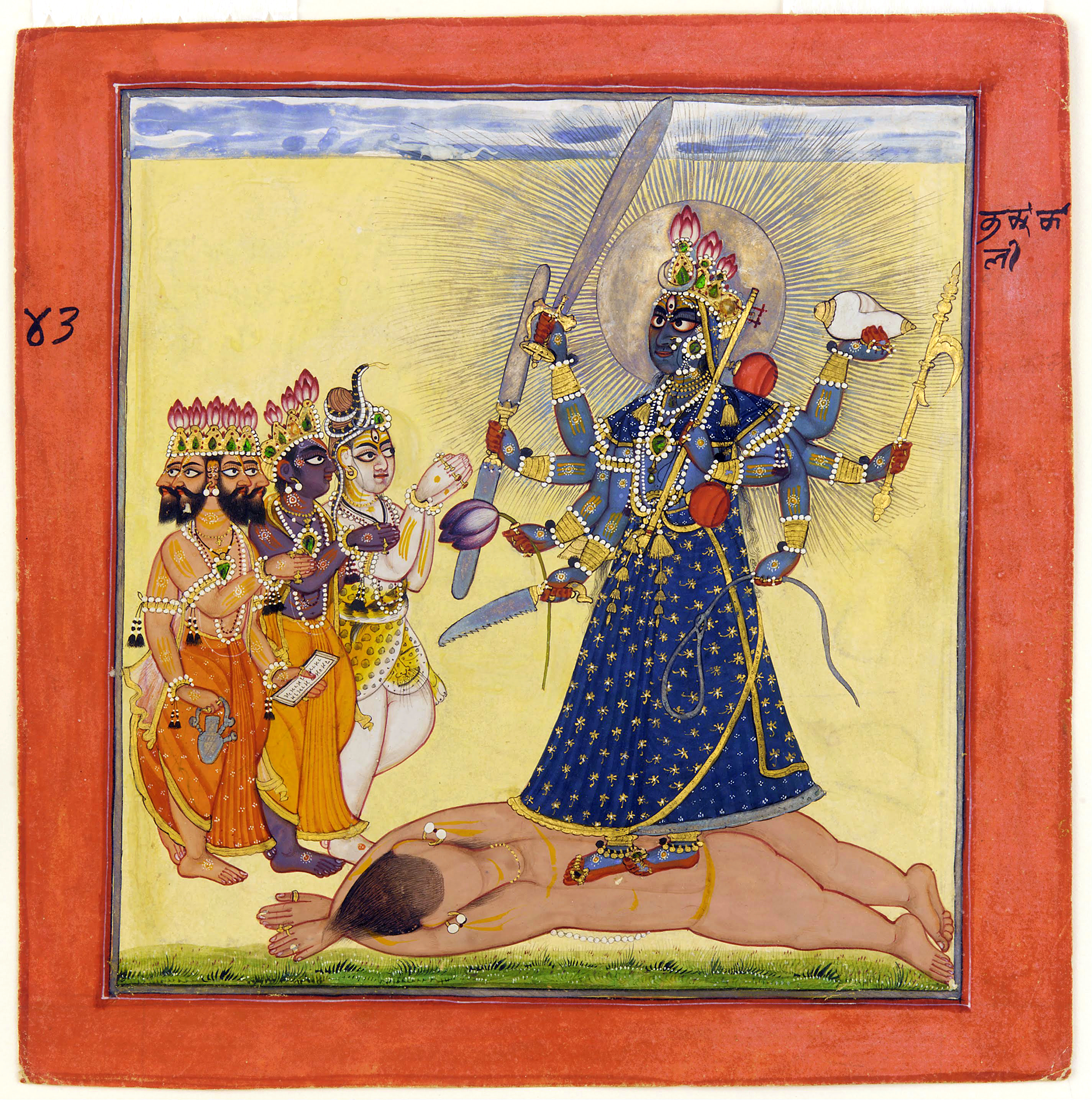
Bhadrakali (IAST: Bhadrakālī; ), also known as Mahakali and Kali, is a Hindu goddess. According to Shaktism, she is one of the fierce forms of the Supreme Goddess Shakti, or Adi Parashakti, mentioned in the Devi Mahatmyam. In Vaishnavism, Bhadrakali is among the many epithets of Yogamaya, the internal potency of illusion of the preserver deity, Vishnu. According to several Puranas, Bhadrakali is a form of the goddess Parvati. She is worshipped in Kerala as Bhagavati, Mahakali, Chamunda, Sree Kurumba, and Kariam Kali Murti. She is purported to be the auspicious and fortunate form of Mahakali who protects the good, known as Bhadra. Etymology In Sanskrit, ''Bhadra'' means ''auspicious.'' Another interpretation of this name is that ''Bhadra'' comes from 'Bha' and 'dra', The letter 'Bha' means 'delusion' or 'Maya'and 'dra' is used as a superlative i.e. meaning 'the most/the greatest etc.' which makes the meaning of Bhadra as ''Maha Maya''. In other words, maya represents th ... [...More Info...] [...Related Items...] OR: [Wikipedia] [Google] [Baidu] |
South India
South India, also known as Dakshina Bharata or Peninsular India, consists of the peninsular southern part of India. It encompasses the Indian states of Andhra Pradesh, Karnataka, Kerala, Tamil Nadu, and Telangana, as well as the union territories of Lakshadweep and Puducherry, comprising 19.31% of India's area () and 20% of India's population. Covering the southern part of the peninsular Deccan Plateau, South India is bounded by the Bay of Bengal in the east, the Arabian Sea in the west and the Indian Ocean in the south. The geography of the region is diverse with two mountain ranges – the Western and Eastern Ghats – bordering the plateau heartland. The Godavari, Krishna, Kaveri, Tungabhadra, Periyar, Bharathappuzha, Pamba, Thamirabarani, Palar, and Vaigai rivers are important perennial rivers. The majority of the people in South India speak at least one of the four major Dravidian languages: Tamil, Telugu, Malayalam and Kannada (all 4 of which are among the 6 Classic ... [...More Info...] [...Related Items...] OR: [Wikipedia] [Google] [Baidu] |
Shiva Temple
A Hindu temple, or ''mandir'' or ''koil'' in Indian languages, is a house, seat and body of divinity for Hindus. It is a structure designed to bring human beings and gods together through worship, sacrifice, and devotion.; Quote: "The Hindu temple is designed to bring about contact between man and the gods" (...) "The architecture of the Hindu temple symbolically represents this quest by setting out to dissolve the boundaries between man and the divine". The symbolism and structure of a Hindu temple are rooted in Vedic traditions, deploying circles and squares. It also represents recursion and the representation of the equivalence of the macrocosm and the microcosm by astronomical numbers, and by "specific alignments related to the geography of the place and the presumed linkages of the deity and the patron". A temple incorporates all elements of the Hindu cosmos — presenting the good, the evil and the human, as well as the elements of the Hindu sense of cyclic time and th ... [...More Info...] [...Related Items...] OR: [Wikipedia] [Google] [Baidu] |
Kollam
Kollam (), also known by its former name Quilon , is an ancient seaport and city on the Malabar Coast of India bordering the Laccadive Sea, which is a part of the Arabian Sea. It is north of the state capital Thiruvananthapuram. The city is on the banks of Ashtamudi Lake and the Kallada river. It is the headquarters of the Kollam district. Kollam is the fourth largest city in Kerala and is known for cashew processing and coir manufacturing. It is the southern gateway to the Backwaters of Kerala and is a prominent tourist destination. Kollam has a strong commercial reputation since ancient times. The Arabs, Phoenicians, Chinese, Ethiopians, Syrians, Jews, Chaldeans and Romans have all engaged in trade at the port of Kollam for millennia. As a result of Chinese trade, Kollam was mentioned by Ibn Battuta in the 14th century as one of the five Indian ports he had seen during the course of his twenty-four-year travels. [...More Info...] [...Related Items...] OR: [Wikipedia] [Google] [Baidu] |
Kerala State Road Transport Corporation
Kerala State Road Transport Corporation (KSRTC) is a state-owned road transport corporation in the Indian state of Kerala. It is one of the country's oldest state-run public bus transport services. The corporation is divided into three zones (South, Central and North), and its headquarters is in the state capital Thiruvananthapuram. Daily scheduled service has increased from to , using 6,241 buses on 6,389 routes. The corporation transports an average of 3.145 million commuters per day. The Kerala Urban Road Transport Corporation (KURTC) was formed under KRTC in 2015 to manage affairs related to urban transportation. It was inaugurated on 12 April 2015 at Thevara. On 9 November 2021, a legally independent company called KSRTC SWIFT was formed to operate the long-distance buses of the Kerala Road Transport Corporation for a period of 10 years with an aim overcome the financial crisis faced by the corporation. History Travancore State Transport Department The corporation's ... [...More Info...] [...Related Items...] OR: [Wikipedia] [Google] [Baidu] |
Fishing
Fishing is the activity of trying to catch fish. Fish are often caught as wildlife from the natural environment, but may also be caught from stocked bodies of water such as ponds, canals, park wetlands and reservoirs. Fishing techniques include hand-gathering, spearing, netting, angling, shooting and trapping, as well as more destructive and often illegal techniques such as electrocution, blasting and poisoning. The term fishing broadly includes catching aquatic animals other than fish, such as crustaceans ( shrimp/ lobsters/crabs), shellfish, cephalopods (octopus/squid) and echinoderms ( starfish/ sea urchins). The term is not normally applied to harvesting fish raised in controlled cultivations ( fish farming). Nor is it normally applied to hunting aquatic mammals, where terms like whaling and sealing are used instead. Fishing has been an important part of human culture since hunter-gatherer times, and is one of the few food production activities that have persisted ... [...More Info...] [...Related Items...] OR: [Wikipedia] [Google] [Baidu] |


