|
Kabarore
Kabarore is a town in Rwanda. It is the headquarters of Gatsibo District. Location Kabarore is located in Gatsibo District, Eastern Province, at the western edge of Akagera National Park, about , west of the International border with the Republic of Tanzania. Its location lies about , by road, north of Kayonza, on the Kayonza- Nyagatare Road. The coordinates of the town are:1° 37' 15.60"S, 30° 23' 6.00"E (Latitude:-1.6210; Longitude:30.3850). Population The exact population of Kabarore is 50,288. Points of interest The points of interest within the town limits or close to the edges of town include: * The headquarters of Gatsibo District * Offices of Kabarore Town Council * Kabarore Central Market * Kabarore Health Center * A branch of the Bank of Kigali External linksLocation of Kabarore At Google Maps See also * Gatsibo District * Eastern Province, Rwanda Eastern Province ( rw, Intara y'Iburasirazuba; french: Province de l'Est; nl, Oostelijke Provincie) is the la ... [...More Info...] [...Related Items...] OR: [Wikipedia] [Google] [Baidu] |
Gatsibo District
Gatsibo is a district (''akarere'') in Eastern Province, Rwanda. Its capital is Kabarore. It lies in the sectors of Gatsibo and Kageyo. It’s at about 1 hour and 50 minutes drive from Kigali city. Geography The district comprises areas in the north-east of Rwanda, between Kayonza and Nyagatare. The German post of Gatsibo was located here, as is the present-day Gabiro military camp. The eastern part of the district is in Akagera National Park, with the Kagera River forming the border with Tanzania. Location of Gatsibo District This District is one of the seven Districts making the Eastern Province. It is divided into 14 Sectors which are; Gasange, Gatsibo, Gitoki, Kabarore, Kageyo, Kiramuruzi, Kiziguro, Muhura, Murambi, Ngarama, Nyagihanga, Remera, Rugarama and Rwimbogo. It is also divided into 69 cells and 603 villages “Imidugudu”. Spreading an area of 1,582.32 km2. The District borders with the Akagera National Park in East, to the North by Nyagatare District; to the ... [...More Info...] [...Related Items...] OR: [Wikipedia] [Google] [Baidu] |
Provinces Of Rwanda
The provinces of Rwanda (Kinyarwanda: ''intara'') are divided into Districts of Rwanda, districts (''akarere'') and municipalities (''umujyi''). Prior to January 1, 2006, Rwanda was composed of 12 provinces. The Politics of Rwanda, Rwandan government decided to establish new provinces in an attempt to address issues that arose from the Rwandan genocide. The new provinces were to be "ethnically-diverse administrative areas". Until 2002, the provinces were called prefectures (''perefegitura''). Provinces As of January 1, 2006 the five provinces of Rwanda are: Provincial districts and sectors Eastern Province Northern Province Western Province Southern Province Kigali Former provinces Prior to 2006 the provinces were: *Butare Province *Byumba Province *Cyangugu Province *Gikongoro Province *Gisenyi Province *Gitarama Province *Kibungo Province *Kibuye Province *Kigali City (Established as a province in 1990) *Kigali-Rural Province (Kigali Ngali) *Ruhengeri Provi ... [...More Info...] [...Related Items...] OR: [Wikipedia] [Google] [Baidu] |
Eastern Province, Rwanda
Eastern Province ( rw, Intara y'Iburasirazuba; french: Province de l'Est; nl, Oostelijke Provincie) is the largest, the most populous and the least densely populated of Rwanda's five provinces. It was created in early January 2006 as part of a government decentralization program that re-organized the country's local government structures. It has seven districts: Bugesera, Gatsibo, Kayonza, Ngoma, Kirehe, Nyagatare and Rwamagana. The capital city of the Eastern Province is Rwamagana. The Eastern Province comprises the former provinces of Kibungo and Umutara, most of Kigali Rural, and part of Byumba. The Akagera National Park is situated is this province. History It is not known when the territory of present day Rwanda was first inhabited, but it is thought that humans moved into the area following the last ice age either in the Neolithic period, around ten thousand years ago, or in the long humid period which followed, up to around 3000 BC.Briggs and Booth 2006 p6 A ... [...More Info...] [...Related Items...] OR: [Wikipedia] [Google] [Baidu] |
Districts Of Rwanda
The five Provinces of Rwanda, provinces of Rwanda are divided into 30 districts (Kinyarwanda: ''uturere'', sing. ''akarere''). Each district is in turn divided into Sectors of Rwanda, sectors (Kinyarwanda: ''imirenge'', sing. ''umurenge''), which are in turn divided into ''cells'' (Kinyarwanda: ''utugali'', sing. ''akagali''), which are in turn divided into Imidugudu, ''villages'' (Kinyarwanda: ''imidugudu'', sing. ''umudugudu''). Prior to 2002, Rwanda was composed of prefectures, subprefectures (which were sometimes called "districts") and 154 communes (Kinyarwanda: ''imijyi'', sing. ''umujyi''). In 2002, communes were replaced by two kinds of divisions called districts and municipalities (Kinyarwanda: ''akarere'' and ''umujyi''). In 2006, the number of districts was reduced from 106 to 30. The districts are listed below, by province. Current list of districts by province Eastern Province # Bugesera District, Bugesera # Gatsibo District, Gatsibo # Kayonza District, Kayonza ... [...More Info...] [...Related Items...] OR: [Wikipedia] [Google] [Baidu] |
Flag Of Rwanda
The flag of Rwanda ( rw, ibendera ry'Urwanda, french: Drapeau du Rwanda) was adopted on 25 October 2001. Details The flag has three colours: blue, yellow, and green, The light blue band represents happiness and peace, the yellow band symbolizes economic development, and the green band symbolizes the hope of prosperity. The yellow sun represents enlightenment. The flag represents national unity, respect for work, heroism, and confidence in the future. According to the state's official rationale, the flag was adopted (along with a new national anthem at the time) to avoid connotations to the 1994 genocide which it stated the previous one embodied. However, some Rwandans at the time expressed doubts about the reasoning and viewed it as an attempt by the ruling Rwandan Patriotic Front to express its political power by changing state symbols. The flag was designed by Alphonse Kirimobenecyo. When hung vertically, the flag should be displayed as the horizontal version rotated clockwi ... [...More Info...] [...Related Items...] OR: [Wikipedia] [Google] [Baidu] |
Rwanda
Rwanda (; rw, u Rwanda ), officially the Republic of Rwanda, is a landlocked country in the Great Rift Valley of Central Africa, where the African Great Lakes region and Southeast Africa converge. Located a few degrees south of the Equator, Rwanda is bordered by Uganda, Tanzania, Burundi, and the Democratic Republic of the Congo. It is highly elevated, giving it the soubriquet "land of a thousand hills", with its geography dominated by mountains in the west and savanna to the southeast, with numerous lakes throughout the country. The climate is temperate to subtropical, with two rainy seasons and two dry seasons each year. Rwanda has a population of over 12.6 million living on of land, and is the most densely populated mainland African country; among countries larger than 10,000 km2, it is the fifth most densely populated country in the world. One million people live in the Capital city, capital and largest city Kigali. Hunter-gatherers settled the territory in the St ... [...More Info...] [...Related Items...] OR: [Wikipedia] [Google] [Baidu] |
Akagera National Park
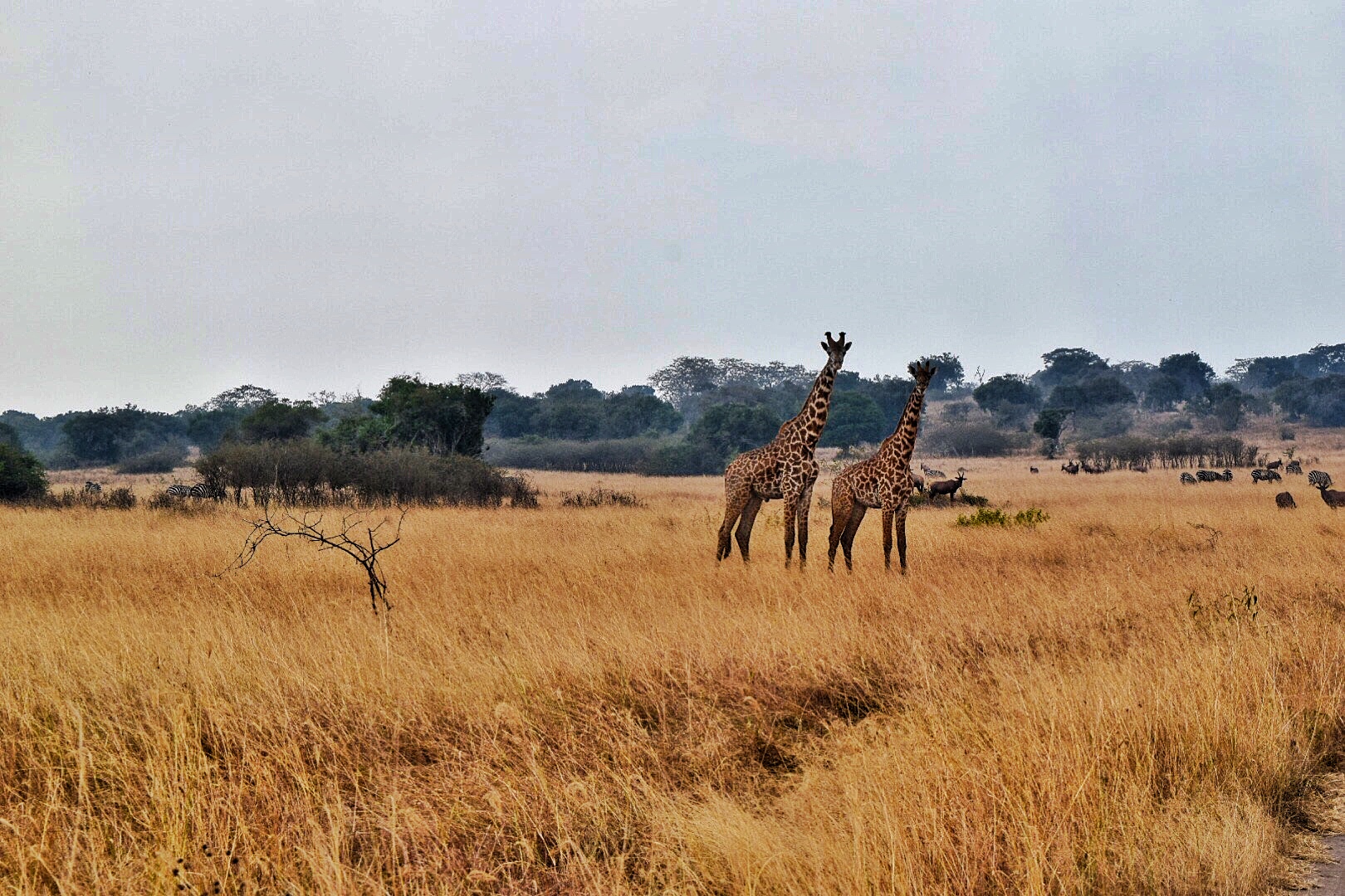
Akagera National Park is a protected area in eastern Rwanda covering along the international border with Tanzania. It was founded in 1934 and includes savannah, montane and swamp habitats. The park is named for the Kagera River which flows along its eastern boundary feeding into Lake Ihema and several smaller lakes. The complex system of lakes and linking papyrus swamps makes up over a third of the park, which is the largest protected wetland in Eastern-Central Africa. History Akagera National Park was founded in 1934 by the Belgian government, which at the time occupied Rwanda. The park was large and was known for its biodiversity. Akagera used to have a large population of African wild dogs. At one point, it was known as the 'Parc aux Lycaons' and wild dogs were so abundant, that the Belgian government considered them a pest. However, a disease epidemic diminished the population and the last wild dogs were seen in 1984.Vande weghe, Jean Pierre: ''Akagera: Land of water, gr ... [...More Info...] [...Related Items...] OR: [Wikipedia] [Google] [Baidu] |
Republic Of Tanzania
Tanzania (; ), officially the United Republic of Tanzania ( sw, Jamhuri ya Muungano wa Tanzania), is a country in East Africa within the African Great Lakes region. It borders Uganda to the north; Kenya to the northeast; Comoro Islands and the Indian Ocean to the east; Mozambique and Malawi to the south; Zambia to the southwest; and Rwanda, Burundi, and the Democratic Republic of the Congo to the west. Mount Kilimanjaro, Africa's highest mountain, is in northeastern Tanzania. According to the United Nations, Tanzania has a population of million, making it the most populous country located entirely south of the equator. Many important hominid fossils have been found in Tanzania, such as 6-million-year-old Pliocene hominid fossils. The genus Australopithecus ranged across Africa between 4 and 2 million years ago, and the oldest remains of the genus ''Homo'' are found near Lake Olduvai. Following the rise of ''Homo erectus'' 1.8 million years ago, humanity spread all ove ... [...More Info...] [...Related Items...] OR: [Wikipedia] [Google] [Baidu] |
Kayonza
Kayonza is a small town in Kayonza district, Eastern Province, Rwanda. The town is centred on a roundabout, where the road east from Kigali splits into the road running north to the Ugandan border, and the road south to Tanzania. It is a major transport hub because of this junction, where a sizeable taxi-minibus park and terminus offers the Okapi, Atraco and Stella express services. It is also used as an overnight rest stop for truck drivers from Tanzania to Kigali and beyond. A small hotel provides basic accommodation, and there are two petrol pumps, a conference centre, a twice-weekly market and various bars and television halls. It is also one of sites the company Zipline A zip-line, zip line, zip-wire, flying fox, or death slide is a pulley suspended on a cable, usually made of stainless steel, mounted on a slope. It is designed to enable cargo or a person propelled by gravity to travel from the top to the bott ... uses for delivering supplies to medical centres around ... [...More Info...] [...Related Items...] OR: [Wikipedia] [Google] [Baidu] |
Nyagatare
Nyagatare is a town in the North East of Rwanda. With a population of more than 100,000, it is one of the most populous settlements in the Eastern Province along with Rwamagana and Kibungo. Location Nyagatare is located in Nyagatare District, Eastern Province, close to Rwanda's International borders with both Tanzania and Uganda. Its location lies about , by road, northeast of Kigali, Rwanda's capital and largest city. The coordinates of the town are:1° 18' 0.00"S, 30° 19' 30.00"E (Latitude:-1.3000; Longitude:30.3250) Overview Nyagatare is the largest metropolitan area and the capital of Nyagatare District, in Eastern Province, in Rwanda's northeast. At the center of a cattle farming region, the city is a point of milk collection for several milk producers such as Inyange Industries Ltd. Milk from Nyagatare is exported to other regions of Rwanda. It hosts tiles manufacturing industry known as EAST AFRICA GRANITE INDUSTRIES Infrastructure Power As of July 2021, only ... [...More Info...] [...Related Items...] OR: [Wikipedia] [Google] [Baidu] |
Bank Of Kigali
Bank of Kigali (BK) is a commercial bank in Rwanda. It is licensed by the National Bank of Rwanda. Location The headquarters and main branch of the bank are located at 6112 KN4 Avenue, in Nyarugenge District, in the city of Kigali, the capital and largest city in Rwanda. The geographical coordinates of the bank's headquarters are: 01°56'54.0"S, 30°03'35.0"E (Latitude:-1.948333; Longitude:30.059722). Overview Bank of Kigali is the largest commercial bank in Rwanda, by total assets. As of 31 December 2019, the bank's total assets were valued at US$1,1059 million, with a loan book of $735.8 million, customer deposits of $697.4 million and shareholders equity of US$239.6 million. On 29 September 2017, Global Credit Ratings affirmed Bank of Kigali Limited's long-term and short-term national scale ratings of AA-(RW) and A1+(RW) respectively; with a stable outlook. The bank has won several back to back international and regional "Best Bank in Rwanda" awards, including from EuroMoney ... [...More Info...] [...Related Items...] OR: [Wikipedia] [Google] [Baidu] |


