|
Jumla (town)
Jumla is the centre of Chandannath Municipality in Jumla District of Karnali Province of Nepal. It is located at 2514 metres (8251 feet) elevation. Geography Jumla is one of the 77 districts in the midwestern hills of Nepal. Rice (Oryza sativa L) cultivation in Jumla ranges from 2,400 to 3,050 m altitude, which is the highest elevation in the world. The highest elevation at 3,050 m is Chhumjul of Jumla, a record altitude, where rice is cultivated in Nepal. Jumli Marshi, a Japonica variety of indigenous rice, having cold tolerant gene, is probably cultivated since 1,300 years ago in Jumla in the bank of the Tila river. The Tila Valley as well as the Sinja Khola Valley are covered with paddy fields growing the 'Kali Marshi' rice variety, a unique red rice that is sought after for its special taste. Jumla has a STOL airport, Jumla Airport, and the road network first reached it from Surkhet in May 2007. It is the usual starting point for treks to Rara Lake. Climate Jumla has a h ... [...More Info...] [...Related Items...] OR: [Wikipedia] [Google] [Baidu] |
Nepalese Federal States
The provinces of Nepal ( ne, नेपालका प्रदेशहरू, translit=Nepālkā Pradeśharū) were formed on 20 September 2015 in accordance with Schedule 4 of the Constitution of Nepal. The seven provinces were formed by grouping the existing districts. The current system of seven provinces replaced an earlier system where Nepal was divided into 14 administrative zones which were grouped into five development regions. History A committee was formed to restructure administrative divisions of Nepal on 23 December 1956 and in two weeks, a report was submitted to the government. In accordance with The ''Report On Reconstruction Of Districts Of Nepal, 2013'' (), the country was first divided into total 7 ''Kshetras'' (area). # (Unnamed) # Madesh Kshetra # Bagmati Kshetra # Gandaki Kshetra # Lumbini Kshetra # Karnali Kshetra # Mahakali Kshetra In 1962, all ''Kshetras'' were dissolved and the country was restructured into 75 development districts; those distric ... [...More Info...] [...Related Items...] OR: [Wikipedia] [Google] [Baidu] |
Karnali Province
Karnali Province ( ne, कर्णाली प्रदेश) is one of the seven federal provinces of Nepal formed by the new constitution which was adopted on 20 September 2015. The total area of the province is covering 18.97% of the country, making it the largest province in Nepal. According to the 2011 Nepal census, the population of the province was 1,570,418, making it the least populous province in Nepal. It borders the Tibet Autonomous Region of China to the north, Gandaki Province to the east, Sudurpashchim Province to the west, and Lumbini Province to the south. Birendranagar with a population of 154,886 is both the province's capital and largest city. Etymology The province's name is derived from the Karnali River, which flows through the province. A meeting of the provincial assembly on 25 February 2018 adopted the name Karnali for the province. History Karnali is an old civilization in Nepal and is connected with the Karnali River Archaeological sites found ... [...More Info...] [...Related Items...] OR: [Wikipedia] [Google] [Baidu] |
Districts Of Nepal
Districts in Nepal are second level of administrative divisions after provinces. Districts are subdivided in municipalities and rural municipalities. There are seven provinces and 77 districts in Nepal. After the state's reconstruction of administrative divisions, Nawalparasi District and Rukum District were divided into Parasi District (officially Nawalparasi (West of Bardaghat Susta) District) and Nawalpur District (officially Nawalparasi (East of Bardaghat Susta) District), and Eastern Rukum District and Western Rukum District respectively. District official include: * Chief District Officer, an official under Ministry of Home Affairs is appointed by the government as the highest administrative officer in a district. The C.D.O is responsible for proper inspection of all the departments in a district such as health, education, security and all other government offices. * District Coordination Committee acts as an executive to the District Assembly. The DCC coordinates with ... [...More Info...] [...Related Items...] OR: [Wikipedia] [Google] [Baidu] |
Jumla District
Jumla District ( ne, जुम्ला जिल्ला), is one of the ten districts of the Karnali province of Nepal. This district has Jumla as its headquarters, an area of ; it had populations of 89,427 and 108,921, respectively, in the national censuses of 2001 and 2011. Its territory lies between longitudes 81⁰ 28' and 82⁰ 18' East, and between latitudes 28⁰ 58' and 29⁰ 30' North. The Nepali language (then known as Khas language) originated in the Sinja Valley. Sinja was the capital of Khas Kingdom, and the dialect called "Khas Bhasa" is still spoken among that region's people. History Khasa Kingdom Jumla was a part of Khasa kingdom during the 11th to 13th century. After 13th-century, Khasa Kingdom collapsed and divided into Baise Rajya (22 principalities) in the Karnali-Bheri region and the Kingdom of Jumla was one of them. Kingdom of Jumla The Jumla Kingdom was one of the many kingdoms that dotted Nepal before its reunification by King Prithvi Nar ... [...More Info...] [...Related Items...] OR: [Wikipedia] [Google] [Baidu] |
Nepal Time
Nepal Standard Time (NPT) is the time zone for Nepal. With a time offset from Coordinated Universal Time (UTC) of UTC+05:45 all over Nepal, it is one of only three time zones with a 45-minute offset from UTC.The others are Chatham Island Standard Time, with an offset of UTC+12:45, and the unofficial Australian Central Western Time, with an offset of UTC+08:45. NPT is an approximation of Kathmandu mean time, which is 5:41:16 ahead of UTC. The standard meridian passes through the peak of Gaurishankar mountain about east of Kathmandu. Nepal used local solar time until 1920, in Kathmandu UTC+05:41:16. In 1920, Nepal adopted Indian Standard Time, UTC+05:30. In 1986 Nepal advanced their clocks by 15 minutes, giving them a time zone of UTC+05:45. See also *Date and time notation in Nepal Nepal uses both the DMY and YMD format when writing dates, and uses 12-hour format for time. Date YYYY-MM-DD is official date format for the Bikram Sambat calendar used in Nep ... [...More Info...] [...Related Items...] OR: [Wikipedia] [Google] [Baidu] |
Chandannath
Chandannath is a municipality in Jumla District in the Karnali Province of Nepal. The municipality was established on 18 May 2014 by merging the existing Mahat Gaun, Talium, Kartik Swami ( Jumla), and Chandannath village development committees (VDCs). At the time of the 1991 Nepal census it had a population of 5,842 persons living in 1,000 individual households. Politics and Leadership Kantika Sejuwal of Nepali Congress is the first elected mayor of Chandannath Municipality in Karnali Province, polling 2,777 votes against 2066 by her nearest rival from CPN Maoist Center. Sejuwal is also the only woman elected mayor in the province with its 25 municipalities, apart from 54 rural municipalities. Twin towns – sister cities * Kathmandu , pushpin_map = Nepal Bagmati Province#Nepal#Asia , coordinates = , subdivision_type = Country , subdivision_name = , subdivision_type1 = Province , subdivision_name1 = Bagmati ... [...More Info...] [...Related Items...] OR: [Wikipedia] [Google] [Baidu] |
Nepal
Nepal (; ne, नेपाल ), formerly the Federal Democratic Republic of Nepal ( ne, सङ्घीय लोकतान्त्रिक गणतन्त्र नेपाल ), is a landlocked country in South Asia. It is mainly situated in the Himalayas, but also includes parts of the Indo-Gangetic Plain, bordering the Tibet Autonomous Region of China to the north, and India in the south, east, and west, while it is narrowly separated from Bangladesh by the Siliguri Corridor, and from Bhutan by the Indian state of Sikkim. Nepal has a diverse geography, including fertile plains, subalpine forested hills, and eight of the world's ten tallest mountains, including Mount Everest, the highest point on Earth. Nepal is a multi-ethnic, multi-lingual, multi-religious and multi-cultural state, with Nepali as the official language. Kathmandu is the nation's capital and the largest city. The name "Nepal" is first recorded in texts from the Vedic period of the India ... [...More Info...] [...Related Items...] OR: [Wikipedia] [Google] [Baidu] |
STOL
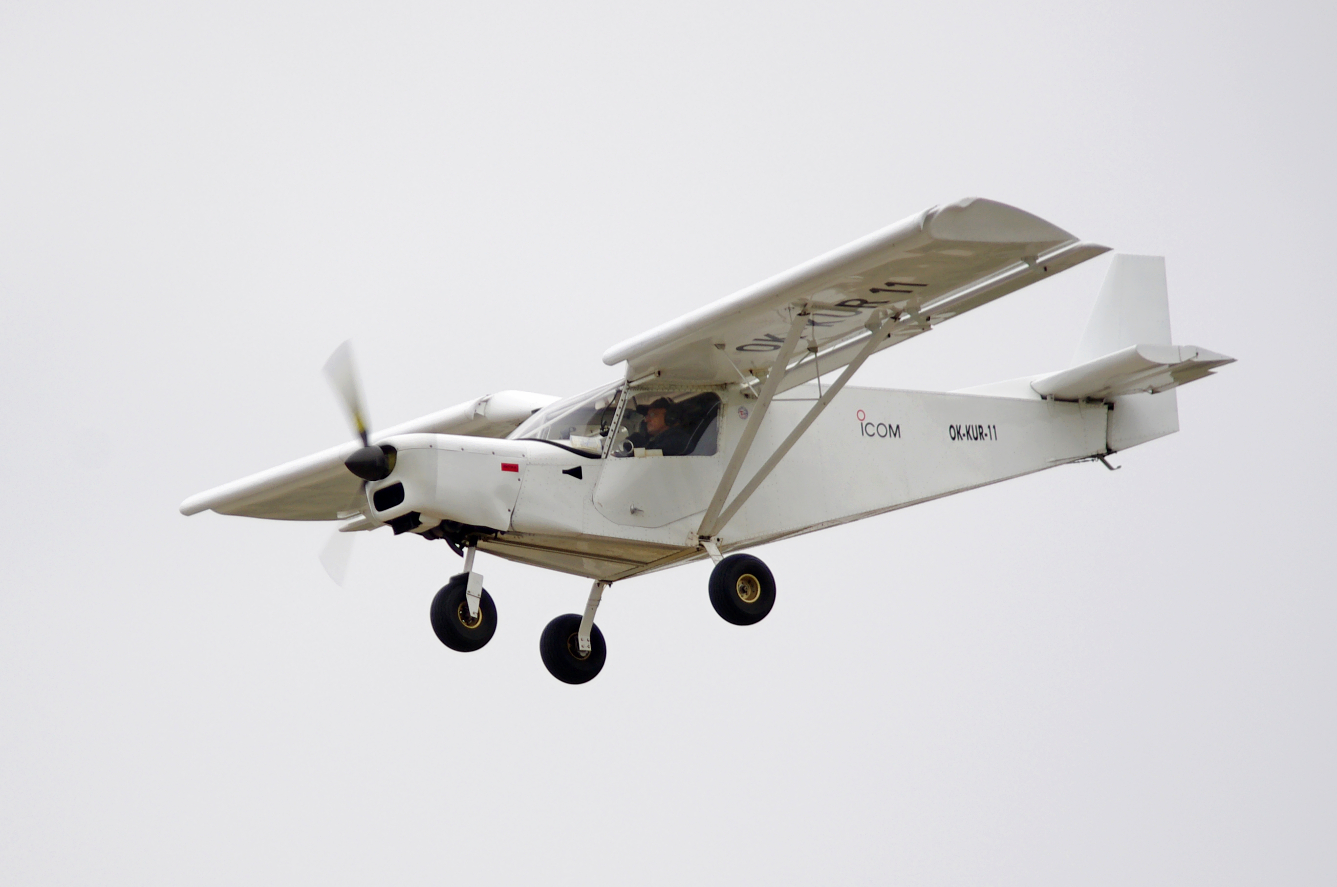
A short takeoff and landing (STOL) aircraft is a conventional fixed-wing aircraft that has short runway requirements for takeoff and landing. Many STOL-designed aircraft also feature various arrangements for use on airstrips with harsh conditions (such as high altitude or ice). STOL aircraft, including those used in scheduled passenger airline operations, have also been operated from STOLport airfields which feature short runways. Design considerations Many fixed-wing STOL aircraft are bush planes, though some, like the de Havilland Canada Dash-7, are designed for use on prepared airstrips; likewise, many STOL aircraft are taildraggers, though there are exceptions like the PAC P-750 XSTOL, the Quest Kodiak, the de Havilland Canada DHC-6 Twin Otter and the Peterson 260SE. Autogyros also have STOL capability, needing a short ground roll to get airborne, but capable of a near-zero ground roll when landing. Runway length requirement is a function of the square of the minimum ... [...More Info...] [...Related Items...] OR: [Wikipedia] [Google] [Baidu] |
Jumla Airport
Jumla Airport is a domestic airport located in Jumla serving Jumla District, a district in Karnali Province in Nepal. Facilities The airport resides at an elevation of above mean sea level. It has one asphalt paved runway designated 09/27 which measures . Airlines and destinations Accidents and incidents *5 July 1992 - RNA De Havilland Canada DHC-6 Twin Otter 300 (9N-ABB), lost directional control on takeoff from Jumla Airport on a flight to Surkhet. The aircraft ran off the runway and struck the airport perimeter fence. None of the three crew were injured and there were no passengers on board.Aviation Safety Network retrieved 18 November 2006 *18 January 1999 - |
Surkhet
Surkhet District ( ne, सुर्खेत जिल्ला, ) is a district in Karnali Province of mid-western Nepal. Surkhet is the one of the ten districts of Karnali located about west of the national capital Kathmandu. The district's area is . It had 288,527 population in 2001 and 350,804 in 2011 which male comprised 169,461 and female 181,381. Its district headquarters, Birendranagar, is the capital of Karnali Province. It is serving as a business hub and document center for Karnali province. According to population, development, road links, landforms, climate, many peoples are migrating here. after becoming province capital developmental activities are boosted and are in peak level. all the governmental works are carried here. Birendranagar is beautiful valley surrounded by hills having moderate climate. Geography and Climate Surkhet Valley is one of the Inner Terai Valleys of Nepal. It borders, Achham district of Sudurpashchim, Dailekh and Jajarkot districts to the nor ... [...More Info...] [...Related Items...] OR: [Wikipedia] [Google] [Baidu] |
Rara Lake
Rara Lake also known as Mahendra Lake is the largest fresh water lake in the Nepalese Himalayas. It is the main feature of Rara National Park, located in Jumla District, Jumla and Mugu Districts of Karnali Province. Rara National Park stretches over . History Rara Lake was included as part of Rara National Park in 1976. In 1976, citizens of the two villages Chapra and Rara were resettled to Nepalgunj. In September 2007, it was declared as a Ramsar site, covering including the surrounding wetland. Currently, this area along with the national park is being protected by the Nepali Army. Features Rara Lake lies at an elevation of , has a water surface of , a maximum depth of , is long and wide. It drains into the Mugu Karnali River via the Nijar River. Its water quality is characterized by high pH, Conductivity (electrolytic), conductivity and total Hard water, hardness. It has been classified as Trophic state index, oligotrophic as it is slightly Water pollution, polluted. The l ... [...More Info...] [...Related Items...] OR: [Wikipedia] [Google] [Baidu] |


